Nor’easter slamming East Coast with heavy rain, snow and strong winds


Following days of mild temperatures and hints of spring as the calendar approached March, winter returned to the Northeast with a bang Friday, as rain and snow drove down in sheets and winds blew at gale force, prompting dire warnings of coastal flooding, dangerous sea conditions and power outages.
“As the saying goes, March is coming in like a lion,” New York Gov. Andrew Cuomo said in a news release. “I am asking for everyone to listen to weather forecasts in your community and take the necessary precautions to prepare for conditions.”
The storm originated as a system of low pressure in the Great Lakes region that dumped snow on northeastern Michigan and Ohio and then rapidly intensified as it moved east, Marc Chenard, a meteorologist with the National Weather Service, said.
“It’s that rapid intensification that is bringing high-impact weather,” including heavy snow inland and flooding in coastal areas, Chenard said.
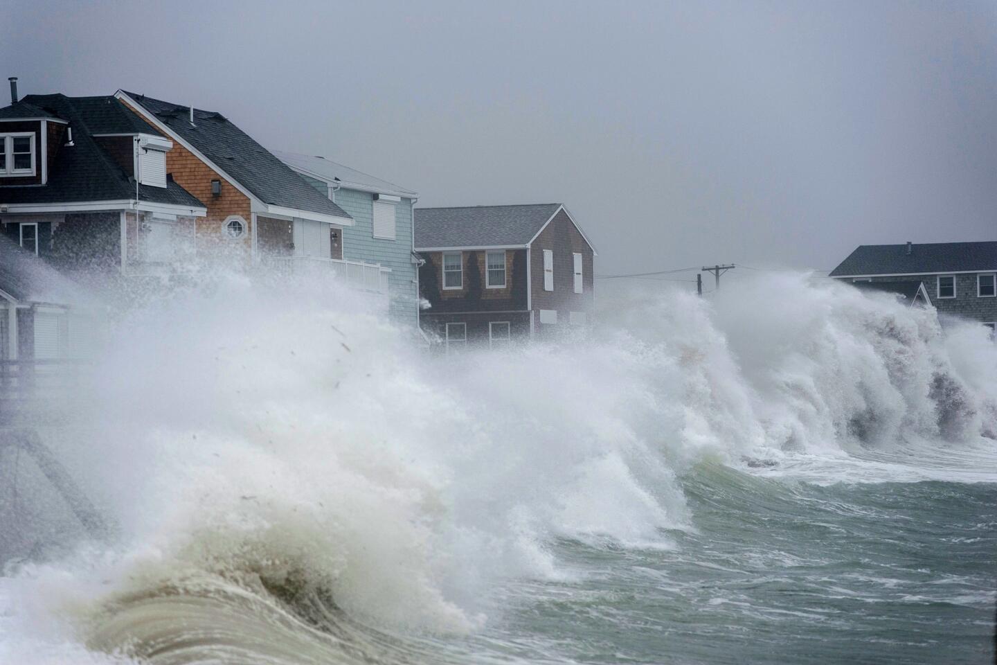
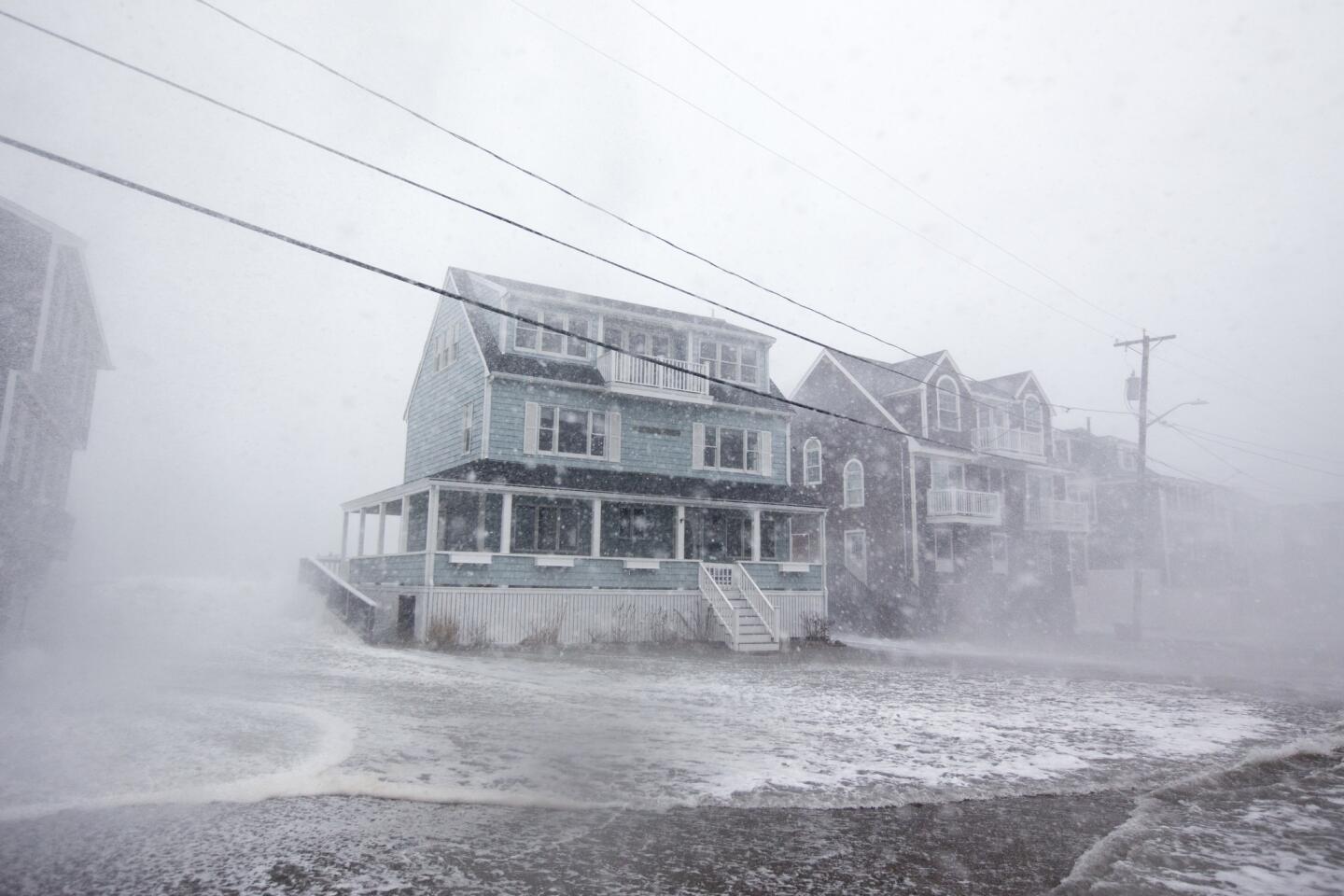
Forecast to hit eastern Massachusetts especially hard, the effects of the storm, which began with rain Thursday night and turned to snow Friday, were being felt up and down the Atlantic coast Friday, from North Carolina to Maine.
National Guard troops have been called in, schools closed, and communities urged to evacuate. More than 2,500 flights across the U.S. have been canceled, with New York-area and Boston airports the most affected, according to the flight tracking website FlightAware.
The powerful nor’easter struck the East Coast at the same time that California braced for blizzards in the Sierra Nevada and floods in burned-out areas of Santa Barbara County.
In Massachusetts, Gov. Charlie Baker said at a news conference Thursday that the storm was “shaping up to be more severe than” the early January “bomb cyclone” that brought heavy snow, frigid temperatures and fierce winds to the region.
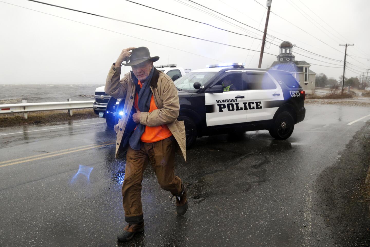
Baker, who activated National Guard troops to assist with emergency response, urged residents in historically flood-prone coastal areas to follow any evacuation orders they receive, warning that astronomically high tides combined with storm surges will prevent water from receding.
“It’s possible that first responders will be unable to reach all flooded areas at peak high tide,” he said. “Do not ride out the storm in your home if you are told to evacuate.”
Meteorologists predicted that the seas in Boston Harbor could rise to above 15 feet, breaking the record set on Jan. 4.
“Take this storm seriously! This is a LIFE & DEATH situation for those living on the coast,” the National Weather Service’s Boston office tweeted Thursday.
On the island of Nantucket, streets flooded, the Atlantic Ocean breached berms, and boats blew ashore hours before high tide Friday.
In the seaside towns of Duxbury and Scituate, officials urged residents to evacuate and canceled school. Fire departments prepared dive teams and high-water vehicles for rescues.
In New York state, parts of Long Island were also experiencing flooding Friday morning, and some upstate areas south of Buffalo had already received more than a foot and a half of snow.
Ahead of the storm Cuomo activated New York’s State Emergency Operations Center and deployed senior officials across the state to assist with emergency management. Stockpiled generators, pumps, sand bags and ready-to-eat meals were on hand for distribution, and utility crews were ready to tackle power outages.
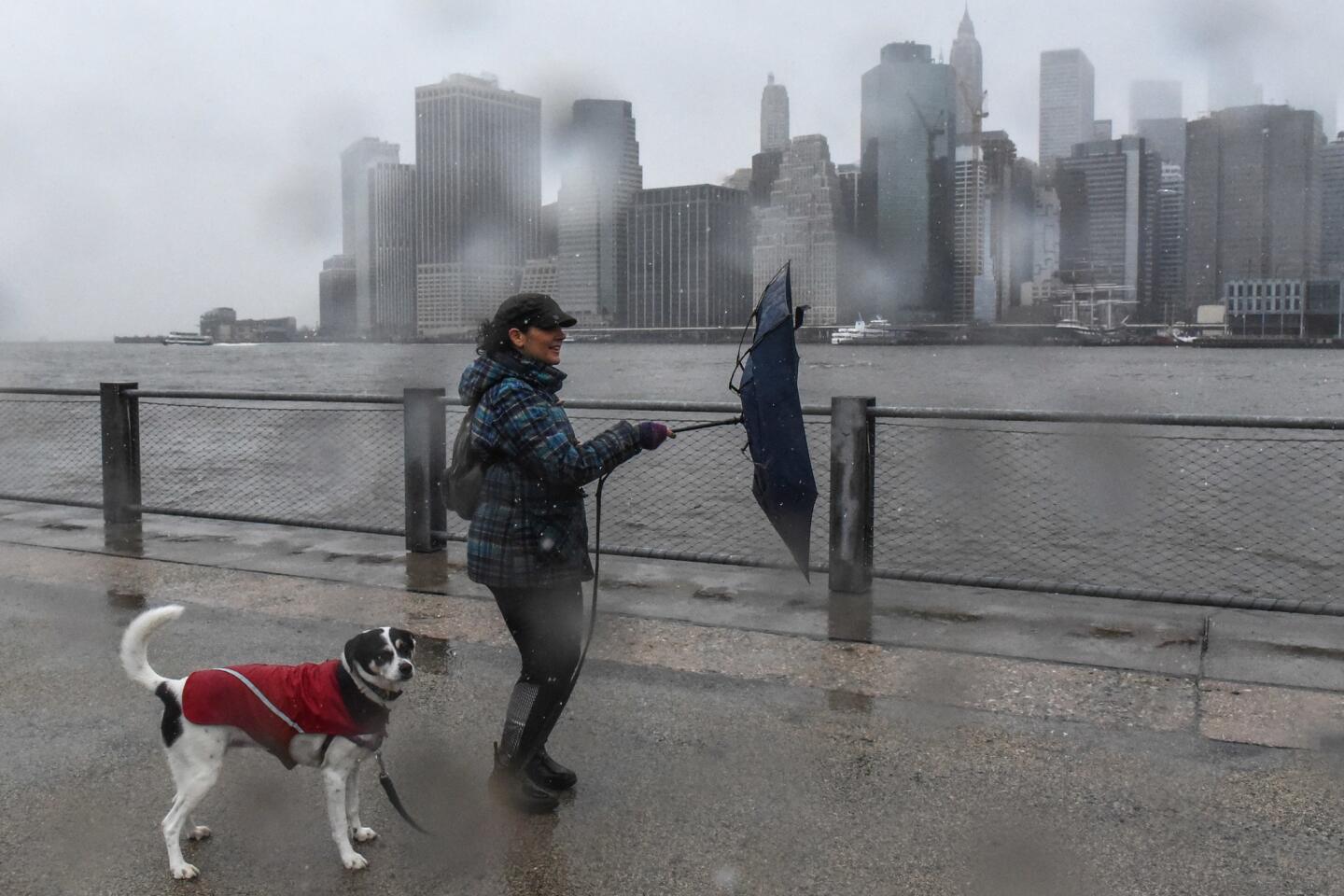
In New York City, it was business as usual for the most part, with commuters heading to work, schools and courts open, and even the occasional pedestrian walking outside without an umbrella.
Subway service was operating normally, though the Port Authority of New York and New Jersey was providing alternate shuttle service to Newark-Liberty International Airport because winds were too strong for Airtrain to operate.
The Department of Sanitation tweeted that it had some 700 salt spreaders ready, and Mayor Bill de Blasio encouraged New Yorkers to follow updates from the city’s emergency management office.
The storm was expected to hit its peak around noon Friday and then continue moving east offshore, Chenard, the meteorologist, said. Rain and snow will subside by Friday night, but winds and coastal flooding will continue into late Saturday morning.
UPDATES:
11:45 a.m. This article was updated throughout with staff reporting.
This article was originally published at 7:05 a.m.


Start your day right
Sign up for Essential California for news, features and recommendations from the L.A. Times and beyond in your inbox six days a week.
You may occasionally receive promotional content from the Los Angeles Times.