L.A. Walks: Trek a ghost route left by the long-gone Red Car trolley line in Silver Lake
Mere blocks from the busy streets and freeways dividing Silver Lake from Echo Park and Atwater Village is a wide, bucolic green space: all that’s left of the Red Car electric trolley line that once ran from downtown Los Angeles through Edendale and to Glendale and beyond. The trolley’s tracks and trestles are gone, but a long undeveloped corridor remains.

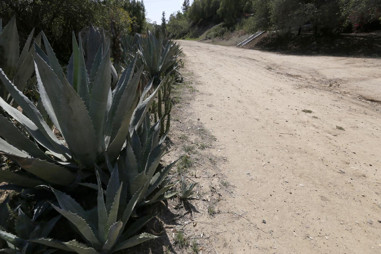
Along the walk, the path broadens into a wide, dirt road -- one of the area’s few unpaved city streets -- all that’s left of the Red Car electric trolley line that once ran from downtown Los Angeles through Edendale and to Glendale and beyond.
1. Start walking from Riverside Drive near the intersection with Gleneden Street, in front of the decades’ worth of murals painted by students of Allesandro Elementary School. Head south on Riverside under a high freeway overpass, then turn right onto Allesandro Street.

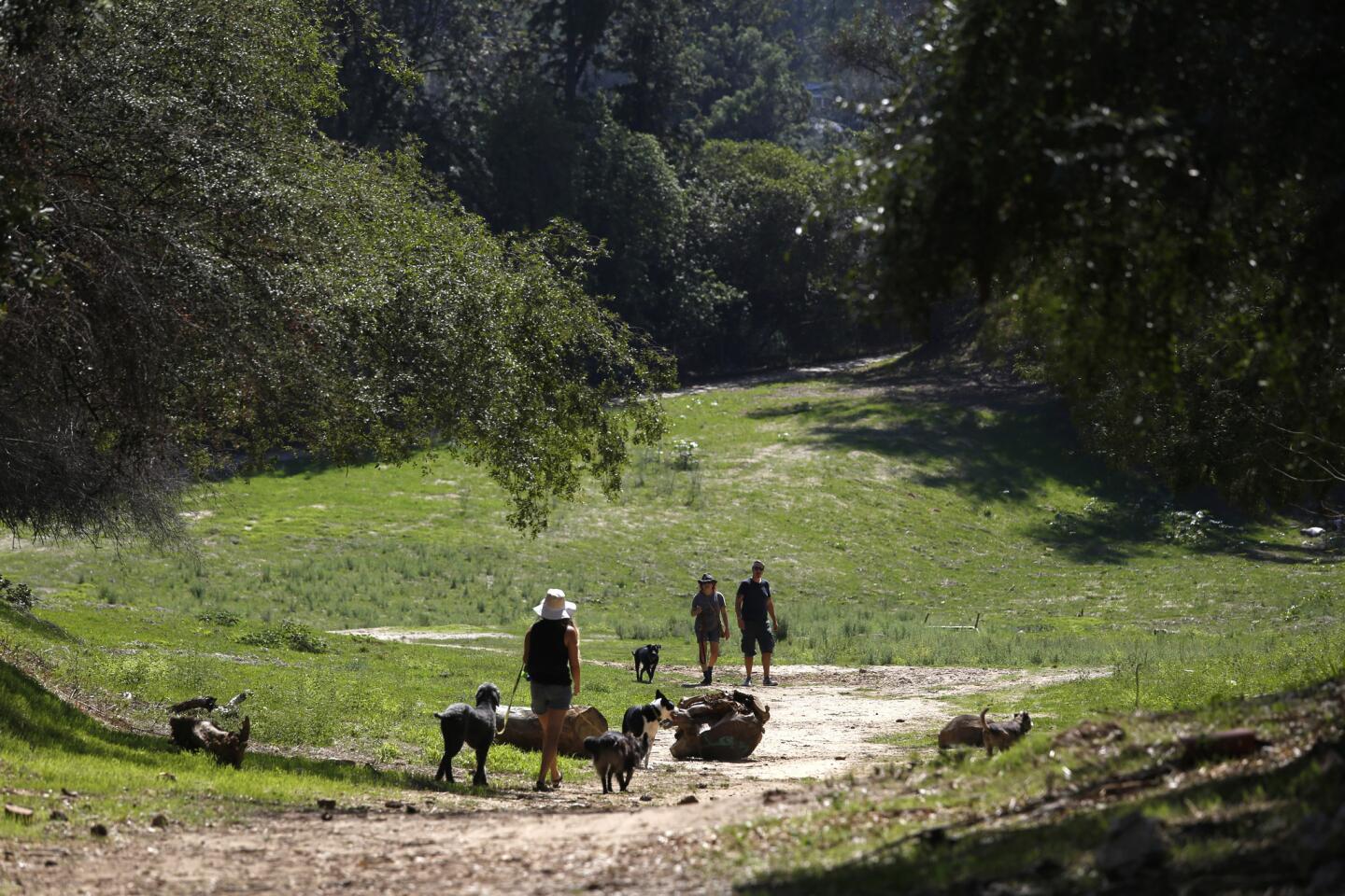
People walking dogs at the wide dirt path that swings into an open field. This two-mile walk is mere blocks from the busy streets and freeways dividing Silver Lake from Echo Park and Atwater Village.
2. Turn right onto Rosebud Avenue and duck under the Glendale Freeway, then turn immediately left onto Corralitas Drive. At the end of the cul-de-sac, take a wide dirt path that swings wide into an open field.

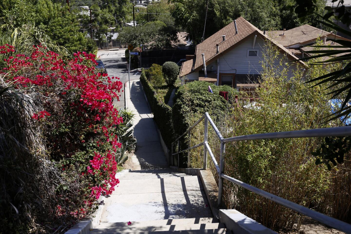
Public staircases, designed for pedestrian access to the trolley line, are on both sides of the road.
3. This broad open space narrows into a canyon and shows some remnants of its electric trolley car past. Here and there are concrete footings that once supported platforms for passengers of the famed Red Car, which served the area from 1906 to 1955.
MAP: Find the perfect L.A. Walk near you
4. As the canyon narrows into deep shade, the path passes a makeshift memorial and goes through a chain-link gate. On the left is Rose Scharlin Cooperative Nursery School, one of the city’s oldest preschools.

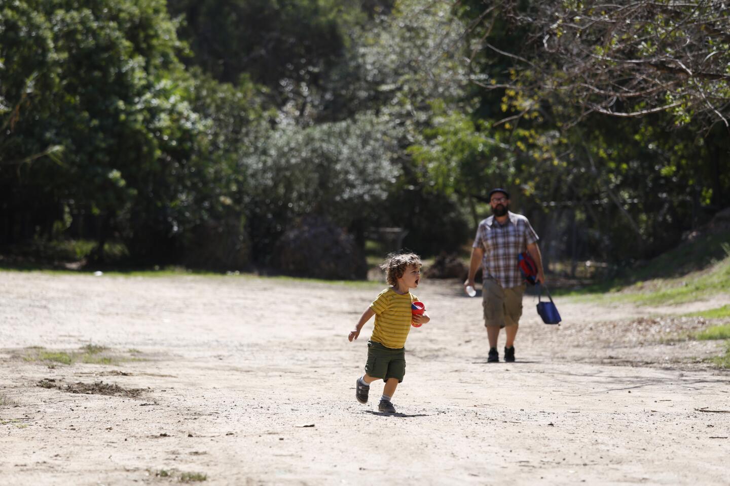
The view along the walk of what’s left of the Red Car electric trolley line that once ran from downtown Los Angeles through Edendale.
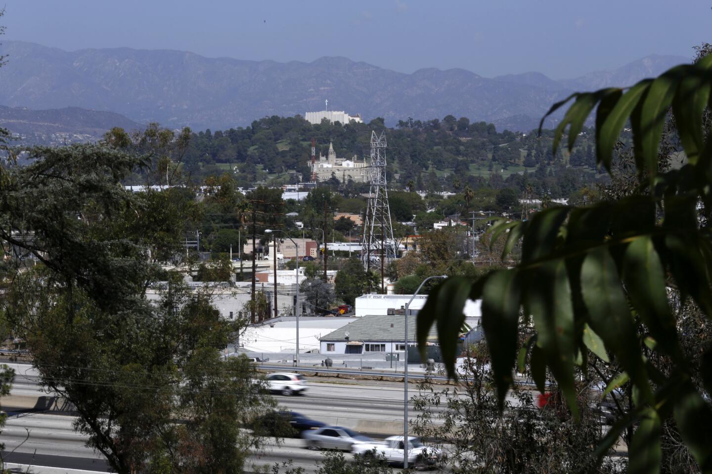
5. The path broadens into a wide dirt road — one of the area’s few unpaved city streets. Public staircases, designed for pedestrian access to the trolley line, enter from both sides. Walk on, past the intersection with India Street on the right. Farther on are views of the roaring 5 Freeway and in the distance Forest Lawn Memorial Park.
More from L.A. Walks: Explore Los Angeles by foot
6. As the trail ends at a bluff and begins to wind steeply downhill, stop to imagine a trestle — the Fletcher Viaduct, the trolley bridge, dismantled in 1959, that crossed Fletcher Avenue far below. Across the divide, you can see a staircase that helped pedestrians access the trolley stop. Just below are the colorful footings that held up the trestle, now the basis of an ongoing community art project.

Views of the 5 Freeway and in the distance Forest Lawn Memorial Park are seen from the trail.
7. Take the trail downhill, walking carefully, then turn right on Fletcher and right onto Riverside to return to your starting point.
8. If the weather is wet or the trail looks too steep or slippery, return to the intersection with India Street. Turn left, walk a block, then turn quickly right onto Riverside Terrace and left onto Gleneden Street. When you hit Riverside Drive, you’re back at the beginning of the walk.
Fleming is the author of “Secret Stairs: A Walking Guide to the Historic Staircases of Los Angeles” and the just-published “Secret Walks: A Walking Guide to the Hidden Trails of Los Angeles.”
Red Car route walk info
The stats
Distance: 2 miles
Difficulty: 2, on a scale of 1 to 5
Duration: 1 to 11/2 hours
Details: Ample street parking. Dogs on a leash are OK.
MORE L.A. WALKS:
One reason to hike Rocky Peak in Simi Valley? Otherworldly rock formations
Oceanside Abalone Cove Trail on Palos Verdes is a walk to awe over
L.A. Walks: Paramount Ranch offers a real hike in the faux Old West