A winter storm that is on track to hit Southern California on Thursday is expected to bring steady rain to the region and has authorities in areas devastated by deadly fires and mudslides on alert.
The heaviest rainfall near the massive burn scars in Santa Barbara and Ventura counties is expected Thursday evening and in the predawn hours Friday, said Curt Kaplan, a meteorologist with the National Weather Service in Oxnard. Flat areas could see an inch of rain, and two to three inches on ocean-facing mountain slopes is possible.
“It looks like a pretty significant storm, honestly,” Kaplan said.
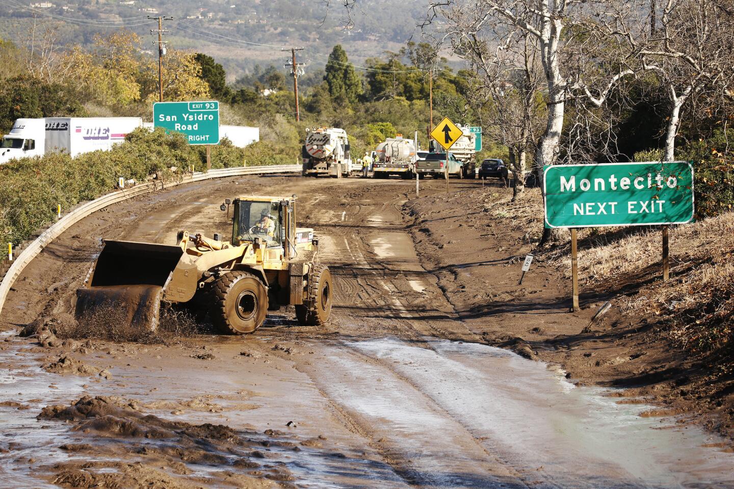
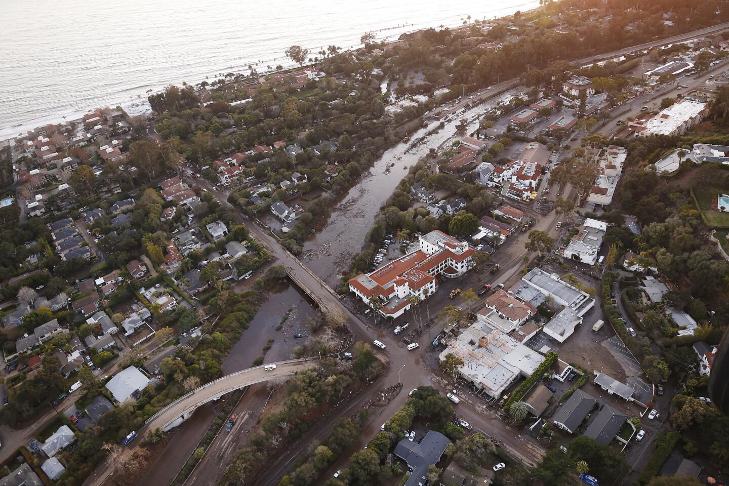
In Santa Barbara County, which is still recovering from January mudslides that killed 21 people, authorities are urging residents in some areas to evacuate ahead of the storm. Forecasters say the storm could dump one-third to two-thirds of an inch of rain per hour at certain points, which could be enough to trigger mud and debris flows near burn areas.
Advertisement
A significant winter storm is expected across SW Calif.Thursday thru Friday morning. Then showers continuing into Saturday. People in recent burn areas, especially the Thomas Burn area need to listen to local officials if asked to evacuate. #Montecito#debrisflows#CAwx#CAstormpic.twitter.com/oadWOGpYzb
The Santa Barbara County Sheriff’s Office has recommended that residents in parts of Goleta, Santa Barbara, Montecito, Summerland and Carpinteria evacuate starting at 8 a.m. Wednesday. The county has created an interactive map that shows which neighborhoods are at risk.
Residents who live near or below mountains burned by the Thomas, Sherpa and Whittier burn areas are “strongly recommended to relocate to safer locations for their own safety,” the county said in an advisory issued Tuesday.
The prospect of yet more mud left Montecito resident John Beck feeling overwhelmed Wednesday. “I’m going to wait till tomorrow before I decide to leave,” he said as he sat down on a wooden chair in his living room. “Nobody knows what’s going to happen.”
The 75-year-old has lived in his white wooden house on Olive Mill Road for the last six years. Because he lived in the voluntary evacuation zone during January’s deadly mudslide, he thought he didn’t need to evacuate. “I figured we would get some water and a little mud, but no one expected that enormity,” Beck said.
Advertisement
Kaplan said National Weather Service meteorologists are in “constant contact” with authorities and emergency managers in Santa Barbara and Ventura counties as the storm moves in from the northwest.
The storm will likely bring a “steady rain,” but forecasters, so far, do not anticipate the same level of intense downpours that were seen during the Jan. 9 storm that ripped away homes in Montecito, Kaplan said.
That storm poured half an inch of rain on Montecito in just five minutes.
“The last one we had, which was obviously devastating, was a short time but a heavy, heavy rain,” Kaplan said. “It was basically a five-minute deluge that really dumped on the hills of Montecito. We’ll see some higher rates but nothing like we saw in those short bursts on Jan. 9.”
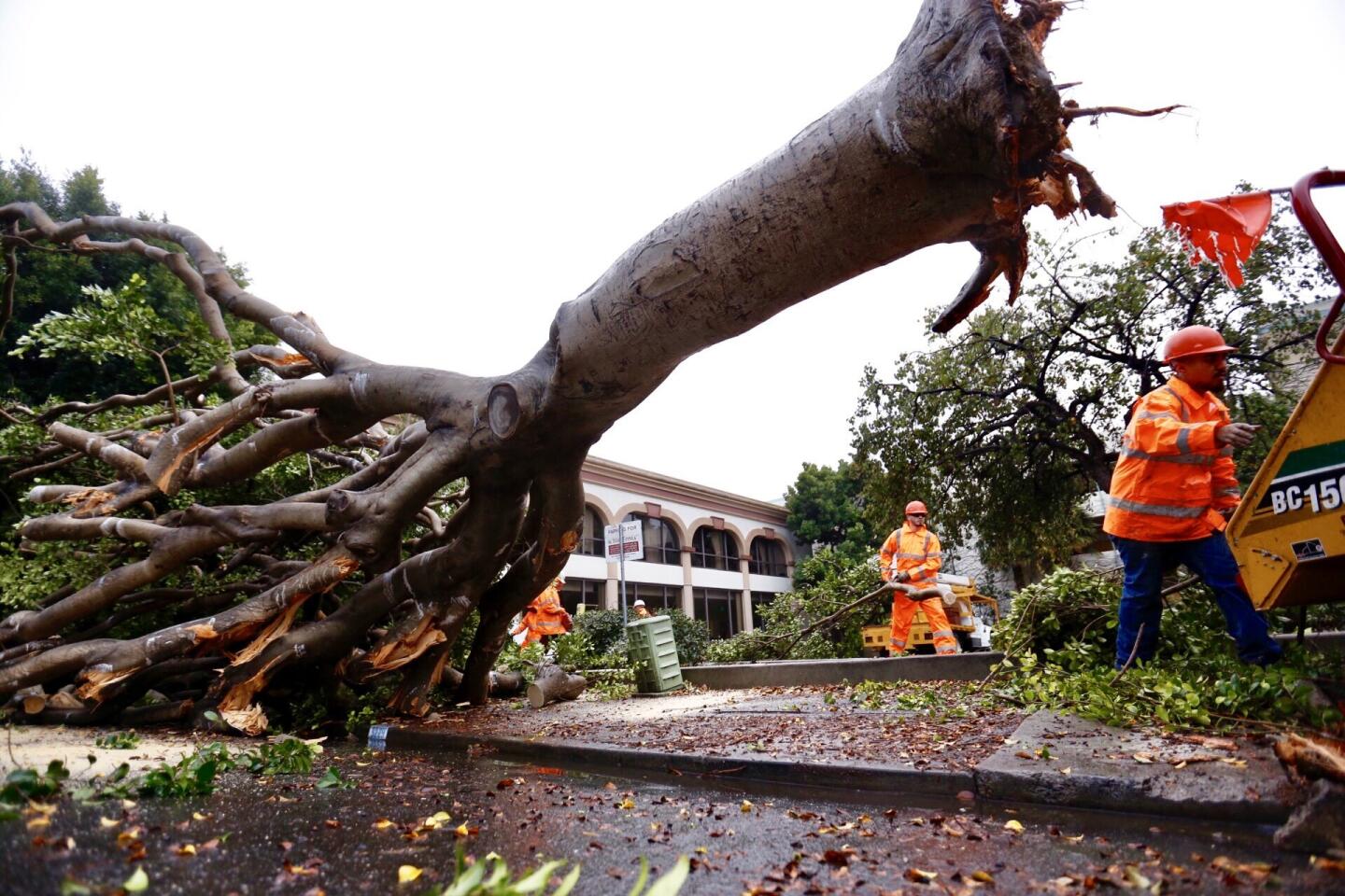
1/48
Contractors for the city of Ventura work to clear a huge tree toppled by wind on South Chestnut street between Main and Santa Clara Streets in downtown Ventura on Tuesday morning.
(Al Seib / Los Angeles Times)
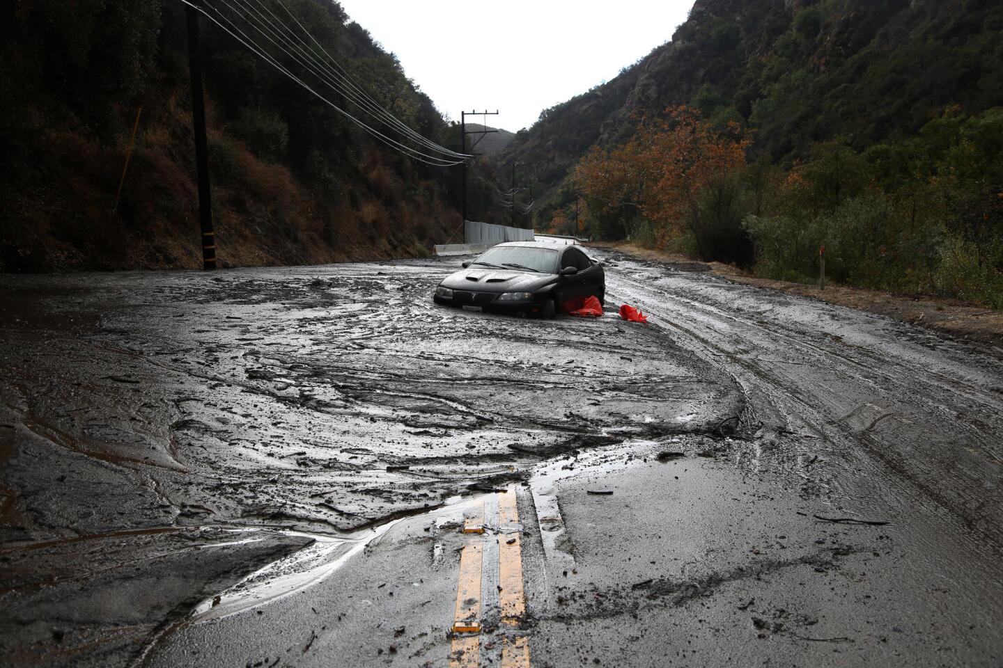
2/48
A car was stuck in a mudslide early Tuesday morning on Topanga Canyon Blvd., in Topanga.
(Katie Falkenberg / Los Angeles Times)
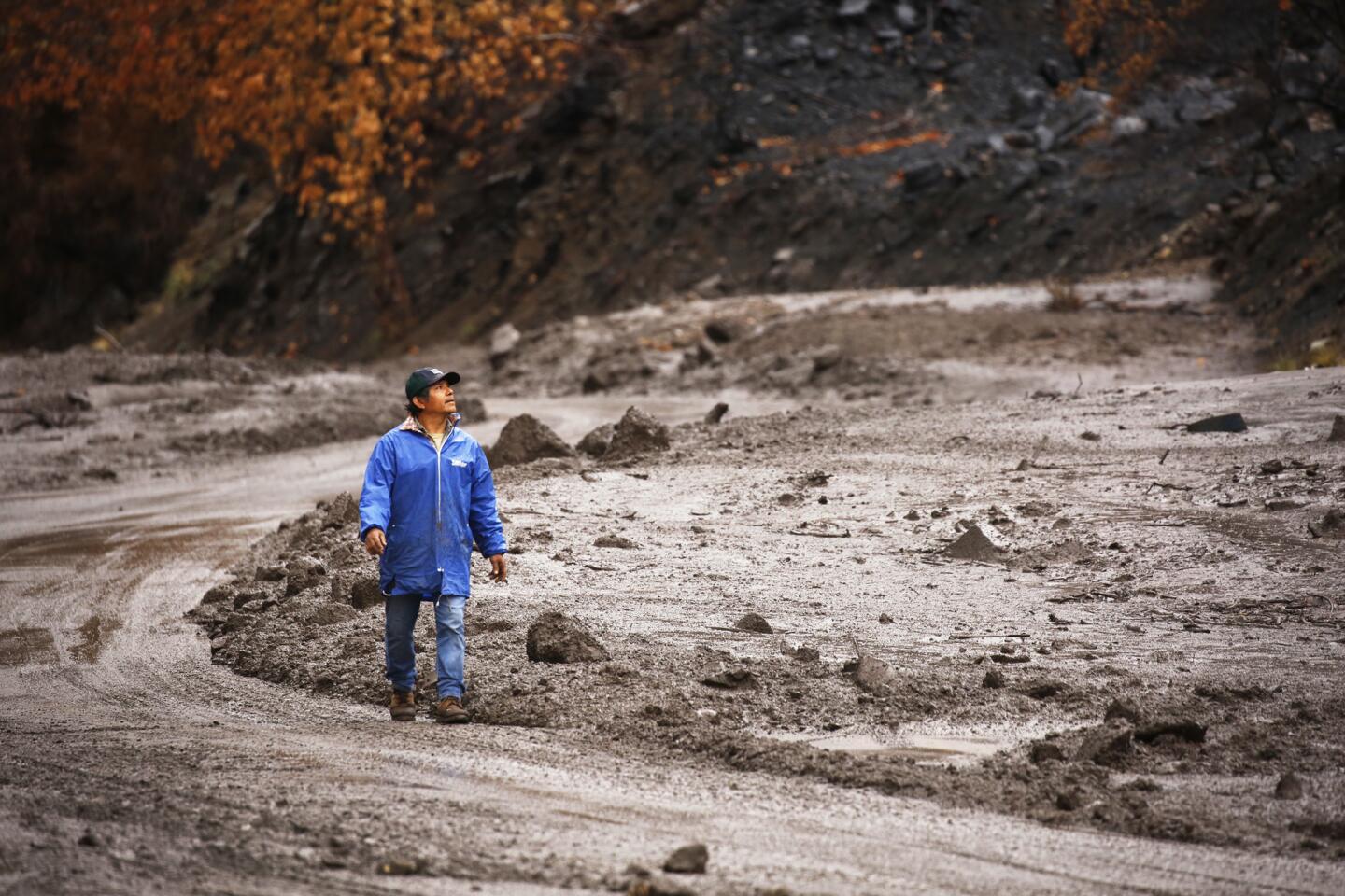
3/48
Mario Romero looks at mud debris covering Maricopa Highway 33 North of Ojai that has several closures due to mud and debris slides covering the roadway Tuesday morning.
(Al Seib / Los Angeles Times)
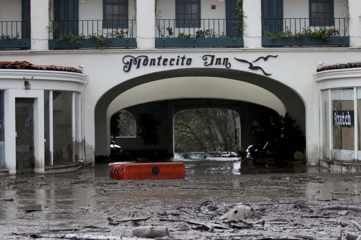
4/48
Debris and mud cover the entrance of the Montecito Inn after heavy rain brought flash flooding and mudslides to the area.
(Daniel Dreifuss / Associated Press)
5/48
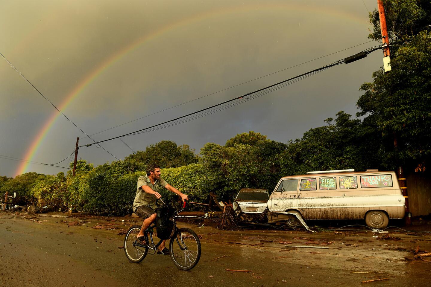
A rainbow appears over the deadly mudslide in Montecito along Olive Mill Road.
(Wally Skalij / Los Angeles Times)
6/48
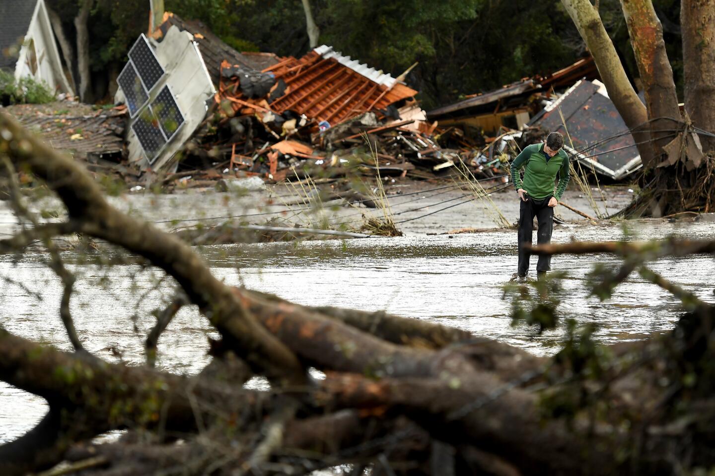
A man walks by destruction along Olive Mill Road in Montecito.
(Wally Skalij / Los Angeles Times)
7/48
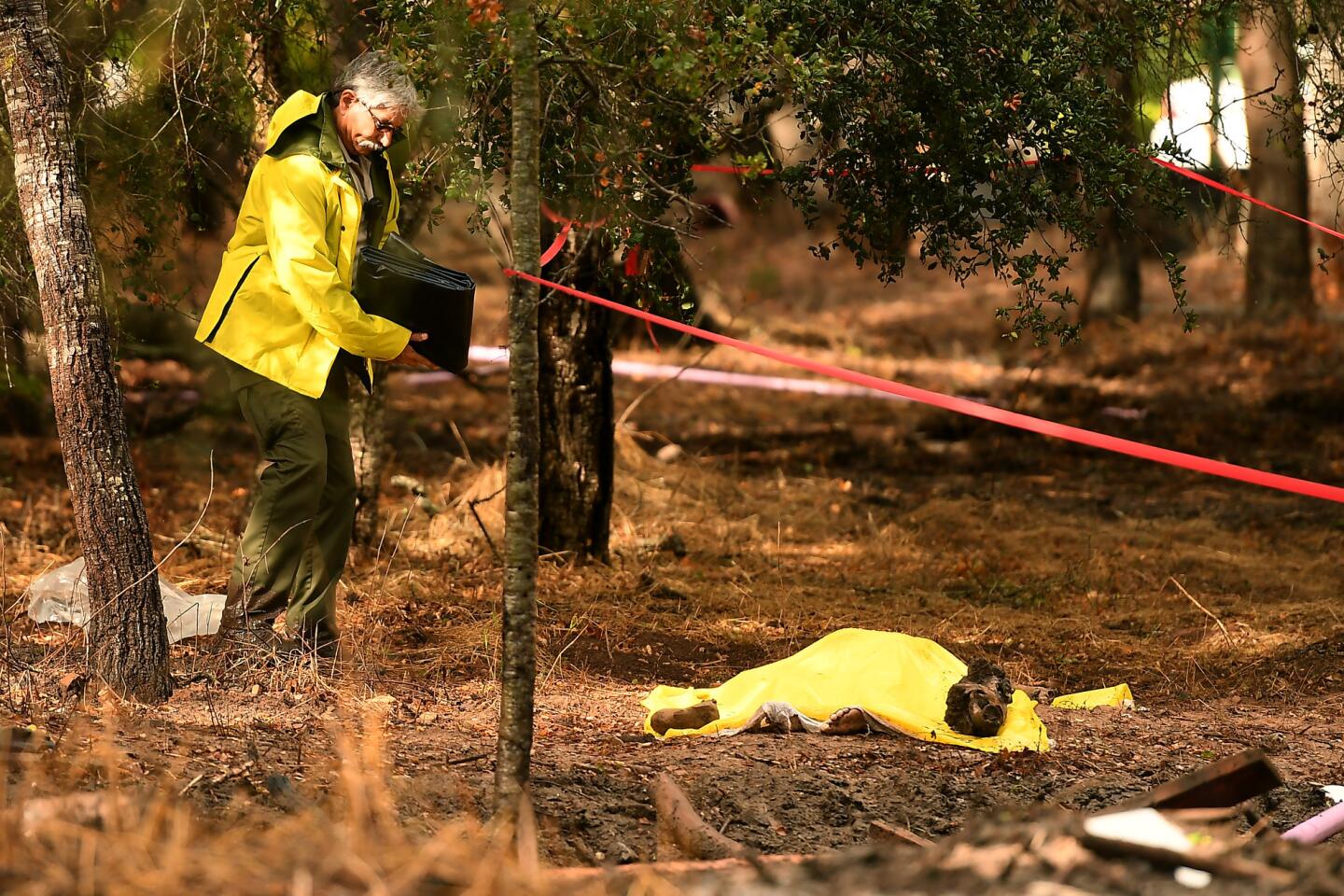
A sheriffs deputy stands near a body covered by a tarp near Hot Springs Road in Montecito after a deadly mudslide swept through the area.
(Wally Skalij / Los Angeles Times)
8/48
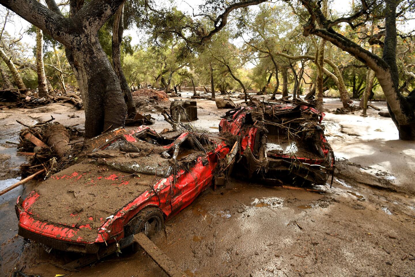
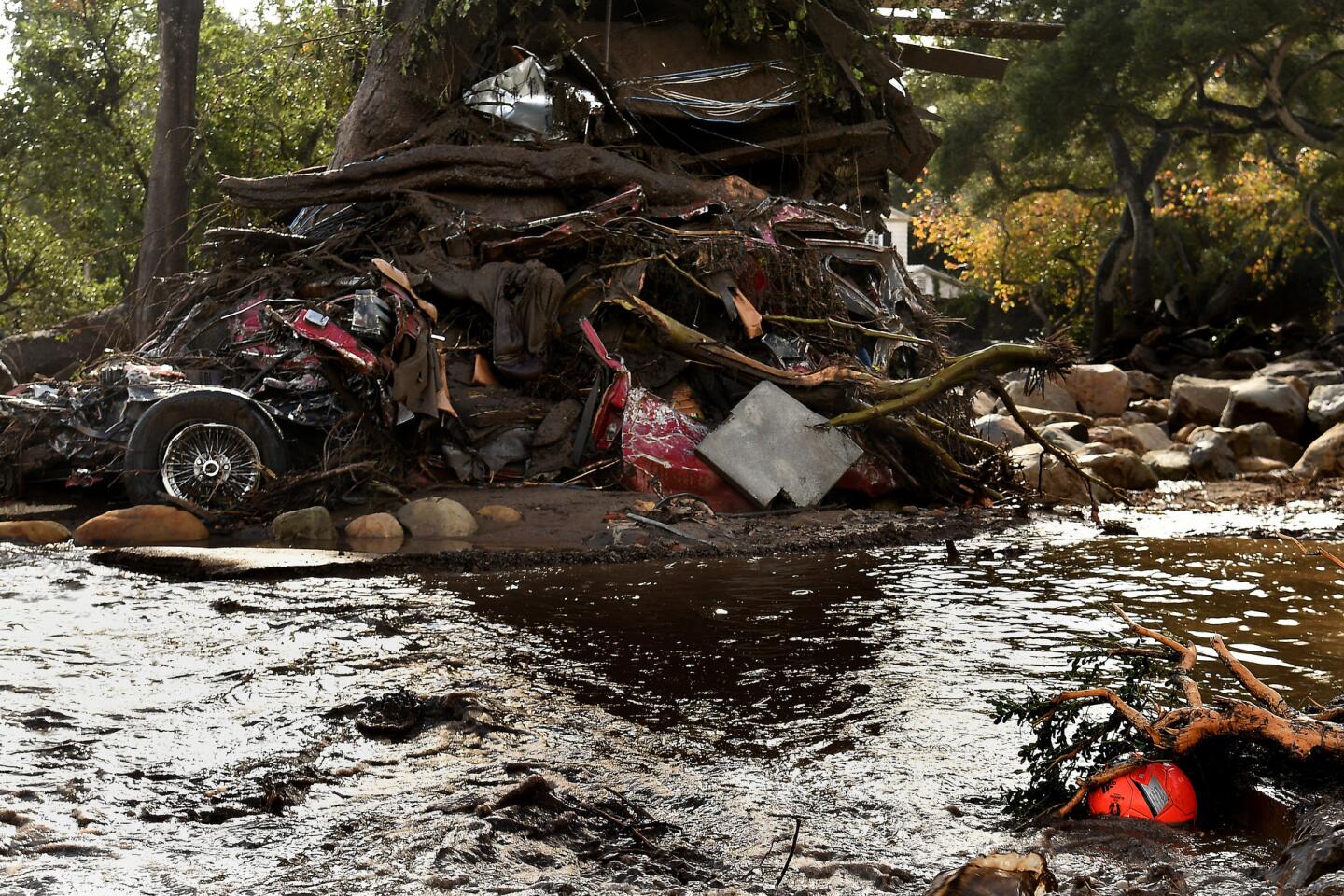
Mangled cars are stuck near Olive Mill Road in Montecito after a major storm hit the burn area Tuesday.
(Wally Skalij / Los Angeles Times)
9/48
A mangled car along with other debris is wrapped around a tree along Hot Springs Road in Montecito.
(Wally Skalij / Los Angeles Times)
10/48
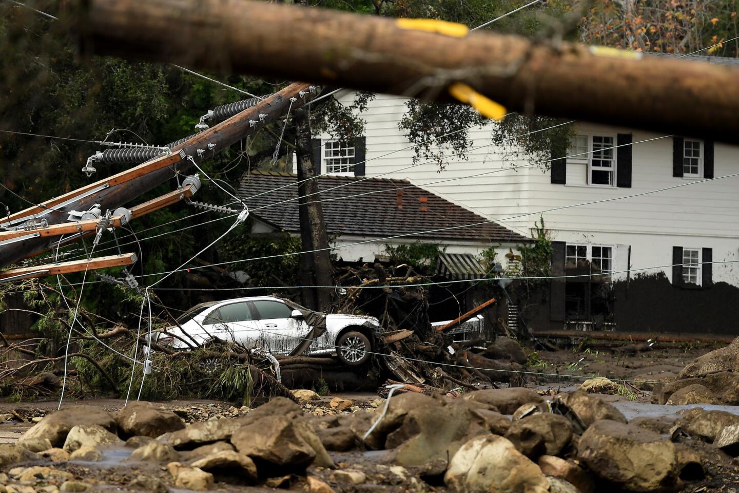
Scene from the 300 block of Hot Springs Road in Montecito following debris and mud flow due to heavy rain Tuesday morning.
(Wally Skalij / Los Angeles Times)
11/48
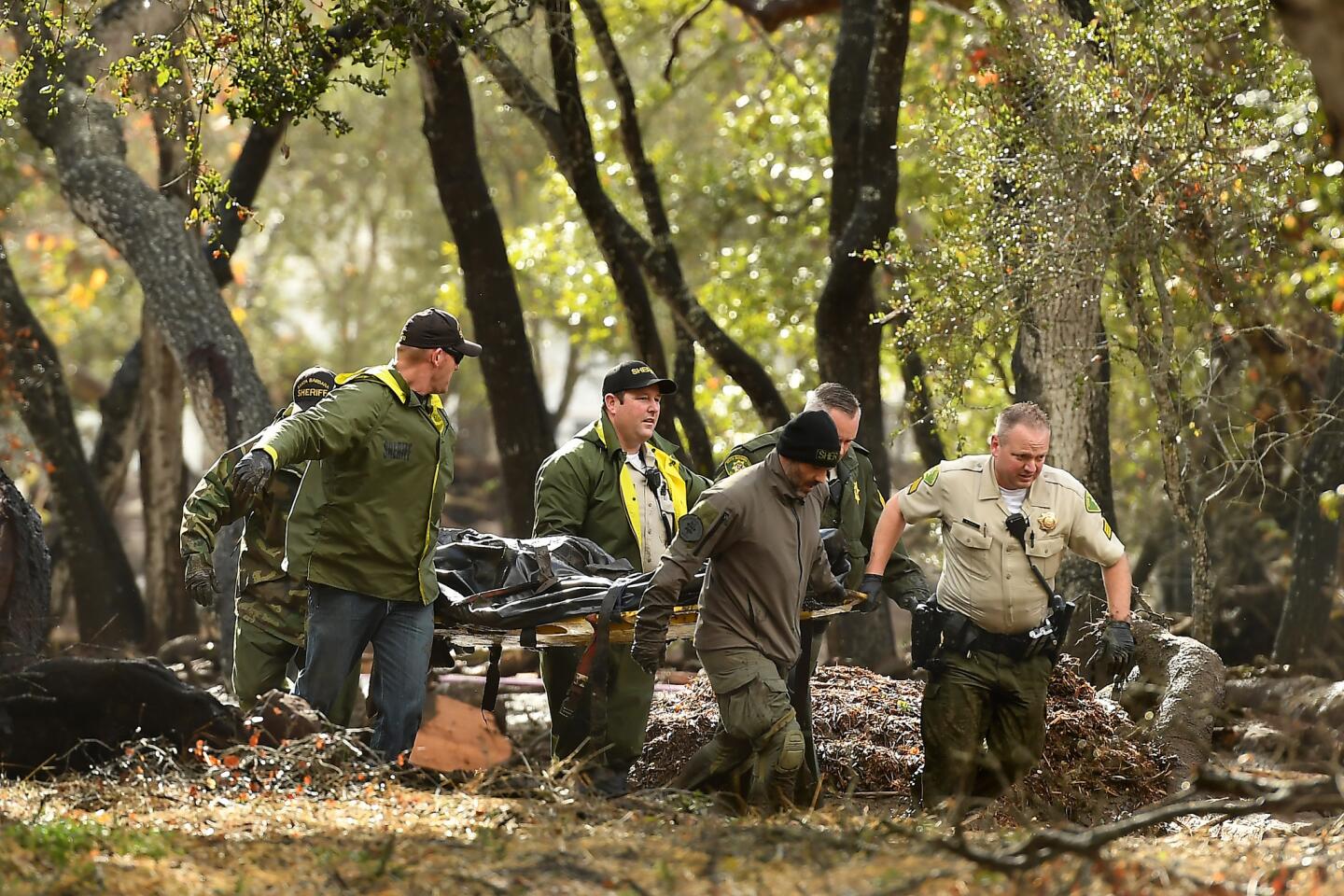
Sheriffs deputies carry a body from the debris near Hot Springs Road in Montecito after a major storm hit the burn area Tuesday.
(Wally Skalij / Los Angeles Times )
12/48
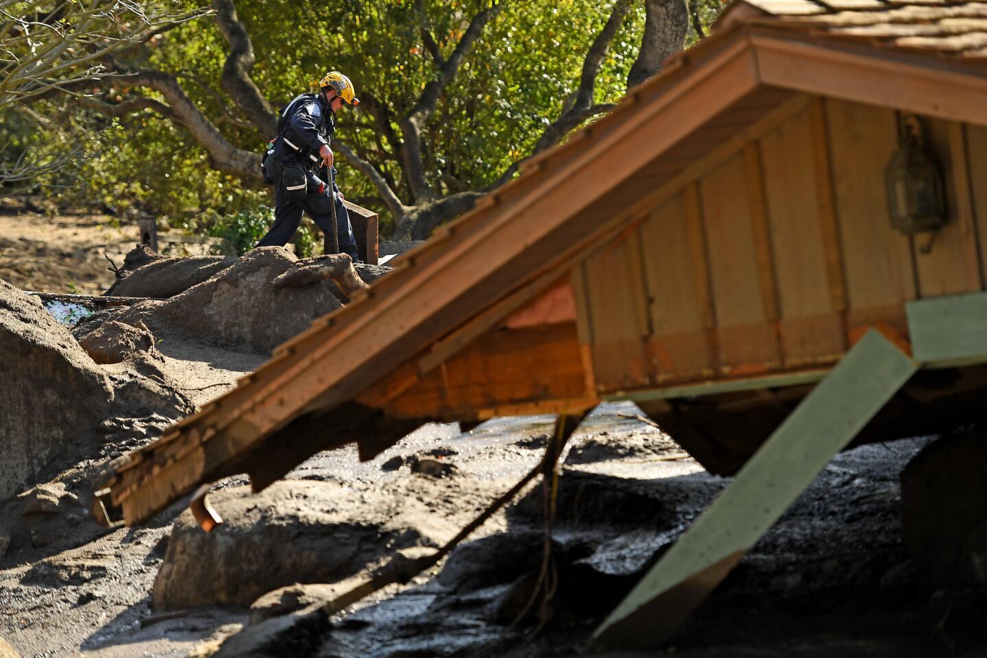
Orange County search-and-rescue crews look for missing people along Olive Mill Road and Hot Springs Road in Montecito.
(Al Seib / Los Angeles Times)
13/48
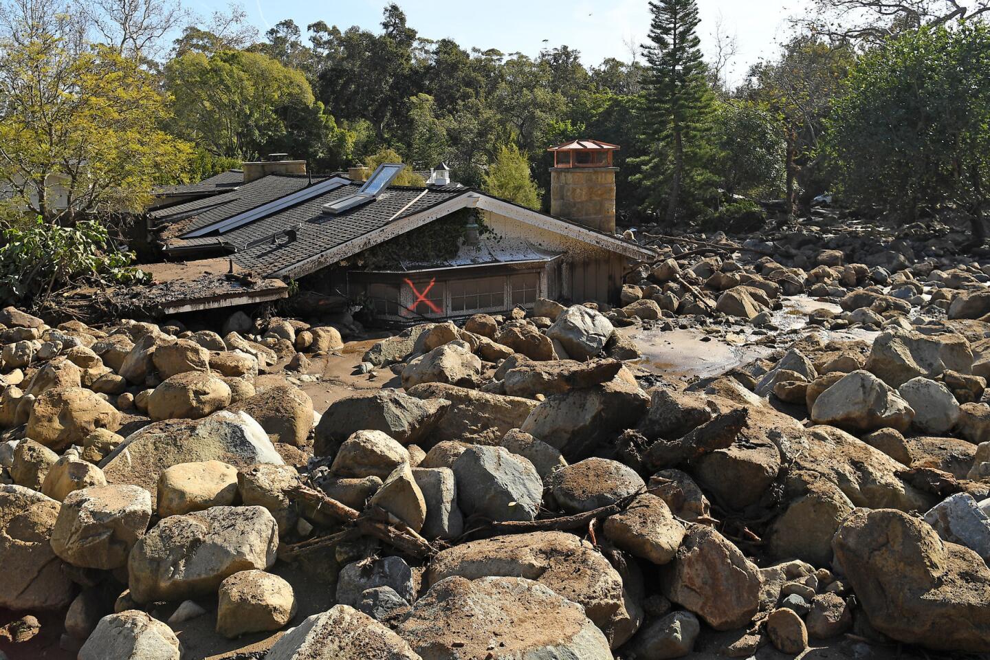
A house is left among boulders and mud along Glen Oaks Drive in Montecito.
(Wally Skalij / Los Angeles Times)
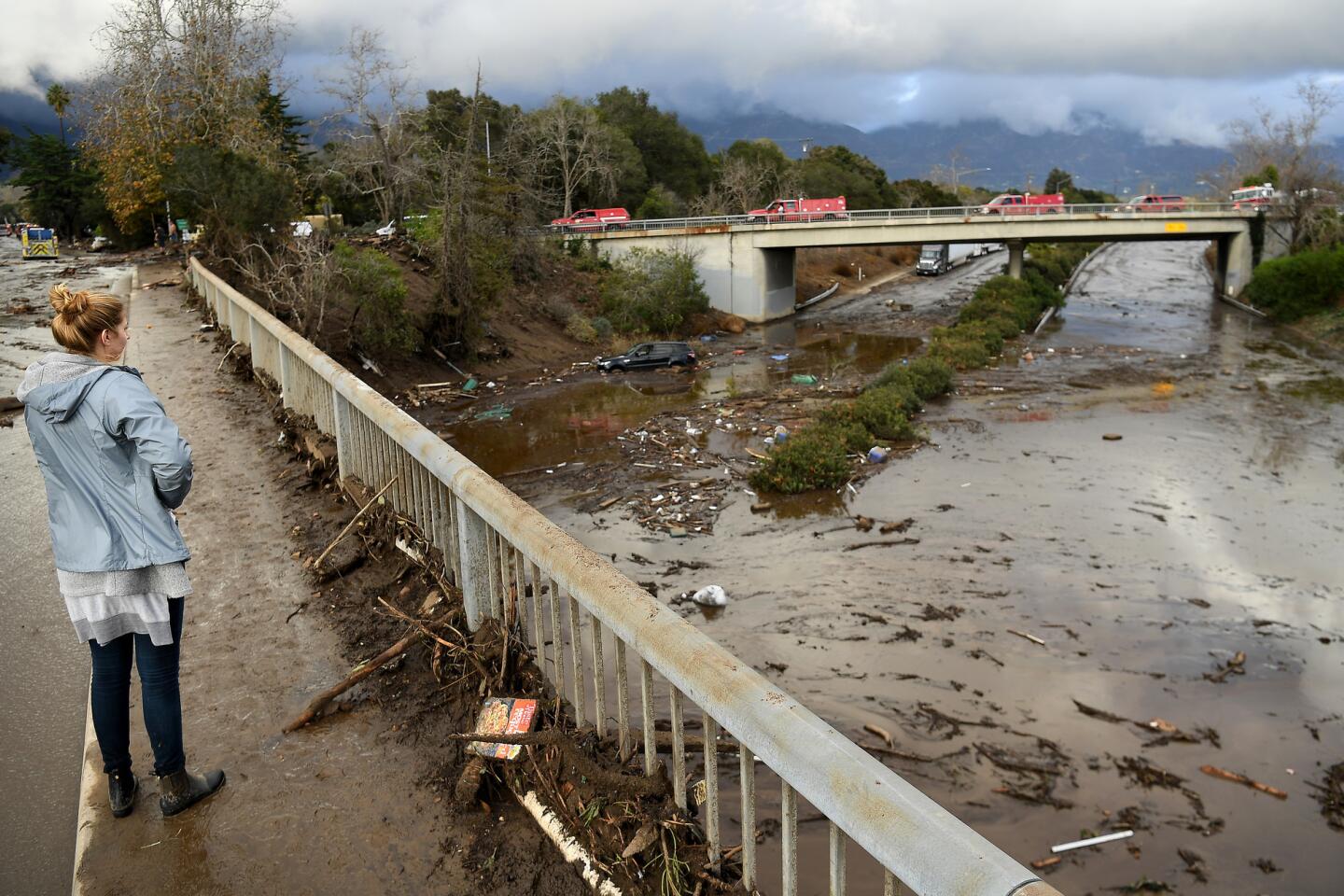
14/48
The 101 Freeway is covered with mud and debris at Olive Mill Road in Montecito.
(Wally Skalij / Los Angeles Times)
15/48
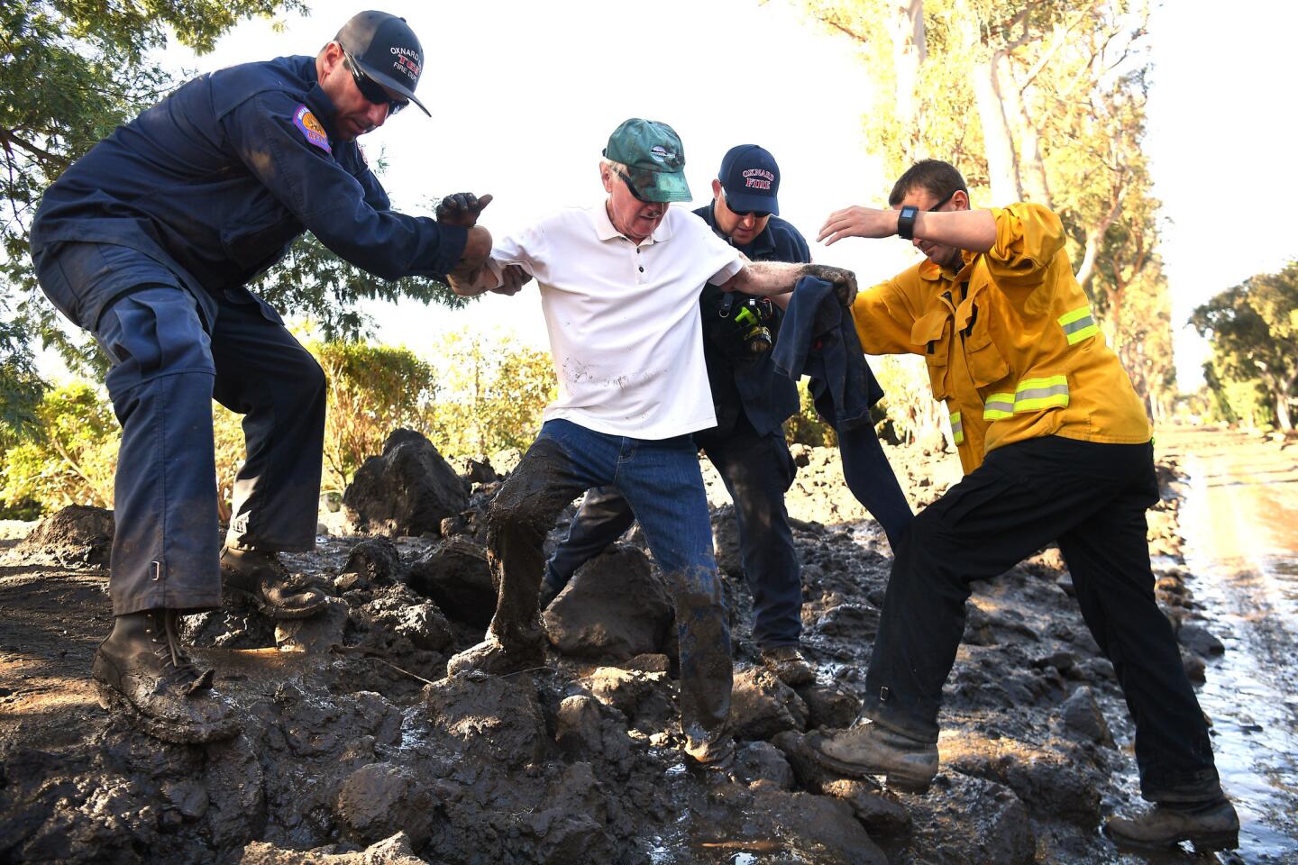
Montecito resident Terry Connery, second from left, is assisted on Wednesday by, from left, firefighters Mark Todd, John Cecena and Jeff Shea after the storm.
(Wally Skalij / Los Angeles Times)
16/48
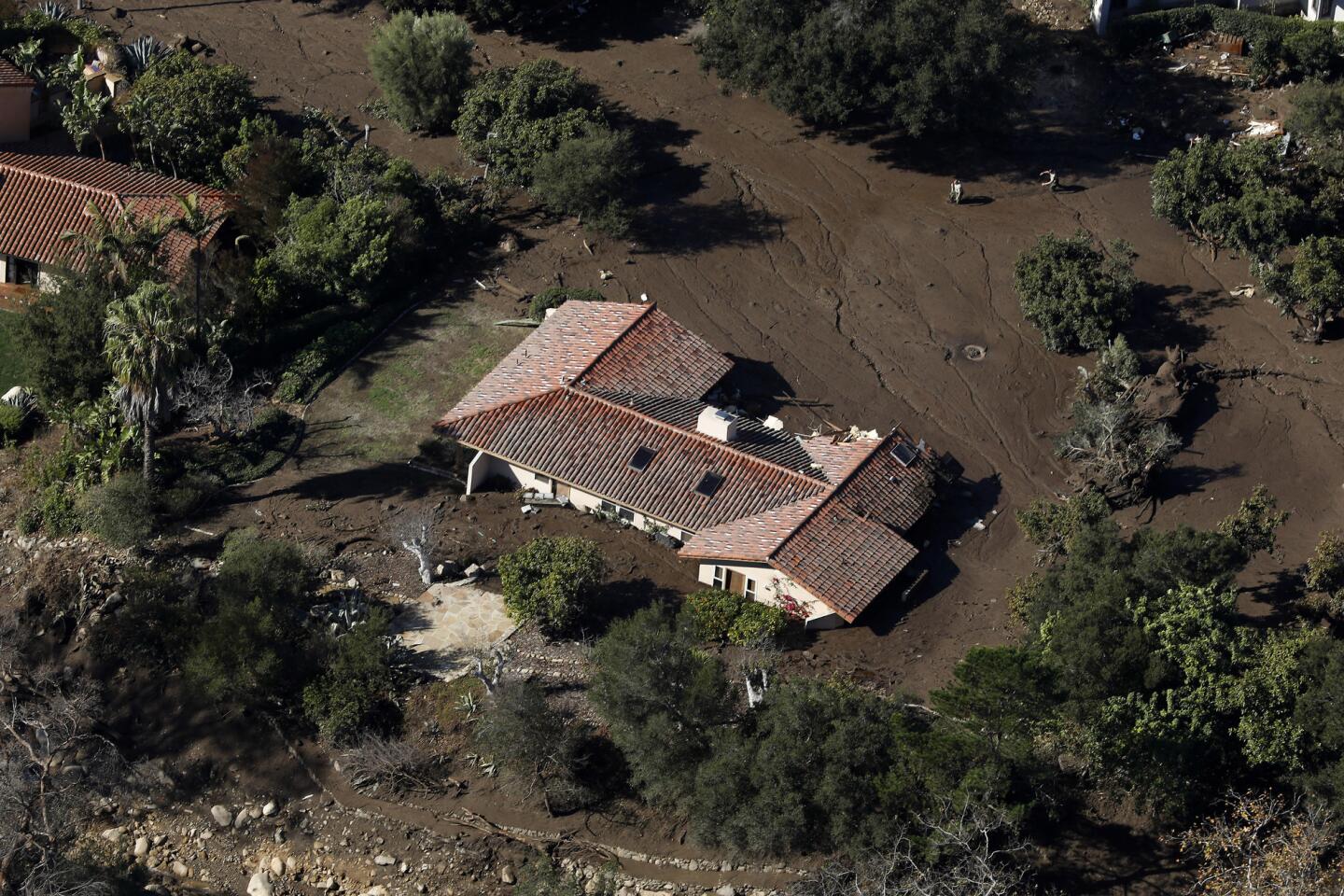
A home off of Romero Canyon Road in Montecito is inundated with mud.
(Mel Melcon / Los Angeles Times)
17/48
Crews work to clear debris from the closed 101 Freeway at Olive Mill Road in Montecito.
(Al Seib / Los Angeles Times)
18/48
The 101 Freeway remains closed as mud and debris clog the roadway at the Olive Mill Road overpass in Montecito.
(Al Seib / Los Angeles Times)
19/48
A member of the search and rescue team inpsects property near a home along Glen Oaks Drive in Montecito.
(Wally Skalij / Los Angeles Times)
20/48
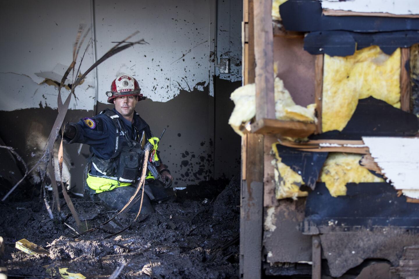
Ventura County fire Capt. Clay Cundiff searches a home for a woman who was reported missing by friends and family on Lilac Drive and Tollis Avenue in Montecito. She was later found safe.
(Brian van der Brug / Los Angeles Times)
21/48
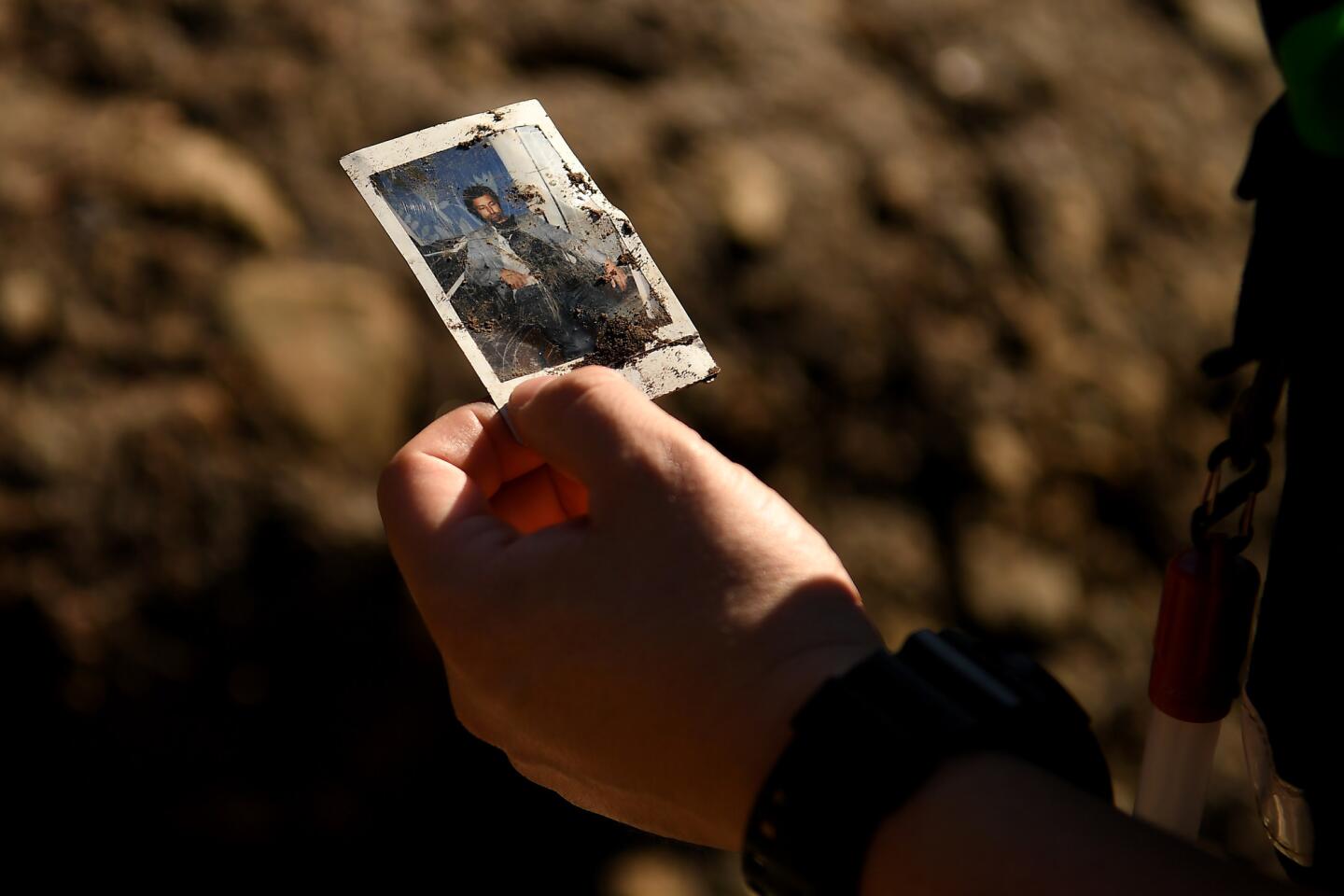
A member of the San Bernardino Search and Rescue holds a picture that was found along the East Cold Springs Creek in Montecito after a major storm hit the burn area Wednesday.
(Wally Skalij / Los Angeles Times)
22/48
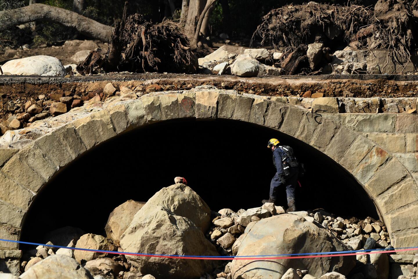
Tim O’Donnell, a member of the L.A. County Search and Rescue team, searches under Ashley Road along the East Cold Springs Creek in Montecito after a major storm hit the burn area Wednesday.
(Wally Skalij / Los Angeles Times)
23/48
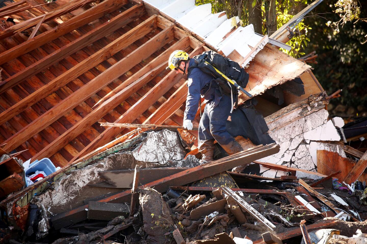
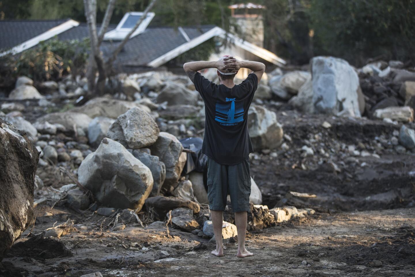
Travis Zehntner looks over the wreckage of a Glen Oaks Drive home where family friend Rebecca Riskin was killed.
(Brian van der Brug / Los Angeles Times)
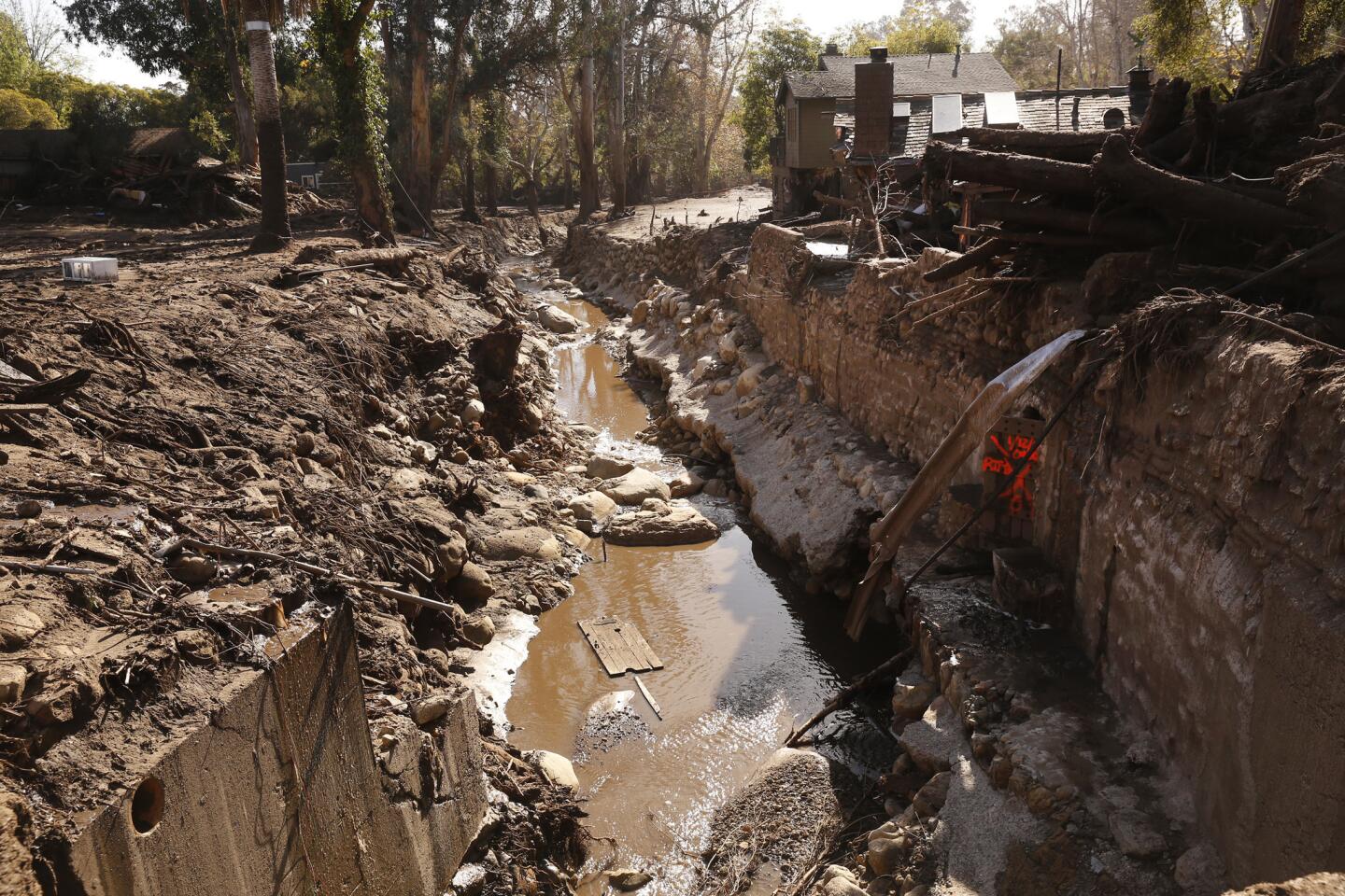
24/48
A home on West Park Lane along San Ysidro Creek in Montecito on Thursday.
(Brian van der Brug / Los Angeles Times)
25/48
A Cantin family holiday card in a pile of debris in the 300 block of Hot Springs Road in Montecito. From left, Kim, mother who survived; father David, who was killed; son Jack, who is still missing; and daugher Lauren, who was pulled from the family home early Wednesday.
(Brian van der Brug / Los Angeles Times)
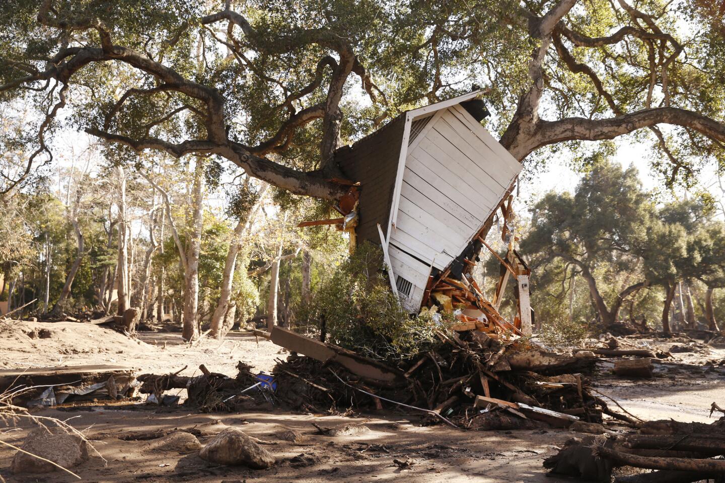
26/48
A structure sits in a tree Friday on East Valley Road in Montecito.
(Al Seib / Los Angeles Times)
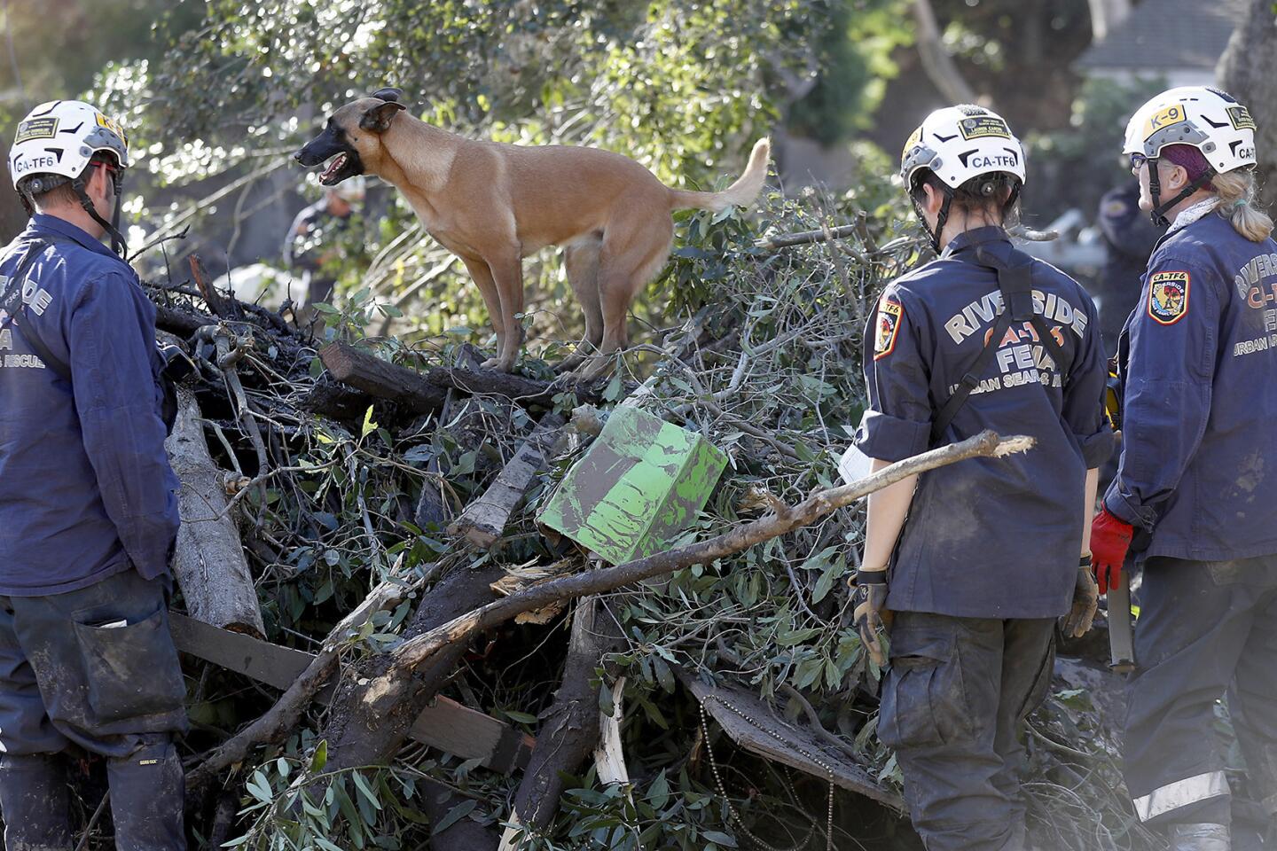
27/48
A dog and its handler from Riverside County search the rubble of a Hot Springs Road home Friday in Montecito.
(Brian van der Brug / Los Angeles Times)
28/48
Water rises high near a home on East Valley Road on Friday in Montecito.
(Al Seib / Los Angeles Times )
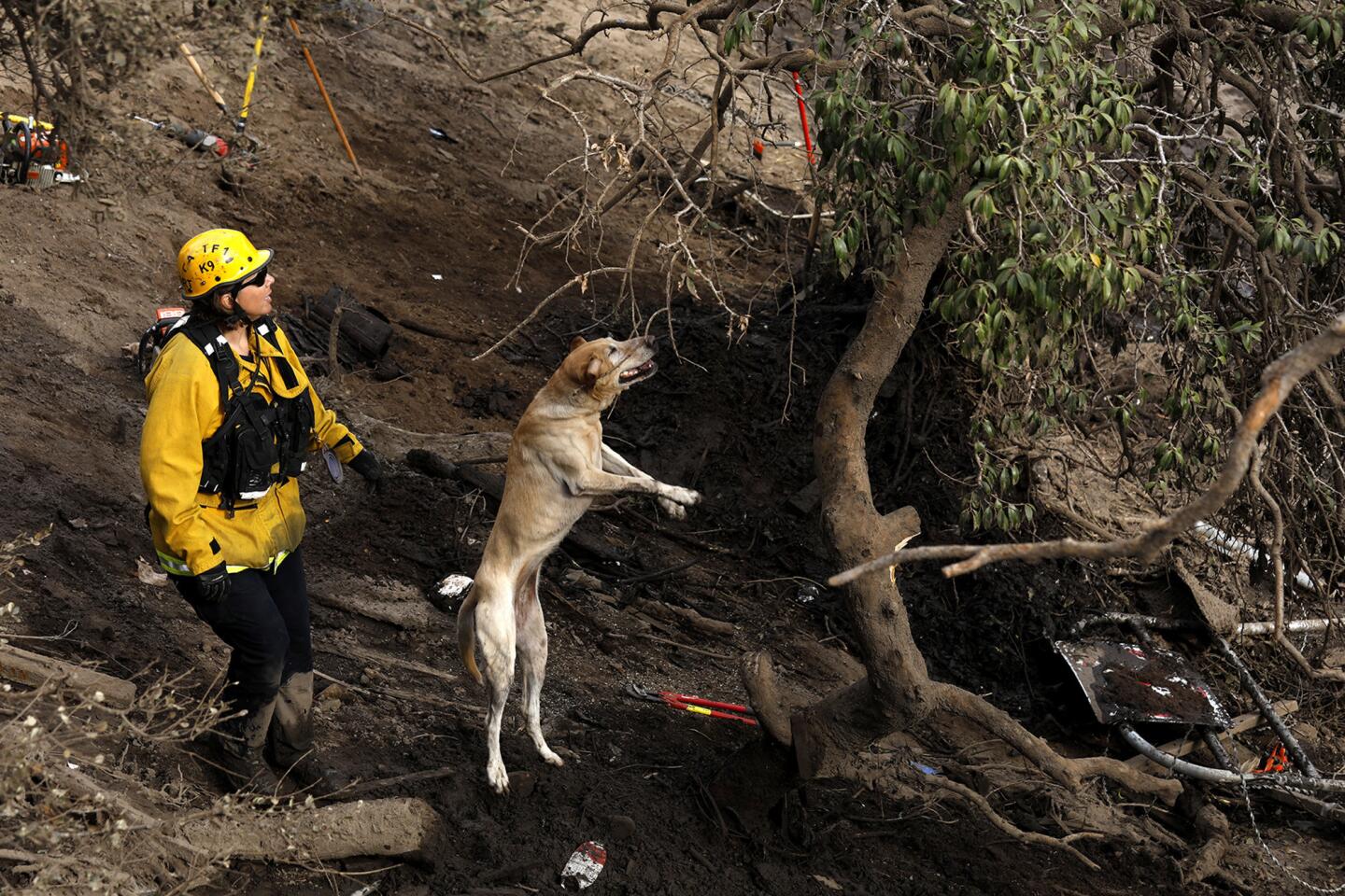
29/48
A dog helps rescue workers search through rocks, mud and debris for bodies Saturday in Montecito.
(Luis Sinco / Los Angeles Times)
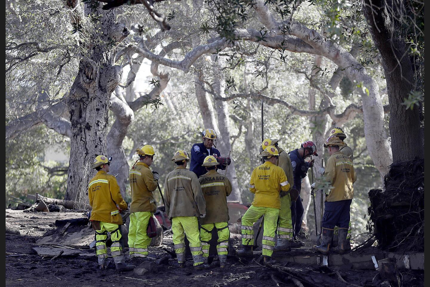
30/48
Firefighters look for missing people along Hot Springs Road in Montecito on Saturday.
(Luis Sinco / Los Angeles Times)
31/48
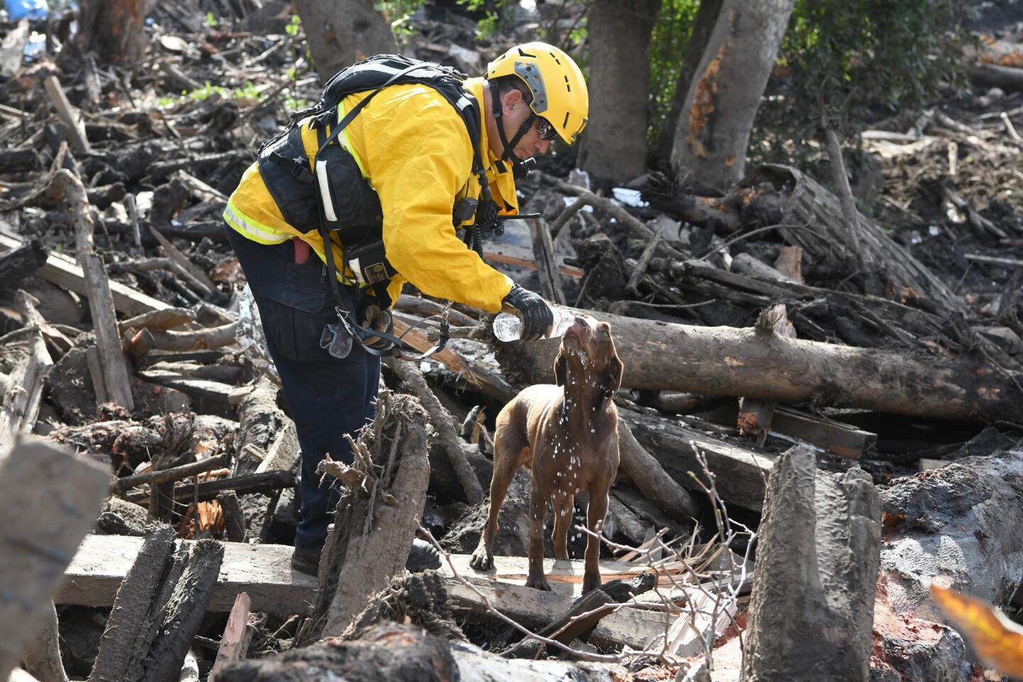
Los Angeles City firefighter Jeffrey Neu gives water to Faith, a cadaver dog, while searching in a wood pile in Montectio Creek.
(Michael Owen Baker / For The Times)
32/48
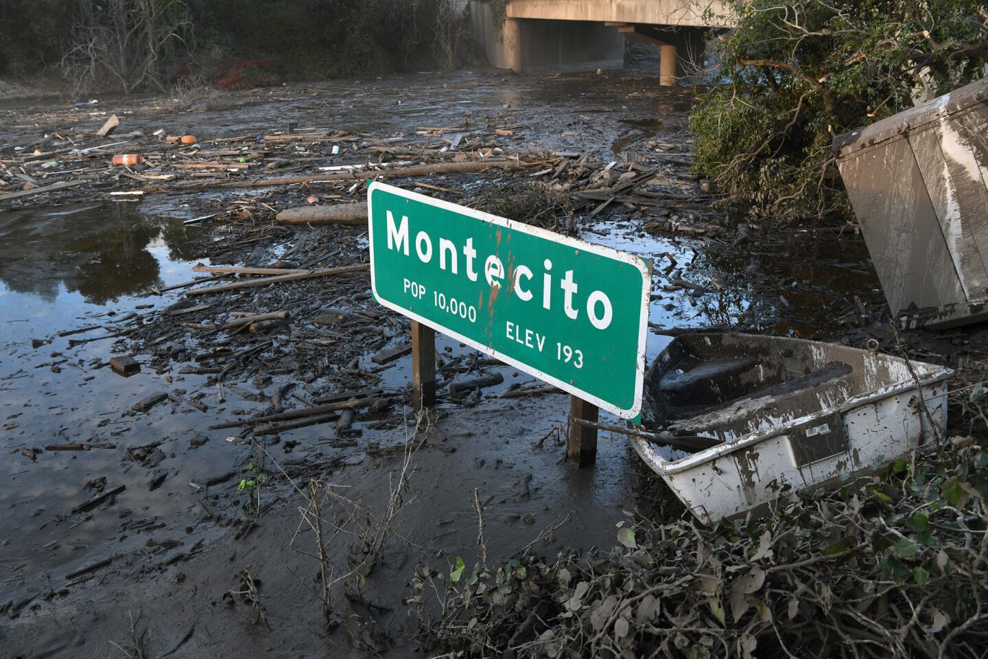
A Montecito freeway sign sits in mud on Highway 101.=
(Michael Owen Baker / For The Times)
33/48
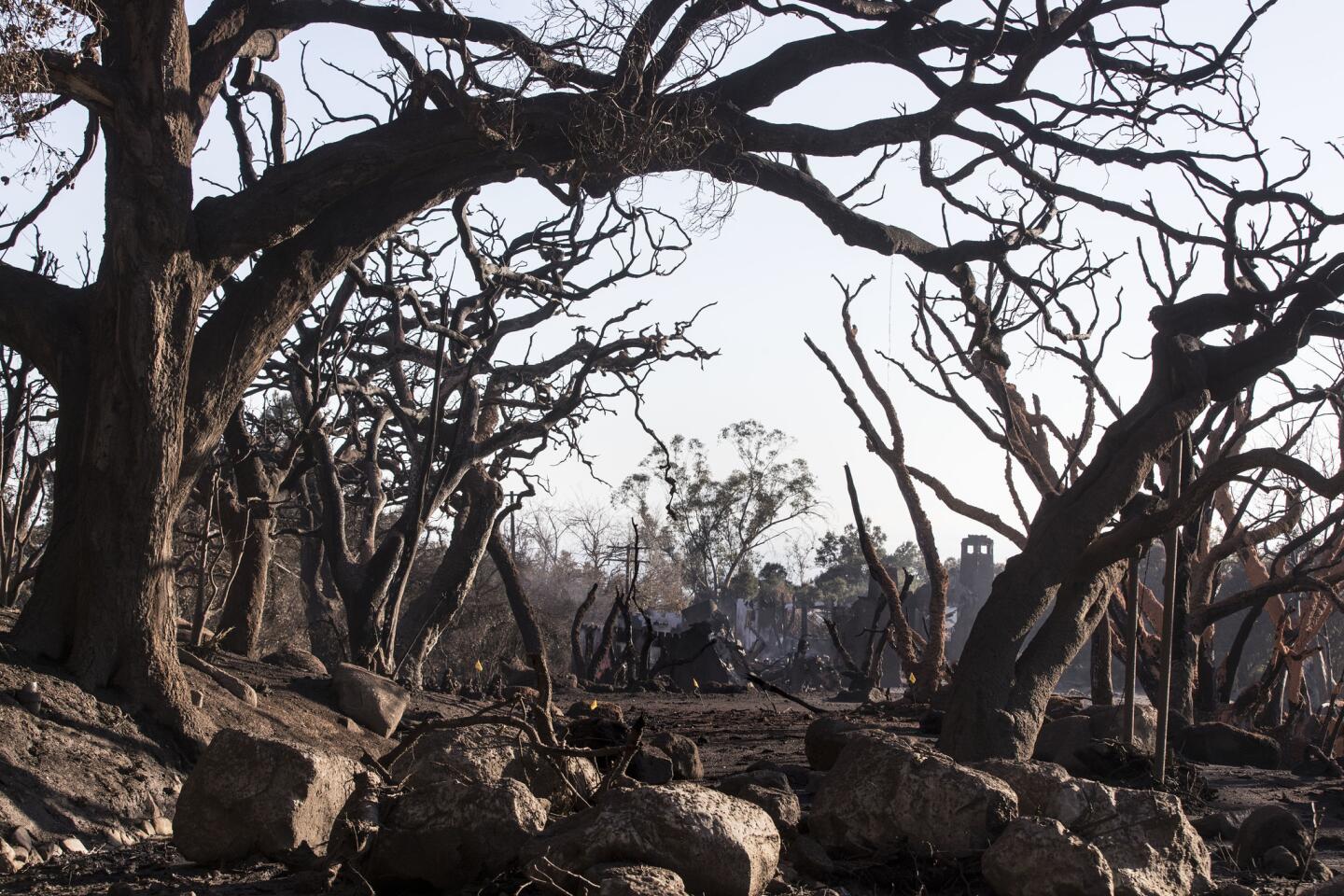
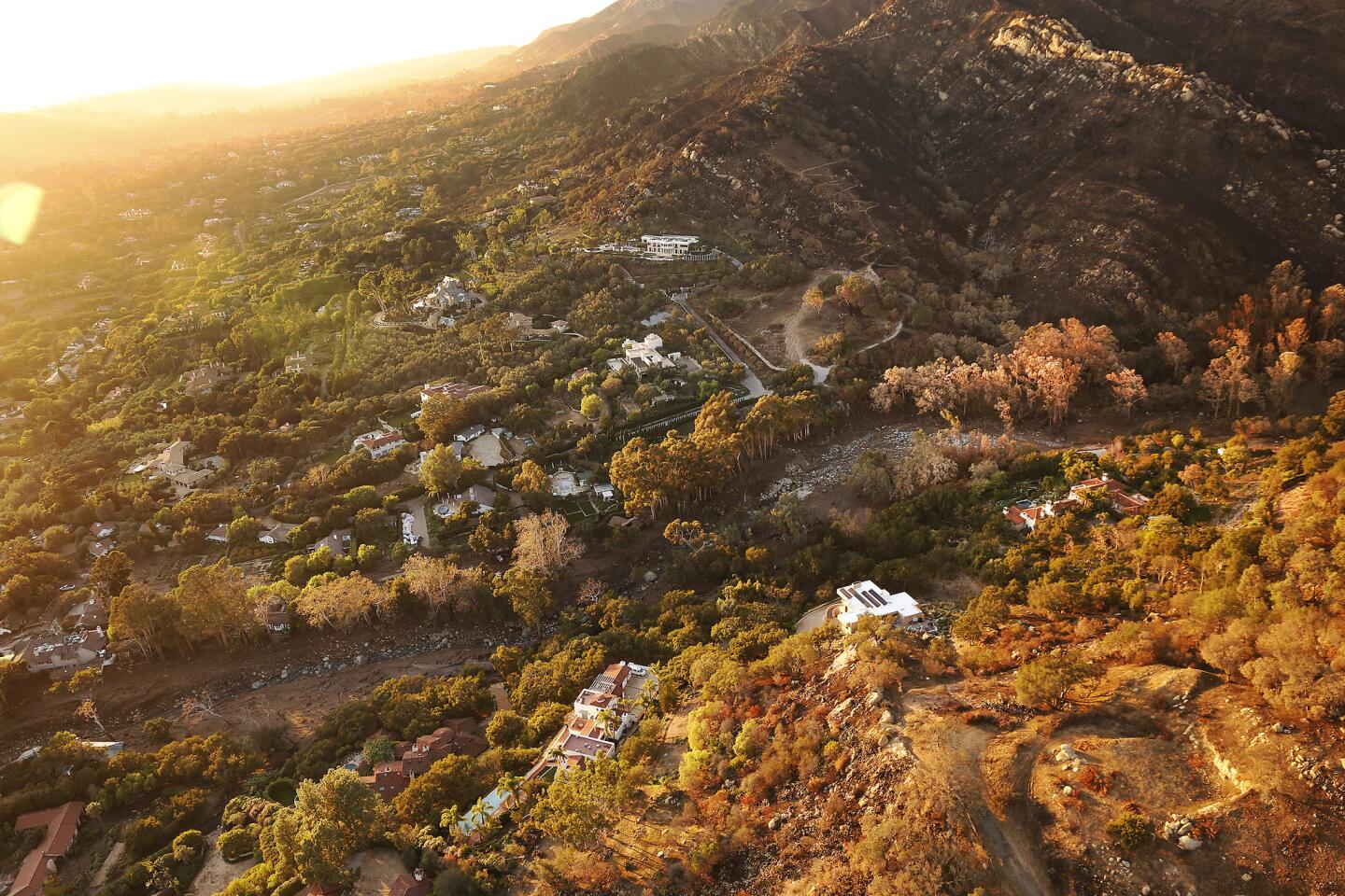
A view of the Thomas Fire burn zone and San Ysidro Creek in the Santa Ynez Mountains which brought mud and debris into Montecito neighborhoods.
(Al Seib / Los Angeles Times)
34/48
Los Angeles City firefighter Hollyn Bullock uses a rescue tool to pry open a car door along Montecito Creek.
(Michael Owen Baker / For The Times)
35/48
Montecito neighbors hug at a candlelight vigil outside the Santa Barbara Courthouse.
(Wally Skalij / Los Angeles Times)
36/48
Mourners gather for a candlelight vigil outside the Santa Barbara Courthouse Sunday for victims of the Montecito mudslides.
(Wally Skalij / Los Angeles Times)
37/48
Geness Lorien listens to speakers during a candlelight vigil outside the Santa Barbara Courthouse.
(Wally Skalij / Los Angeles Times)
38/48
Mourners gather for a candlelight vigil outside the Santa Barbara Courthouse Sunday for victims of the Montecito mudslides.
(Wally Skalij / Los Angeles Times)
39/48
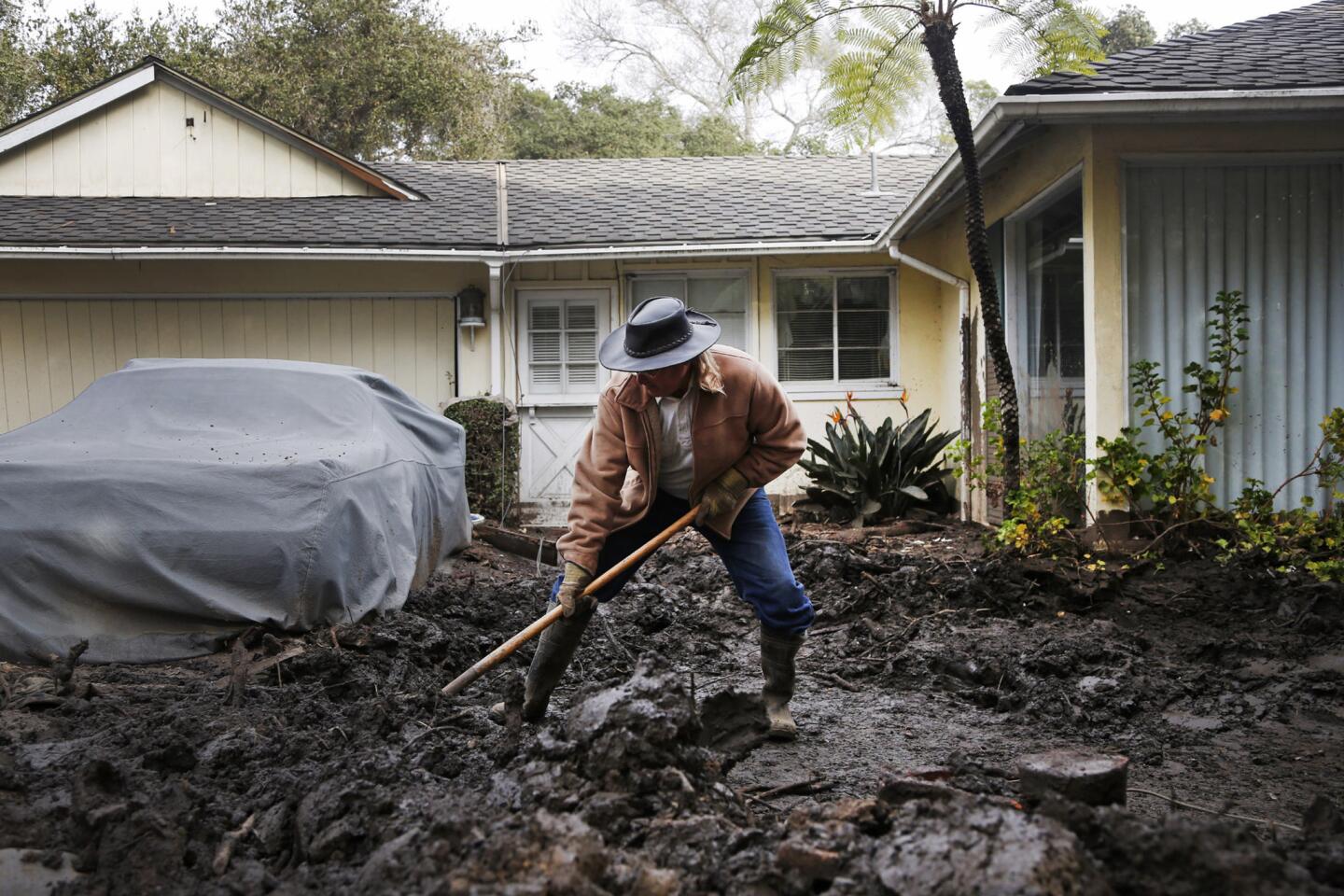
Mark Vance shovels mud away from his house on Olive Mill Road in Montecito, California.
(Katie Falkenberg / Los Angeles Times)
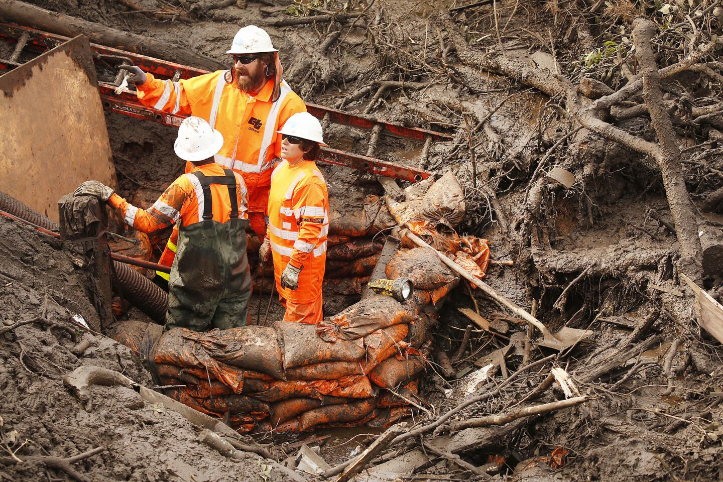
40/48
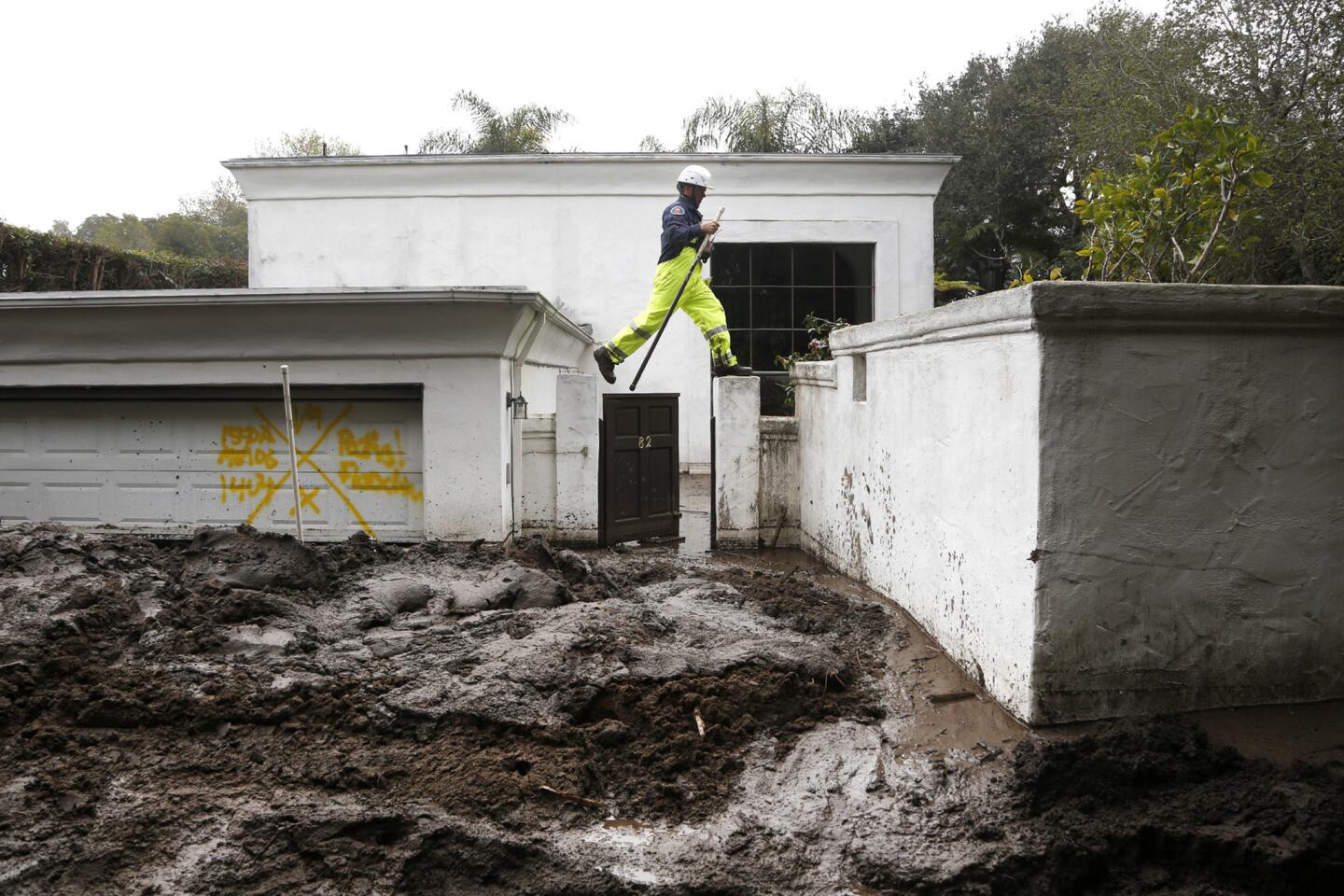
Jesse Rudnick, with the Regional Task Force 1 out of Marin County Fire and Rescue, searches for missing people around a Montecito home.
(Katie Falkenberg / Los Angeles Times)
41/48
Hugo Bautista, left and Jose Garcia, contractors with Union Pacific Railroad make sure track is clear at the Olive Mill Road crossing in Montecito.
(Al Seib / Los Angeles Times)
42/48
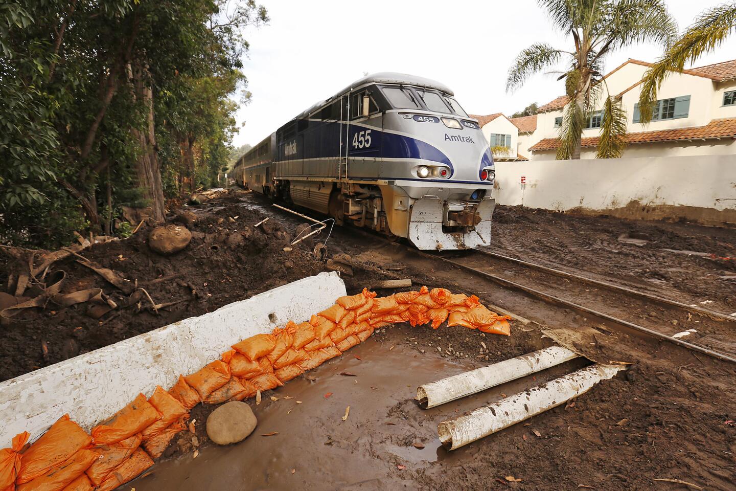
Amtrak has added extra trains and cars for passengers trying to get around the 101 Freeway closure in Montecito.
(Al Seib / Los Angeles Times)
43/48
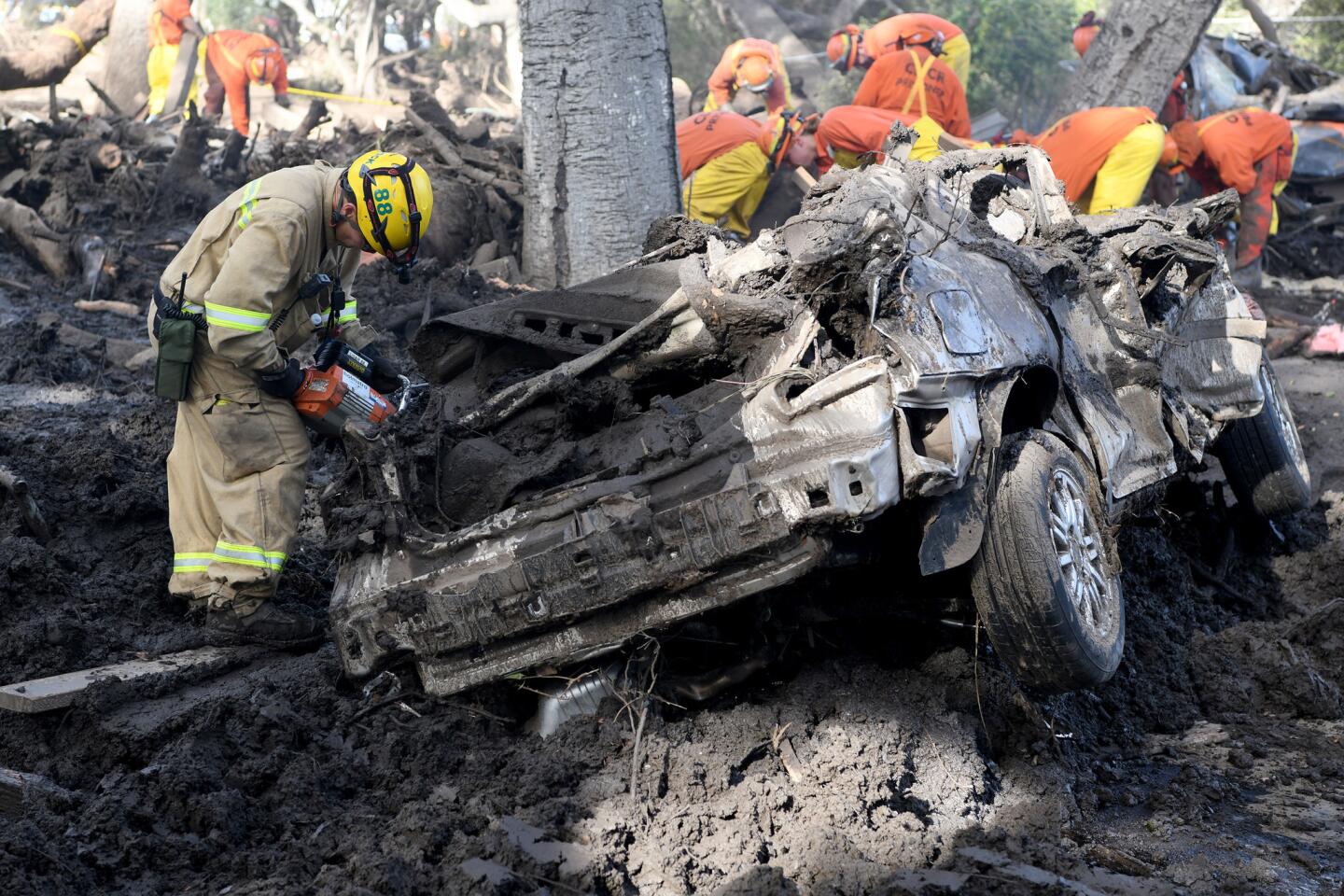
Crews continue to clear mud and debris from the 101 Freeway near Olive Mill Road on Tuesday, January 16, 2018. Officials said they hoped to have the freeway opened by next Monday.
(Al Seib / Los Angeles Times)
44/48
Cal Trans crews work on clearing a drain along the 101 Freeway in Montecito on Tuesday, January 16, 2018.
(Al Seib / Los Angeles Times)
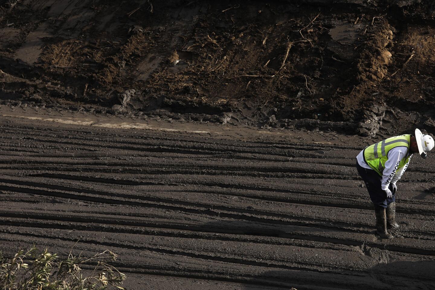
45/48
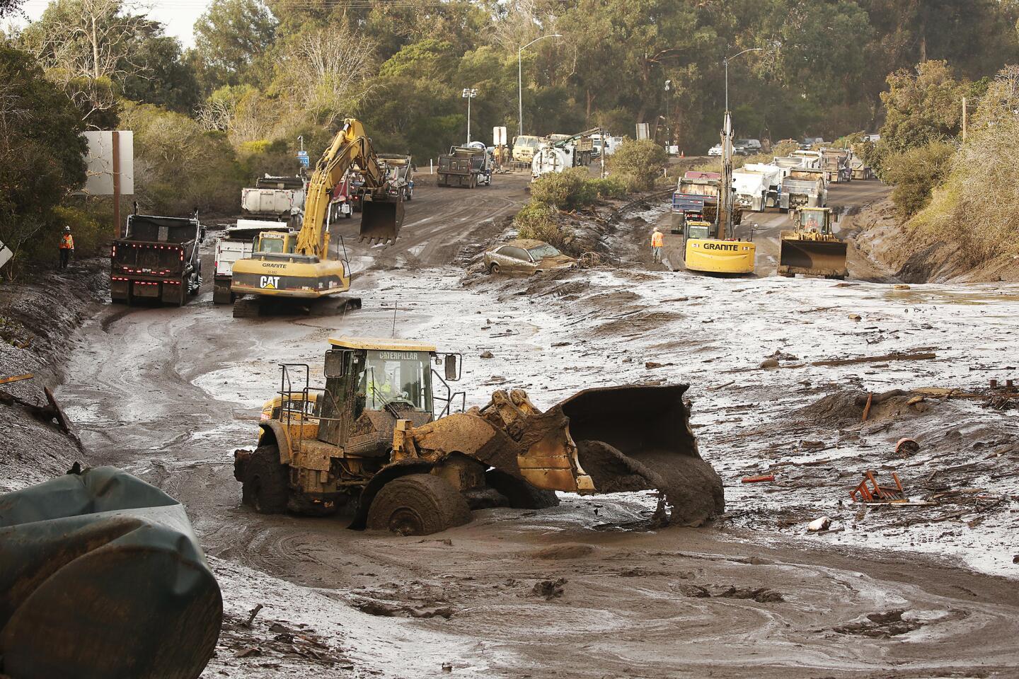
A worker takes a breather from directing a bulldozer driver who clears mud from the 101 freeway in Montecito.
(Genaro Molina / Los Angeles Times)
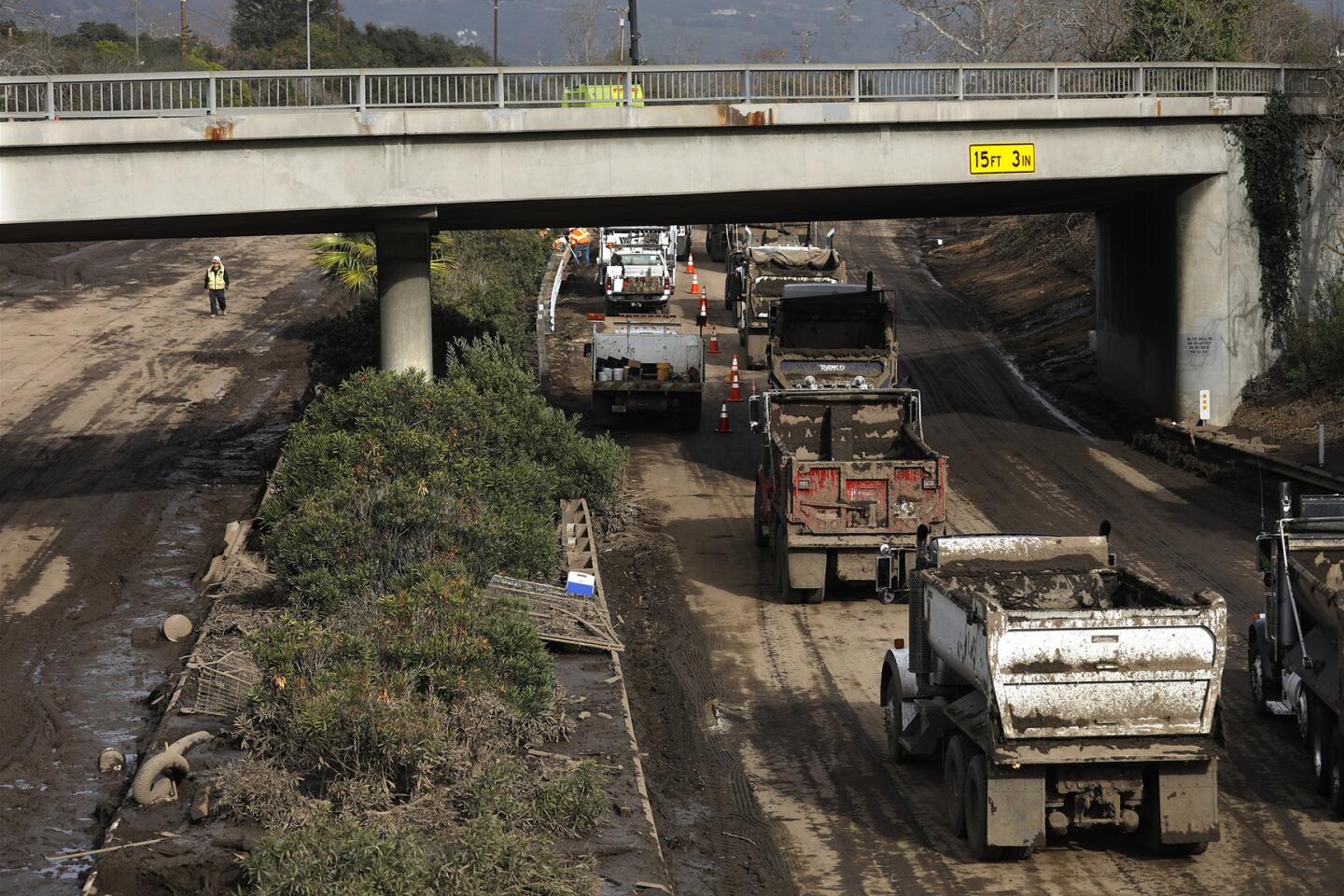
46/48
Progress is slowly being made as a worker and trucks traverse a recently cleared portion of the the 101 freeway at Olive Mill Road in Montecito.
(Genaro Molina / Los Angeles Times)
47/48
Santa Barbara Supervisor Joan Hartmann, from front left, Jefferson Litten, Hartmann’s Chief of Staff, and San Barbara City Councilman Eric Friedman, pink shirt, join others as they applaud first responders, fire fighters and law enforcement who’ve been aiding in the aftermath of the Montecito mudslide during a community meeting at the La Cumbre Junior High School in Santa Barbara.
(Genaro Molina / Los Angeles Times)
48/48
Margaret Stewart, with the Los Angeles City Fire Department, watches as her dog, Veya, tries to locate a victim of the mudslide along Highway 101 at Olive Mill Road in Montecito.
(Genaro Molina / Los Angeles Times)
Still, he said, the storm is expected to bring a significant amount of rain, which poses the threat of flooding and mud and debris flow near recent burn areas.
Advertisement
Like many others in his Montecito neighborhood, Ken Diebold didn’t evacuate during January’s mudslide because he thought he was far enough away from the burn area and his house was in a voluntary evacuation zone. Their Olive Mill Road home was inundated however, and he was forced to escape through a window with his wife and three children.
“I’m never going to do that to my family again. My wife told me we can’t live anywhere near an evacuation zone, so we are renting a house five miles away,” Diebold said Wednesday.
Regional snow levels should lower to 5,000 to 6,000 feet, and up to a foot of snow is expected at higher elevations, according to the weather service.
The storm system likely will die down by Friday, but cloudy skies, cool temperatures and showers are possible throughout the day Saturday.
Another, weaker storm is on track to move into Southern California by the middle of next week, forecasters said.
Incoming! Winter storm moves in this afternoon with periods of heavy snow through Saturday. Totals will be measured in FEET and mountain travel will become dangerous. #cawxpic.twitter.com/yunx6vk2Pj
Northern California mountain areas are expected to get several feet of snow from Wednesday through Saturday, making driving treacherous. The snow is expected to reach the Interstate 80 corridor in the Sierra Nevada by Wednesday afternoon, according to the weather service.
By 2 a.m. Friday, snow levels will be as low as 1,500 feet.
Donner Pass, Carson Pass, Ebbetts Pass and Sonora Pass in the Sierra Nevada could get 60 to 80 inches of snow, forecasters said. Lassen Volcanic National Park is forecasted to receive 36 to 48 inches.
Juanita Garcia of Apple Valley and her daughter Alexis, 4, walk up a snowy slope to go sledding in Big Bear after several inches of snow fell in the San Bernardino National Forest on Tuesday.
(Gina Ferazzi / Los Angeles Times )
Times staff writer Alene Tchekmedyian contributed to this report.
Hailey Branson-Potts is an enterprise reporter on the State Team who joined the Los Angeles Times in 2011. She reports on a wide range of issues and people, with a special focus on Northern California and the Central Coast. She grew up in the small town of Perry, Okla., and graduated from the University of Oklahoma.
Former Los Angeles Times staff writer Melissa Etehad is an Iranian American who enjoys writing about national and international issues. She received her master’s in journalism from Columbia University and a bachelor’s in international affairs from UC San Diego and has reported from the Middle East and Europe. She previously worked at Al Jazeera English and the Washington Post’s foreign desk, where she covered the intersections of politics, religion and gender. She’s a native Farsi speaker.