California’s snowpack is deeper than last year, but more is needed, officials say
First, the good news: Thanks to a series of frosty winter storms, California’s snowpack is now double what it was last year at this time, according to officials.
Now the bad news: The amount of water actually contained in the fluffy white stuff is still well below average.
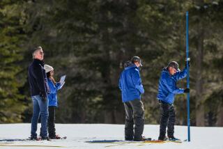
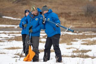
Snow levels measured statewide on Tuesday showed that water content was 56% of the historical average for Dec. 1. One year earlier, the water content measured just 24% of average.
Interested in the stories shaping California? Sign up for the free Essential California newsletter >>
“It’s certainly a better sign than there was last year,” said David Rizzardo, chief of snow surveys for California’s Department of Water Resources. “Anything is better than zero.”
Although the string of recent snowstorms is welcome, they have done little to ease four years of drought, experts say.
“We are still not getting the rain and snow frequency amounts we would like to see,” Rizzardo said.
Northern California, specifically the Sierra Nevada, needs more than one storm a week to help build snowpack to healthy levels, Rizzardo said.
In April, snowpack levels fell to just 5% of the seasonal average, which prompted Gov. Jerry Brown to order mandatory reductions in urban water use.
To restore the state’s reservoirs to pre-drought levels, California would need the snowpack to reach 150% of average, Rizzardo said. The snowpack provides about a third of California’s water supply.
It remains unclear whether continuing El Niño conditions will translate into heavy snowfall this January and February. Traditionally, the warm wet weather conditions that characterize El Niño in California do little to increase Northern California snowpack, Rizzardo said.
In fact, the spate of recent snowstorms had nothing to do with subtropical El Niño storms, according to Michelle Mead, a meteorologist with the National Weather Service in Sacramento. The snowpack was the result of a northern polar jet stream.
A cold storm arriving Thursday could bring up to six inches of snow to several Northern California communities, including Donner Pass, but little is expected beyond that.
“Over the next 10 days, there will be a couple of weak storms that will bring light snow to the Sierra, but significant snowfall isn’t likely,” the National Weather Service said.
For breaking news in California, follow VeronicaRochaLA on Twitter.
ALSO
California water conservation lagged in October, but state is still on course
Plans for a new city in the Santa Clarita Valley hit another roadblock
California Atty. Gen. Kamala Harris sues to shut down 2 car donation charities
More to Read
Start your day right
Sign up for Essential California for news, features and recommendations from the L.A. Times and beyond in your inbox six days a week.
You may occasionally receive promotional content from the Los Angeles Times.
