Despite clear risks, Santa Rosa neighborhood that burned down was exempt from state fire regulations
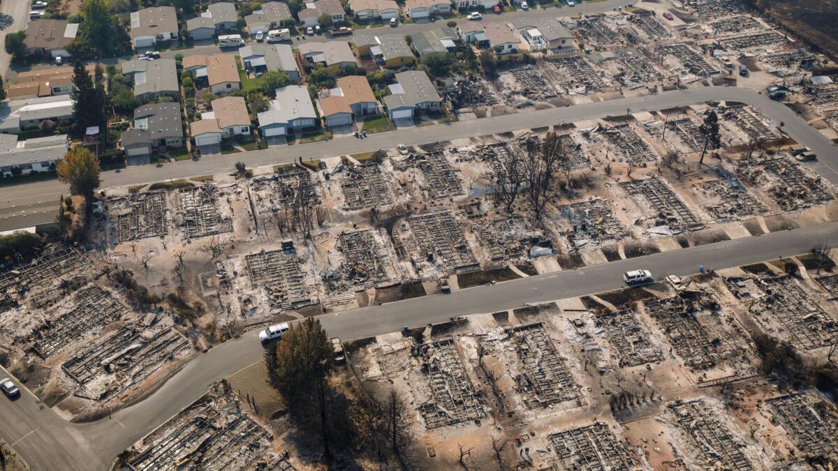
Coffey Park was built on city streets, not forested country lanes.
The Santa Rosa suburb was a planned development laid out on a typical grid with sidewalks and landscaped yards. The fire hazard zone shown on city and state maps was to the north and east, on the other side of the 101 Freeway.
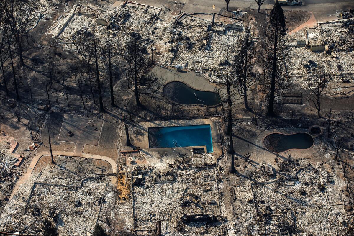
Yet when the Tubbs fire swept down the mountain, Coffey Park proved defenseless in its path. In a matter of hours, the neighborhood was almost totally consumed, leaving hundreds of houses burned to the ground and residents in disbelief.
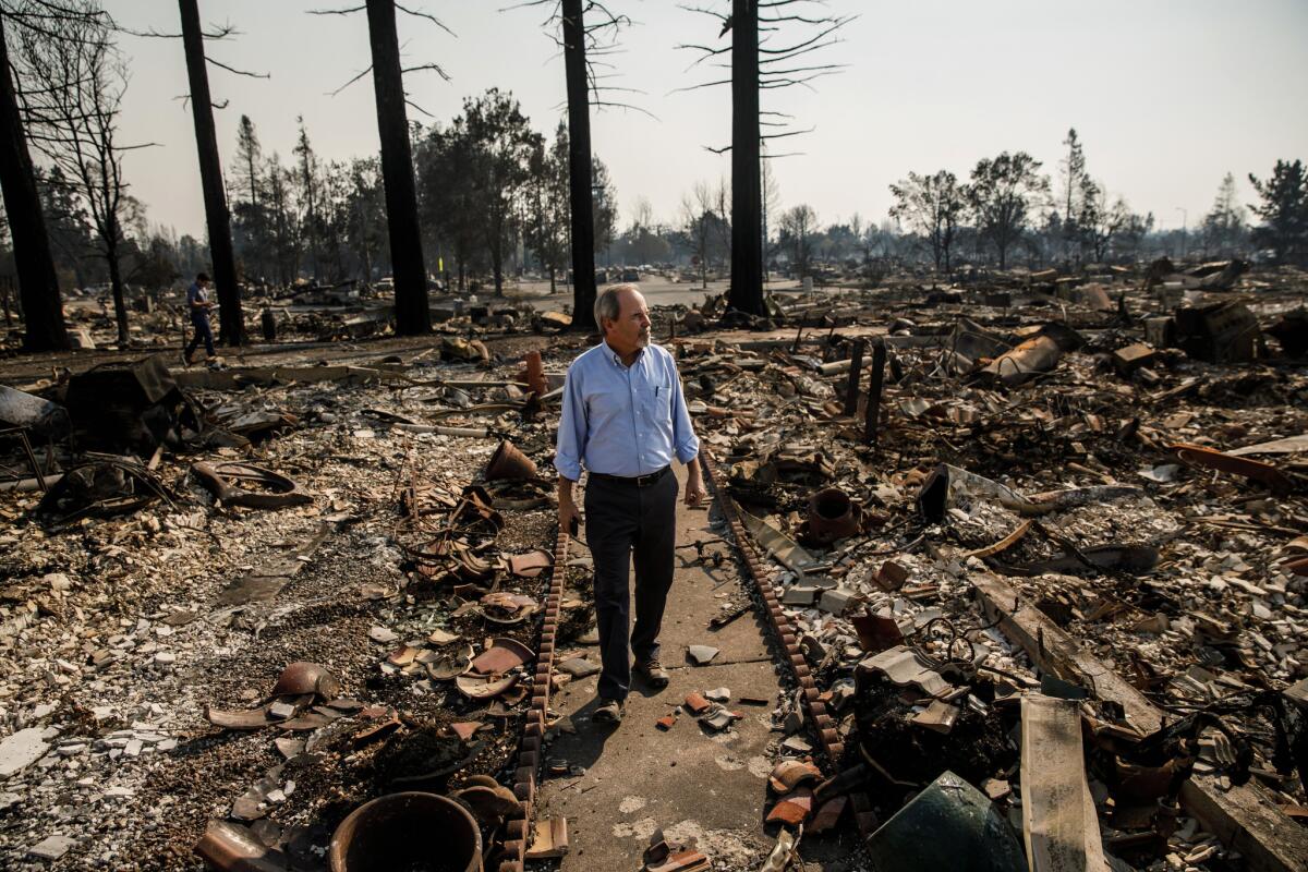
“We live in a subdivision in the middle of freaking Santa Rosa,” said Anna Brooner, whose house still stands on the side of Randon Way that didn’t burn, facing a scene of rubble and ash oddly punctuated by street trees that still have leaves and a plastic recycling bin that didn’t melt.
“I could see living on the outskirts of the mountains, you always have the potential of fire,” Brooner said. “But you would never expect it in a subdivision of this size.”
Surprising as it was to residents, the destruction of Coffey Park wasn’t a mystery to fire scientists. They view it as a rare, but predictable, event that has exposed flaws in the way fire risk is measured and mitigated in California. Because it was outside the officially mapped “very severe” hazard zone, more than five miles to the east, Coffey Park was exempt from regulations designed to make buildings fire resistant in high-risk areas.
California fire officials developed hazard maps in the 2000s that for the first time, tied building codes to geographies based on risk. Max Moritz, a fire specialist with the University of California’s Cooperative Extension, said the maps were an important step forward in assessing fire danger.
But the Coffey Park catastrophe has shown that the methodology, and the law underlying it, were too narrow.
“With a lot of hazard mapping, once you get into a density of development, it’s mapped urban and it’s considered unburnable,” Moritz said. “From its core, our whole approach to fire behavior modeling, we are not talking about burning in urbanized environments.”
The fire hazard zones now need to be recast with more consideration for the impact of wildland fire on developed areas, Moritz said.
Revisions of the hazard maps are in the works and will incorporate lessons from the Tubbs fire, said Dave Sapsis, Research Program Specialist with the state’s Fire and Resource Assessment Program, the unit of Cal Fire that maps fire hazard zones.
“I do believe when we remap we are going to be looking at new data that could potentially expand these very high zones into areas that were not mapped.” Sapsis said.
Though a forensic examination will be required to understand exactly what happened at Coffey Park, the unburned trees still standing in the neighborhood tell wildland fire experts that the cause was not a giant front of flames sweeping out of the nearby hills and fields.
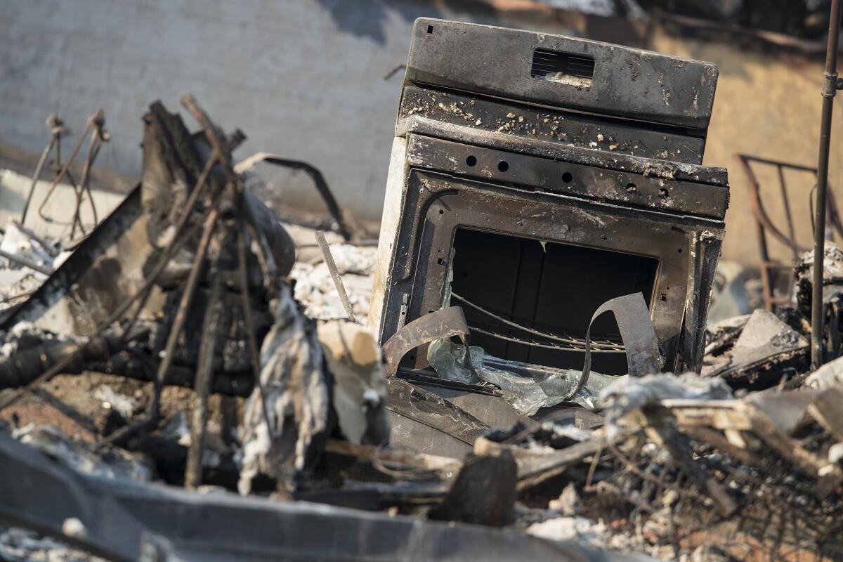
Most likely, the fire was touched off by embers blown from a distance. Firebrands capable of igniting a house can travel more than a mile.
“When you’ve got firebrands going into every crook and cranny, they’re going to find somewhere to start combustion,” Sapsis said.
Fire experts surmise that most of the damage was caused by fire spreading from house to house, leaving some parkway trees and things like trash cans oddly unscathed.
“Those houses are like highly concentrated energy packages just waiting to ignite,” said Donald Falk, a wildland fire researcher in the University of Arizona School of Natural Resources and the Environment. “In that wind-driven situation, I think the predictions of what’s fire-safe and what’s not kind of go out the window.”
Similar urban conflagrations have been seen before. In 1982, exposed electrical wire touched off a fire that was driven by Santa Ana winds through a four-block area of Anaheim, destroying 40 apartment buildings.
And when the Boles fire tore through the Siskiyou County town of Weed in 2014, more than 150 buildings were destroyed or damaged.
“We are seeing it happen more often,” Moritz, the UC researcher, said.
The problem for fire risk management is balancing the huge losses from urban conflagrations with their infrequent occurrence.
The weather events that underlie them — high wind and temperature, low humidity and parched vegetation — are rare in the historical record, said Mark A. Finney, research forester with the U.S. Forest Service’s Rocky Mountain Research Station.
“It’s not as though this stuff is unprecedented,” Finney said. “It’s just rare in any one given spot.”
To establish the probability of a Tubbs fire destroying a neighborhood 10 miles from its starting point, “you have to incorporate all the uncertainty in ignition locations, uncertainty in weather, uncertainties of terrain. That’s a tall order. There are methods. They’re relatively new.”
A broader measure of risk than Cal Fire’s maps is called the wildland-urban interface model. It takes into consideration the proximity of human habitation to wildland areas.
A wildland-urban interface map prepared by the Silvis Lab of Wisconsin encompasses all of Coffey Park and a good deal more of northeast Santa Rosa.
But wildland/interface mapping is also fraught with uncertainty because of the challenge of pinpointing population in wildland areas, Sapsis said.
Although Cal Fire publishes its own wildland-urban interface map, it does not carry any legal consequences, he said.
Another complication is that the legislation underlying hazard mapping only allows Cal Fire to plot “very high severity” zones in areas designated as local jurisdiction, including cities. The hazard zones nearest to Santa Rosa are categorized as “moderate” or “high” and thus would not extend into the city.
“It’s likely that if the state had authority to map in local responsibility areas other than very high, much of Santa Rosa would have been included,” Sapsis said.
It isn’t clear how much the designation of a fire hazard zone would have lessened the damage in Coffey Park. The state law, written in response to the 1991 Tunnel fire that destroyed 2,900 homes in Oakland, applies only to new construction and substantial remodeling.
The designation of a fire hazard zone could, however, ensure that as Coffey Park is rebuilt, there would be mandatory building requirements to better protect it against a future conflagration.
Some experts suggested that the startling losses from the Tubbs fire could spark consideration of more aggressive measures such as mandatory retrofits or at least the canvassing of neighborhoods like Coffey Park to identify vulnerabilities that could be remedied such as ensuring that attic vents, the most common source of firebrand ignition in houses, are screened.
Moritz, the UC scientist, pointed to an analogy with the fire councils that obtain grant money for mitigation programs.
“They go through to remove vegetation, support fuel break,” he said. “Very few of these grant funds ever support mitigating ignition vulnerabilities. It goes to mitigating hazard, not vulnerability.”
Experts are reluctant to say that even the most stringent fire proofing would have saved Coffey Park, particularly in light of reports of modern fire-resistant homes and even big-box stores being destroyed in the Tubbs fire.
“It’s anybody’s guess,” Moritz said. “Without a doubt, had that fire come into and hit an interface that was built according to today’s standards, you would have much less a chance of getting as far into that neighborhood as it did. It would have made some difference.”
Falk, the University of Arizona fire researcher, agreed that the effect of stiffer building codes would be hard to predict, but could only have helped.
And he hopes that officials move quickly.
“The shelf life of an event like this, as devastating as it seems now, eventually will dissipate,” Falk said. “Now is the time to have that dialogue.”
ALSO
At Napa vineyards untouched by wildfires, the grapes must still be picked
A Santa Rosa woman died in the fires, her neighbors survived. Here are their stories
More to Read
Start your day right
Sign up for Essential California for news, features and recommendations from the L.A. Times and beyond in your inbox six days a week.
You may occasionally receive promotional content from the Los Angeles Times.
