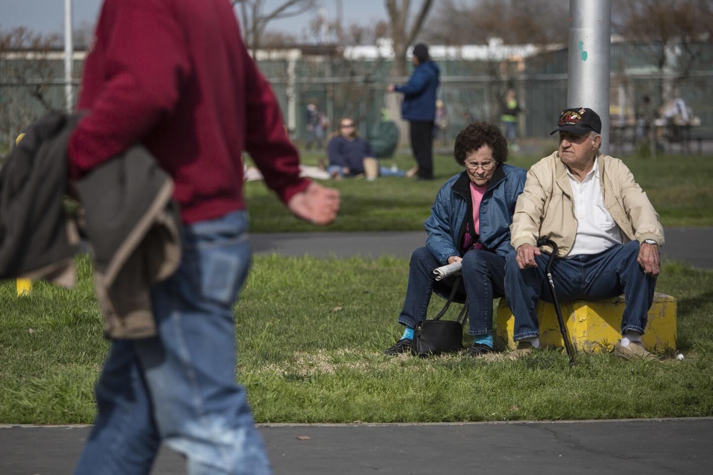
Authorities lifted mandatory evacuation orders Tuesday for communities downstream of the imperiled Oroville Dam amid a lessened flood risk, but they stressed that an incoming storm system means the danger is not over and that many residents might have to flee again.
Although the storms are expected to be far weaker than the ones that inundated Northern California last week, any additional rainfall could exacerbate the problems in the region, where more than 100,000 people were evacuated Sunday amid concerns that a damaged spillway at Oroville Dam could fail.
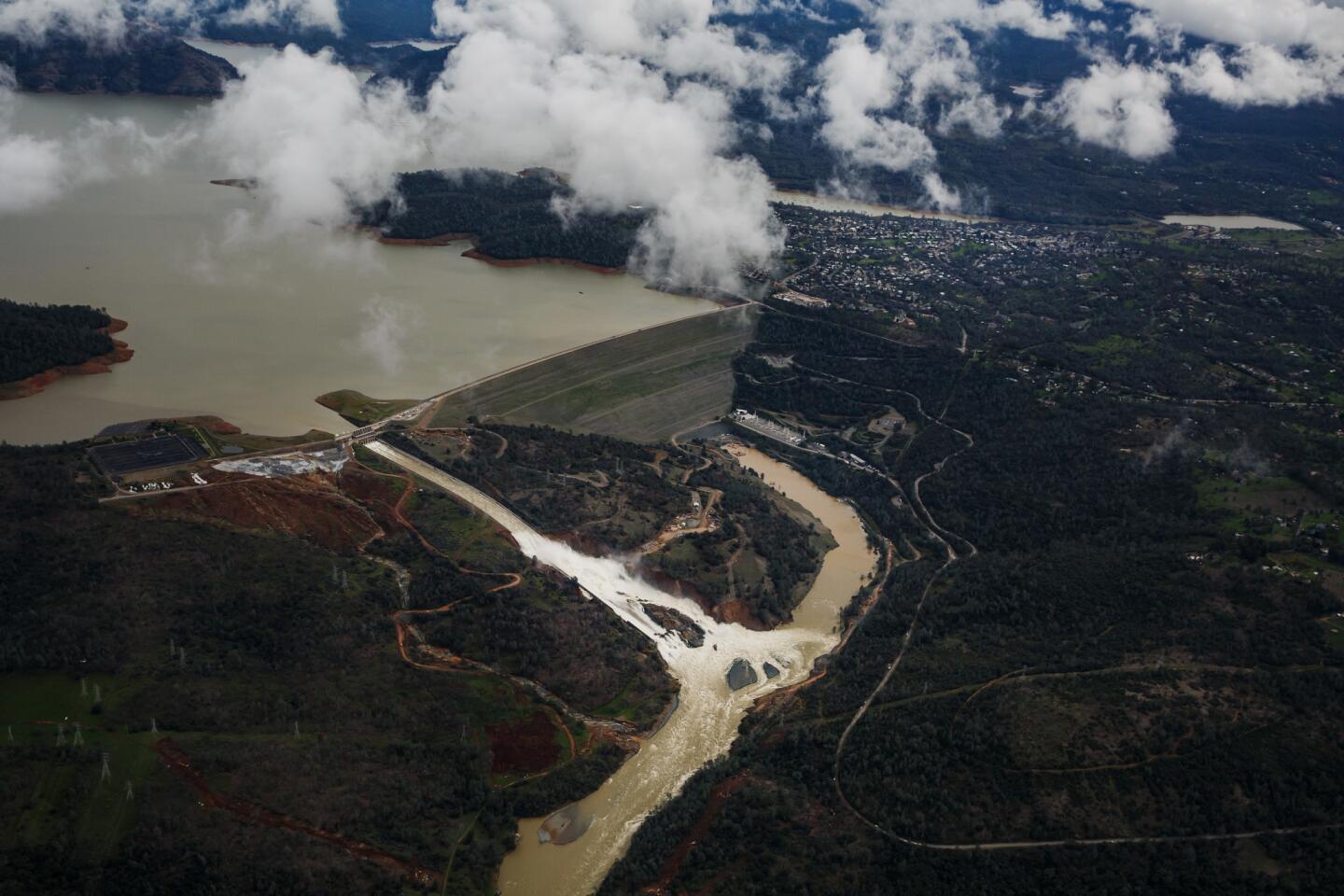
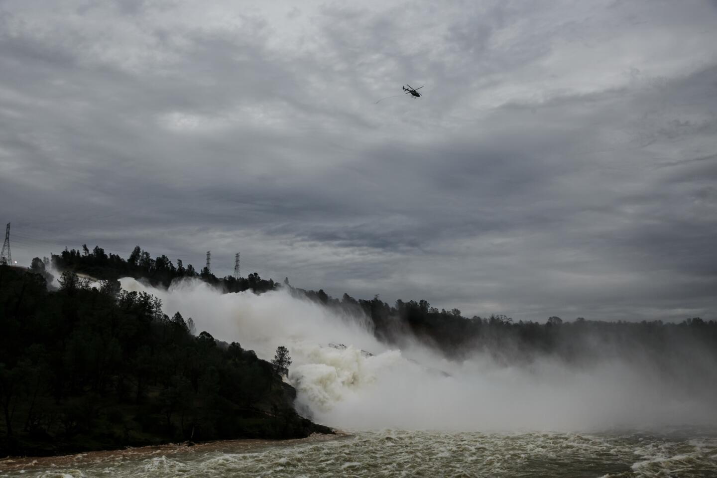
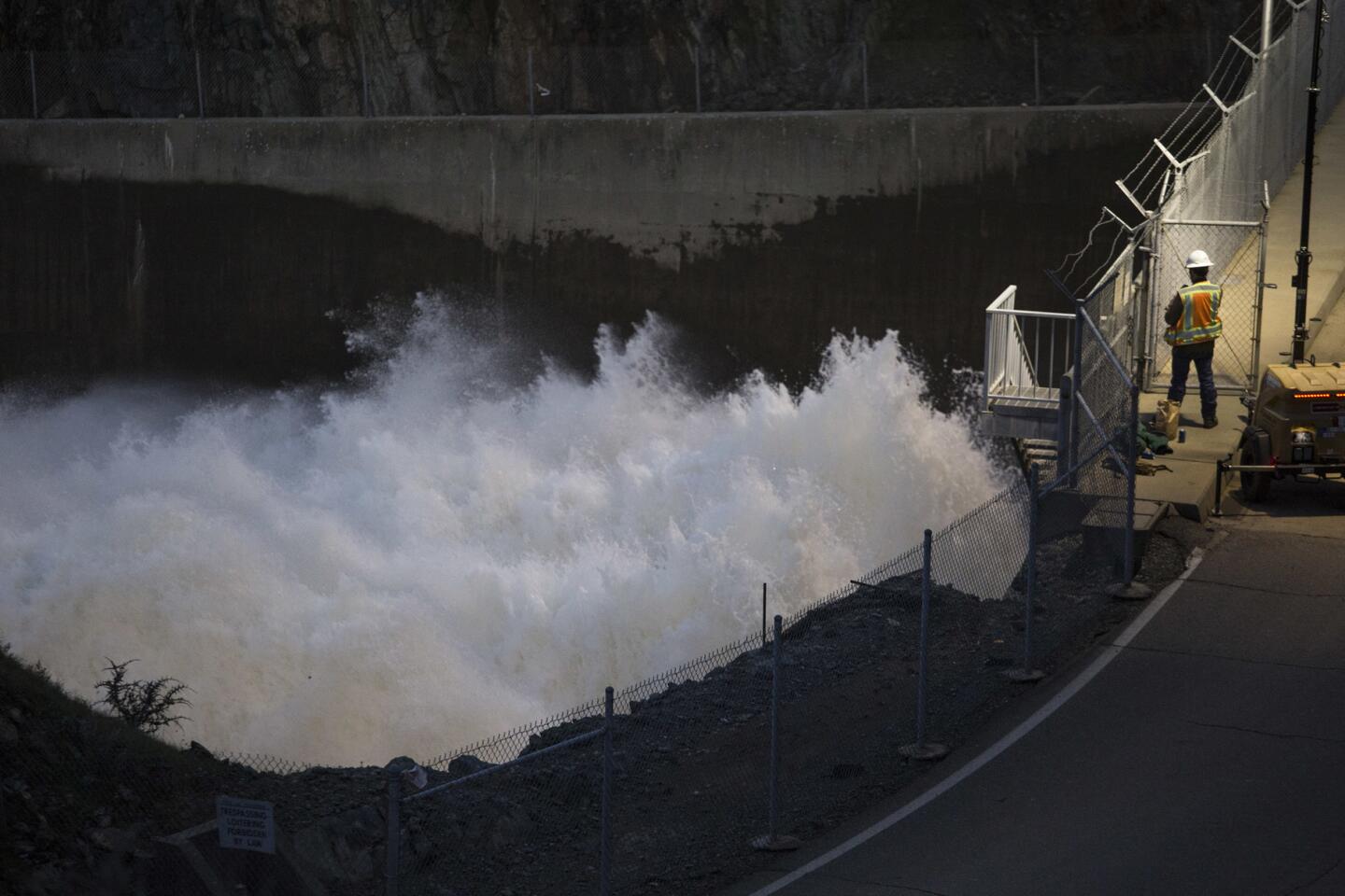
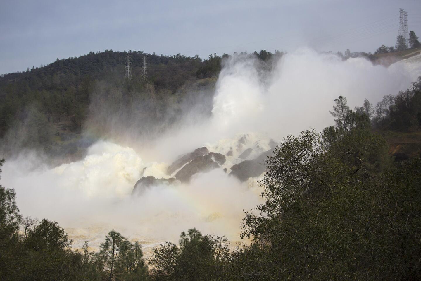
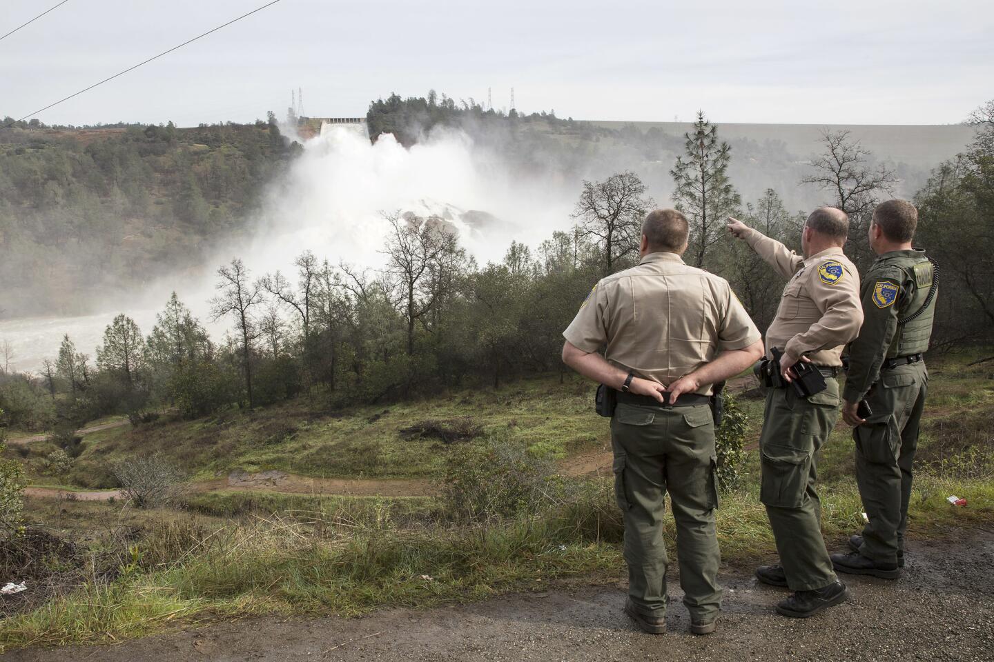
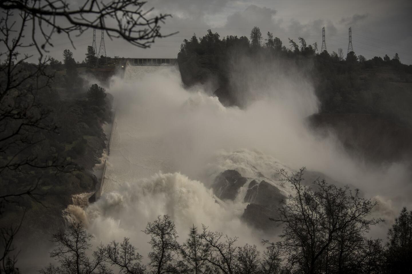
Officials have been lowering the level of Lake Oroville for several days, preparing for the storm. Both the main and emergency spillways are damaged, but officials are hoping to continue using the main spillway throughout the storm to keep the lake below maximum capacity. By doing that, they hope to avoid more water flowing down the emergency spillway, which was so damaged Sunday that officials feared it could collapse and cause major flooding downstream.
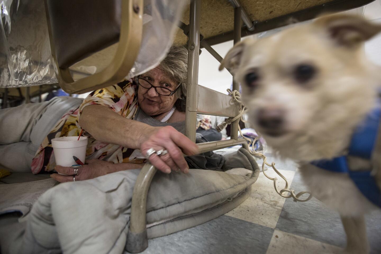
Interview with Erica Stenholm and Ronnie Vaughan (Marcus Yam / Los Angeles Times)
“All residents are advised to remain vigilant and prepared as conditions can rapidly change,” the Butte County Sheriff’s Office said in a statement. Residents, authorities said, should be prepared to evacuate again at a moment’s notice should new problems arise.
The storm system is expected to arrive late Wednesday or early Thursday morning and could bring 2 to 4 inches of rainfall over Lake Oroville, said Tom Dang, a meteorologist with the National Weather Service in Sacramento. Another storm Friday could drop an additional 1 to 3 inches on the region and is expected to have a much greater impact on Southern California.
“There’s no real sign at this stage of any let-up in the precipitation,” Dang said.
The Northern California rain is also expected to be much cooler than last week’s. That’s good news when it comes to flood concerns. Warmer storms cause mountain snowpack to melt more quickly, sending runoff coursing into rivers, canals and reservoirs.
Last week’s storm was “very warm,” with snow levels as high as 8,000 feet and higher, Dang said. This week, snow levels are forecast at 5,000 to 6,000 feet, which is much more typical for a storm this time of year, he said.
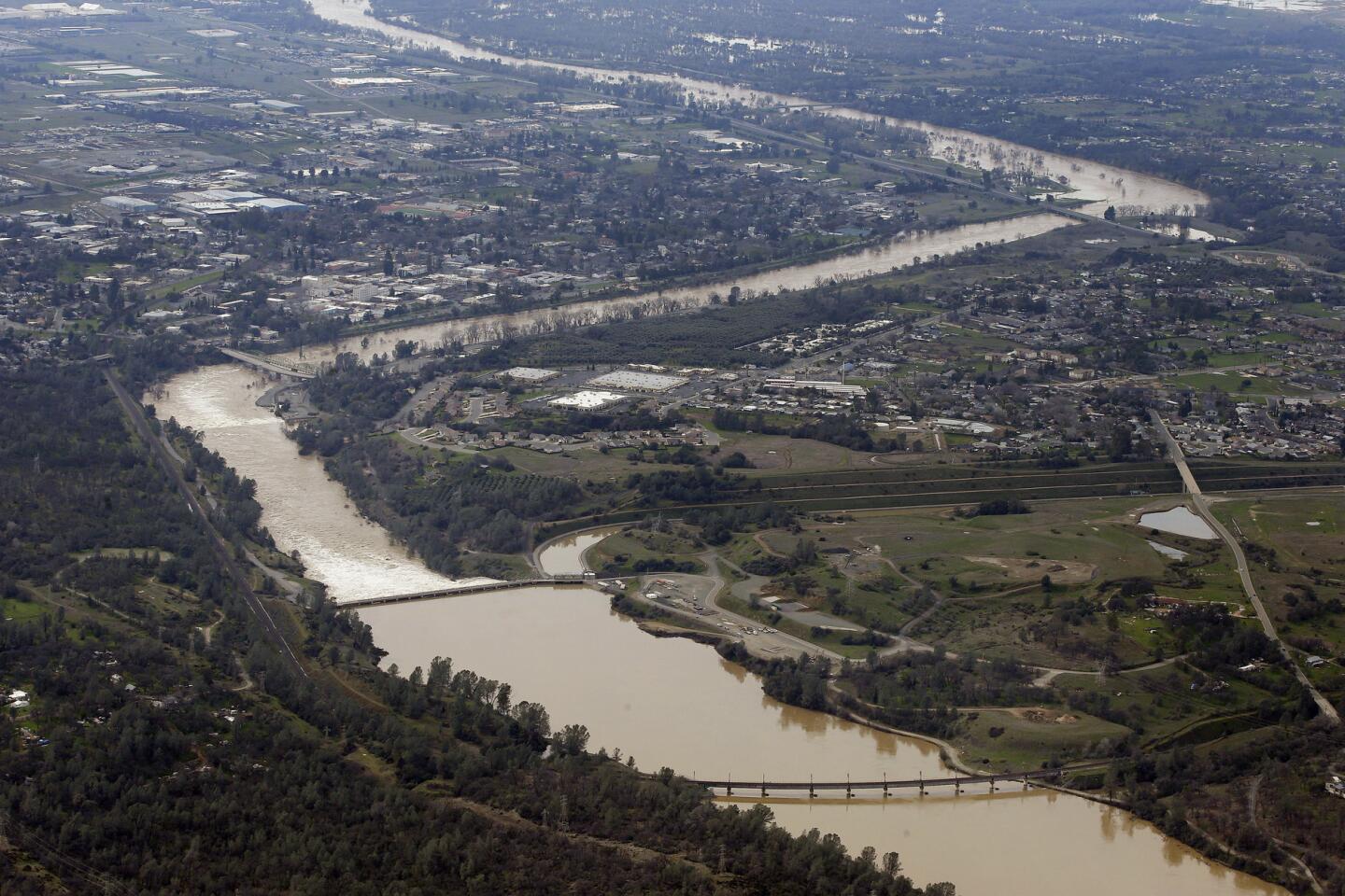
In the five days from Feb. 6 to Friday, Oroville received more than 6 inches of rain, according to the National Weather Service. The surrounding mountains and foothills received up to 24 inches of rain and snow in the same time period.
The storm’s runoff sent water into the Oroville reservoir at an average rate of 115,260 cubic feet per second, data show. The lake’s water level climbed 50 feet in five days.
In addition to the crisis at Oroville Dam, several levees throughout the region have seen structural damage, adding to the flood threat, Dang said. Many reservoirs in Northern California are having to release large amounts of water, causing rivers to rise.
Portions of the Sacramento and San Joaquin rivers are at or near flood stage, he said. The Feather River, downstream from Lake Oroville, has seen flooding for several days.
Although this week’s storms are expected to be smaller, they’re “certainly impactful,” Dang said.
“The storms last week have really left Northern California in a vulnerable state right now, and any amount of rainfall isn’t helpful at this stage.”
1/66
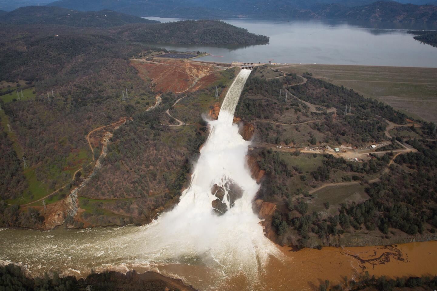
An aerial view of the water flowing out of the Oroville Dam main spillway, in Oroville, Calif., on Tuesday, February 21, 2017.
(Marcus Yam / Los Angeles Times) 2/66
An aerial view of the water flowing out of the Oroville Dam’s main spillway on Feb. 21. (Marcus Yam / Los Angeles Times)
3/66
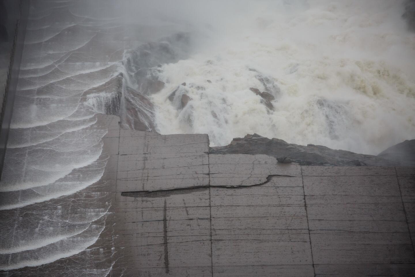
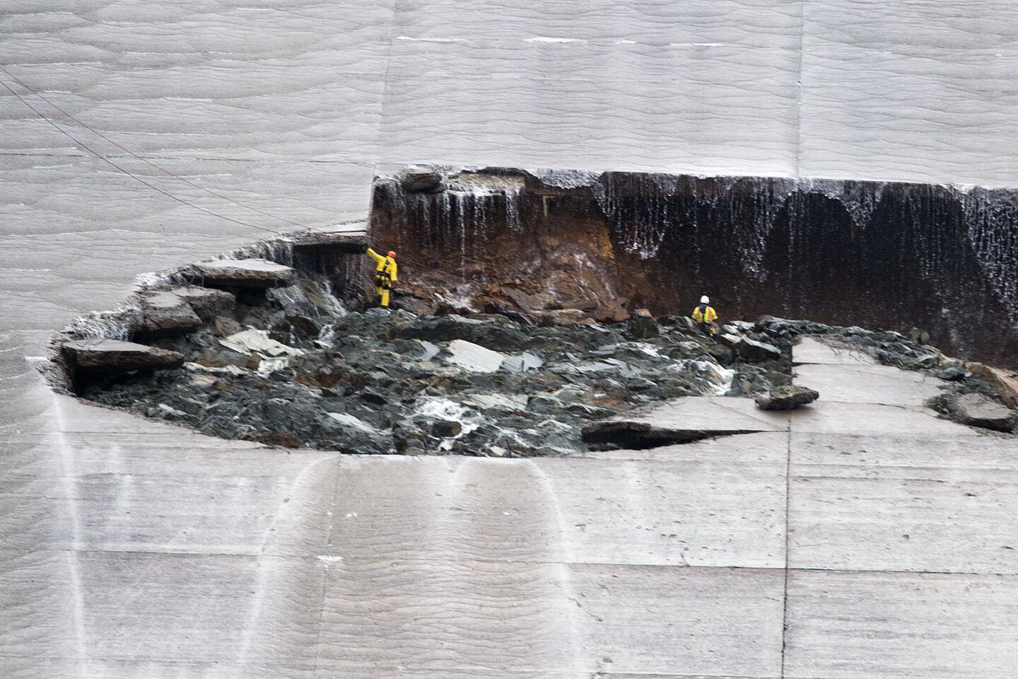
Reduced water releases at the Oroville Dam have made damage to its main spillway more visible. (Marcus Yam / Los Angeles Times)
4/66
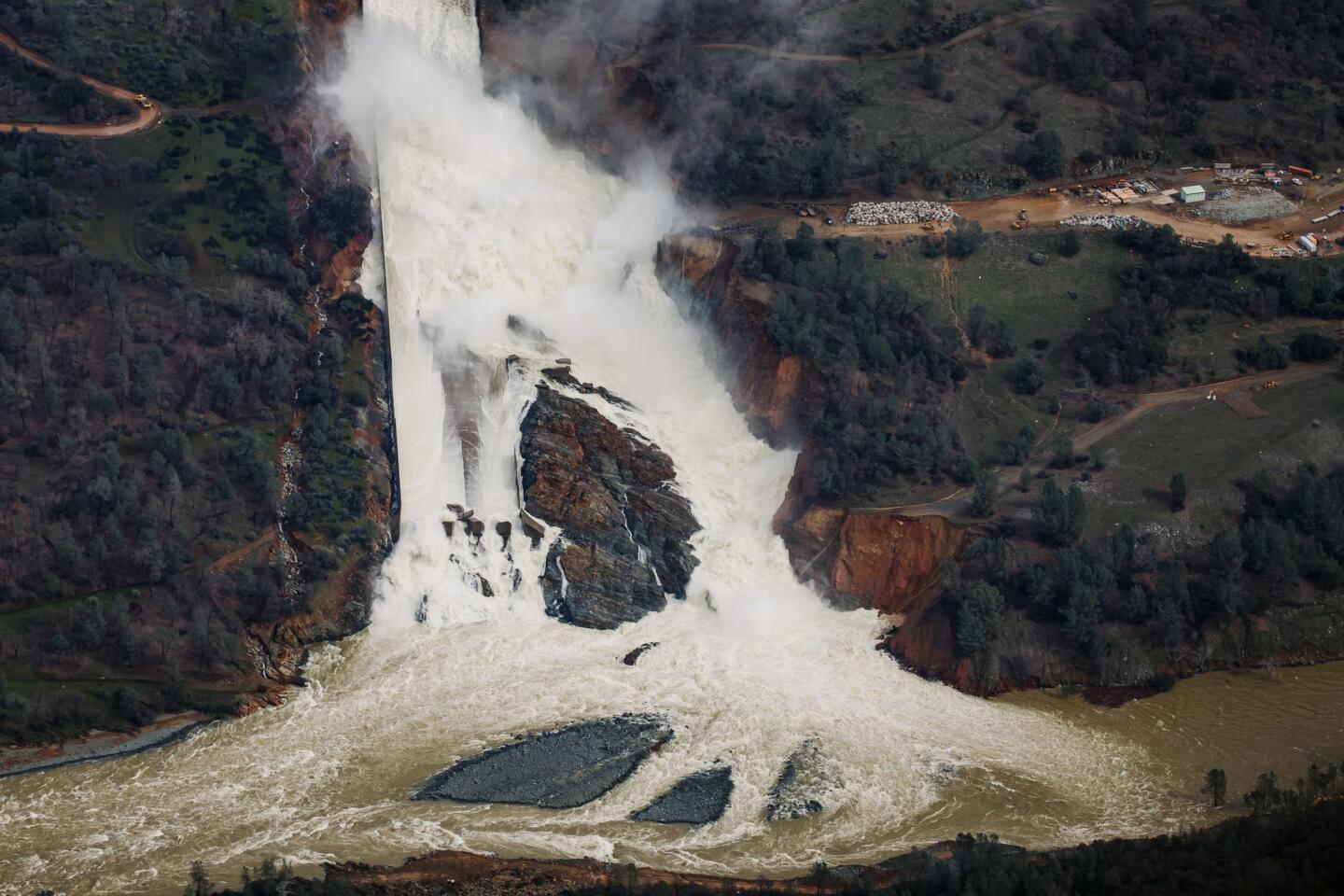
With a reduced flow on Sunday, most of the water being released from the Oroville Dam is not going down the spillway; it has broken through and is flowing down the hillside. (Marcus Yam / Los Angeles Times)
5/66
With a reduced flow on Sunday, most of the water being released from the Oroville Dam is not going down the spillway, it’s broken through and is going down the hillside.
(Marcus Yam / Los Angeles Times) 6/66
With a reduced flow on Sunday, most of the water being released from the Oroville Dam is not going down the spillway, it’s broken through and is going down the hillside.
(Marcus Yam / Los Angeles Times) 7/66
Juan Alvarez reassures his girlfriend, Sarah Hendrix, after helping her move out of her home in rural Maxwell. Water was a foot high and crews had to evacuate 100 people because of flooding-- some by boat.
(Marcus Yam / Los Angeles Times) 8/66
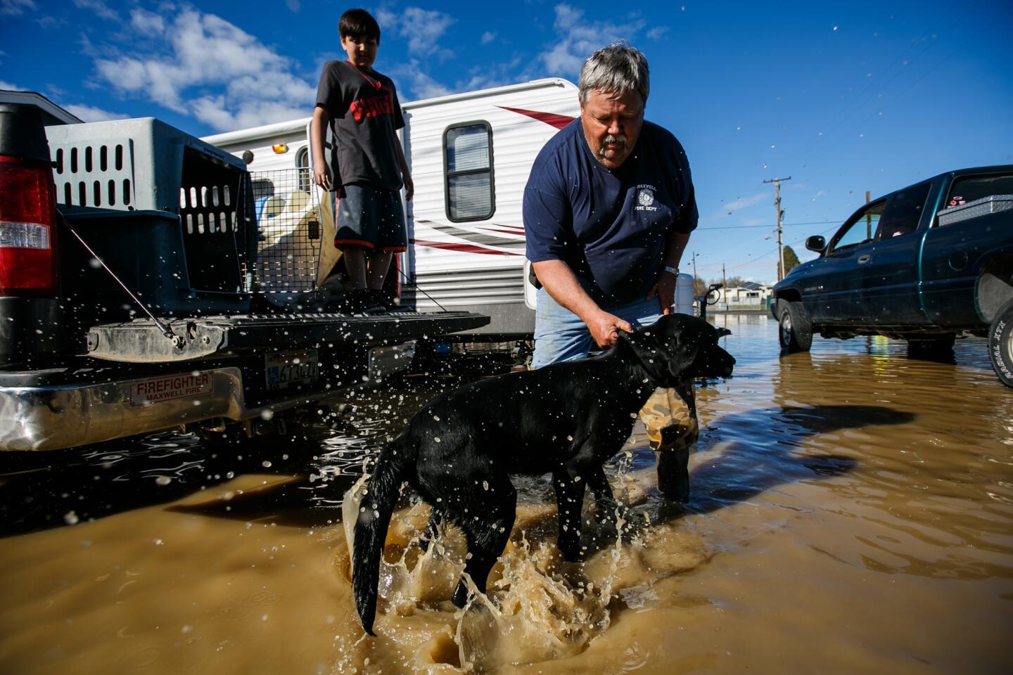
Ron Chambers lets Duke out of his crate for the first time in hours since the flooding began n Maxwell, Calif. on Saturday.
(Marcus Yam / Los Angeles Times) 9/66
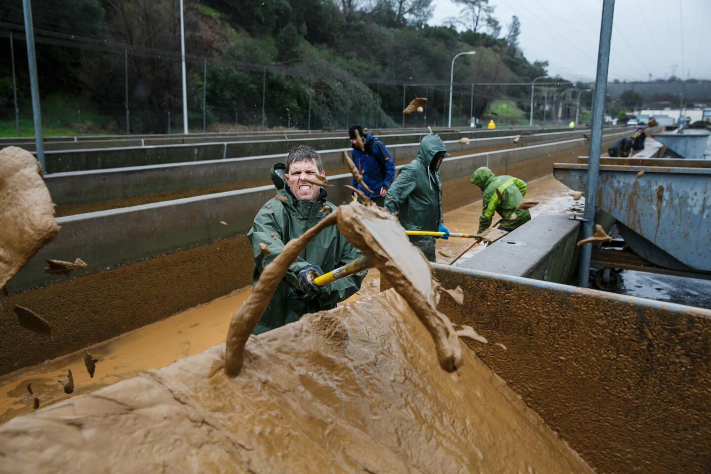
Kevin Anfinson and other volunteers help shovel the muddy sediment that has built up in the salmon raceway at the Feather River Fish Hatchery in Oroville, Calif. (Marcus Yam / Los Angeles Times)
10/66
Fernando Martinez and his mother, not pictured, wade through a road in Gridley, Calif., flooded by the Feather River as it continues to swell from the water being let out of Lake Oroville.
(Marcus Yam / Los Angeles Times) 11/66
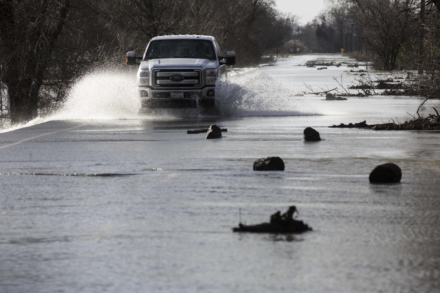
A man in a 4x4 truck turns around on Gridley Road after having second thoughts about making it across the flooded road, which had been closed.
(Brian van der Brug / Los Angeles Times) 12/66
Randy Boheim packs up his tools and emergency supplies in anticipation of having to evacuate his whole family as floodwaters creep closer to his home in an Oroville, Calif., mobile home park. The nearby Feather River continued to swell from the water being let out of Lake Oroville ahead of this weekend’s storm.
(Marcus Yam / Los Angeles Times) 13/66
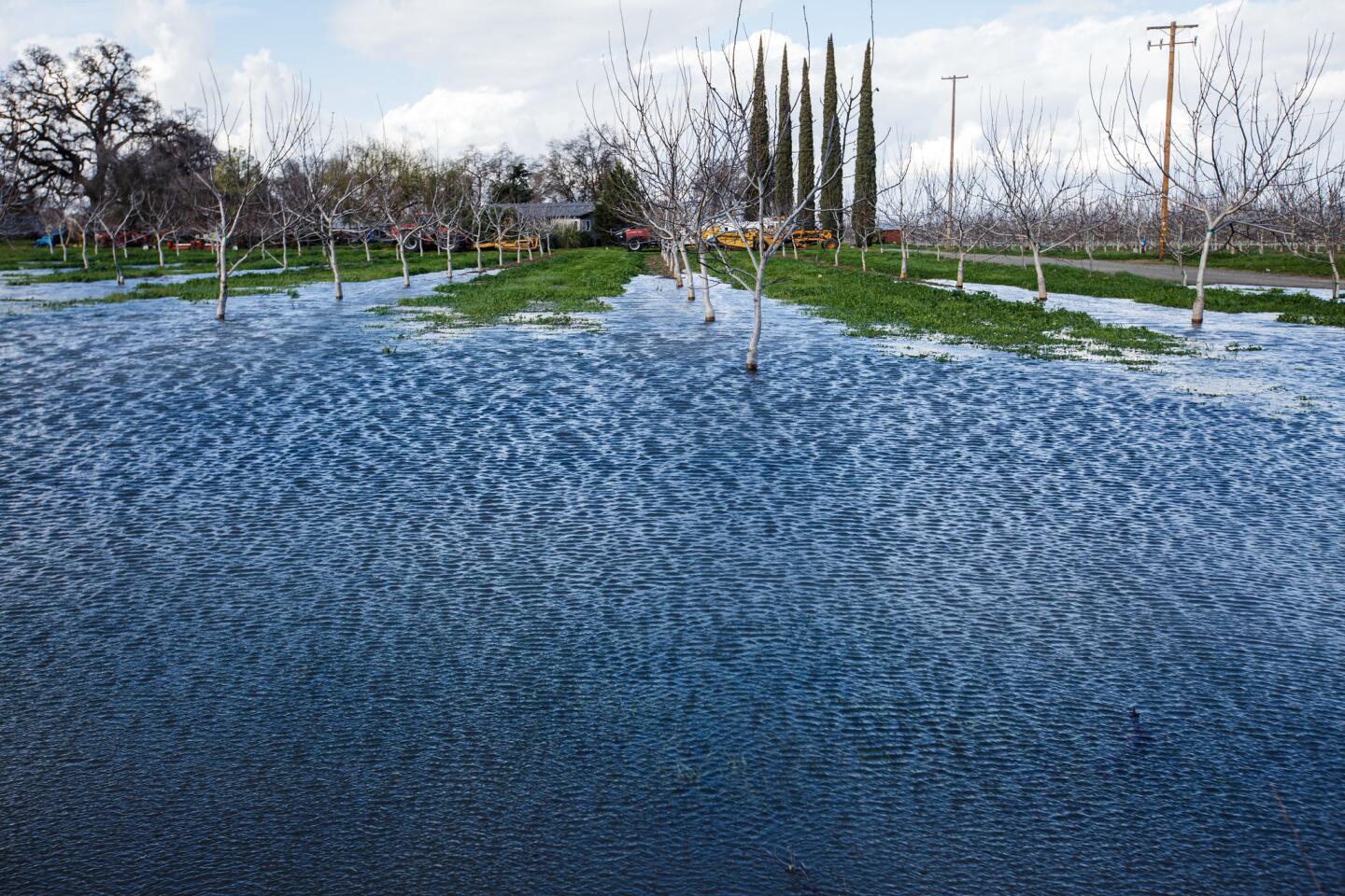
A plantation in Oroville, Calif., sits in floodwaters as the Feather River continues to swell from the water being let out of Lake Oroville ahead of this weekend’s storm.
(Marcus Yam / Los Angeles Times) 14/66
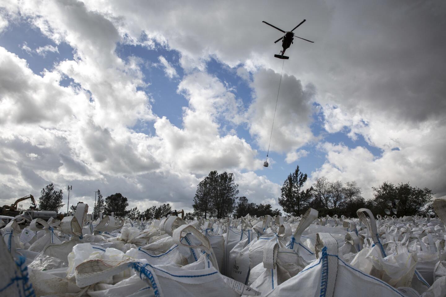
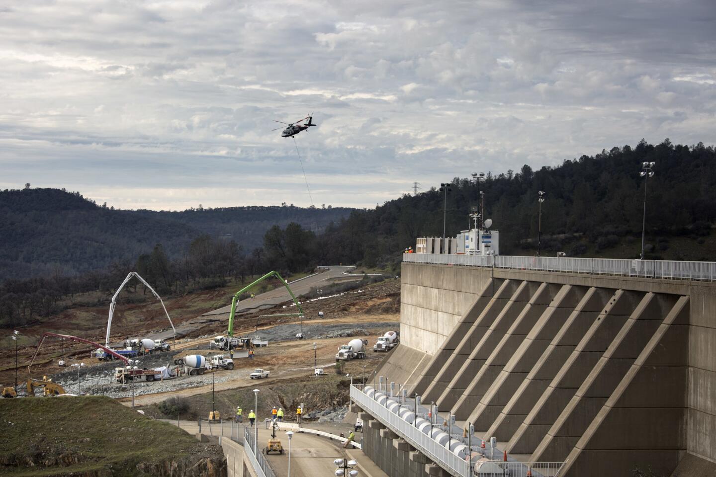
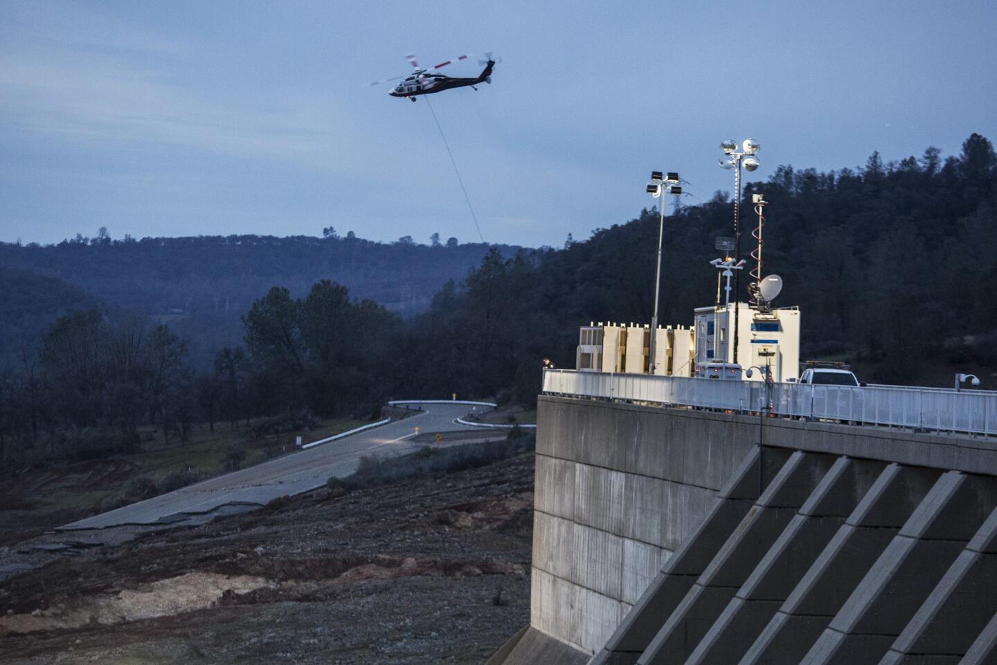
Helicopters ferry sand and rocks to the Oroville Dam’s emergency spillway reconstruction project in Oroville, Calif., ahead of coming rains.
(Brian van der Brug / Los Angeles Times) 15/66
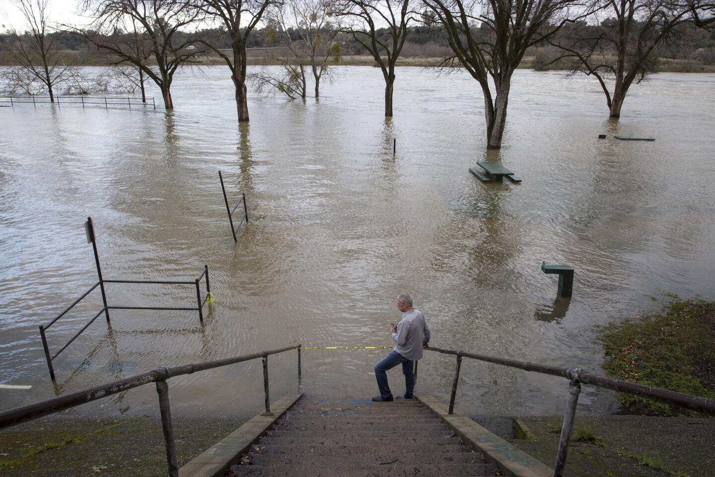
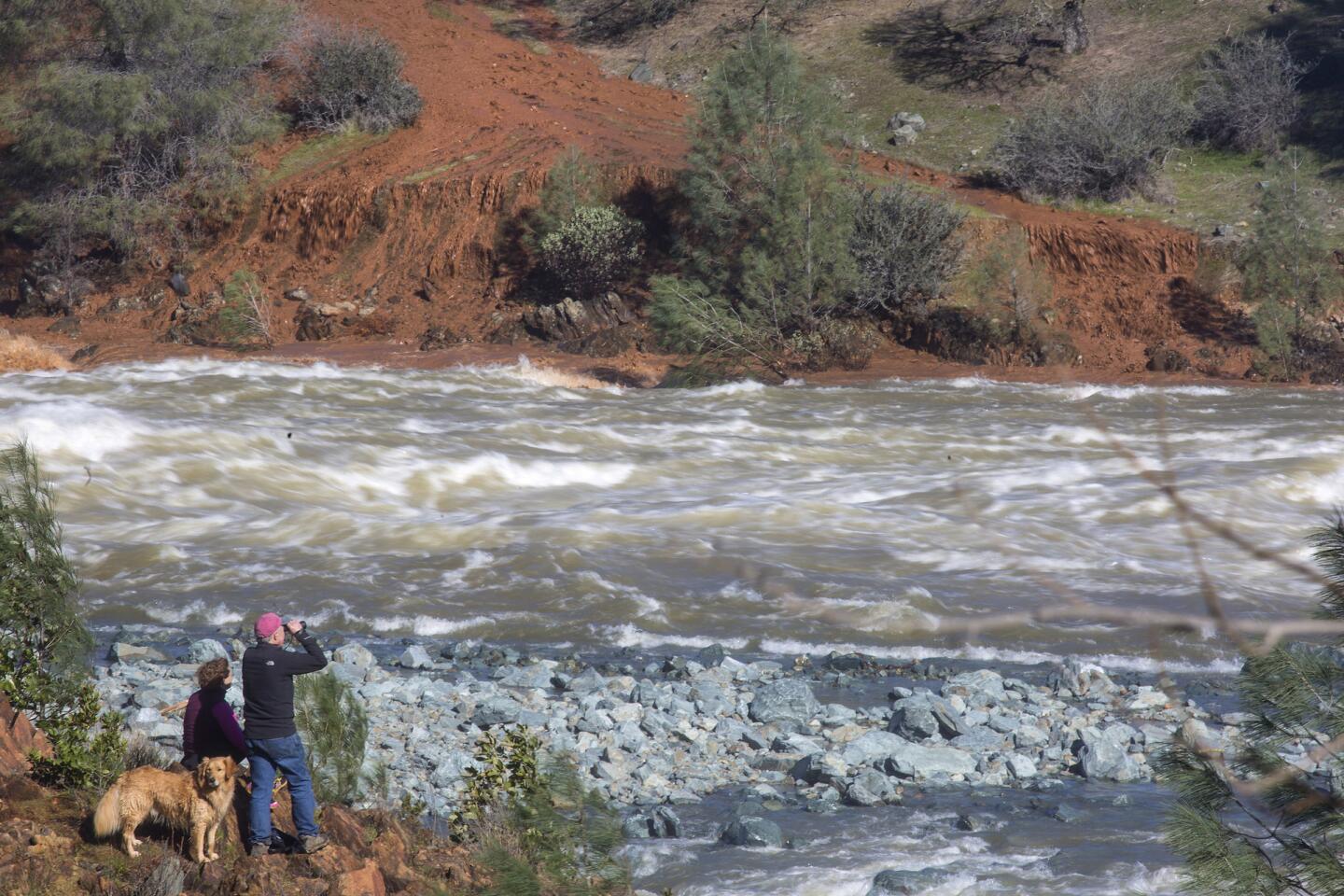
California Water Service district manager Toni Ruggle surveys the Feather River at Bedrock Park downstream from the Oroville Dam.
(Brian van der Brug / Los Angeles Times) 16/66
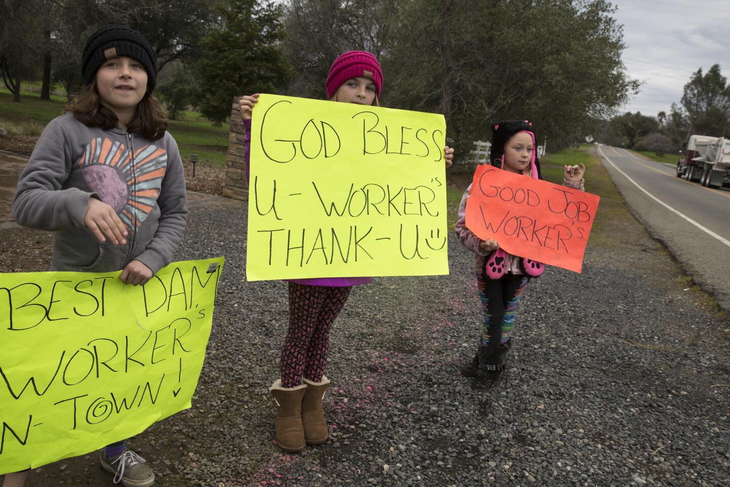
McKenna Harvey, 9, left, Kylie Atteberry, 11, and Brooklyn Atteberry, 7, hold signs thanking workers in the repair effort at the Oroville Dam.
(Brian van der Brug / Los Angeles Times) 17/66
A helicopter flies over as water flows from the main spillway at Lake Oroville. (Marcus Yam / Los Angeles Times)
18/66
Reconstruction continues in a race to shore up the emergency spillway at Oroville Dam. (Brian van der Brug / Los Angeles Times)
19/66
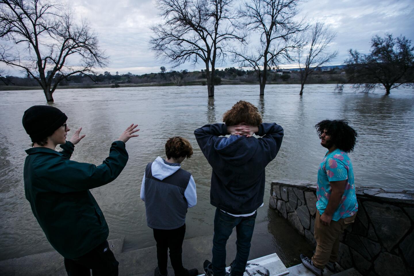
As rain clouds gather, friends from left, Johnny Eroh, Cody Balmer, Kristien Bravo and Jerel Bruhn hang out by the flooded Feather river in the Bedrock neighborhood of Oroville, Calif., last week. (Marcus Yam / Los Angeles Times)
20/66
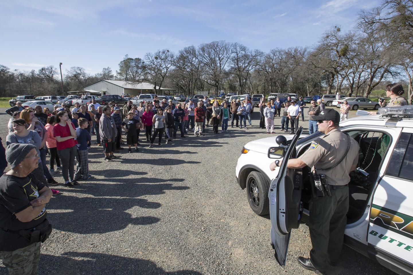
Evacuees at the Bangor Community Hall in Bangor, Calif., listen to Butte County sheriff’s deputies in February as the mandatory evacuation order was lifted. An evacuation advisory was lifted Wednesday. (Brian van der Brug / Los Angeles Times)
21/66
Evacuees at the Bangor Community Hall get the news from Butte County sheriff’s Deputy Jeff Heath that the evacuation order has been lifted.
(Brian van der Brug / Los Angeles Times) 22/66
Evacuee Sharon Dalton, right, hugs Raiden Ellis, 10 months, and Chris Ellis as they say their goodbyes as she leaves the Bangor Community Hall in Bangor, Calif., on Tuesday.
(Brian van der Brug / Los Angeles Times) 23/66
David McGlamery returns to his Oroville home with his belongings after the evacuation order was lifted. The family had to retreat to Chico, where they initially stayed at a Walmart parking lot with other evacuees. (Marcus Yam / Los Angeles Times)
24/66
Bill Tirey helps family members move back into their home in the Bedrock neighborhood of Oroville near the Feather River after evacuation orders were lifted.
(Marcus Yam / Los Angeles Times) 25/66
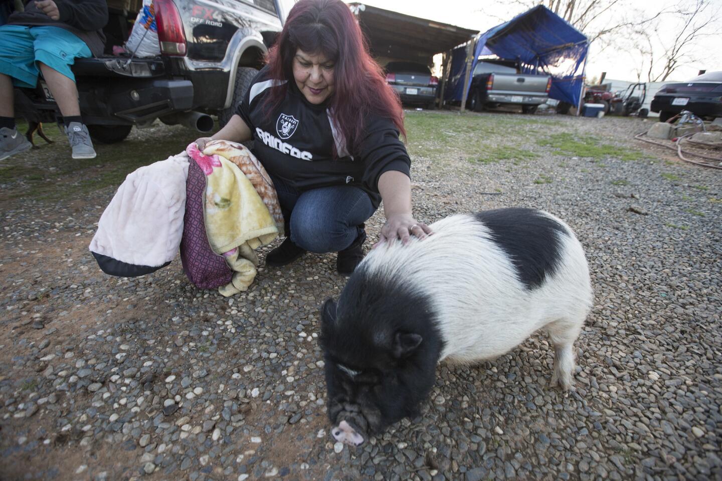
Maria Alancar returns home to greets her pet pig Bacon, who was left behind when the family moved to higher ground in Honcut, Calif.
(Brian van der Brug / Los Angeles Times) 26/66
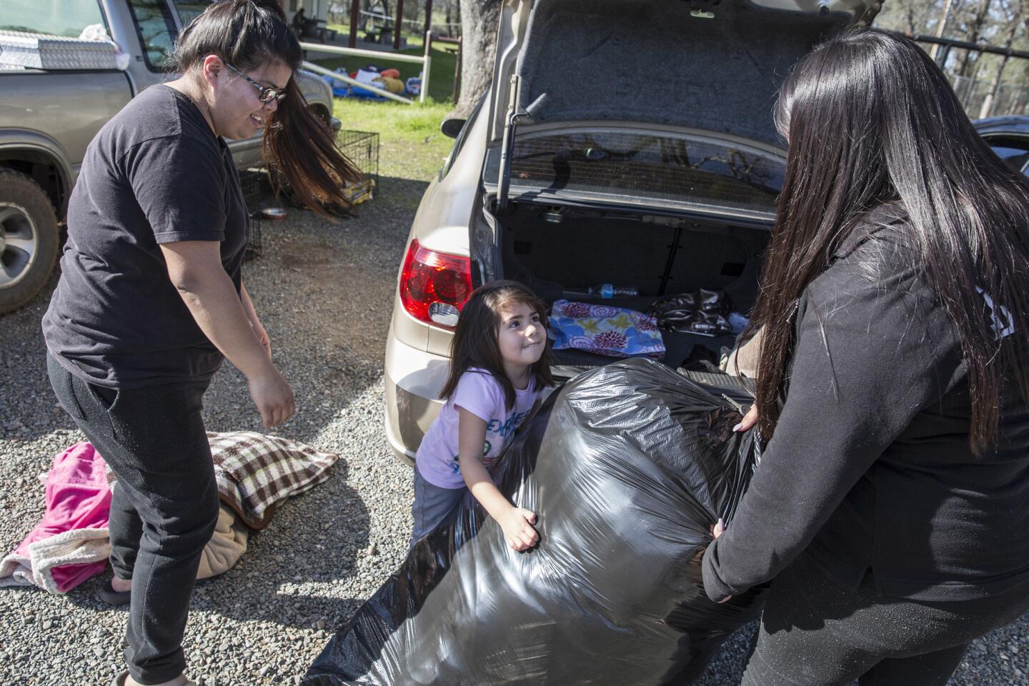
Sulet Lopez, 21, left, Melissa Mendoza, 3, and Yeanet Lopez, 18, pack up their car at the Bangor Community Hall in Bangor, Calif., to head home after the evacuation order was lifted.
(Brian van der Brug / Los Angeles Times) 27/66
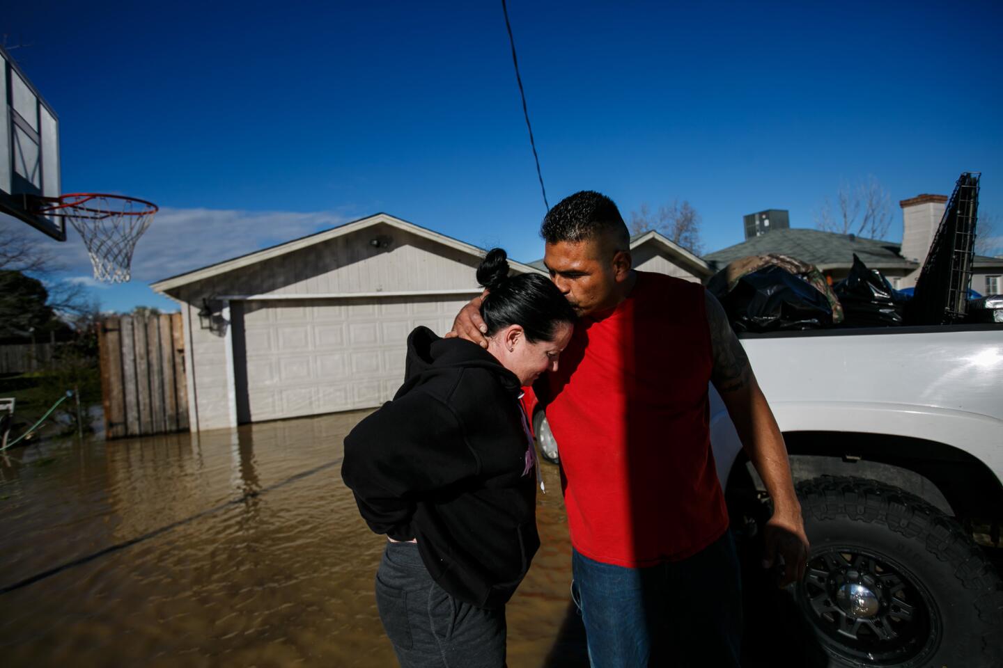
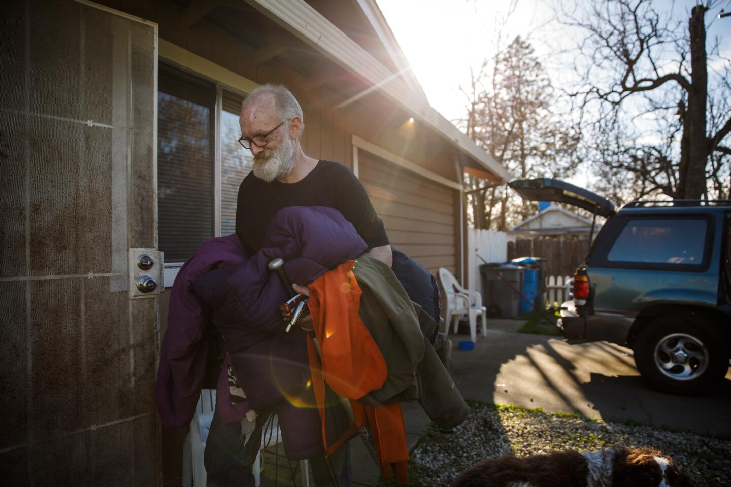
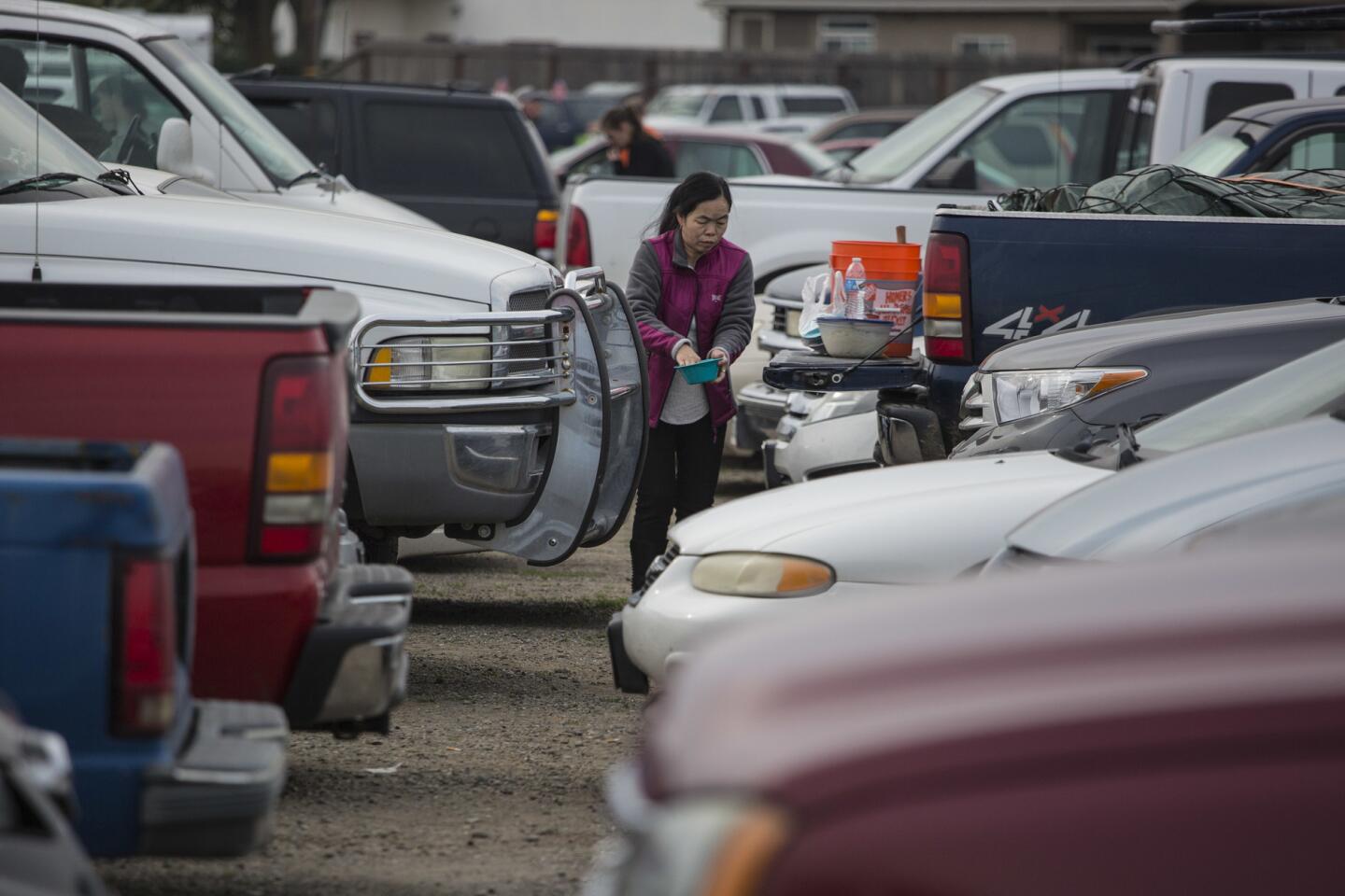
Erica Stenholm, left, Ronnie Vaughan, and Brooklyn Jackson, 7, unpack their car upon returning home after the evacuation order had been lifted in Oroville.
(Marcus Yam / Los Angeles Times) 28/66
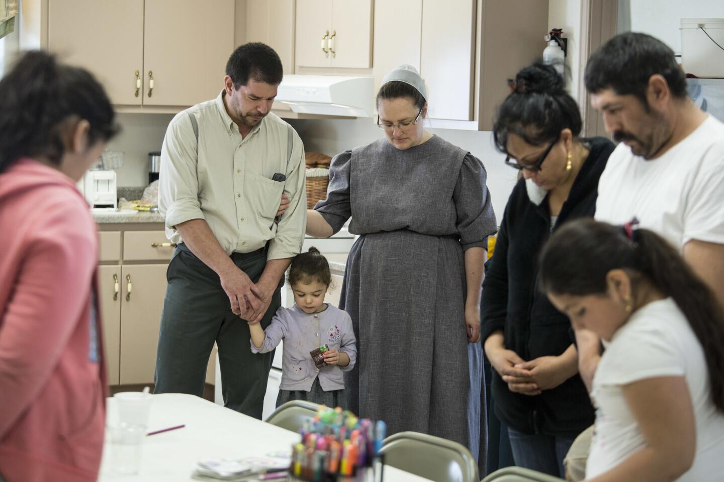
Jonah Avina, left, and his wife, Eileen, pray before lunch at the Maranatha Mennonite Fellowship in Bangor, Calif., on Tuesday. The Bangor-area Mennonites are hosting several immigrant families evacuated from the nearby town of Honcut.
(Brian van der Brug / Los Angeles Times) 29/66
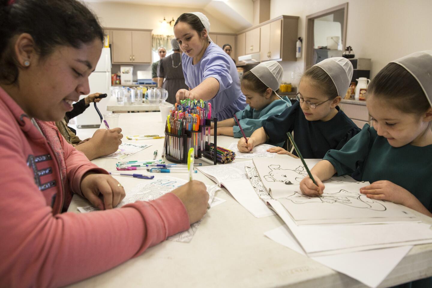
Evacuee Estafani Reynoso, left, colors with Mennonite children at the Maranatha Mennonite Fellowship in Bangor, Calif.
(Brian van der Brug / Los Angeles Times) 30/66
Crews work on a damaged section of the emergency spillway at Lake Oroville on Monday. (Josh Edelson / AFP/ Getty Images)
31/66
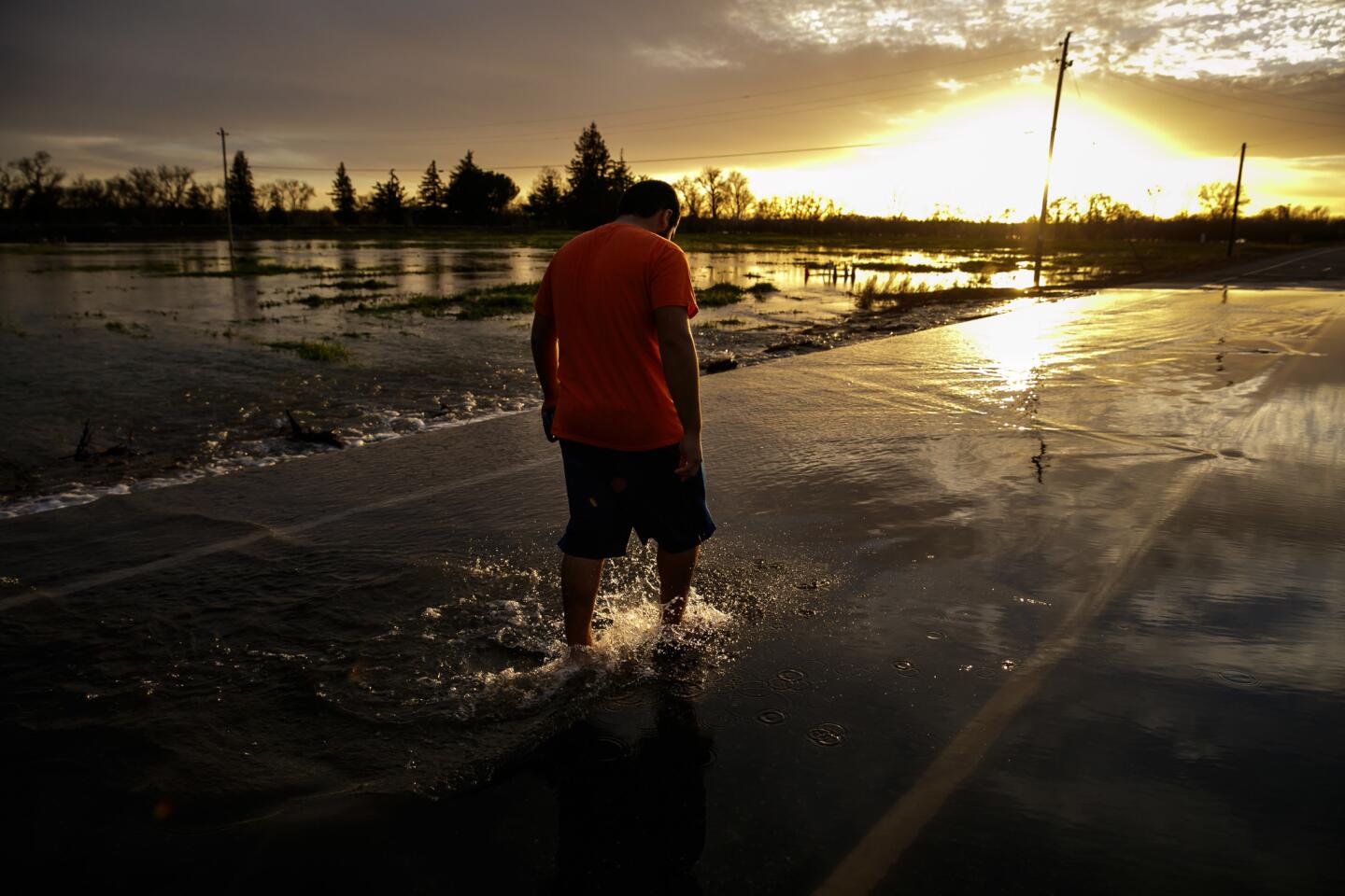
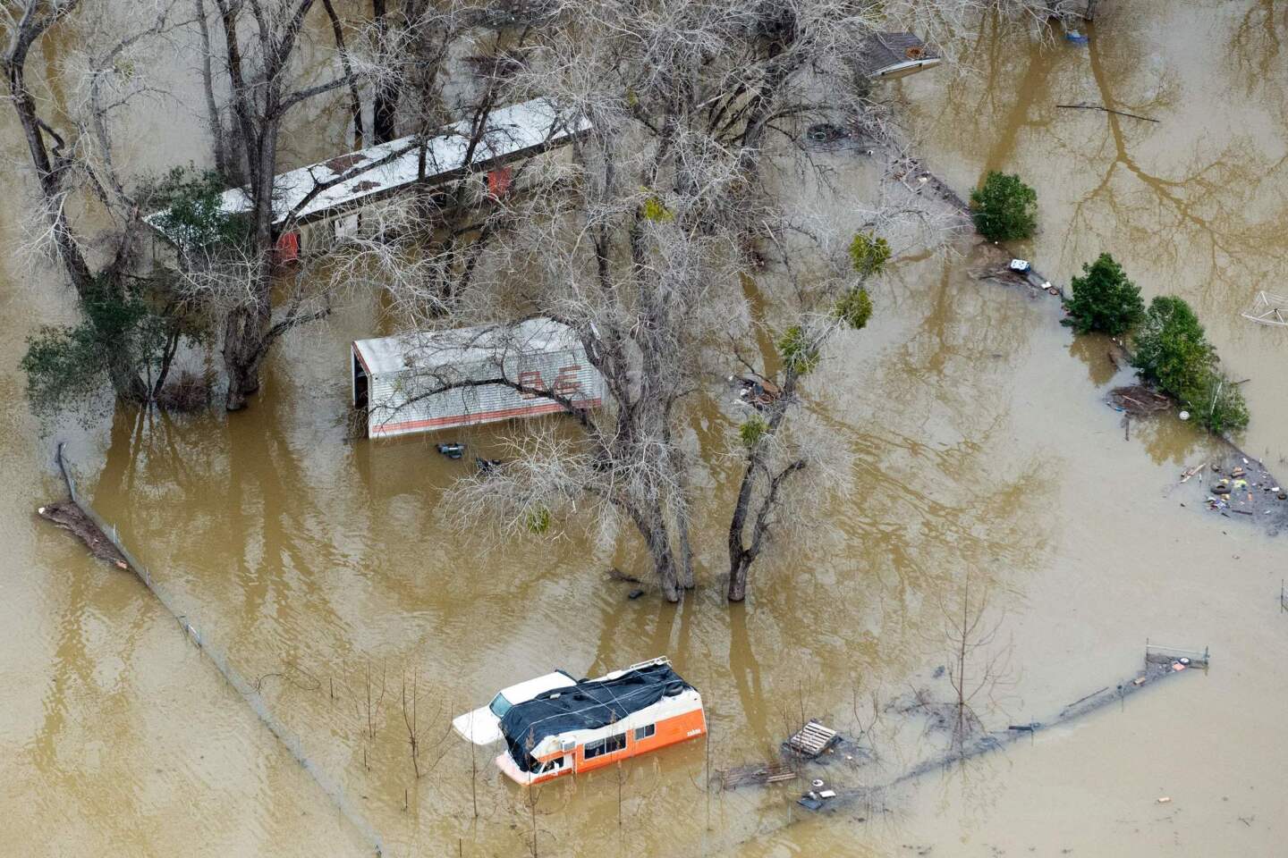
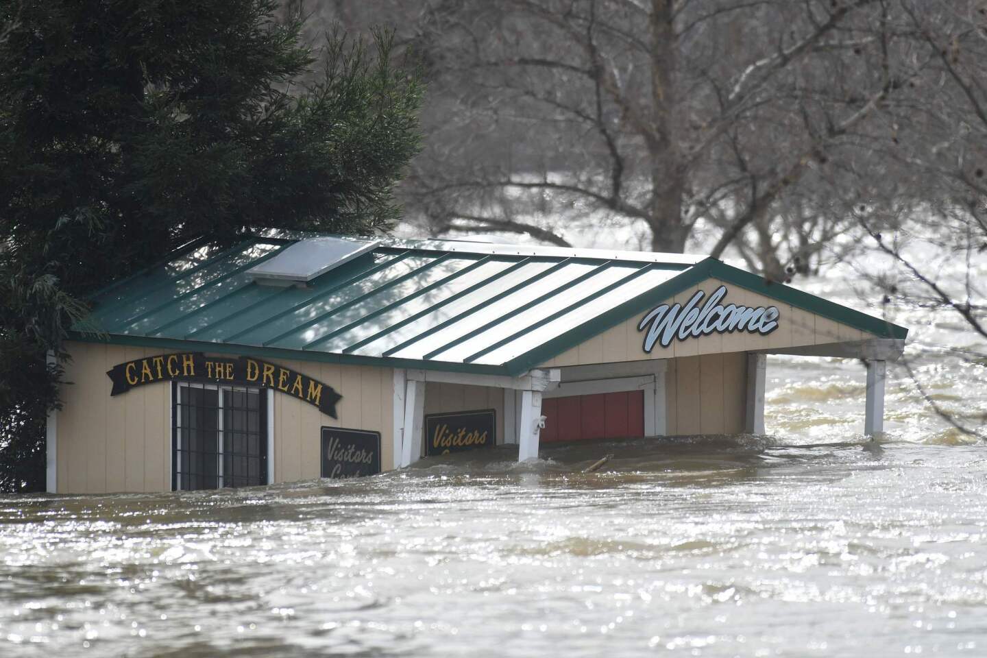
An Oroville property is flooded on Monday as thousands were under evactuation orders.
(Josh Edelson / AFP/Getty Images) 32/66
The Marysville cemetery underwater along the Feather River.
(Marcus Yam / Los Angeles Times) 33/66
Nirmal Singh, a Sikh priest, conducts a morning prayer ritual as evacuees sleep in the background at the Shri Guru Ravidass, a Sikh temple that has opened its doors for evacuees of the Oroville Dam crisis in Rio Linda, Calif.
(Marcus Yam / Los Angeles Times) 34/66
Kamlesh Nahar, far left, talks to fellow evacuees at the Shri Guru Ravidass Temple.
(Marcus Yam / Los Angeles Times) 35/66
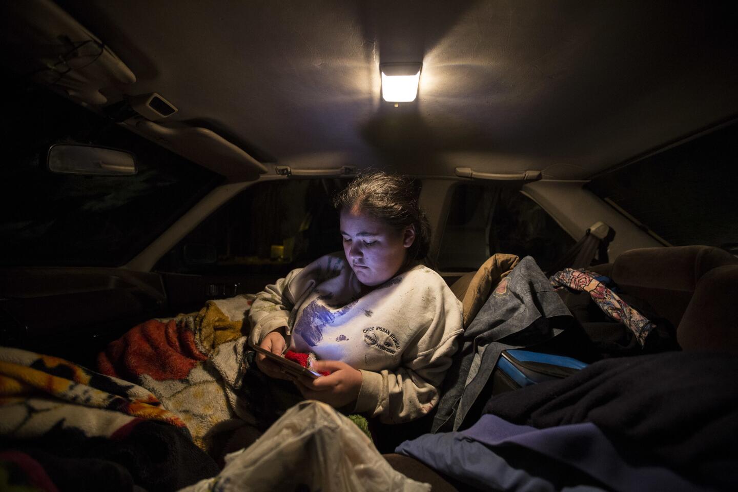
Maria Lopez reads on her smartphone as she spends a second night in her father’s car in the parking lot of the Bangor Community Hall.
(Brian van der Brug / Los Angeles Times) 36/66
Sharon Dalton finds a quiet spot under a table as she spends a second night with her dog Cruiser inside the Bangor Community Hall.
(Brian van der Brug / Los Angeles Times) 37/66
Verna Chadwick and 10-month-old son Raiden Ellis during a second night in the Bangor Community Hall.
(Brian van der Brug / Los Angeles Times) 38/66
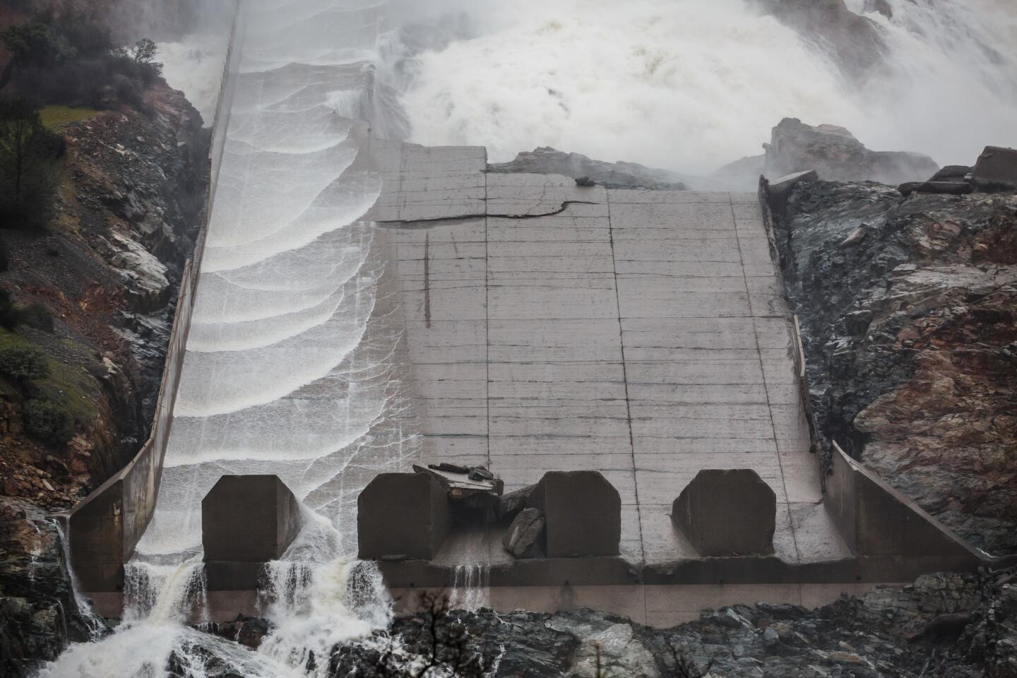
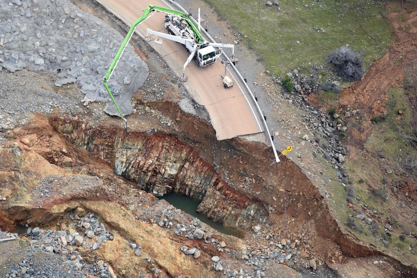
The emergency spillway, left, and the damaged main spillway at Lake Oroville are seen in an aerial photo Monday.
(Elijah Nouvelage / Getty Images) 39/66
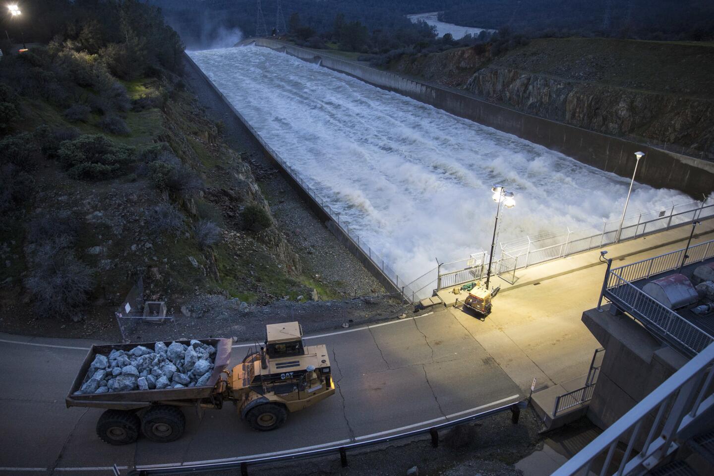
A dump truck crosses the primary spillway to deliver boulders to the damaged emergency spillway at Lake Oroville on Monday evening.
(Brian van der Brug / Los Angeles Times) 40/66
Helicopters place large rocks on the damaged emergency spillway at Lake Oroville on Monday evening.
(Brian van der Brug / Los Angeles Times) 41/66
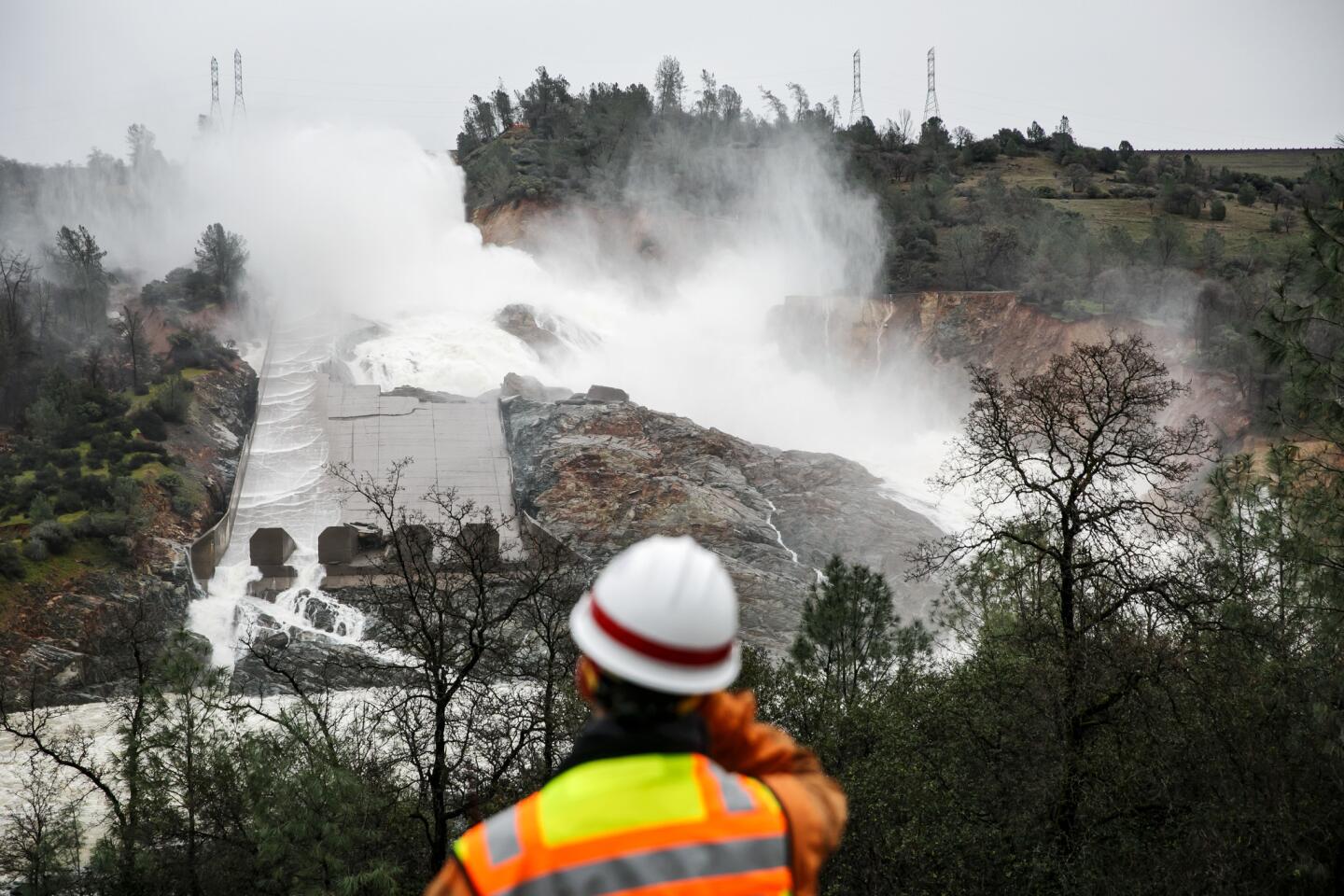
Around-the-clock monitoring continues on the damaged primary spillway at Lake Oroville on Monday evening.
(Brian van der Brug / Los Angeles Times) 42/66
Water rushes down a spillway at the Oroville Dam. (Brian van der Brug / Los Angeles Times)
43/66
California Department of Fish and Game wardens view the damaged spillway on Monday. (Brian van der Brug / Los Angeles Times)
44/66
Bill O’Kelley, 86, and wife Doris O’Kelley, 84, of Oroville sit near a flagpole Monday at the Silver Dollar Fairgrounds evacuation center in Chico, Calif.
(Brian van der Brug / Los Angeles Times) 45/66
Coua Tha, of Oroville prepares a meal for her family in the parking lot at the Silver Dollar Fairgrounds evacuation center in Chico, Calif.
(Brian van der Brug / Los Angeles Times) 46/66
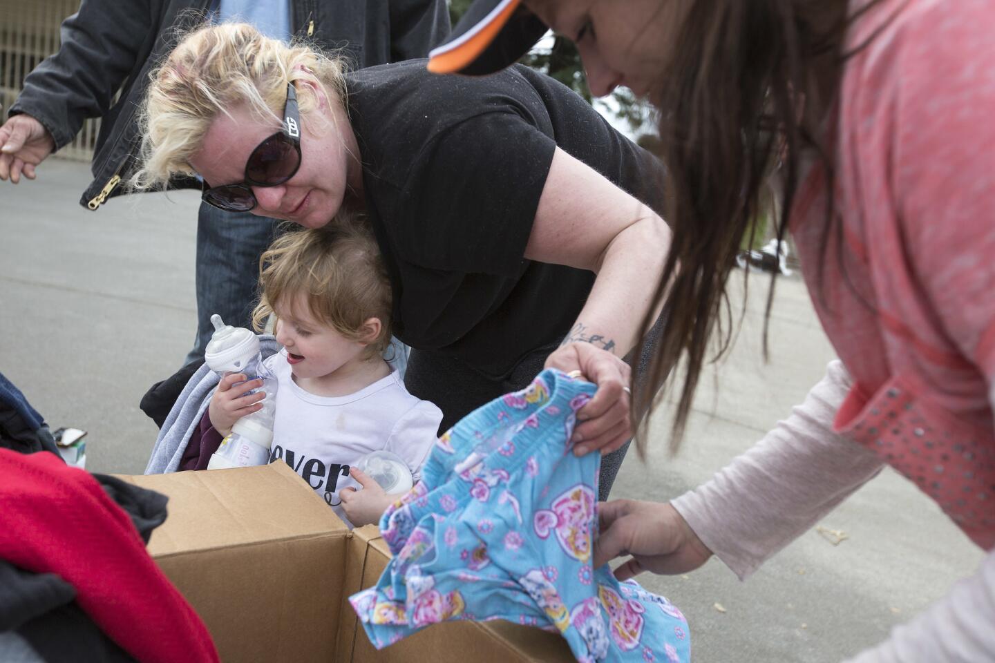
Desiree Garcia and daughter Kay’lee Pearl Garcia, 3, of Oroville look over donated clothing Monday at the Silver Dollar Fairgrounds evacuation center in Chico, Calif.
(Brian van der Brug / Los Angeles Times) 47/66
Members of Oroville’s Jordan Crossing Mission pray with a volunteer service member Monday at the Silver Dollar Fairgrounds evacuation shelter in Chico, Calif.
(Brian van der Brug / Los Angeles Times) 48/66
The swollen Feather River flows through Oroville, Calif., on Monday.
(Rich Pedroncelli / Associated Press) 49/66
A building is submerged in Riverbend Park as more water is released from Lake Oroville.
(JOSH EDELSON / AFP) 50/66
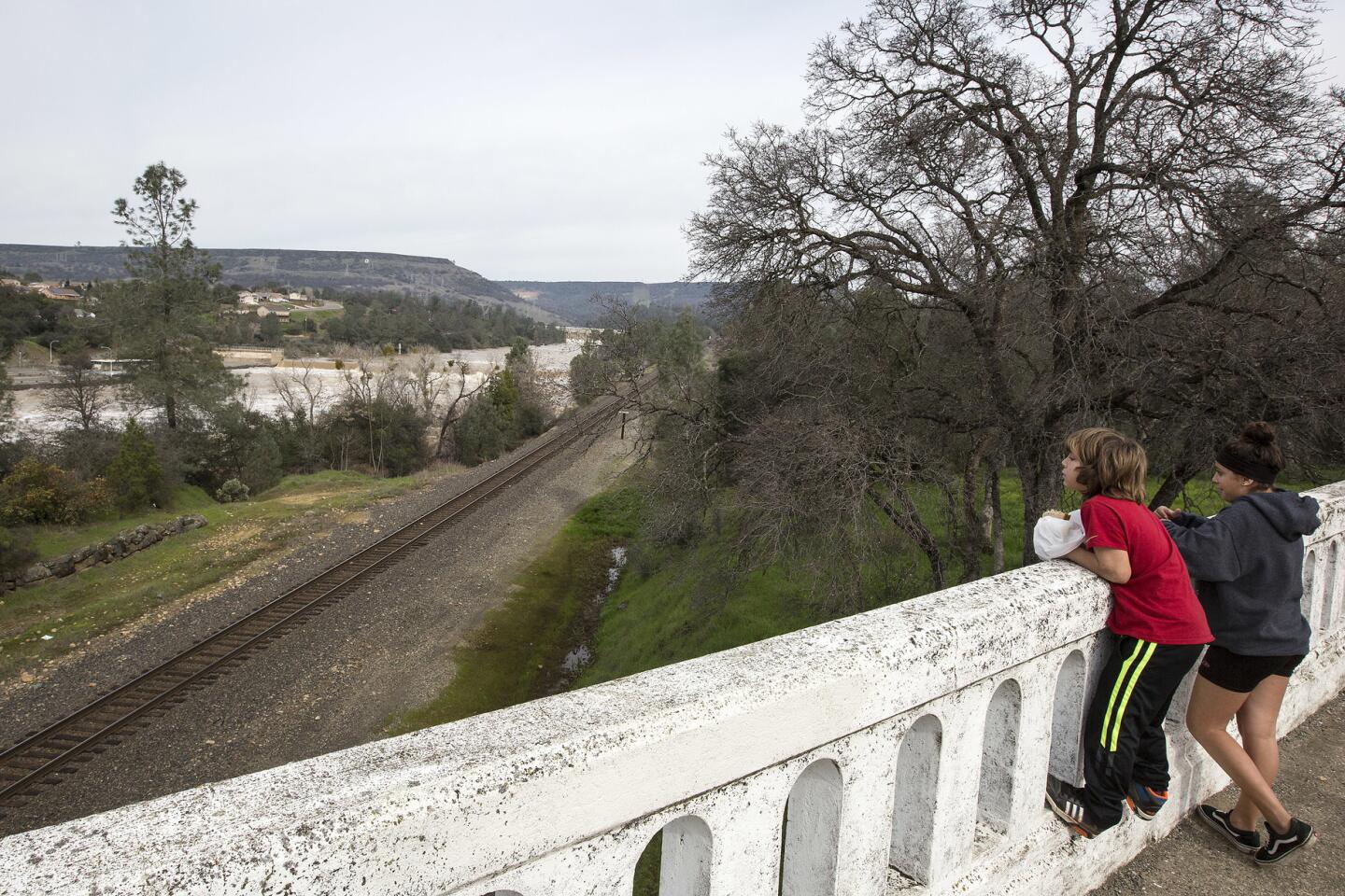
Siblings Zach Soto, 11, left, and Gabby Soto, 13, keep an eye on the Feather River along a railroad bridge in Oroville, Calif., on Monday. The family decided to stay in Oroville as they live on high ground near downtown.
(Brian van der Brug / Los Angeles Times) 51/66
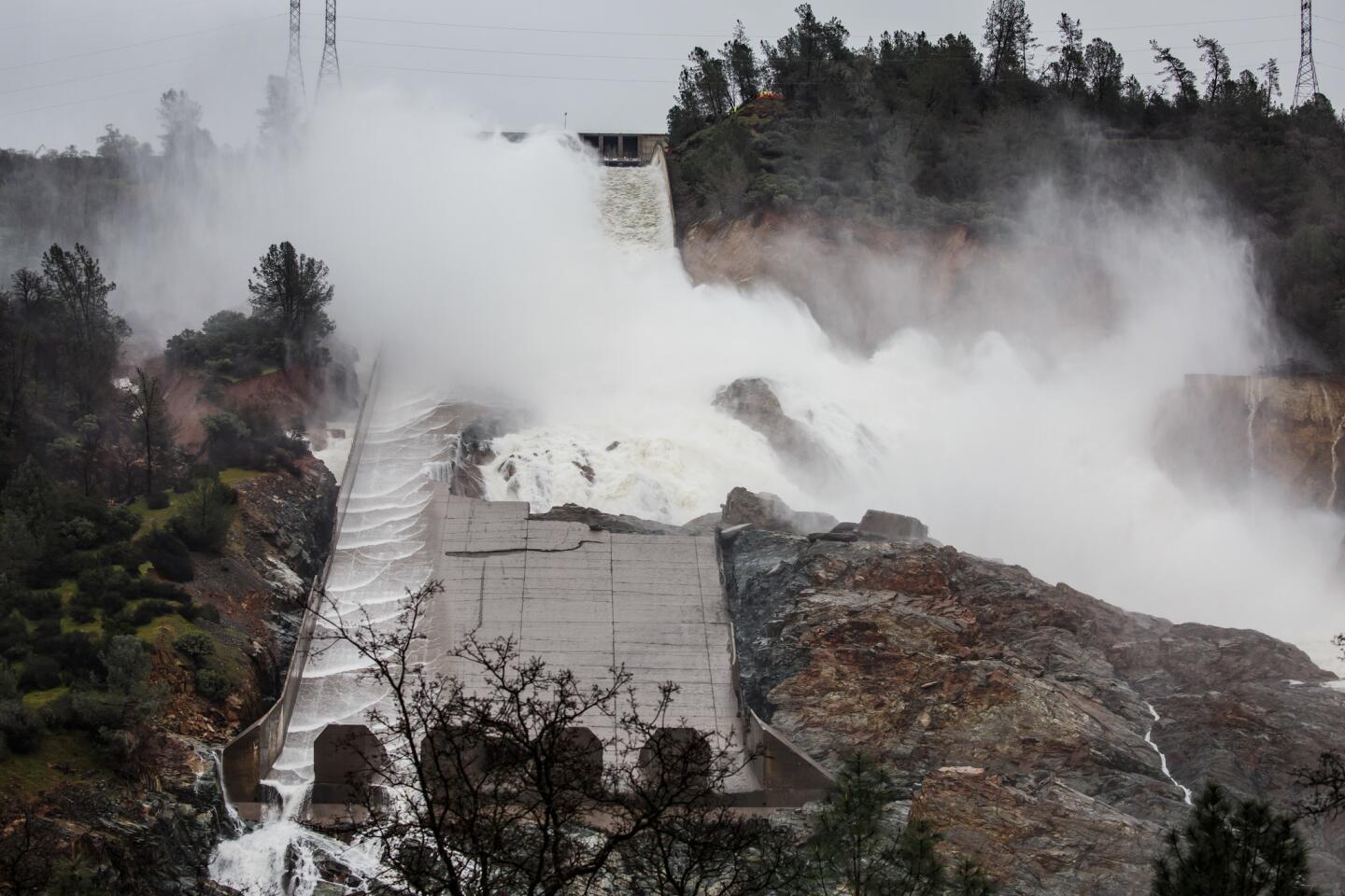
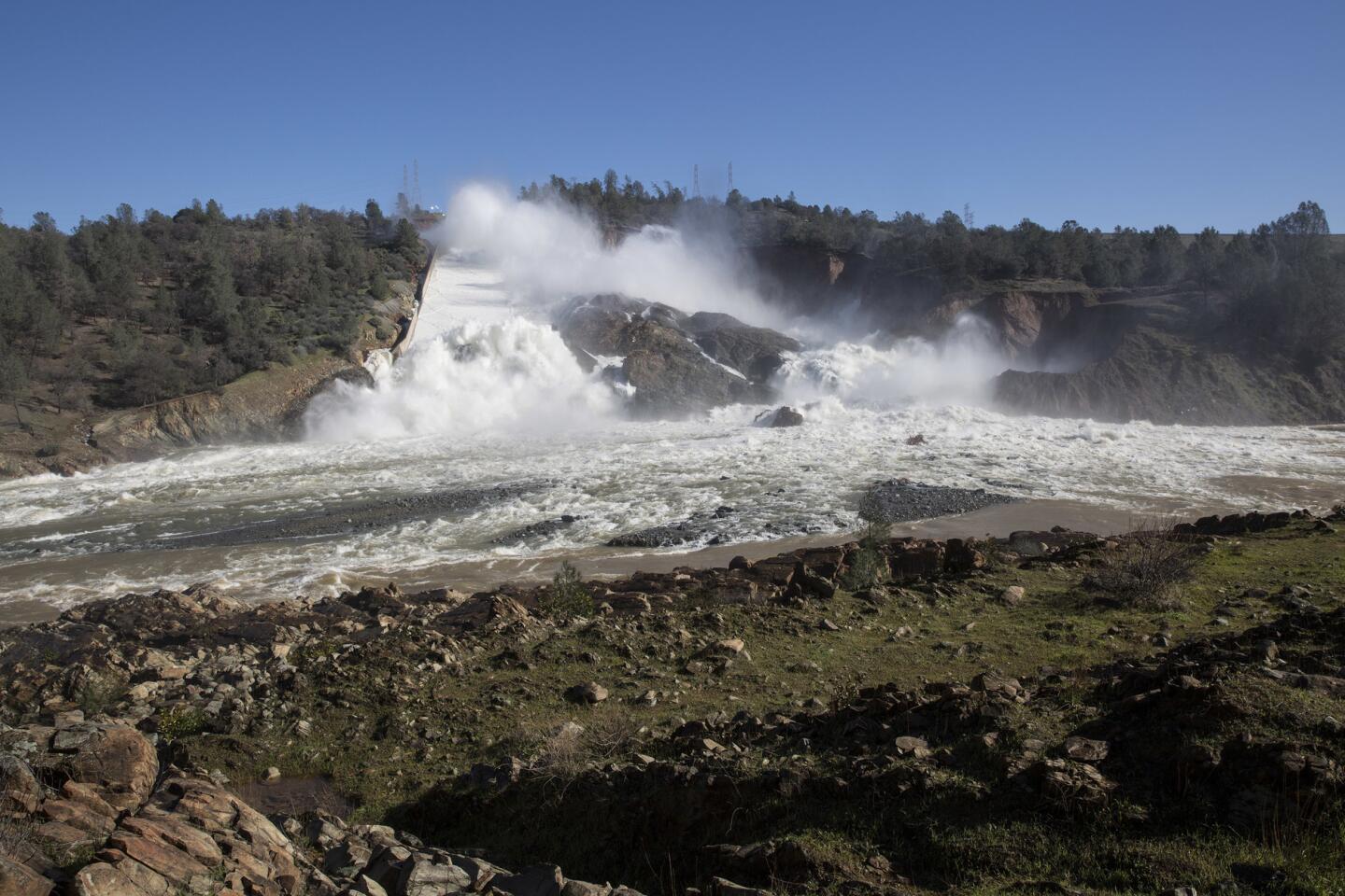
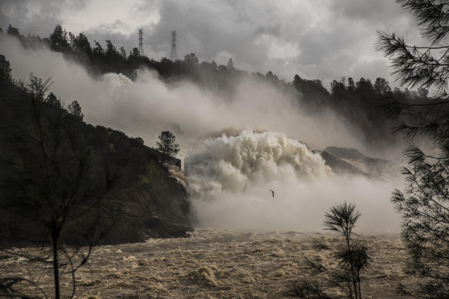
Water flows down the damaged main spillway of the Oroville Dam at 55,000 cubic feet per second into the Feather River. (Brian van der Brug / Los Angeles Times)
52/66
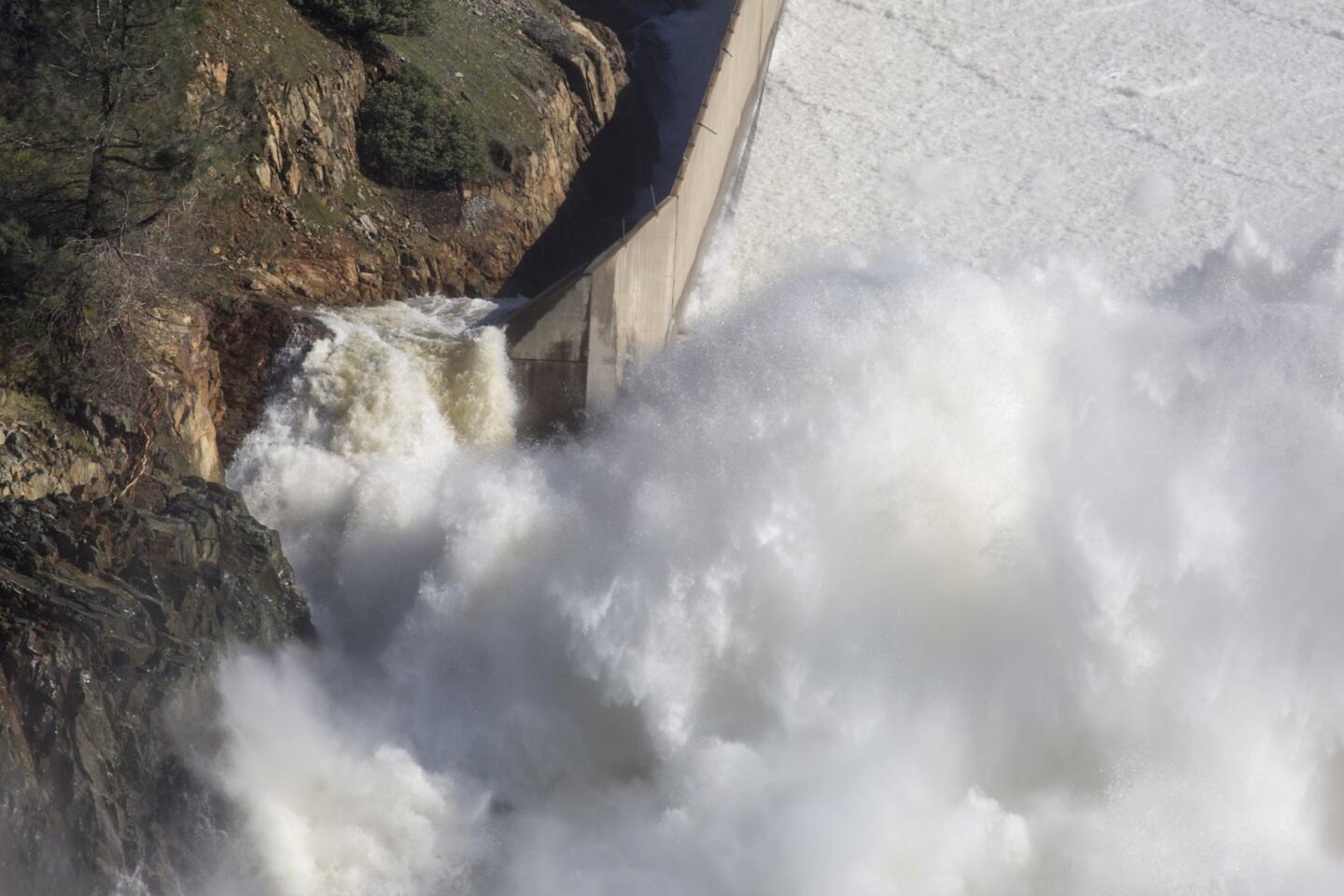
Water from Lake Oroville flows down the damaged main spillway.
(Brian van der Brug / Los Angeles Times) 53/66
Water from Lake Oroville flows down the emergency spillway of the Oroville Dam toward the Feather River.
(Brian van der Brug / Los Angeles Times) 54/66
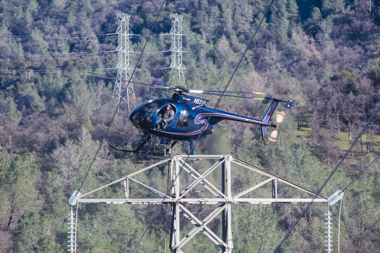
Pacific Gas & Electric crews aided by a helicopter removed transmission lines and insulators from towers standing in the bed of the emergency spillway of Lake Oroville.
(Brian van der Brug / Los Angeles Times) 55/66
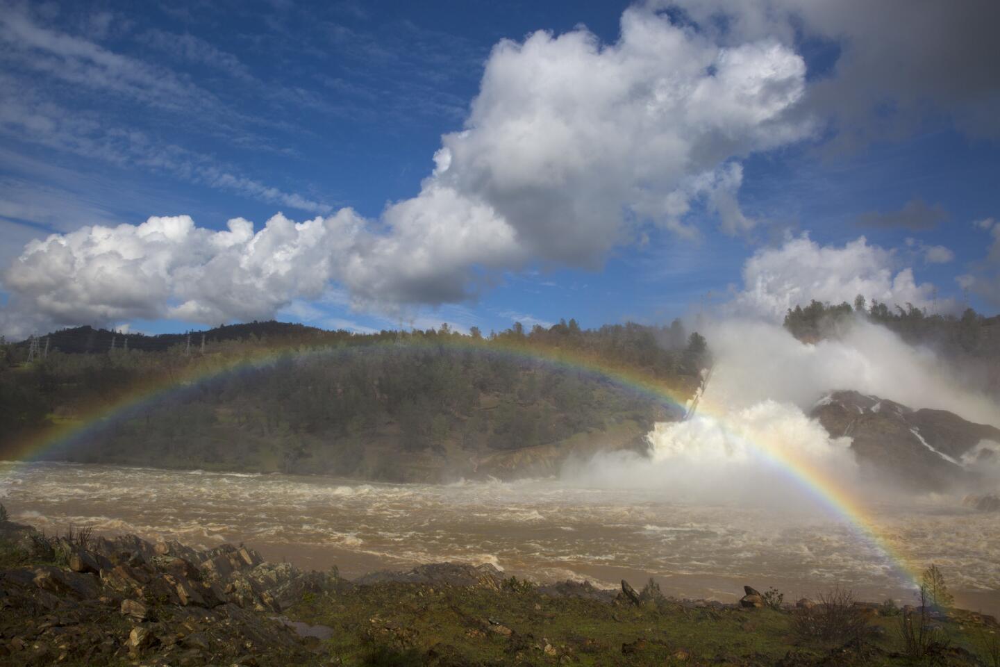
A rainbow appears over Feather River as water cascades down the damaged spillway at Lake Oroville Dam.
(Brian van der Brug / Los Angeles Times) 56/66
Water cascades down the spillway below Oroville Dam. The water is being released by authorities to avoid flooding at Lake Oroville because of recent heavy rain. (David Butow / For The Times)
57/66
Pacific Gas and Electric Co. crews move two electric transmission line towers on the bank of Feather River as a precaution if the Lake Oroville Dam emergency spillway needs to be used.
(Brian van der Brug / Los Angeles Times) 58/66
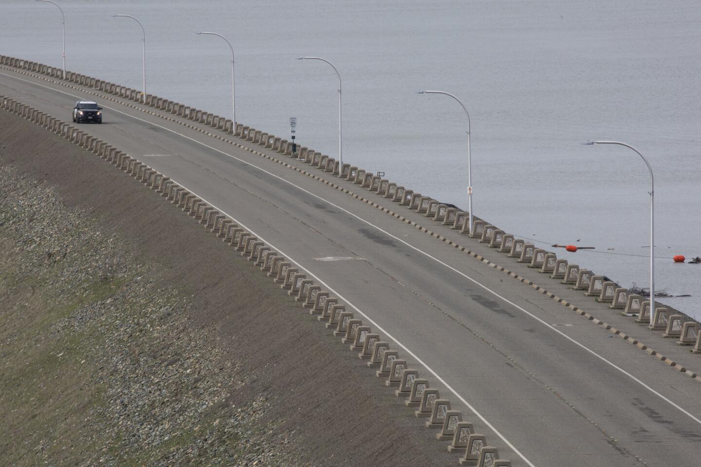
A California Highway Patrol cruiser patrols Lake Oroville Dam, which is closed to the public due to the damaged spillway.
(Brian van der Brug / Los Angeles Times) 59/66
Water cascades down the spillway below the Oroville dam. The water is being released by authorities to ease flooding in Lake Oroville because of recent heavy rain.
(David Butow / For the Times) 60/66
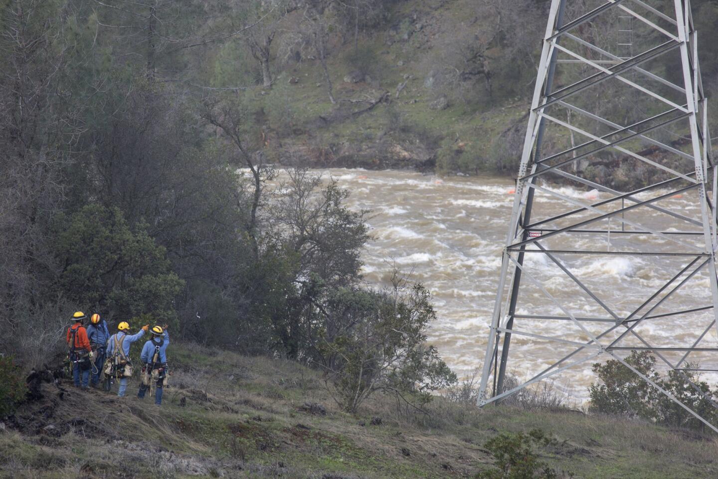
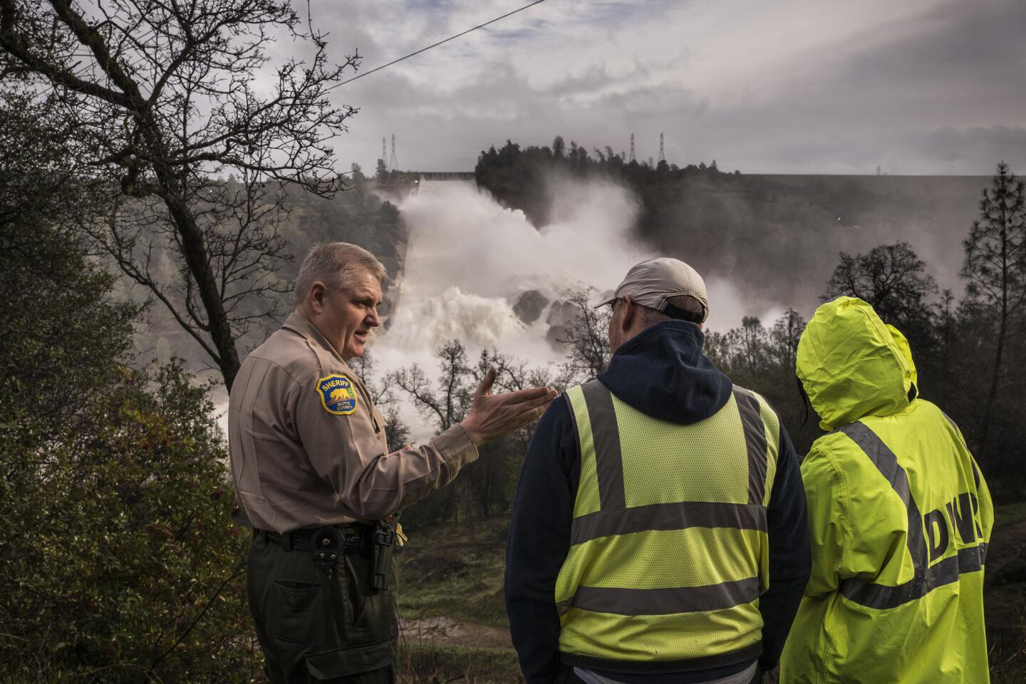
Butte Country Sheriff Kory L. Honea speaks with department of water and power workers at an overlook as the observe runoff from the Oroville Dam.
(David Butow / For the Times) 61/66
Water trickles down as workers inspect part of the Lake Oroville spillway failure in Oroville, Calif.
(Randy Pench / Associated Press) 62/66
A boat launch at Bidwell Canyon is still hundreds of yards above the current lake level on Jan. 21, 2016.
(Brian van der Brug / Los Angeles Times) 63/66
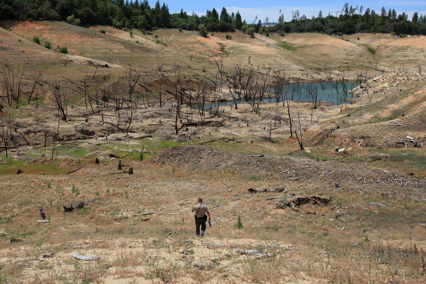
California State Park Ranger Bryan Taylor searches for signs of disturbance or theft as California’s severe drought conditions are revealing historic artifacts at Lake Oroville, June 21, 2014.
(Allen J. Schaben / Los Angeles Times) 64/66
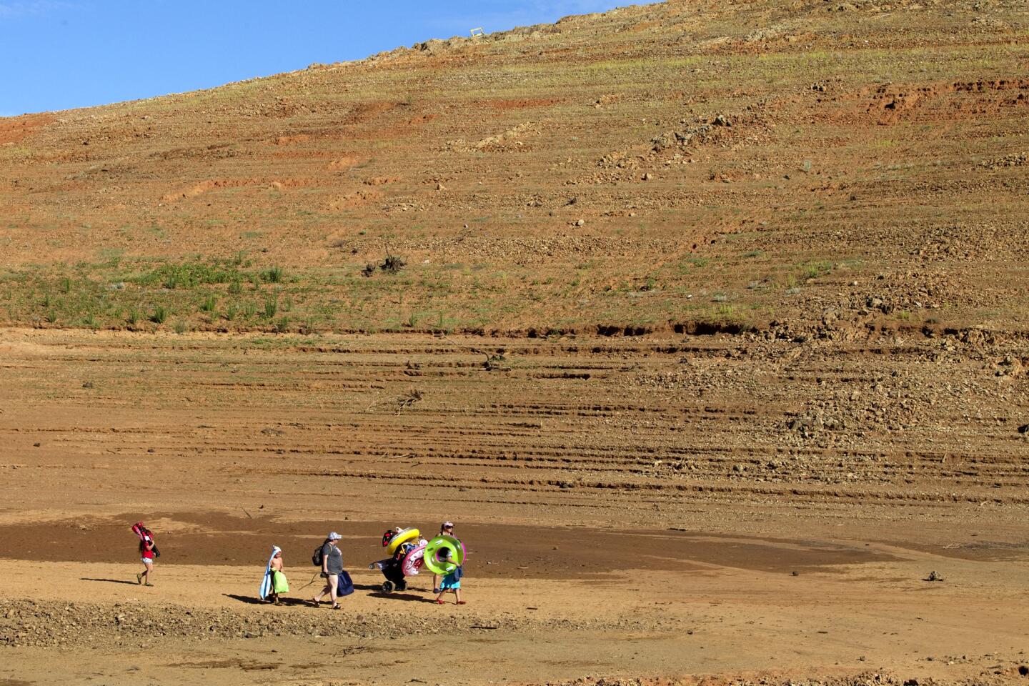
Severe drought conditions are evident as a family treks across a long path back to their car at Lake Oroville, June 21, 2014.
(Allen J. Schaben / Los Angeles Times) 65/66
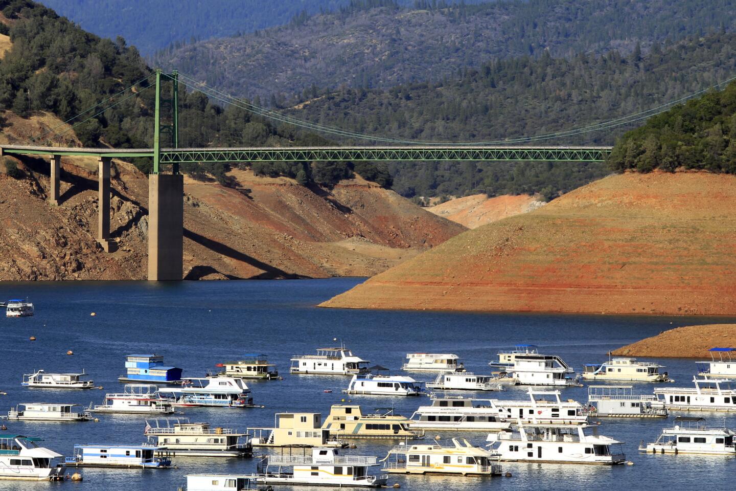
Houseboats are dwarfed by steep banks that show the water level down 160 feet from the high water mark at the Bidwell Bar Suspension Bridge over Lake Oroville on June 21, 2014.
(Allen J. Schaben / Los Angeles Times) 66/66
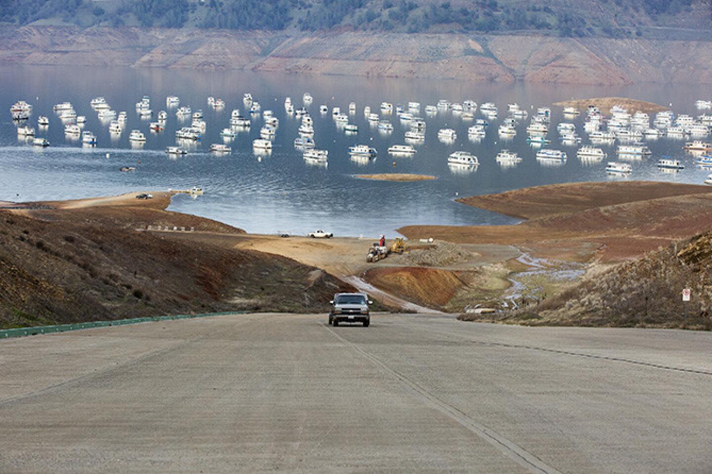
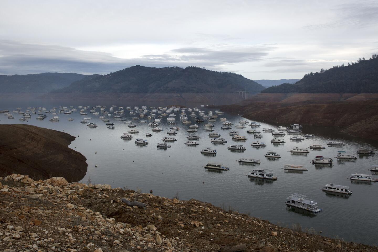
Houseboats at Bidwell Canyon Marina at Lake Oroville, January 21, 2016.
(Brian van der Brug / Los Angeles Times) Forecasters say there is a potential for another series of strong storms in Northern California early next week that could bring additional flooding, though they are less confident about the specifics because it is still early, Dang said.
Christina Widener, 51, evacuated with her husband and her 94-year-old grandmother, who suffers from dementia. They drove to Red Bluff, about 60 miles away, before finding a motel room.
“I think it made sense at the time,” she said of the hasty evacuation order Sunday evening. “But I wish she hadn’t left.”
The mother of four has lived in her bungalow near the river’s edge for 32 years, and in 1997 defied an evacuation order despite the threat of arrest.
“We didn’t leave then and nothing happened,” she said, grabbing boots and a kitty container out of the back of her Ford SUV.
Widener had nothing but praise for the hospitality of Red Bluff — waitresses offered to pay for their meals, strangers invited them to stay in their homes. Someone even offered to do their laundry.
“They were awesome,” she said.
Although some evacuees drove far from Oroville, others made arrangements to stay with family or friends who reside in the foothills behind the lake — safe ground should the dam fail.
“As long as you are up above, you should be good, right?” said Jerry Smith, a 26-year-old solar installer. He finished loading frozen pizzas and bottled waters at a newly reopened grocery store, and was anxious to move on with his wife.
“I’m sorry, but we’ve got to go. We haven’t been home yet.”
Was he anxious?
“No, we should be OK.”
In Southern California, meanwhile, the storm system expected to arrive Friday could provide a walloping, with possible flash flooding, mudslides and rock slides.
“The Friday storm in particular could in fact become the strongest of the season in the Los Angeles region,” said UCLA climate scientist Daniel Swain.
A slow-moving storm is expected to debut into the Southland with some light rain Thursday night or Friday morning, but is expected to dump large amounts of rain in a short time frame during its peak Friday afternoon and evening, said Ryan Kittell, a forecaster with the National Weather Service in Oxnard.
Rainfall totals for the Los Angeles metropolitan area are predicted to be between 2 to 4 inches, with 6 to 8 inches expected in the mountains and foothills, he said.
“The raw numbers don’t look that scary, but if we get the bulk of that coming over a small period, that will cause a lot of issues,” Kittell said. Much of that rain could fall within a 12-hour period Friday, and it could fall at a rate of more than an inch per hour, he said.
There is a high likelihood, Kittell said, for a “lot of roadway flooding,” as well as falling trees because the storm also is expected to usher in powerful winds.
hailey.branson@latimes.com
Twitter: @haileybranson
ALSO
Oroville dam crisis: Could it have been prevented?
Here’s the nightmare scenario at Oroville Dam that officials are fighting to prevent
Current pace of Oroville Dam water release is ‘reasonable and sustainable,’ officials say