Satellite images show ‘double jeopardy’ wildfire danger
When it comes to Southern California’s increasingly perilous fire season, you can blame it on the rain. That’s the paradoxical case made by satellite data from NASA and India.
Scientists at NASA’s Jet Propulsion Laboratory and at Chapman University said the satellites show the effects of a steady and largely forgettable rainfall that fell during a roughly four-day period at the end of January.
JPL scientist Son Nghiem, the principal investigator in the project, said the rain came just as much of the vegetation throughout the region was awakening from a dormant stage.
The rain provoked a growth in vegetation that, followed by a hot, near-record dry period, simply resulted in more fuel for potential wildfires. The situation was a true “double jeopardy” one, Nghiem said Monday.
“This timing enhanced vegetation growth early this year, particularly in Ventura County, supplying significant new fire fuel despite one of the driest overall rainfall seasons on record,” he said. “Had the rains fallen earlier, when the vegetation was in a dormant state, the effects would have been minimal.”
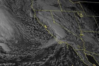
Scientists said the satellite data could be used going forward to give fire agencies a broad picture of where the greatest danger lies. The Indian satellite tracked soil moisture levels. The NASA satellite tracked the moisture level of vegetation.
Nghiem said scientists were already working to help fire agencies make assessments of fire danger conditions by using satellite data, and that “tremendous progress” has been made. He said the latest data reinforces the potential of the technology, which can gather information from places that might be inaccessible to people either because of the terrain or lack of resources.
“If we can show that the satellite data is useful to help fire agencies make assessments of wildfire danger,” there’s a potential to create something that can warn officials “in near real time,” Nghiem said.
“Within minutes, the data can be turned into a kind of work product that can be directly used by fire agencies,” he said.
Southern California’s wildfire season got off to an ominously early start because of dry conditions even during the region’s nominally wettest months: January, February and March. On top of that, strong Santa Ana winds buffeted the landscape during a time of year when they normally don’t.
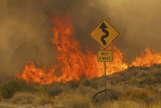
Earlier in the month, the Springs fire in Ventura County grew into a monster of more than 28,000 acres that was buffeted by winds that blew over desiccated scrublands.
The fire finally lost its momentum after a cool-down and light rains. But no sooner had the rains come than the region became embroiled in the kind of heat wave that rapidly undoes whatever the rains did to raise moisture levels in vulnerable brush.
Rich Thompson, a meteorologist for the National Weather Service in Oxnard, said Monday brought blistering temperatures in the San Fernando Valleys and elsewhere in the high 90s to the early 100s.
Beginning Tuesday, temperatures should steadily decline and they could plunge all the way down to the 70s by Wednesday. But, he said, temperatures are expected to jet back up by next Sunday and Monday.
“You’ve got to love the spring in Southern California,” Thompson cracked.
Southern California got most of its rain of the rain year — measured from last July to June 30 of this year — from fall through December. But then, as if a spigot got turned, the rains all but stopped.
It only rained just over 1 inch of rain in January, but most of it came during a few days late in the month, and especially on Jan. 24 and 25, when almost all of the month’s rain fell, said Bill Patzert, a climatologist for JPL.
“That was our last gasp of rain” for several months, he said. “After that, rain was ephemeral to whimsy.”
Nghiem said much of the rain’s vegetation crawls out of a dormant state in late December through January. The rains at the end of the latter month spurred vegetation growth, he said.
“That put water into the soil at a time when the vegetation was waking up from the dormant state,” Nghiem said. “It provided water at the right time for the vegetation to grow very fast.”
That wouldn’t have been a problem had it kept raining, as it can during the winter months. But instead it just got dry and it windy, he said.
He said satellite data showed just how quickly the situation turned after the late January rains. An image of Riverside County -- which recently had a large wildfire -- from Feb. 25 shows a landscape color-coded in green, to show the elevated moisture levels of the vegetation. An image from May 1 shows a different situation.
“In February you see a lot of green,” Nghiem said. “Then on the first of May, all the green is gone. That’s exactly where it burned.”
ALSO:
High temperatures set records, more heat on the way
Villaraigosa-backed school board candidate leads money race
Three-acre brush fire in Culver City under control, officials say
More to Read
Start your day right
Sign up for Essential California for news, features and recommendations from the L.A. Times and beyond in your inbox six days a week.
You may occasionally receive promotional content from the Los Angeles Times.
