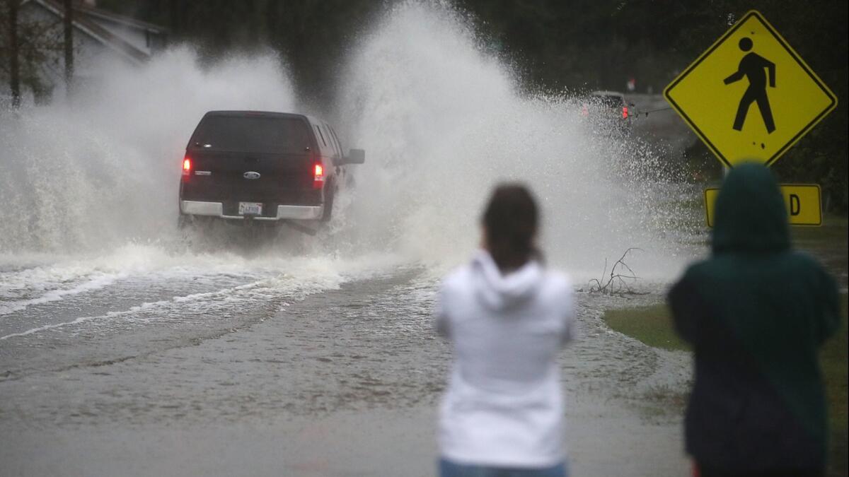
Florence weakens as it moves inland, but all that water has to go somewhere — and that’s the problem

Florence weakened into a tropical depression Sunday morning as it slogged inland over the mid-Atlantic states, but the slow-moving storm, which has killed at least 15 people, remains a major threat to the region’s millions of waterlogged residents.
The biggest problem now for residents in Virginia and the Carolinas isn’t high winds and ocean storm surge, but rain and flooding. Florence is expected to unload an additional seven to 10 additional inches of rain over central North Carolina after dumping more than 32 inches over parts of the state’s southeast.
Heavy rains are also expected to spread into southwest Virginia and southern West Virginia, where officials warned of potential landslides in the Appalachian mountains.
By the time Florence weakens as it turns toward New England, forecasting officials expect, some parts of North Carolina — which has borne the brunt of the storm — will get the kind of weekly rainfall totals statistically expected once every thousand years.
As of 9 a.m. Sunday, the city of Wilmington, N.C., with a heavy assist from Florence, reported receiving 86.79 inches of rain so far this year, breaking a record set in 1877.
All that rain has to go somewhere. Much of it will eventually end up dumping into the Atlantic Ocean. But to get there, storm water will have to pass through the region’s coastal river networks, and that’s where officials expect new perils in the days to come.
Rivers across North Carolina, South Carolina and southern Virginia have been pushed past their limits and hit major flood stages, in which the flooding of buildings and roads require significant evacuations.
“Catastrophic” flooding is expected on the Cape Fear River near Fayetteville, N.C., where the river is expected to crest to its highest level since 1945, National Weather Service forecasters said.
Transportation officials said hundreds of roads, including some key freeways, remained flooded or blocked, primarily in southeast North Carolina, where the storm knocked out nearly half of the cell towers in some areas, according to the Federal Communications Commission.
GPS services are sending unwitting drivers onto flooded roads, said North Carolina state officials, who have been asking out-of-state drivers to avoid North Carolina entirely. State troopers reported responding to 48 collisions and 128 calls for service overnight.
More than 700,000 customers — about 14% of the state’s consumers — have lost power in North Carolina, energy officials reported. Fewer than 55,000 customers remain without power in South Carolina on Sunday morning, down from a high of 167,000 customers a day earlier, according to the U.S. Energy Department.
Evacuees have started to return to coastal South Carolina even as local officials warned of catastrophic river flooding.
In northeastern Horry County, S.C., where two people died during the storm, National Guard troops attempted to divert water from the swollen Waccamaw River.
The river drains into an area the size of Rhode Island, parallel to the coast near Myrtle Beach. If it rises as expected, 12 feet by Wednesday, it could wash 200,000 tons of toxic coal ash into neighborhoods from a shuttered Santee Cooper power plant in Conway.
Officials were also rushing to construct temporary dams on the Pee Dee and Lynches rivers to prevent flooding that could cut off coastal Myrtle Beach and portions of surrounding Georgetown County from the mainland.
Even as flood preparations accelerated, South Carolina’s governor lifted an evacuation order for Georgetown and Horry counties, leading to bizarre scenes as shuttle buses ferried waterfront residents home past National Guard crews and other emergency responders.
In Myrtle Beach, residents ventured out on foot to grab a bite at beachfront restaurants or buy groceries at the reopened Piggly Wiggly and Food Lion.
Workers were removing plywood from the windows of Dirty Don’s Oyster Bar, where owner Don Cauthen said he planned to serve returning residents as of noon Sunday.
Cauthen, who lives near the Intracoastal Waterway, said he expects the Waccamaw River to flood, which could strand those returning to the coast in coming days.
But he said it made sense to allow people to try to make a mad dash home before the two major highways are flooded.
Neighbors alarmed by initial dire warnings about the storm calmed down when it was downgraded and now are more curious than concerned about flooding, he said, “Which might not be a healthy thing.”
Ned and Anna Marie King decided to stay in their waterfront home facing the Intracoastal on Riverside Drive, which is marked by a “flood zone” sign. So did the rest of their neighbors.
They sandbagged the doors, removed area rugs and propped wood blocks under the furniture as they kept an eye on a dock across the churning channel to monitor the water level.
They’d propped their house up when they moved in two years ago. “I wish we had gone up two more blocks,” said Ned King, referring to the foundation they raised by five cinderblocks. “It takes a long time for it to rise and a long time for it to go away. It’s just miserable.”
Their son, who had evacuated before the storm, called from Orlando, Fla. They were not sure when he would be able to return, given the flooding expected inland.
“Even though the evacuation has been lifted,” Anna Marie King said, “the biggest concern is people trying to get back in.”
Hennessy-Fiske reported from Myrtle Beach and Pearce from Los Angeles.
More to Read
Start your day right
Sign up for Essential California for news, features and recommendations from the L.A. Times and beyond in your inbox six days a week.
You may occasionally receive promotional content from the Los Angeles Times.


