‘Polar vortex’ could send wind chill to 65 below zero in Midwest
A large chunk of the Midwest is facing “life-threatening” subzero temperatures, officials said.
Parts of the U.S. may see days of record-low temperatures beginning Sunday as forecasters expect a deep freeze to bring wind chill as low as 65 below zero in parts of the Midwest. Temperatures will hover around zero throughout the East Coast region early next week.
“It’s going to be very cold and the wind chills are going to be very low,” said Bob Oravec, a forecaster with the National Weather Service. “It hasn’t been this cold in several decades for the big East Coast cities.”
Parts of the Upper Midwest -- such as Minnesota, North Dakota, South Dakota, Wisconsin and Montana -- will get hit hardest, he said. Many of these areas have wind chill advisories.
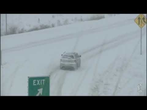
PHOTOS: Snow storm pounds East Coast
Because of the cold, for the first time in 17 years, Minnesota is closing all its schools on Monday.
“I have made this decision to protect all our children from the dangerously cold temperatures now forecast for next Monday,” said Gov. Mark Dayton said in a statement. “I encourage Minnesotans of all ages to exercise caution in these extreme weather conditions.”
In neighboring Wisconsin, Milwaukee and Madison schools also announced on their websites that they would be closed because of the frigid weather.
But the Green Bay Packers NFL wild-card playoff game against the San Francisco 49ers on Sunday was to go on as planned. In a release on the Packers website, the team said it is pairing up with Delaware North Companies Sportservice to help fans battle the cold by offering free cocoa and coffee.
Even the term forecasters use to describe the potential cause of this weather pattern -- “polar vortex,” a counterclockwise-rotating pool of cold, dense air -- sounds chilling.
“It’s a semi-permanent circulation that’s typically at higher latitudes across the world, like at the North Pole,” Oravec told the The Times. “But at the moment, the polar vortex is being pushed farther south into the U.S., transporting very cold air.”
East Coast states, reeling this week from heavy snow, are not expected to feel the frigid temperatures until Tuesday.
“Temperatures will be fairly warm on the Eastern seaboard on Monday morning,” Oravec said. “It will start off in the lower 40s in big cities such as Washington, D.C., Baltimore, Philadelphia, New York City and Boston ... but will drop rapidly during the day.”
By Tuesday morning, temperatures will fall to near zero, Oravec said.
State and local officials in some areas took to social media to urge people to alert authorities if they see homeless people.
The Boston Public Health Commission posted a page on its website outlining “homeless resources for extreme cold weather conditions.”
Vincent C. Gray, the mayor of Washington, D.C., said on his Twitter account that people should call 311 or the district’s hypothermia helpline if they see homeless people out in the cold.
Slightly better weather is on the horizon.
“At least temporarily, by the middle to latter part of the coming week, temperatures will be milder than they have been,” Oravec said.
ALSO:
More deaths in Northeast as snow gives way to bitter cold
Cronut-crazed New Yorkers brave frigid temperatures for pastry
Allow gay marriages to continue, Utah couples tell Supreme Court
Twitter: @saba_h


Start your day right
Sign up for Essential California for news, features and recommendations from the L.A. Times and beyond in your inbox six days a week.
You may occasionally receive promotional content from the Los Angeles Times.