Experts sift the ashes, seeking clues about what causes raging firestorms
ESCONDIDO, Calif. -- On the evening of Oct. 22, Richard Halsey hiked up a ridge overlooking Interstate 15 and stared into the Santa Ana winds bombing through the canyons.
A trained firefighter, an educator and an ecologist, Halsey was hardly a wide-eyed bystander to the fires that had begun erupting across the region. Still, even to his trained eye, it did not appear that the flames were a threat to his home in this San Diego County city.
The next morning, they were in his backyard.
“The whole world was in flames,” he said. “It was just: boom, boom, boom, boom, boom. And you’re thinking: What is going on?”
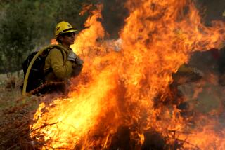
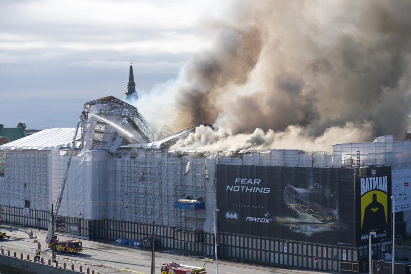
The result, by the end of the week, was no mere wildfire. It was a full-fledged firestorm of 35 simultaneous fires, 20 of them sizable blazes requiring a significant dedication of firefighting resources.
It stretched from north to south along more than 200 miles of coastline and so far east that it encompassed the full spectrum of Southern California’s ecological diversity: the Mediterranean waterfront of Malibu, the piney woods of Running Springs, the rugged peaks of the San Diego mountains.
Such events are rare enough that firefighters, ecologists and meteorologists don’t really have a name for them, but they have happened before, and no one is entirely sure how to predict their behavior.
“If you’ve been in fire long enough, it makes the hair on the back of your neck stand up,” said Halsey, founder of the California Chaparral Institute, which promotes understanding of the region’s natural habitat. “You don’t know where it’s going to start. But it’s going to start.”
Scientists are looking to delve into the issue. Some are planning to fly over recently scorched hills in an effort to develop more detailed maps of the fires.
In doing so, they may be able to determine whether fires burned “clean,” temporarily eliminating the brush inside the perimeter, or whether there are still unburned “islands” of volatile brush. The information could play into a divisive debate among ecologists about whether communities near recently burned patches are immunized, to some degree, from the next round of fires.
Others are hoping to assemble detailed accounts of regionwide fire “events” -- not just the October fires but past conflagrations too. They’ll soon begin overlaying fire maps with additional data, including moisture levels in plants and trees, sources of ignition and maps of smaller fires that burned out or were stopped before they grew into significant blazes.
“We’ll have a lot more data to work with,” said Tom McGinnis, a U.S. Geological Survey ecologist stationed at Sequoia and Kings Canyon National Parks. “We can start to figure out which ones took off.”
When firestorms erupt, they carry terrible consequences, and Southern California has been struck with some regularity in the last quarter-century:
* July 1985: A massive, scattered conflagration burned more than a million acres in 11 Western states. In California, flames threatened town centers in Ojai and San Luis Obispo; no urban center was more devastated than the Baldwin Hills community in Los Angeles County, where 66 homes were destroyed or damaged.
* June 1990: More than a dozen fires erupted across the region. Flames raged in the Carbon Canyon area of San Bernardino County; in Santa Barbara, where more than 600 buildings were lost; and in Glendale, where the College Hills fire destroyed or damaged 67 homes and was later tied to John Leonard Orr, an arson investigator and a notorious arsonist.
* October and November 1993: Fires ripped through more than 173,000 acres across Southern California: in Malibu, Calabasas, Altadena and Laguna Beach, where more than 300 homes were destroyed.
* October 2003: More than a dozen fires, including the infamous Cedar and Old fires, destroyed more than 3,000 homes in San Bernardino and San Diego counties.
Those who have lived through it find it a difficult memory to shake.
One afternoon in the fall of 1993, Ketta Brown, now 47 and a Laguna Beach Unified School District board member, returned home from picking up her son at preschool, looked out her window and saw the flames.
She and her husband, Jeb, had bought their home overlooking Laguna Canyon Road two years earlier. Theirs was one of the first houses lost to a ferocious firestorm that destroyed 366 homes.
“It was incredibly eerie the whole day,” said Brown, who eventually rebuilt her home on the same spot. “There was intense wind, intense heat and dryness. You get this crackly feeling in your skin.”
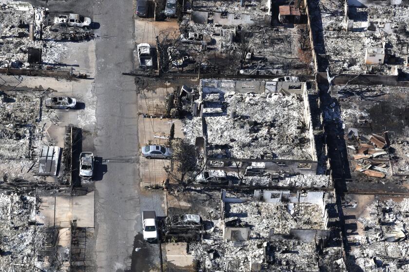
It was a feeling she had again during last month’s firestorm, which destroyed 2,000 residences and killed seven people. Indeed, many of the same conditions were present: temperatures in the 90s, wind gusts that would register on hurricane charts, relative humidity lower than 10%.
Those conditions, however, while they may have been extreme this year, are not altogether uncommon, and some wonder whether the weight of circumstance might overwhelm an attempt to study the behavior of regional conflagrations.
“You need to have ignitions in the right place at the right time with the fuel in the right conditions. But it’s a roulette wheel,” said UC Riverside geology professor Peter Sadler. “I’m not sure we know enough to be able to say that there’s something else going on other than a run of bad luck.”
Still, ecologists are already seeing patterns in the ashes.
Bill Patzert, climatologist for the Jet Propulsion Laboratory in La Canada Flintridge, said the spacing between the fires that engulf the Southland makes more sense when viewed through the prism of climate changes in the region. Rain, when it happens, allows growth of new vegetation. The inevitable drought conditions that follow parch that vegetation to a crisp and flammable tinder. And the droughts have become increasingly severe, setting the stage for explosive wildfires.
“The wet and dry cycle is also the fire cycle,” Patzert said. “It’s a natural roller coaster Southern Californians have been riding for centuries.”
There are, of course, many more of us today. And that, said U.S. Geological Survey research ecologist Jon Keeley, one of the West’s top wildfire ecologists, may be the last piece of the puzzle: the reason that regionwide fire events seem to be happening with greater frequency.
Most of the fires are caused by people, whether it’s an arsonist or someone flicking a cigarette butt out a car window. And graphs showing population growth in Southern California and the growth in the number of wildfires produce virtually identical slopes, Keeley said.
“It’s a linear relationship,” Keeley said. “What causes the catastrophic fires is ignitions during Santa Anas. And the more people you have on the landscape, the higher the probability of that happening.”
Indeed, he said, enough is known about the regionwide fire events that Southern Californians can start to guard against them for the first time.
There is little reason to think, for instance, that the fires will slow the pace of development, he said, but they could help determine where new houses are built. Keeley has received calls from planners who want to map the distribution of Santa Ana winds with an eye toward limiting development in those corridors.
Keeley has also called for closing certain wilderness areas -- often the site of ignitions -- once Santa Ana winds reach a threatening level.
“It’s extreme,” he conceded. “But we are living in a more and more crowded world all the time. And we have to recognize that we’re going to lose some freedoms as that happens.”
Keeley has also suggested that local officials consider burying overhead power lines.
Dave Hillman, chief of law enforcement at the California Department of Forestry and Fire Protection, said that at least eight of the fires that raged last month -- and probably more -- were caused by power lines.
Keeley said burying power lines would be “extremely expensive.” But he said he’d like to see a financial comparison of the cost of the fires in San Diego County and the cost of burying electric lines there.
Officials have said insured losses in the county will probably reach $2 billion.
“You can put a lot of power lines underground,” Keeley said, “for a lot less than that.”
hector.becerra@latimes.com
More to Read
Start your day right
Sign up for Essential California for news, features and recommendations from the L.A. Times and beyond in your inbox six days a week.
You may occasionally receive promotional content from the Los Angeles Times.
