Gusts, hot weather to persist
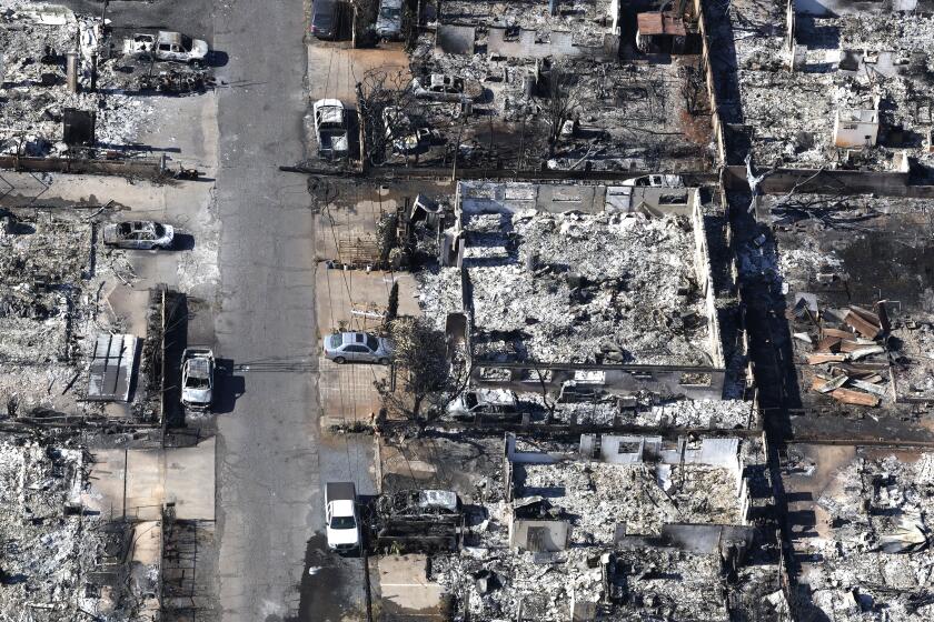
The strong winds and high temperatures responsible for fanning Southern California’s wildfires aren’t expected to subside until Wednesday evening, giving the region a mild respite, although no signs of rain are in the immediate forecast, weather officials said Monday.
The region faces at least a day-and-a-half more of powerful gusts, low humidity and temperatures creeping into the low 90s, said Edan Lindaman, a meteorologist for the National Weather Service.
“We’re not looking at winds dying down until Wednesday evening,” Lindaman said. “We’ll finally get some relief from the offshore trend. So we won’t be seeing the very intense Santa Ana winds with all that dry air from the high desert.”
Typical high temperatures Monday reached 82 in Fillmore, 85 in Oxnard and 86 in Malibu. Though no longer exceeding 100 mph, gusts were recorded Monday at 72 mph in the Newhall Pass and 66 mph in Warm Springs.
By Wednesday evening, winds coming from the ocean are expected to drop beach temperatures to the mid-70s and inland temperatures to the low 80s. Humidity could rise in the coastal areas, a potential help in some of the blazes burning near the ocean.
Any moisture would be a welcome change for the Southland, which is experiencing humidity percentages in the single digits amid its driest season on record.
Despite the prospects of a changing trend Wednesday, some experts say this is the start of what could be a devastating fire season.
“Santa Ana winds are a winter thing and actually peak in December,” said Bill Patzert, a climatologist for the Jet Propulsion Laboratory in La Canada Flintridge.
Patzert said bursts of Santa Ana winds traditionally last two days, making this possible four-day trend highly unusual.
Even when the wind dies down, the high temperatures and unprecedented dryness ensure that firefighters will be on the front lines for days to come, he said.
More to Read
Start your day right
Sign up for Essential California for news, features and recommendations from the L.A. Times and beyond in your inbox six days a week.
You may occasionally receive promotional content from the Los Angeles Times.


