Here’s where to see the magnificent waterfalls that have returned to SoCal after the big rains
At last, we can stop pretending. Now that the rains have returned after all those dry years, we can stop claiming we love to roam the sere foothills and canyons in search of some small hint of moisture.
Truth is, we’ve always secretly hated that word “sere,” an old-fashioned way to say dry. Also, we like green better than brown, and rushing rivers better than forest fires.
And we definitely like falling water – glorious, thunderous falling water – more than meager drips, dry washes and naked rock faces.
Here are some places to recapture the thunder — and remember to obey all posted warnings.
Los Angeles area
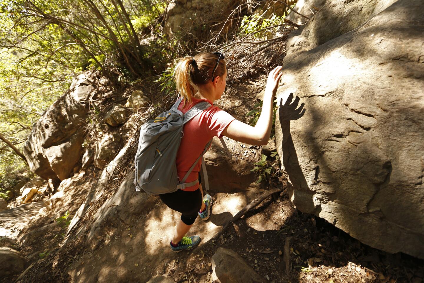
Eaton Canyon Falls, Pasadena

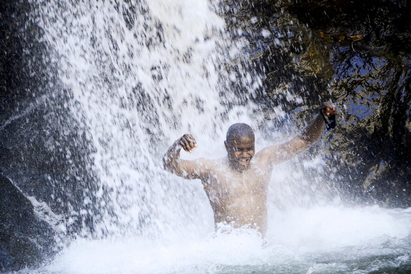
From the edge of Altadena, this hike takes you along Eaton Wash, then up a nook in the San Gabriels. The trail crosses the wash several times, so you’ll either get good practice rock-hopping or you’ll get your feet wet.
The payoff is a roaring waterfall about 40 feet tall. The relatively flat trail is about 3.8 miles out and back. And it’s one of the most popular hikes in L.A. County, so you’ll have plenty of company.
The trek: I went on a 90-degree Sunday earlier this month and there were hundreds of us on the trail, including a few who had scrambled up near the upper falls to show off and shoot selfies.
At least five deaths have been reported near the falls since 2011, along with dozens of rescues. In 2014 the U.S. Forest Service, which manages the area, declared the upper falls off limits. But some hikers can’t resist the risk.
If solitude is key to your outdoor fun, forget about this place on a spring or summer weekend. But if you’re OK sharing the falls, trees, rocks and trail, and if you don’t mind spotting the occasional bit of graffiti, stray pipe and one overhead bridge, there’s plenty here to enjoy.
Trail conditions: Most of the trail is wide and easy, though there are several water crossings. Signage is clear. Two hours, if you take your time. Dogs on leashes OK.
Directions: Interstate 210 to Sierra Madre Boulevard/Altadena Drive, head north on North Altadena Drive, then east on Veranada Avenue for a few hundred yards to the parking lot for the trailhead and Eaton Canyon Nature Center, 1750 N. Altadena Drive, Pasadena.
Info: Eaton Canyon Nature Center, has information about the area and some trails, but many of its maps don’t include the falls. Fortunately, info is available at Eaton Canyon Trail and and Modern Hiker
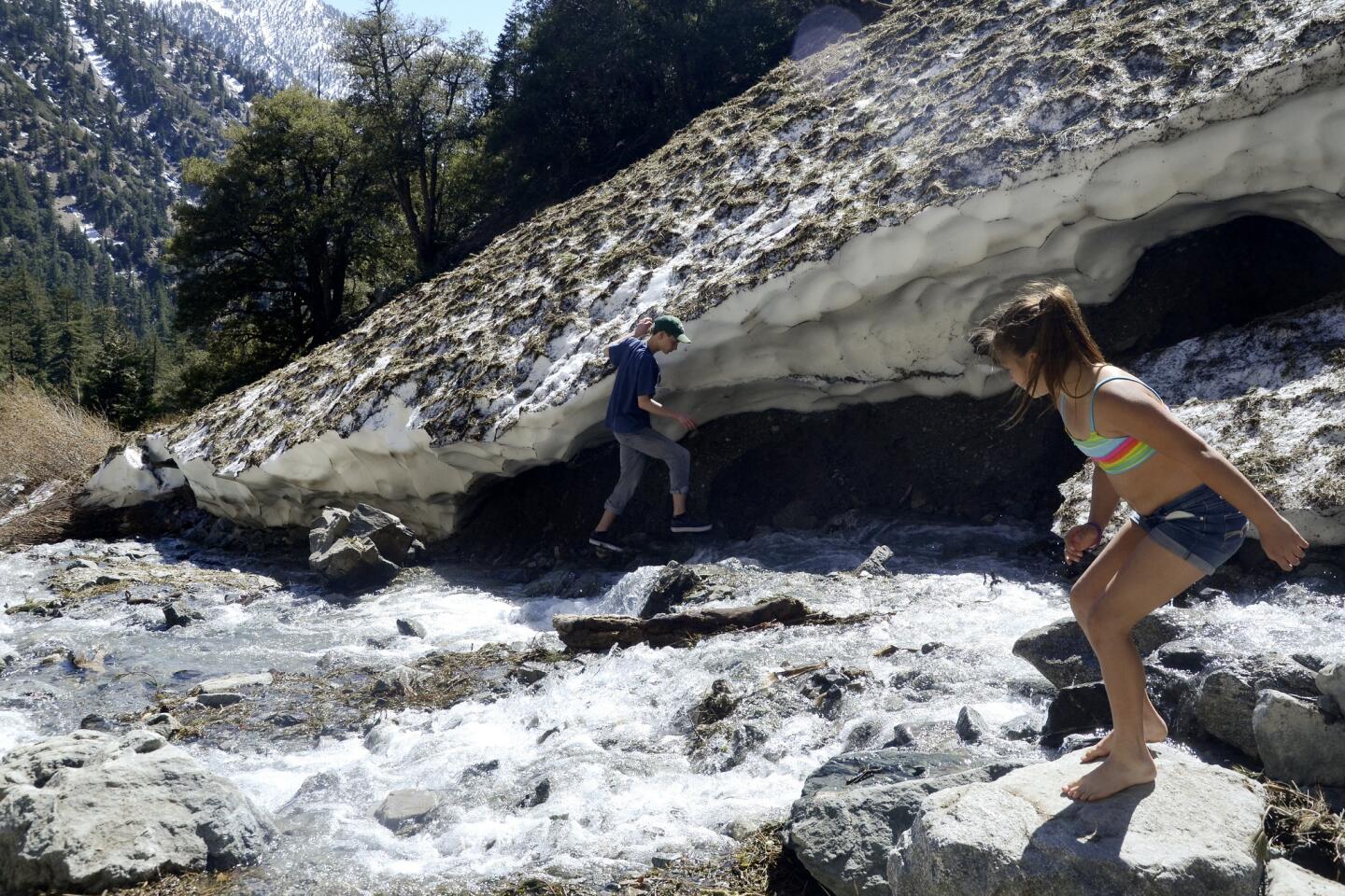
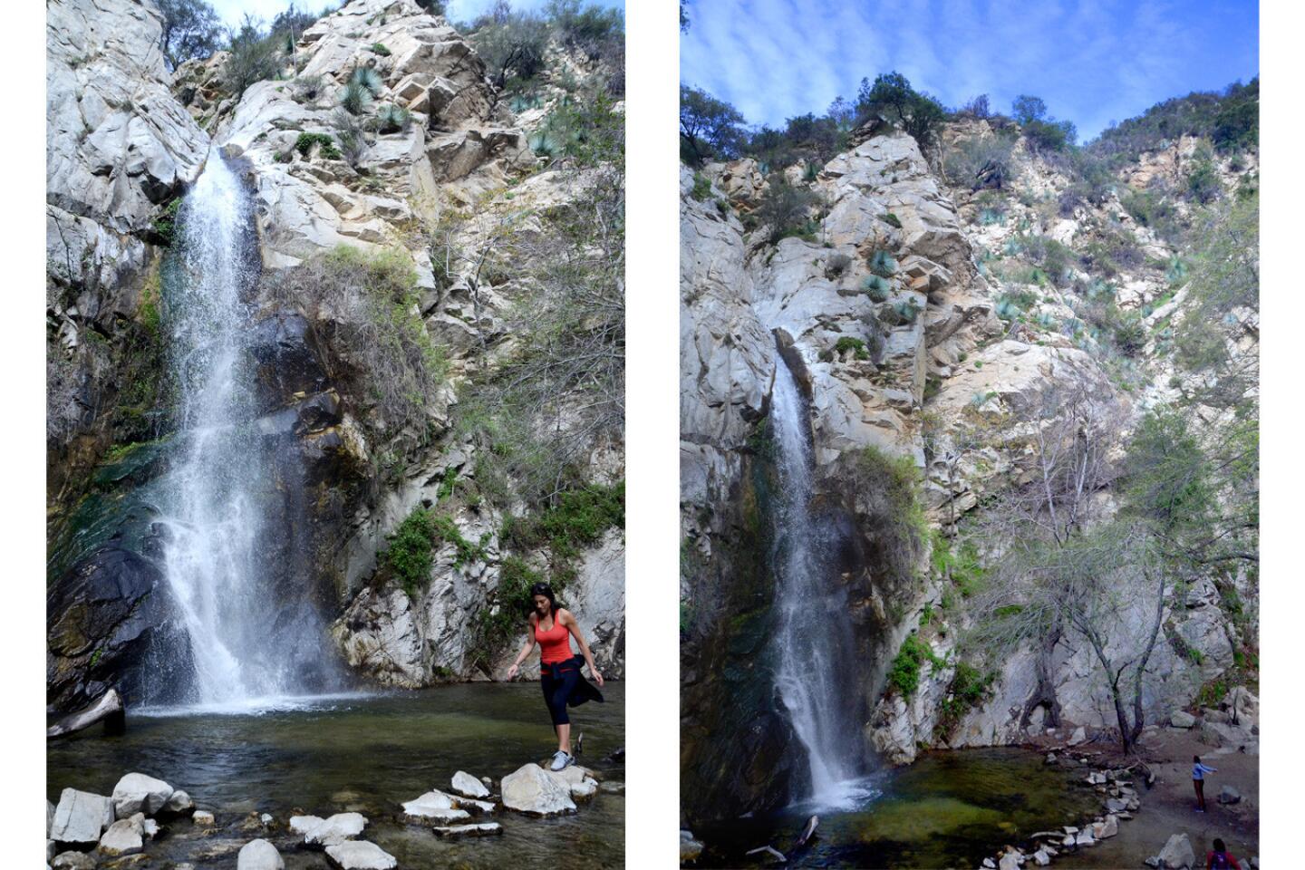
San Antonio Falls, Mt. Baldy

A mere 1.4-mile out-and-back hike will take you to this 75-foot-tall series of falls. Lately, they’re raging.
The trek: The surrounding slopes are dramatically steep — hence the many hairpin turns on the road to Mt. Baldy Village — but the mostly blacktop trail is only a slight incline, with an elevation gain of 308 feet.
You can get good and close to the right-hand side of the falls, and there’s room for several people to lean back against the rocks and admire the spray. When I made this visit on a Monday afternoon in mid-March, there were only a handful of people.
Below the falls, the stream was less than a foot deep in many spots, but it was flowing so strongly I didn’t cross it. Even though I took plenty of time snapping photos, I was back in my car within about 90 minutes of starting the hike.
Trail conditions: Signage is clear. Most of the route is blacktop along Falls Road, which is closed to public traffic. The trail does traverse a slope with loose rocks, so there are half a dozen steps you’ll want to choose with care. Dogs on leashes OK.
Directions: The falls are 50 miles east of downtown Los Angeles. From Interstate 210, take Exit 52, turn left on Base Line Road, then immediately right on Padua Avenue and head north for 1.7 miles. Turn right on Mt. Baldy Road and continue for 12 miles to the trailhead at Falls Road.
To park legally, you’ll need an Adventure Pass, which can be had for $5 at the Visitor Information Center in Mt. Baldy Village, Snow Crest Lodge or the Mt. Baldy Lodge.
Info: San Antonio Falls; Mt. Baldy Chamber of Commerce, Hike Speak
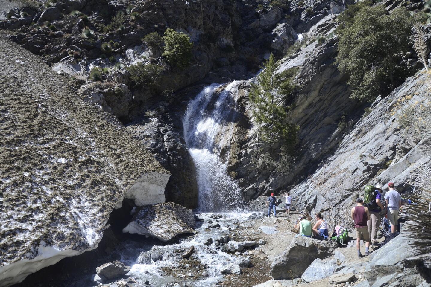
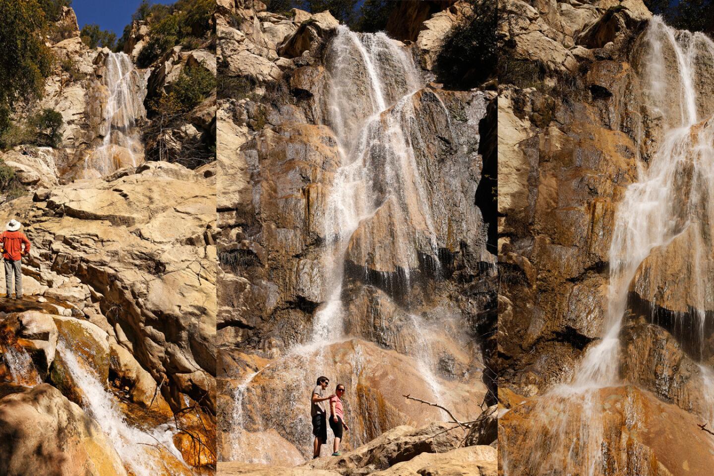
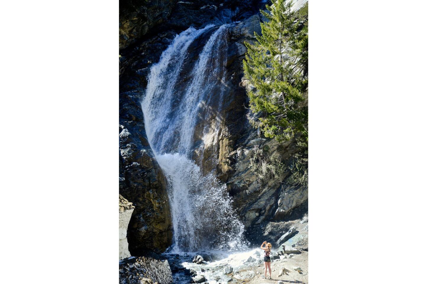
Sturtevant Falls, Arcadia

To reach these falls, you can follow the Sturtevant Falls Trail from Chantry Flat through Big Santa Anita Canyon. The falls typically flow year-round, but they’re doubly active now.
The trek: The route, mostly shaded, follows the Santa Anita Wash as it meanders past cabins, some a century old. It’s 3.1 miles out and back, or 3.4, depending on who’s counting.
The trail, very well marked, is a little odd — the first three-fifths of a mile is a blacktop road that swoops to the canyon bottom. Then the pavement ends and the next mile is largely flat. You cross the stream a few times and then boom, there’s a 75-foot-tall tower of water thundering before you.
I set off at 9 a.m. on a Wednesday and saw many people, but never more than a dozen at a time. For a few minutes, I had the falls all to myself — and then 10 people and a drone showed up.
Trail conditions: Enjoy that easy first half-mile, because on the return trip it will be an all uphill the last half-mile. Dogs on leashes OK. Equestrians sometimes use the trail too. I saw a small amount of litter, but nothing compared to the bottles, wrappers and cigarette butts people leave in Eaton Canyon.
Directions: From Interstate 210, exit at Santa Anita Avenue in Arcadia and head north on North Santa Anita Avenue, which becomes Chantry Flat Road. Park at the Chantry Flat lot, where you’ll need an Adventure Pass, or at the neighboring Adams’ Pack Station. The trailhead is on the right side of Chantry Flat Road just before the parking area. The parking lots sometimes fill on weekends, so arrive early. The general store at Adams’ Pack Station, open Fridays, Saturdays and Sundays, also sells $5 Forest Service Adventure Passes.
Info: Sturtevant Falls
Santa Barbara area
In Santa Barbara, you’ll find several options for viewing these chutes — most within a 15- to 20-minute drive from downtown. (Alas, access to 66-foot Nojoqui Falls, farther up the coast, is closed indefinitely because of trail damage.)
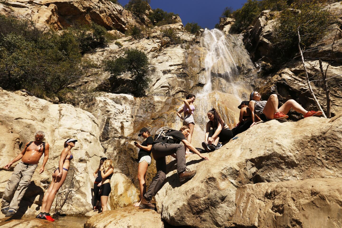
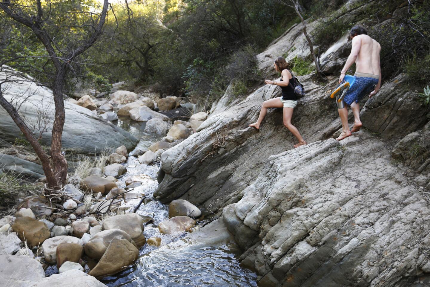
Seven Falls

The first thing you need to know about this 2.4-mile out-and-back hike is that it’s popular. Although none of the cascades is especially tall, the sandstone-carved pools make this a favorite among locals.
The road leading to the trailhead is packed with vehicles on the weekend. You might want to walk from the Santa Barbara Mission (just a short hop — OK, about two miles), where weekend parking is less congested.
The trek: You’ll begin on a gently inclined paved walkway that quickly yields expansive views of avocado orchards, downtown Santa Barbara and the Channel Islands.
Look carefully and you’ll notice the blackened tree limbs from the 2009 Jesusita fire, which charred Mission Canyon.
After about a half-mile, you’ll hear Mission Creek as the route descends to a wooden bridge where you’ll catch your first good glimpse of running water.
Thrill seekers may want to start boulder hopping up the creek. Otherwise, continue onward, observing how nature works its magic on cement, where at a fork (stay left) the pavement morphs into a dirt path.
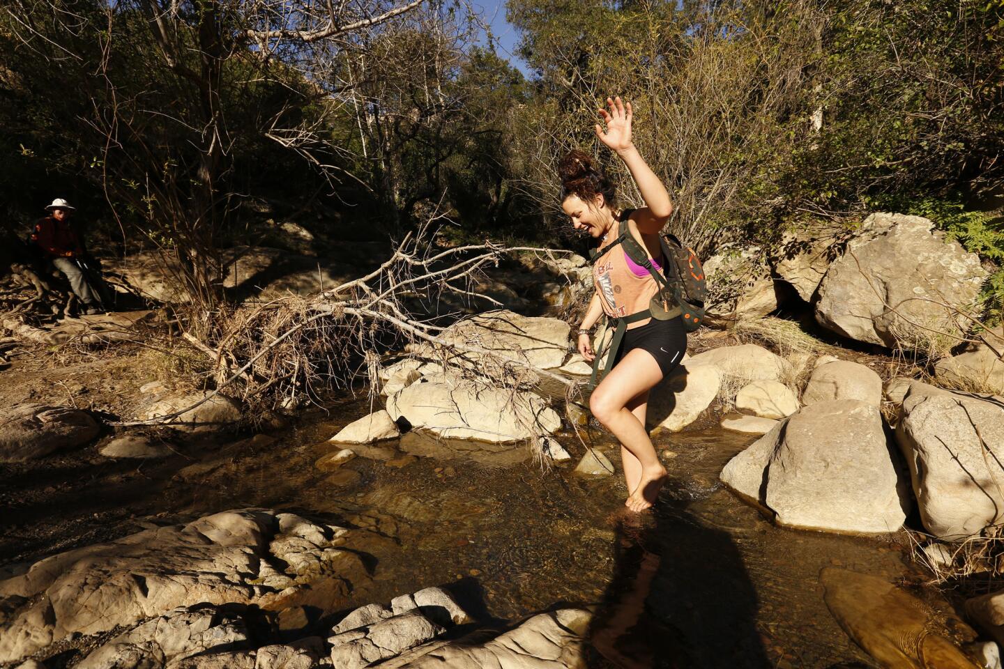
At the one-mile mark, you’ll reach a creek crossing. Here you have two options: Squeeze along a narrow footpath (on the west side of the water) with abundant poison oak and low hanging branches, or enjoy the more challenging scramble up the creek.
Either way, you’ll end up at the first chute in about 15 minutes or less. You can stop here, but if you can navigate to the bottom of the second and biggest fall you’ll start to appreciate the magic of the narrow canyon.
Alas, the place was filled with small clumps of college students, the bravest of whom took turns sliding down the 25-foot cascade into the pristine water. Depending on the water level, you may be able to do the same.
If you’re especially limber—that’s code for “adept at climbing” — you may want to continue to the other pools, but keep in mind going up is easier than going down.
Trail conditions: Heavy rains left their mark with numerous rock slides that have since been removed. Signage: Clear. Dogs on leash OK.
Directions: From the Santa Barbara Mission, follow Los Olivos Street to Mission Canyon Road. Turn right on Foothill Road (California 192), then left at the firehouse. Continue up the road and turn left at the fork onto Tunnel Road. The trailhead is a three-minute drive from that point. Parking at the trailhead is limited and strictly enforced.
Info: Seven Falls
San Ysidro Falls, Montecito
This 3½-mile out-and-back hike, steps from the high-end San Ysidro Ranch, is more accessible — no bouldering required. And you’ll never be more than a few feet from the roar of rushing water.
The same goes for the private estates you’ll pass on the first leg of the path, which parallels Park Hill Lane. But despair not; you will soon be immersed in oak groves and chaparral. Be sure to follow the wooden trail signs as you pass through the first of two gates.
The trek: Stay right at the first fork; soon you’ll pass through the second gate, which opens on a nice patch of prickly pear. This is one of the few sunny parts of the trail; much of the rest is shaded. The second fork soon appears with a hairpin right. Don’t take it.
A quarter-mile farther you’ll arrive at the third fork where you’ll stay right onto the now-narrow trail where you must watch for poison oak. Here things gets steeper and rockier but nothing is technical.
After a quick descent to a wonderful viewpoint of San Ysidro Creek, the trail ascends to an alluring swimming hole fed by a mini-waterfall that splits a giant rock in half. I suggest taking the little detour to the left to get an up-close view and, if it’s warm enough, dip into the cool pool.
Back on the trail you’ll shuffle over concrete for a few steps and continue to a section with old pipes that were converted into handrails you don’t really need.
From here you’ll snake up San Ysidro Canyon before navigating a couple of rockfalls that obliterate the trail, which soon descends to the creek. Once across, stay left. Just past a gravelly slope, the 60-foot cataract appears.
Go on a warm day and as you splash in the water, you’ll get a sense of what the Garden of Eden was like. Weekends attract visitors, but on my midweek visit I had the place to myself.
Trail conditions: This route is steeper and longer than the Seven Falls hike. The trail is in decent shape except for a couple of pesky rockslides near the end. Signage: Clear. Dogs on leash OK.
Directions: Take San Ysidro Road to East Valley Road (California 192) and turn right. After nine-tenths of a mile, turn left onto Park Lane and then left on Mountain. There is street parking on Mountain; depending on where you park the trailhead is no more than a block away.
Info: San Ysidro Falls
Tangerine Falls, Montecito

The hike to this falls is the most dramatic and challenging, at nearly three miles round trip and with 800-plus feet of elevation gain. You’ll climb over boulders and duck your head frequently under giant tree roots, all while avoiding poison oak.
It’s also tricky to find the base of the falls, so it’s best to go with a local who has hiked this trail. If that’s not possible, take a careful look at the website below before you go.
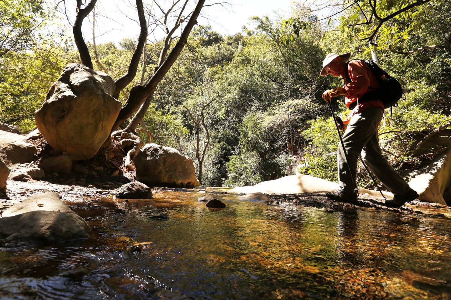
The trek: You’ll start your climb on Cold Spring Trail, on the right side of the creek through a dense thicket of oak and bay trees. The terrain at the beginning is easy to navigate.
After a quarter of a mile or so, you’ll come to the West Fork of the trail, which requires an easy creek crossing followed by a not-too-steep slope upward into a sunlit spot with abundant wildflowers.
For the most part, though, you’ll be hiking — I mean climbing — in the shade.
Soon, the far-off waterfall comes into view, a reminder of the elevation gain you’ll be required to push through.
A rustic sign, courtesy of the Boy Scouts, with the initials “T.F.” appears, directing you across the creek. Here’s where you’ll start to appreciate your steadfast dedication to weightlifting and yoga.
Once across you’ll pull yourself up the steep ravine by holding on to the tangles of tree roots.
Chances are you’ll be able to follow others; I went March 11 and the canyon was packed with (mostly students) heading to the falls. Hint: Use the water pipes to guide you at least part of the way
Even at a relatively slow pace, this can be a cardio-buster of a climb, followed by a thrill seeker’s traverse across a rock face with little room for error.
But once across, you’ll be rewarded with awesome views of the Pacific and a clear, inviting pool directly under the 100-foot cataract. Spring weekends are packed, but the perch is perfect for basking in the sun.
Trail conditions: The trail is in good condition, but you won’t always be on it, which is the fun yet difficult part. Signage: Needs improvement. Dogs on leash are OK, but I’d leave Buster at home unless he or she is an experienced climber.
Directions: From U.S. 101, exit on Hermosillo Road. Continue on Hermosillo to Hot Springs Road and turn right. Continue north to East Mountain Drive and turn left until the road is traversed by Cold Spring Creek. Park on either side of the crossing and either side of the street.
Info: Tangerine Falls
Sign up for The Wild
We’ll help you find the best places to hike, bike and run, as well as the perfect silent spots for meditation and yoga.
You may occasionally receive promotional content from the Los Angeles Times.