National monuments? Maybe they will be
It’s tough to visit California’s Bodie Hills. Although many travelers turn off U.S. Highway 395 in the Eastern Sierra to see the well-known ghost town of the same name, far fewer venture into its rugged backdrop, which has no paved roads, no marked trails, no developed campgrounds.
“These really are the last remnants of the Wild West,” says Stacy Corless, who works for a nonprofit seeking to protect and preserve the hills.
FOR THE RECORD:
National monument candidates: Two photographs accompanying a Travel section article on Sunday about areas in the Western United States that may become national monuments were mislabeled. Both photographs appeared on the section’s front page. The largest photograph, labeled Berryessa-Snow Mountain, was Cascade-Siskiyou. The photo labeled Cascade-Siskiyou was Berryessa-Snow Mountain. —
Bodie Hills isn’t a national monument — at least not yet. Along with 13 other lightly traveled spots in the West, it was identified in an Interior Department document earlier this year as a “good candidate” for designation.
By definition, national monuments are singled out for protection because they have one compelling cultural or natural feature. (The 1,267-foot Devils Tower in Wyoming is a good example; it became the first one in 1906.) National parks, on the other hand, have numerous natural wonders that make them worthy of a higher level of land protection. Presidents may create national monuments with the stroke of a pen — without congressional approval — thanks to the Antiquities Act of 1906, signed by preservation-minded President Teddy Roosevelt.
Since the names of the potential monuments were leaked in February, the Department of Interior has insisted the paper was merely a brainstorming document. Some Utah politicians complained about the “secret” nature of the list, and Utah Sens. Bob Bennett and Orrin Hatch, both Republicans, have since introduced bills that would give Congress a say in how national monuments are created.
Whether the Bodie Hills or any of these remote lands become national monuments is unknown. These are hard places to get to — and hard to get to know. In Yosemite, you can see Half Dome without leaving your car; here, you must dig deeper to find more subtle natural wonders: a flawless night sky or a perfect bit of solitude. But isn’t that all part of the allure?
Here are quick looks at the 14.
Berryessa-Snow Mountain, Calif.
Hard to believe there’s anything considered pristine near the well-traveled Napa Valley, but 500,000 acres of unspoiled rivers and hilly oak woodlands await just east and north of California’s prime wine country.
Grab a cabin or campsite at Pleasure Cove on man-made Lake Berryessa and then kayak up Putah Creek about four or five miles to get a firsthand look at cottonwoods and willows in the streamside lowlands.
Head north to Mendocino National Forest, where a drive on unpaved forest roads takes you to the trailhead for a hike up 7,056-foot Snow Mountain.
Info: Pleasure Cove Marina, Lake Berryessa, https://www.goberryessa.com; Mendocino National Forest’s Stonyford Work Station, (530) 934-3316
Bodie Hills, Calif.
Stopping at the old mining town at Bodie State Historic Park is a must in this remote area of the Eastern Sierra south of Bridgeport, Calif. But to really appreciate the hills, visitors should take 18 scenic miles on the off-road Geiger Grade from high desert sage to little aspen groves that blaze yellow in the fall. Part of the grade rises 2,000 feet on the flank of Bodie Peak, which, if you take the time to climb on foot, affords stunning views of the Sierra Crest. Contact: Bureau of Land Management, Bishop Field Office, (760) 872-5000
Cascade-Siskiyou, Calif.
As a bookend to the Modoc Plateau, the Cascade-Siskiyou area of California sits in the extreme northwest corner of the state and borders the national monument of the same name in southern Oregon.
The 52,495-acre monument, created by President Clinton in 2000 to protect the “extraordinary biodiversity” in this area, could be expanded to include the Klamath River on the California side. There’s plenty to do in this desert-and-forest mix — fishing, shooting white-water rapids on the Upper Klamath or taking a 108-mile drive from the dry, high desert in the east to more lush forested mountains in the west and the little town of Happy Camp. The State of Jefferson Scenic Byway begins north of Yreka on historic California Highway 96.
Info: Klamath National Forest, (530) 842-6131
Modoc Plateau, Calif.
Sagebrush-covered flats and scattered juniper give rise to rocky slopes on the Modoc Plateau in the northeast corner of the state that’s home to herds of wild horses and antelope.
Hardy hikers can try an eight- to 10-mile cross-country hike up Hot Springs Peak in the trail-less Skedaddle Mountains east of Susanville, Calif. But there’s an easier option to tap the beauty of this high-desert range: Drive the 31-mile unpaved Buckhorn Backcountry Byway that starts east of Ravendale and continues into Nevada.
Info: Modoc National Forest, (530) 233-5811
Heart of the Great Basin, Nev.
This is what the Wild West is all about. High-desert hills dotted with sagebrush and juniper give rise to roughly hewn 12,000-foot-tall Toiyabe, Toquima and Monitor peaks.
The jumping-off point is Austin, a “living” ghost town about 170 miles east of Reno that’s smack dab in the center of Nevada. Hardy hikers and backpackers can walk pieces or all of the 72-mile Toiyabe Crest Trail to see glacier-carved canyons and remote creeks up close or take an easy quarter-mile walk to see Native American pictographs and petroglyphs inside Toquima Cave as well as some nearby hot springs.
Info: Greater Austin Chamber of Commerce, (775) 964-2200, https://www.austinnevada.com; Humboldt-Toiyabe National Forest, Austin Ranger District, (775) 964-2671
San Rafael Swell, Utah
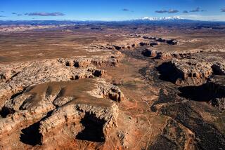
This stretch of south-central Utah could well have turned up in a John Ford movie (though he favored Monument Valley, Ariz., for his classic westerns). Interstate 70 cuts right through the area about 75 miles long and 40 miles wide, offering sweeping views of this land of spires, arches, narrow canyons and gorges.
The must-see stop: Goblin Valley State Park, which looks like clay blobs left on an abandoned potter’s wheel. Meander around the bizarre landscape of stone hoodoos and rock domes and you’ll catch views of the usually snowy Henry Mountains in the distance. The park is between Green River and Hanksville at the southern end of the swell.
Info: Goblin Valley State Park, (435) 275-4584
Northern Prairie, Mont.
This is where big grasslands meet Big Sky.
The rolling, undulating sea of prairie has been deemed the largest native grasslands remaining in the United States. No dramatic rock formations or craggy peaks clutter the horizon; this more nuanced landscape provides nesting grounds for the long-billed curlew, a shorebird that winters in California.
A good point of entry is Pine Butte Guest Ranch run by the Nature Conservancy, which offers naturalist-led hikes, horseback rides and cabins from which you can watch light and wind play with the grasses. The ranch is five miles north of Choteau on Montana Highway 89 and is open until the first week in October.
Info: Pine Butte Guest Ranch, (406) 466-2158
Lesser Prairie Chicken Preserve, N.M.
The lesser prairie chicken has become an iconic figure in this 58,000-acre area of New Mexico west of Roswell.
The flamboyant bird, whose numbers have shrunk by 97% since 1900, cuts a strange figure on this lonely mix of sand dunes and grasses, managed by the Bureau of Land Management. Each April, the nearby Milnesand Prairie Preserve allows visitors (only 100, and you have to register in advance) to watch the birds perform their mating dance on traditional breeding grounds called “leks.”
Info: BLM Pecos office, (575) 627-0272.
Otero Mesa, N.M.
The 1.2-million-acre mesa on the Texas-New Mexico border is notable for having the only pure herd of native pronghorn antelope and the last large tract of desert grasslands in the Chihuahuan Desert. Black-tailed prairie dogs, mountain lions and others call the vast area home.
This is rugged, roadless land, but intrepid hikers who seek out a hike up the west side of Alamo Mountain will be rewarded with thousands of petroglyphs along the way.
Info: Bureau of Land Management, Las Cruces District Office, (575) 525-4300; for directions to Alamo Mountain, contact Coalition for Otero Mesa, (505) 843-8696; https://www.oteromesa.org
Northwest Sonoran Desert, Ariz.
This huge swath of untouched desert west of Phoenix could double the existing 500,000-acre Sonoran Desert National Monument.
Arizona Highway 238 takes you to the saguaro cactus forests that define the monument. You can hike in nearly any direction to get the lay of the land, but know that marked trails are rare, and there are no developed campgrounds or services.
For a gentler introduction to saguaros, head south to the paved Cactus Forest Drive in Saguaro National Park west of Tucson.
Info: Bureau of Land Management, Lower Sonoran Field Office, (623) 580-5500; Saguaro National Park, (520) 733-5153
Owyhee Desert, Oregon/Nevada
The largest herd of California bighorn lives in the Owyhee Desert in Oregon and Nevada, an area omitted when nearby canyon lands in Idaho were protected last year by Congress.
The Owyhee Uplands Backcountry Byway takes visitors on a 103-mile-long drive on gravel and paved roads (OK for passenger vehicles) from the high desert of sagebrush and bunchgrasses to canyons of the Owyhee River. Access the byway from Jordan Valley, Oregon, or Grand View, Idaho.
Info: Bureau of Land Management, Owyhee Field Office, (208) 896-5912
Vermillion Basin, Colo.
The basin in the northwestern part of the state provides a home for the greater sage grouse, the largest grouse in North America, whose habitat is on the wane.
Sagebrush and pinyon-juniper woodlands frame the area around Vermillion and Irish canyons, which are notable for numerous petroglyphs on narrow rock walls. Stop at Irish Canyon to view the rock art, hike a bit of the area and camp out.
From the town of Maybell, take U.S. 40 to Colorado 318 and on to Moffat County Road, which travels through the canyon. Contact: Bureau of Land Management, Little Snake Field Office, (970) 826-5000
Cedar Mesa, Utah
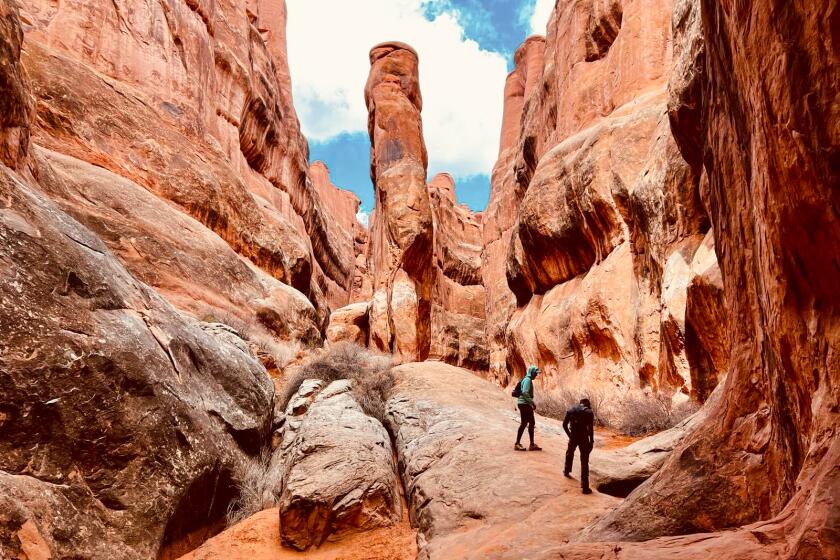
The mesa and canyons here highlight classic southern Utah wow factors: stunning red rock and sandstone arches.
What makes this area east of Blanding a standout is an abundance of prehistoric dwellings and artifacts that date back as much as 1,200 years go.
To tour the area, you can take a five-mile hike down Kane Gulch to see impossibly high Anasazi cliff dwellings and the 20-foot span of Stimper Arch or opt for an easy nine-mile driving loop around Natural Bridge National Monument about half an hour north.
Info: Bureau of Land Management, Monticello Field Office, (435) 587-1500
San Juan Islands, Wash.
Of all the 14 proposed sites, the hundreds of islands in Puget Sound are the best known to kayakers, hikers and other travelers.
From San Juan Island, you can see otters and whales off the bluff trails between April and September. The smaller islands are a bird-watcher’s dream where glaucous-winged gulls, pigeon guillemots and crested puffins nest or just live.
Access is by ferry from Anacortes, about an hour and a half north of Seattle, or Vancouver, British Columbia.
Info: San Juan Islands Visitors Bureau Office, (888) 468-3701, https://www.visitsanjuans.com
travel@latimes.com
More to Read
Sign up for The Wild
We’ll help you find the best places to hike, bike and run, as well as the perfect silent spots for meditation and yoga.
You may occasionally receive promotional content from the Los Angeles Times.

