San Francisco County piers
Candlestick Point Park PierOverview: This plank pier is only 150 feet long. Although the views here aren’t as striking as others along the bay, there is plenty to see in the 170-acre Candlestick Point State Recreation Area, including small wildlife, plus ducks and other water fowl. A colorful human subspecies — the windsurfer — often is in evidence.
Background: The site is named for Candlestick Stadium, formerly home of the Giants baseball team and current home of pro football’s ‘49ers. (Trivia point: It was the site of the last full concert by the Beatles on Aug. 29, 1966.) The stadium, as well as the pier, is in the Alemany Gap, an opening between the coastal mountains and the ocean responsible for the wind, fog and erratic weather patterns.
Parking: Plenty of free parking; take one of the paths that leads about a third of a mile to the coastline and the pier.
Directions: Take the Candlestick Park exit from Highway 101 in San Francisco. Follow the Hunters Point Expressway around the stadium to the state recreation area. There’s limited parking along the road, plentiful parking near the main picnic/ day use area.
Pier 24
Overview: Pier 24 sits on the Embarcadero underneath the Bay Bridge, the major traffic artery between San Francisco and Oakland. It was built in 1935 and used for various industrial purposes until 1980. It then was vacant for more than a quarter-century. After an imaginative, two-year remodel, it opened as Pier 24 Photography and now houses the Pilara Foundation and the Pilara Photographic Collection in 28,000 square feet. It also hosts two or three major photographic exhibitions a year. Open Mondays-Thursdays by appointment only. (415) 512-7424, https://www.pier24.org
Parking: There are metered parking spots along the Embarcadero as well as a pay parking lot at Pier 30/32 at Bryant Street and the Embarcadero.
Directions: Take Market Street to its end at the Ferry Building. Turn right on Embarcadero. Pier 24 is about a third of a mile.
Pier 14
Overview: This 637-foot-long pedestrian span is the newest recreational pier on the San Francisco waterfront. Opened in 2006, it was built so that visitors and downtown workers could get some exercise and take in the views. U-back chairs dot the pier — you can sit and do a 360-degree swivel so that your view changes from water to city skyline. It’s a nice stop for anyone with 10 minutes on their hands.
Parking: The Ferry Building is about a 25-yard walk to Pier 14, https://www.ferrybuildingmarketplace.com/parking.php
Directions: Take Market Street south to where it ends at the Ferry Building. The entrance to Pier 14 is about a 50-yard walk south on Embarcadero.
Pier 7
Overview: This is coolest pier in San Francisco to hang out, people watch and take in the stellar views. There are nice touches down its 840-foot length, including stylish ornamental iron handrails and light fixtures. Best of all are the crafted iron and wooden benches — you can happily plop down and enjoy (this stretch of the Embarcadero tends to get more sun than other spots). The pier is close to Fisherman’s Wharf so lots of visitors find it, but because it has no shopping, those who come are mostly here for the views. There is also a great look down the pier’s length at the imposing Transamerica Pyramid, Coit Tower and the Bay Bridge.
Parking: There are all-day parking lots across Embarcadero, but they are pricey. Better options are the metered spots along Embarcadero or on Pier 5 at the Ferry Building where hourly rates are a bit cheaper.¿
Directions: Take Market Street south until it dead-ends at the Ferry Building. Turn left on Embarcadero. Pier 7 is three-tenths of a mile from the Ferry Building.
Pier 39
Overview: The biggest outdoor, multistory shopping mall sitting on/masquerading as a pier in California. A visitor will probably have one of two reactions: waste-of-time tourist trap or a mecca for mainstream eating and the acquisition of vacation mementos. Water views are a bit obscure except through restaurant windows.
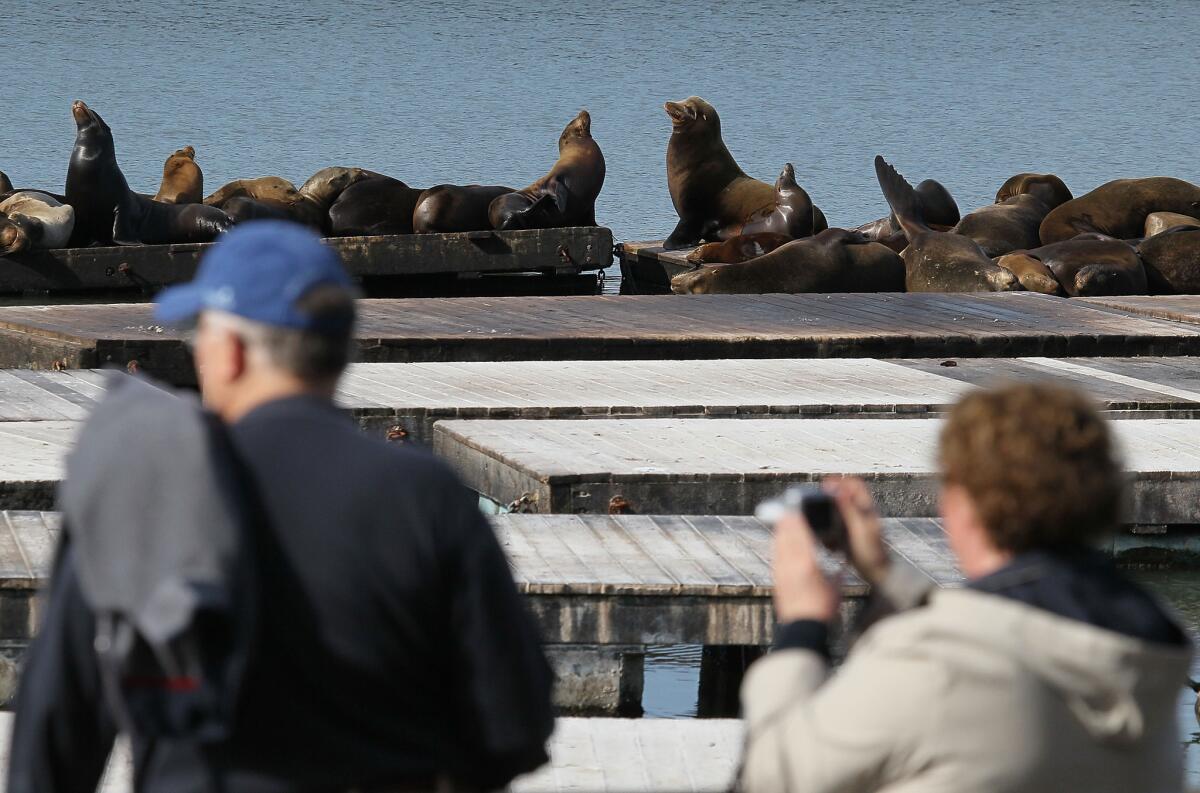
Background: There is one fabled bit of wildlife that is a big draw to Pier 39, the seal lion colony of K dock. After the 1989 Loma Prieta earthquake, sea lions began to take over docks on the west side of the pier. From late July to mid-May there can be hundreds to more than a thousand mostly younger males lolling about and barking volubly.
Directions and parking: Everything you need to know about how to get here and where to leave your car, https://www.pier39.com/Information/directionsparking.htm
Pier 41
Overview: This nondescript wooden pier serves passenger ferry traffic and has the best city skyline and harbor views of any pier along the waterfront. If you want to shoot photos or videos, this is the place to do it.
Notable views: On non-foggy days you get sharp views of Alcatraz and Angel islands, as well as the Marin coastline beyond. In the other direction, the San Francisco skyline, notably Coit Tower and the Transamerica Pyramid, dominates. Turn north and sea lions are barking up a storm on the K dock at Pier 39.
Parking: Pier 39 garage across the Embarcadero.
Directions: See above for directions to Pier 39.
Municipal Pier
Overview: Built in the early 1930s, this crescent-shaped pier is a bit ramshackle but it puts the visitor out over the bay better than any other pier along the waterfront. There are strong views of the city as well as the Golden Gate Bridge, Marin coast, Angel and Alcatraz islands. It’s also an ideal spot to get a close look at any cargo or military ship that might be entering or leaving San Francisco Bay. A walk on its 1,850-foot length is highly recommended, but even on mild days it’s good to have a jacket.
Parking: Free parking in the lot at the foot of the pier, but it can fill up early in the day. Another option is to park at Fort Mason and walk to the pier.
Directions: Exit Highway 101 in San Francisco at Van Ness Avenue and take it all the way to the pier.
Fort Mason Piers
Overview: At this former Army base, the three large piers, with the large warehouses behind them, share housing for one of the largest arts complexes in the United States. A multicultural consortium of groups, including fine art museums, dance groups, theaters and even legal services for the arts, reside here, along with supporting organizations. Fort Mason has a full calendar of performance and educational events.
Background: The three piers and four multistory concrete warehouses were constructed from 1908 to 1912. During World War II, more than 1.5 million troops and more than 23.5 million tons of cargo were sent to the Pacific from Fort Mason’s piers. In the 1960s, Fort Mason was decommissioned, and Congress established the first urban national park, the Golden Gate National Recreation Area, which includes Fort Mason Center. A nonprofit organization was formed to run and develop the center, with the massive piers at the forefront of that effort.
Notable views: Fort Mason is mostly about indoor activities, but out on the edge of the wide piers there are fine, end-of-harbor views of the water, the Golden Gate Bridge and Marin.
Parking: Vehicles can park in the Fort Mason complex from 8 a.m.-midnight every day with the exception of major holidays. $8 maximum on weekdays, $10 on weekends.
Directions: For directions as well as information about Fort Mason and what to do there, go to https://www.fortmason.org
Fort Point Pier
Overview: From a visitor’s standpoint, the pier’s most notable virtue is the dramatic view of the underside of the Golden Gate Bridge as it begins its stretch across the bay. Visitors also have a good chance of seeing boat traffic going in and out of the bay. Take a jacket along because even on mild days this can be a windy spot.
Background: Built before the Civil War to provide protection for San Francisco Bay, the fort has loads of character with its striking, high-walled design notable for its elaborate period masonry. Fort Point became a National Historic Site in 1970.
Parking: Limited parking near the pier; there is more free parking in the Fort Point complex. Admission to the fort is also free.
Directions: From San Francisco, take Highway 101 north and exit right at the Golden Gate Bridge toll plaza before getting on the bridge. Turn right at the end of the exit ramp and then left onto Lincoln Boulevard. Take the first left onto Long Avenue and follow onto Marine Drive and Fort Point at its end. https://www.nps.gov/fopo/index.htm
-- Christopher Smith
More to Read
Sign up for The Wild
We’ll help you find the best places to hike, bike and run, as well as the perfect silent spots for meditation and yoga.
You may occasionally receive promotional content from the Los Angeles Times.
