San Luis Obispo County piers
Pismo Beach PierOverview: Fishermen and walkers predominate on this 1,370-foot pier, which has a distinctive diamond-shaped end. You’ll find a bait shop-meets snack bar-turned souvenir stand about halfway out on the plank span. At the foot of the pier is a tourist information booth manned by Pismo Beach denizens who offer tips on where to eat, shop and stay.
Background: Some California beach towns seem to ignore their piers; others seem to dote on them. Pismo Beach is one of the latter. The commercial life of the town has drawn its existence from a pier that has been at the site since 1881.
Views: This is all about surf and sand — the wide, sweeping beach to the north and south and the incessant pounding of the surf.
Parking: The lot at the pier’s foot, as well as street spaces nearby, which cost $1 an hour.
Directions: From Highway 101, exit at Price Street. Take Price to Pomeroy Avenue, turn left and follow it to the pier.¿
Avila Beach Pier
Overview: This plank pier, about 1,785 feet long, is spartan but in good shape. The most interesting thing about the pier is the small plaza at its foot, with a dozen whimsically designed shops, none chain affiliated.
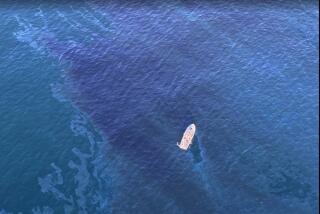
Background: The drama of the pier — and, indeed, of Avila Beach itself — was the closure of this small town for more than a year after an oil spill, from leaking tanks nearby, was found under the beach in 1989. Happily, the cleanup went well, and access to the town, its small business district and its pier was restored.
Parking: Free spaces can be found next to the small plaza at the pier’s foot.
Directions: From the 101, exit at Avila Road and head to the ocean. After about 1½ miles, turn left onto Front Street and follow it to the pier.
More: https://www.avilabeachpier.com
Port San Luis (Harford) Pier
Overview: This pier has a pleasing, rustic place-that-time-forgot ambience. Spring through fall there’s usually a noisy sea lion or two hanging out.
Background: Originally built in 1873, the pier was used to load and unload passenger steamboats and cargo ships. A railroad existed on the pier, but as rail traffic moved inland, the port languished. In the ‘40s, oil was discovered nearby, which led to the pier’s resurgence. Then the fishing trade took hold and flourished through the end of the century. Today the Olde Port Inn restaurant and several more modest eateries hold sway, along with several wholesale fish markets.
Parking: Free in the sizable parking lot at the foot of the pier; 14 free spaces near the end of the pier, with a two-hour maximum stay.
Directions: From the 101, exit on Avila Road and take it to end, about 2 ½ miles. (The first pier on this drive is a college marine lab and not open to the public.)
Morro Bay Piers
Overview: The North T (a.k.a. the Coast Guard Pier) and South T piers in the Morro Bay harbor are 30-foot-wide twin piers about 150 yards apart. Neither offers much in the way of tourist appeal; basically, they function as commercial docks.
Views: The piers provide one of the best close-up views of the Morro Bay rock minus the eyesore three-stack power plant, which is across the street and behind the piers.
Parking: Free in the adjacent restaurant lot, which parallels the shore and holds several hundred spaces.
Directions: From Highway 1, take the Main Street exit south, follow it to Morro Bay Boulevard, turn left toward the bay, to Embarcadero and turn right. Embarcadero leads to the long parking lot that fronts several seafood restaurants as well as the piers.
Cayucos Pier
Overview: A narrow, 8-foot-wide, weatherbeaten span that doesn’t look particularly well kempt. There is a pronounced sway at the pier’s end — it is about 950 feet long — as swells roll past. No shops or services, but Duckie’s Chowder, at the foot of the pier, serves seafood, burgers, sandwiches and salads.
Views: Morro Rock to the south dominates the landside view.
Parking: Free on nearby Ocean Avenue; other free spaces, with a 30-minute limit, are on Cayucos Drive.
Directions: From Highway 1 turn at Cayucos Drive. The pier is less than a quarter of a mile at the end of the street.
San Simeon Pier
Overview: This rough plank pier, constructed in 1957 and rebuilt several times after storms, stretches about 800 feet over comparatively shallow waters. It’s a gorgeous and accessible setting, with eucalyptus trees near the base of the pier and a small, arcing beach on the pier’s north side.
Views: Although the water views are pleasant, the visual payoff comes when you turn inland and see Hearst Castle in the distance.
Parking: Parking lot at the foot of the pier.
Directions: From Highway 1, turn left at Hearst San Simeon State Park and into the lot.
-- Christopher Smith
More to Read
Sign up for The Wild
We’ll help you find the best places to hike, bike and run, as well as the perfect silent spots for meditation and yoga.
You may occasionally receive promotional content from the Los Angeles Times.
