West Virginia’s Carnifex Ferry Battlefield State Park
Carnifex Ferry is not Gettysburg. It’s not Antietam. It’s not Shiloh.
It was a little-known battle early in the Civil War that helped West Virginia break away from Virginia and become the 35th state.
The battle on Sept. 10, 1861, pitted 5,000 Union troops led by Brig. Gen. William S. Rosecrans against 2,000 Confederate troops directed by Brig. Gen. John B. Floyd.
The Union troops forced the Confederates to abandon an entrenched position on the Patterson farm. The site was called Camp Gauley by the Confederates. Floyd retreated down an old roadway that led to a ferry, crossed the Gauley River and took his troops eastward to Lewisburg.
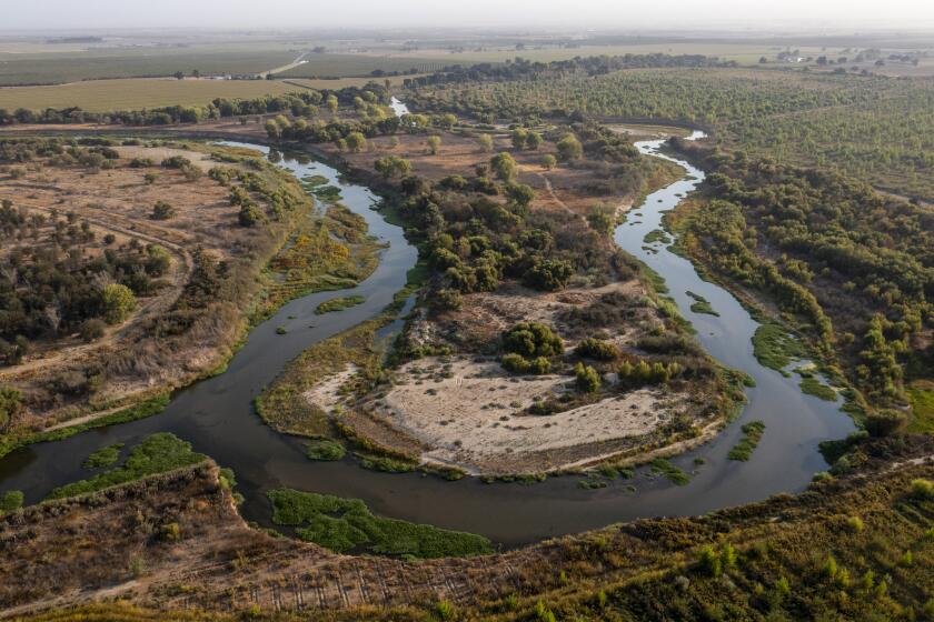
The battlefield overlooks the Gauley River, one of the very best whitewater streams in the United States and a favorite of paddlers in the fall, when the U.S. Army Corps of Engineers releases water to the river from Summersville Reservoir.
After Carnifex Ferry, the Confederates were unable to regain control of the Kanawha Valley. West Virginia’s 1863 statehood movement was never seriously challenged by the Confederates.
The Union forces had 17 killed and 141 wounded. The number of Confederate deaths is unknown; about 30 were wounded.
Numerous Ohio regiments fought in the battle, plus others from Illinois and Indiana. It was the first battle for most of the troops on both sides. It included two Ohioans who later became U.S. presidents: Rutherford B. Hayes was a major and William McKinley was a private.
It also featured Ohio’s Fighting McCooks: three brothers and 15 sons who fought for the Union. Daniel McCook and three sons were killed during the war. You can tour the brick McCook House in Carrollton in eastern Ohio. It is owned by the Ohio Historical Connection and managed by the Carroll County Historical Society: 800-600-7072 or https://www.carrollcountyohio.com/history/mccook/house/house.htm.
The major feature on the Carnifex Ferry battlefield is the still-standing William Patterson House. It bears the marks of small arms and artillery fire from 1861. It is the centerpiece of the subdued Carnifex Ferry Battlefield State Park, a day-use area park that covers 156 acres.
It’s not fancy. There is one replica cannon, three trails, a historic sunken road, a lone marked grave, a ball field, a picnic area, horseshoe pits, volleyball, a playground and three overlooks. There are also about a dozen interpretive signs.
The grave belongs to Granville Blevens of the 45th Virginia Infantry. He died of fever four days before the battle and was buried on the Patterson farm.
The battle began on the afternoon of Sept. 10 when the Union troops advanced against Floyd’s campsite and attacked. The Confederate lines repulsed the attack. For that reason, the federal casualties were higher than the Confederate defenders.
There were five partial assaults by the Union troops on the Confederate positions over four hours. Floyd, however, was worried about Rosecrans’ artillery and decided to retreat that night across the river.
One of the best ways to explore the battlefield is to hike the Patterson Trail, a 2-mile loop that circles the battlefield. You can access the trail at the Patterson House. It runs across a grassy field and then drops into Pierson Hollow, where Ohio troops, in fading light, fired on other federal troops, killing two and wounding 30.
The trail then doubles back and goes past Copperhead and Pillow Rapids overlooks. Pillow Rapids, 600 feet below, is one of the biggest rapids on the Gauley River. The trail then runs through woods at the edge of the cliff above the river.
The major battlefield features for visitors are re-created wooden breastworks where the Confederate line once stood, and an old sunken road that led to the ferry crossing used by Floyd in his retreat.
In fact, you can hike a short section of the Old Ferry Road within the park. It begins near Picnic Shelter No. 3 and is a moderate hike. The ferry crossing is about 1.2 miles to the southeast.
Floyd’s nighttime retreat was very successful. Earlier, four men drowned and he lost one of the ferry boats trying to cross the dangerous river to get in position before the battle.
The state park was listed on the National Register of Historic Places in 1974. It is one of the oldest state parks in the United States, established in 1935.
The battlefield is on the Civil War Discovery Trail, which connects 636 sites in 16 states to teach the history of the Civil War. Call 800-CW-TRUST or https://www.civilwardiscoverytrail.org.
From U.S. Route 19 south of Summersville, take state Route 129 west about five miles. Turn left on Carnifex Ferry Road. It’s about one mile to the park.
For park information, contact Carnifex Ferry Battlefield State Park, 304-872-0825 or 1-800-CALL-WVA, https://www.carnifexferrybattlefieldstatepark.com.
More people probably know about the Gauley River than the battlefield. Today, the whitewater stream is known as the Gauley River National Recreation Area. It covers 25 1/2 miles of the Gauley and 5 1/2 miles on the Meadow River that empties into the Gauley.
The Gauley is largely an artificial river managed by the U.S. Army Corps of Engineers. Summersville Dam was built from 1960 to 1966 at a cost of $48 million to control floods. The lake is fed by a drainage that covers 803 square miles of mountainous terrain.
The dam is the second largest earthen fill dam in the eastern United States. The U.S. Army Corps of Engineers considers the dam to be one of its most scenic. It is 390 feet tall, 2,280 feet wide, and used 12 million cubic yards of fill.
The lake is popular with boaters. It is lowered 75 feet in the fall and that creates the whitewater. The water is funneled from the lake into the river on September and October weekends via tunnels that are 29 feet in diameter and 1,555 feet long.
About 60,000 paddlers will tackle the Gauley in a typical year. The Gauley is marked by huge single-drop rapids like Iron Ring and Sweet’s Falls plus long boulder-strewn rapids such as Lost Paddle and Pure Screaming Hell. There are big rocks and small chutes.
There are more than 100 rapids in the 28-mile section below Summersville Dam, several of which are Class 6, the most difficult and dangerous. The whitewater is intense as the river drops 668 feet. That’s what draws paddlers.
It is generally paddled as the 11-mile Upper Gauley or the 17-mile, less intense Lower Gauley. There are overnight trips that cover both sections.
For information, contact Gauley River National Recreation Area at 304-465-0508 or https://www.nps.gov/gari.
(c)2014 Akron Beacon Journal (Akron, Ohio)
Visit the Akron Beacon Journal (Akron, Ohio) at https://www.ohio.com
Distributed by MCT Information Services
PHOTOS (from MCT Photo Service, 312-222-4194):
More to Read
Sign up for The Wild
We’ll help you find the best places to hike, bike and run, as well as the perfect silent spots for meditation and yoga.
You may occasionally receive promotional content from the Los Angeles Times.


