Winter storms in Southland threaten debris flows

The threat is real and widespread, looming over many of the state’s mountain and foothill residents.
After the biggest year of wildfire in California’s modern history that saw more than 4 million acres burned in the state and millions more scorched among our Western neighbors, the winter rains are finally coming and bringing with them serious risk of debris flows and potential mudslides.
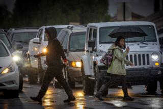
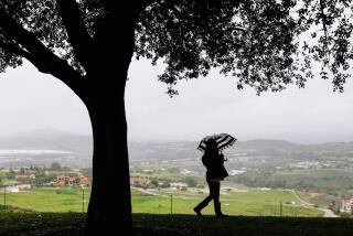
The National Weather Service warns that Southern California’s summer-like temperatures are petering off and wet weather will bring periods of rain, gusty winds and mountain snow through next week.
Forecasters project increasing clouds and scattered rainfall totaling a fourth of an inch in most areas between Friday and Sunday morning, the Weather Service tweeted. A quarter-inch to a half-inch of rain is expected between Sunday night and Monday evening. Snow levels are down to 2,000 feet and the mountains will receive 6 to 10 inches.
“We will likely have travel problems on the I-5 over the grapevine,” said Joe Sirard, a meteorologist with the Weather Service. Sirard said rainfall rates over the weekend should not be enough to cause debris problems.
At midweek, however, California could be affected by an atmospheric river that would deliver significant rain and snow. Just last week a storm in Oregon triggered a deadly mudslide before it eventually brought rain to Northern California.
“Southern California has a long fire-flood history and has the greatest risk of post-fire debris flows in the world,” said Jason Kean, a research hydrologist with the U.S. Geological Survey who studied the 2018 Montecito mudslide that killed 23 people. “This year is a big-concern year, too, simply because of the area that burned.”
From the Oregon border down to San Diego, virtually no region of California was immune to experiencing wildfire last year. Another dry winter was followed by record-setting heat that transformed the landscape into tinder, which freak lightning storms then set aflame, kicking off our annual cycle of fire, smoke, evacuations, destruction and death.
And though some Californians — especially those in the San Gabriel and San Bernardino mountain foothills — may feel a sense of routine in the annual cycle of debris flow and flood warnings that pop up every winter, the risks this year are outsized compared to our recent past, experts say.
Areas above Azusa west of Morris Reservoir, the Monrovia Wilderness Preserve and northeast of Yucaipa where the Ranch 2, Bobcat, Apple and El Dorado fires burned are all considered at high risk of experiencing debris flows with even a decent amount of rain, which should arrive over the next week in three storms.
The standard amount of rain it takes to trigger a debris flow after a moderate or extreme fire is usually about a half-inch an hour, but some of these areas are so steep and unstable it could take as little as two-tenths of an inch to start seeing mud and rocks flow down, Kean said.
The dangers exist along the coast as well, where residents of Santa Cruz and San Mateo counties experienced their worst year of fire ever. The communities are tight-knit and secluded in the lush coastal range, where the connection to the outside world is often just one way in and one way out, said Nate Armstrong, the area’s deputy chief with the California Department of Forestry and Fire Protection.
Armstrong’s crews battled the 86,000-acre CZU Lightning Complex fire for months last fall as it spread into areas that hadn’t seen fire in generations. The soil in some of those areas is weak without vegetation holding it in place and hydrophobic after the fire’s extreme heat baked gasses released from the burning plants into the earth, leaving behind an oily sheen when they cooled.
“You combine that with the steepness of the terrain and the communities built at the bottom of those drainages — that’s where you get the risk from,” Armstrong said.
Residents around Swanton along the coast and Boulder Creek along the Highway 236 corridor face the most serious risks, he said. As the second and third storms in the series arrive, officials will weigh whether to advise residents to evacuate early. The weather along the Central Coast is notoriously hard to predict, he said.
Armstrong’s concern — which is supported by recent events — is that residents are so fatigued from evacuating for wildfires, and beaten down by recent wind-caused power outages and yet more fires last week, that when it comes time to heed warnings about debris flows and mudslides, no one will listen.
The situation nearly parallels what Santa Barbara County residents faced in the winter of 2017-18, when the Thomas fire erupted in December, putting people out of their homes for days. They were then told to leave again a month later because of rainstorms.
Officials at the time estimated that only about 10% of residents in Montecito heeded the evacuation orders. Ultimately, 23 people died when a powerful storm cell dumped a huge amount of rain on the hills in minutes in the middle of the night, triggering a 2-mile-long mudslide that destroyed hundreds of homes and buried U.S. 101.
“Our concern coming into the rain season is we’re going to do these evacuations multiple times,” Armstrong said. “They might evacuate the second or third time, but the fifth? They might say, ‘Oh, it didn’t happen the first four times,’ and that might be the time.”
At this point, it’s too early to say how big a wallop the last of next week’s three storms is expected to carry, but early signs suggest it’s not on par with the storm that buried Montecito, officials said.
“This is not that type of scenario,” said Eric Boldt, a warning coordination meteorologist with the National Weather Service. Regardless, the public should stay tuned for updates and listen to authorities if they say it’s time to evacuate.
“We still don’t want to let our guard down,” Boldt said. “If they’re worried about their property and danger to themselves, they need to be leaving before they get the message from someone.”
More than 95% of California continues to experience drought conditions and the remainder is abnormally dry, the U.S. Drought Monitor reported Thursday.
More to Read
Start your day right
Sign up for Essential California for news, features and recommendations from the L.A. Times and beyond in your inbox six days a week.
You may occasionally receive promotional content from the Los Angeles Times.
