Monterey mudslides injure resident, damage 25 structures as L.A. braces for heavy rain
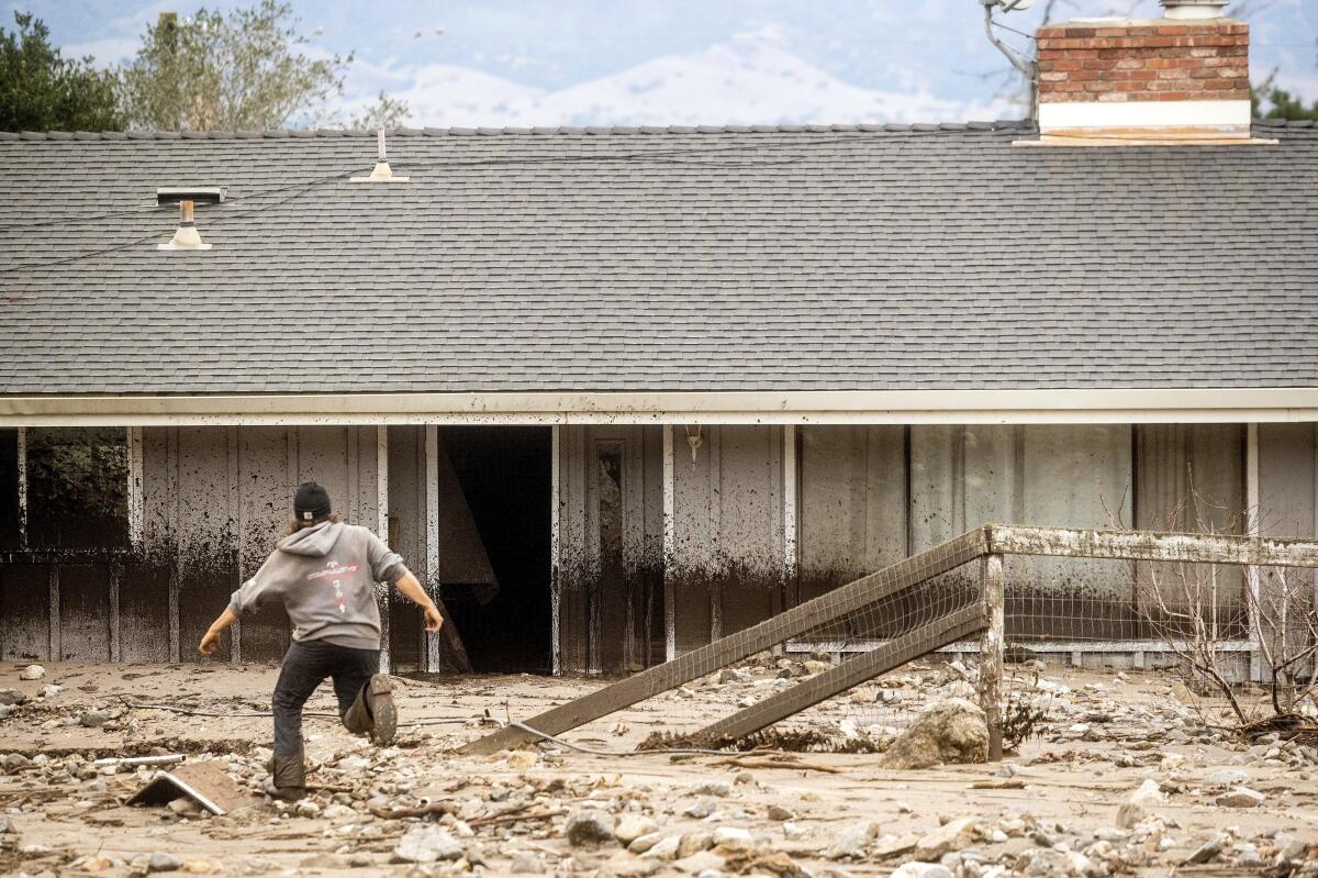
Heavy rains along the Central Coast triggered mudslides and debris flows, trapping a woman inside her home Wednesday near Salinas, Calif.
The woman was able to escape and suffered moderate injuries, Monterey County Regional Fire District Deputy Fire Marshal Dorothy Priolo said. She was taken to a local hospital, where she was treated and released.
The winter storm also damaged at least 25 other residences, sheds and stables nearby, Priolo said. About 50 animals, including horses, were rescued by the Monterey County chapter of the Society for the Prevention of Cruelty to Animals, who assisted residents in moving the animals to safety.
“At some locations, the mudflow came straight down the hill through the properties and across roads. In other cases, the mud flowed through trees and equipment or other items on the properties and became debris flows,” Priolo said.
It hadn’t yet been determined whether any sections of hillside fell in their entirety, Priolo said, or if the flow was only soil mixing with rainwater. Agencies will work in the coming days to identify additional building damage and loss.
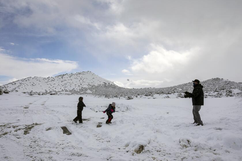
A winter storm swept over much of Southern California, dusting mountaintops with snow and bringing traffic to a standstill on several passes.
The mudslides occurred near the Sierra de Salinas mountain range on the northeast side of the River fire, which burned more than 48,000 acres last fall. The soil there is weak and, without vegetation to hold it in place, at heightened risk for debris flows and mudslides.
The atmospheric river that was in the region had largely left the Bay Area by Thursday and was heading south. Lingering moisture was producing scattered showers that were moving inland, said Roger Gass, a meteorologist with the National Weather Service in Monterey.
“We are on the tail end of the moisture plume,” said Gass, adding that rain is expected to taper off by Thursday evening in Northern California.
Most of the reported flooding in the area is “nuisance” and in low-lying areas, Gass said.
“This flooding is nothing out of the ordinary for a typical winter storm,” he said.
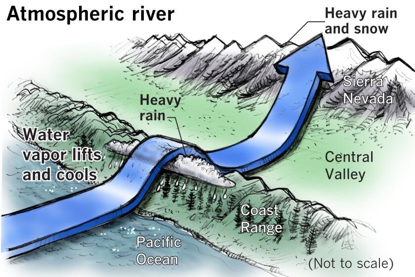
How atmospheric rivers bring heavy rain and snow to California
Evacuation orders in Santa Cruz and San Mateo counties were downgraded to warnings Thursday morning. The Monterey County Sheriff’s Office issued evacuation orders for the Carmel River Lagoon area Thursday morning after the NWS warned of heavy rains and the potential for a rapid rise of the Carmel River.
A low-pressure system off the Pacific Northwest on Wednesday pulled the atmospheric river — which was predicted to trend very quickly south — toward the battered Central Coast, meteorologist Brayden Murdock said from the National Weather Service in Monterey.
The storm delivered several feet of snow to the Sierra Nevada, particularly between Yosemite National Park and Mammoth.
Mammoth Mountain is expecting up to 9 feet of snow over the next few days.
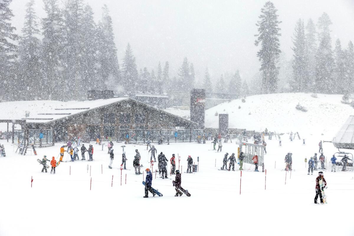
Heavy snow near Tahoe has skiers excited for the weekend, when skies are expected to clear, according to the NWS. But for now, snow and icy conditions have closed some mountain roadways, including parts of Highway 88, the gateway to the Kirkwood resort. Highway 395 will remain closed until Friday.
Highway 89 was closed near Emerald Bay in Tahoe.
A blizzard warning will stay in effect for much of Mono County, including Bridgeport, Coleville and Mammoth Lakes, until 4 a.m. Friday, according to the weather service. Officials warned of strong winds causing tree damage and power outages. Wind chills of up to 20 degrees below are predicted near the ridges of the Sierra Pass and could cause frostbite in as little as 30 minutes.
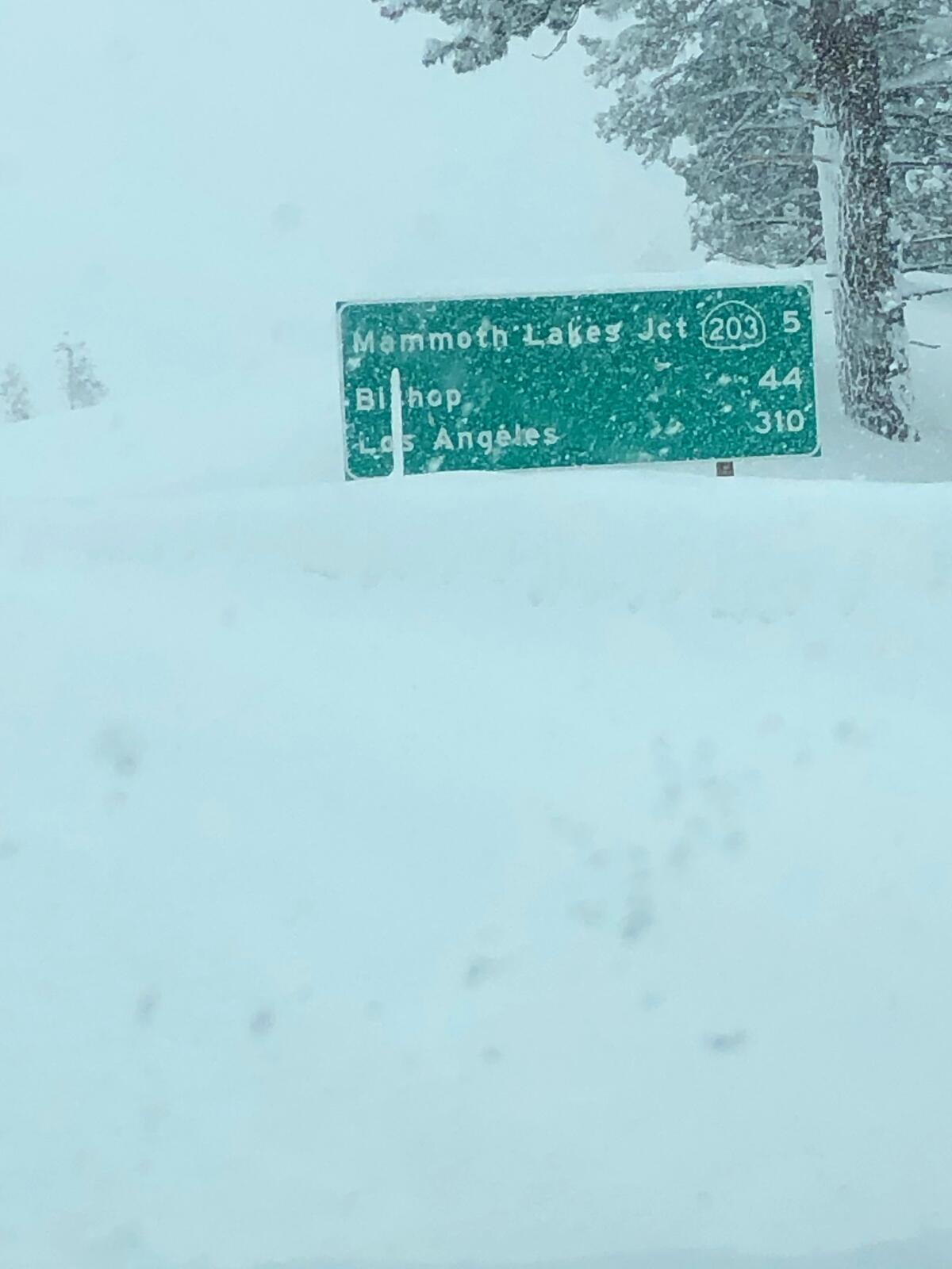
The Eastern Sierra Avalanche Center warned against traveling along the eastern slopes of the Sierra Nevada mountain range, as “extreme” and “widespread” avalanching through Friday morning is possible between Virginia Lakes and Bishop Creek.
The system, which was creeping south Thursday morning, had dropped more than 13 inches of rain on portions of San Luis Obispo County. An additional 3 to 6 inches of rain is expected across San Luis Obispo and Santa Barbara counties through Thursday afternoon before the storm shifts to the Los Angeles area.
Rainfall will be strongest in L.A. County on Thursday night, tapering off around 5 a.m. Friday, said Rich Thompson, a meteorologist with the NWS in Oxnard.
“I know it’s dry right now, but the rain is coming. It’s just a matter of waiting,” Thompson said.
In anticipation of the rainfall, the National Weather Service issued a flash-flood watch in the Southern California areas burned in the Bobcat, Lake and Ranch2 wildfires last year.

Between 1.5 and 3.5 inches of rain is expected in L.A. and Ventura counties, forecasters said, with 2 to 5 inches falling in mountains. Wind gusting along the coast and in the valleys are expected between 25 and 35 mph.
Up to 3 inches of snow is expected in the mountains above 6,000 feet, and a 24-hour snow warning will go into effect at 3 p.m. Thursday.
The weather service said the storm, which could produce thunderstorms Friday, could increase traffic delays and road flooding.
The San Bernardino County Sheriff’s Department issued evacuation warnings for areas near last year’s El Dorado fire, including Mountain Home Village, northeast Yucaipa and Oak Glen. Flash flooding is possible, officials said.
Riverside County also issued evacuation warnings for residents near the El Dorado and Apple burn scars and those living in the Santa Ana River Bottom area.
Officials with the Angeles National Forest warned against driving through the area until Friday afternoon, as flooding is possible in the Lake and Bobcat burn scars and snow at high elevation could bring black ice to roadways.
Neonika Walker, a spokeswoman for Los Angeles County Public Works, said “moderate debris and mudflows are possible” at sites not previously burned by wildfires. “Some streets may be completely blocked by debris,” Walker said.
After closing overnight for several days, the 5 Freeway through the Grapevine remained open in both directions Thursday morning. But snow with the latest storm could bring another closure, officials warned.
The northbound lanes of Highway 99 are closed between the 5 Freeway split and Route 223 because of dust caused by high winds.
More to Read
Start your day right
Sign up for Essential California for news, features and recommendations from the L.A. Times and beyond in your inbox six days a week.
You may occasionally receive promotional content from the Los Angeles Times.

