Southern California winds threaten trees and power lines
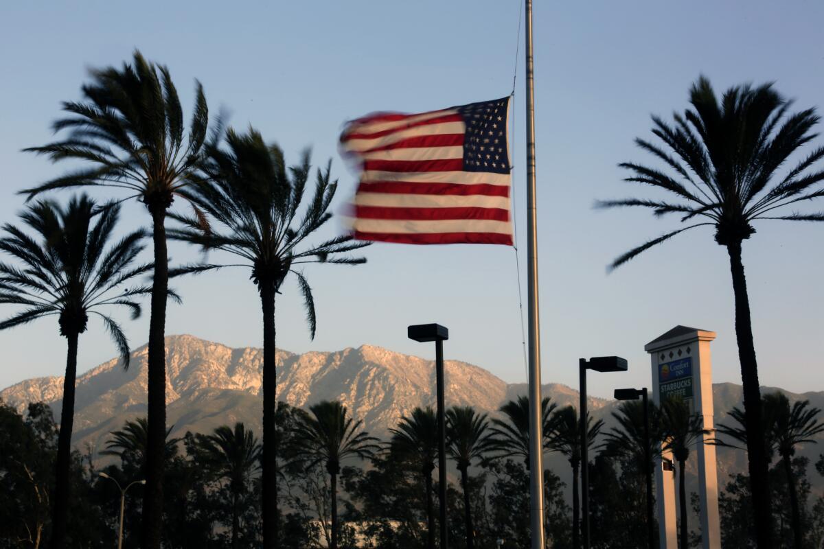
Winds whipped through swaths of Southern California on Saturday, prompting forecasters to warn of downed trees and power lines.
In the Los Angeles area, the strongest winds were blowing in the Santa Clarita and northern San Fernando valleys, where gusts were reaching 50 mph Saturday morning, while West Los Angeles was recording gusts of 30 to 35 mph, said Mike Wofford, meteorologist with the National Weather Service in Oxnard. The winds were expected to pick up slightly throughout the day, with isolated gusts of 65 mph possible in some mountain areas, but largely confined to western L.A. County, he said.
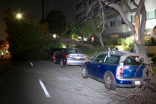
Already by Saturday morning a tree had fallen onto two vehicles in the 1100 block of Beverly Drive, briefly blocking the street before crews cleared it, said Brian Humphrey of the Los Angeles Fire Department. No injuries were reported.
Scattered power outages were reported throughout L.A. County, particularly on the Westside. As of 1 p.m. Saturday, about 3,179 of Southern California Edison’s 5 million customers remained without power, with 1,755 in L.A. County and the bulk of the remainder in Riverside, San Bernardino, Tulare and Ventura counties. More than 2,100 Los Angeles Department of Power and Water customers also were without power, the majority of them in Hollywood and Del Rey.
Wind advisories were posted from 3 p.m. Saturday until 3 p.m. Sunday for the L.A. County mountains, coastal areas and most valleys, as well as the Ventura County valleys and mountains, with the weather service warning the conditions could pose challenges to those driving high-profile vehicles along Highway 101, the 210 and 405 freeways and many canyon roads. A wind advisory was also in effect for the Santa Barbara County mountains and South Coast until 3 a.m. Sunday and in the Antelope Valley until 9 p.m. Saturday.
Forecasters said the fire danger posed by the winds would be mitigated by Saturday’s high humidity, although that was expected to change Sunday as conditions dried out. A light rain was falling along the northern edge of Los Angeles County and the Interstate 5 corridor in the Gorman area Saturday morning. Those areas could also see light snow, with snow levels dropping to 5,000 feet, but not significant enough to cause travel issues, Wofford said.
The breezy weather was being caused by a low pressure system moving through Northern California and into Nevada that set up a typical scenario, that sends north winds through the San Joaquin Valley and down into coastal areas, Wofford said.
As the low pressure system moves farther toward the east Sunday, the winds are expected to shift with it, becoming warmer and drier as they blow offshore, he said.
“Then it becomes more like a traditional northeast Santa Ana wind, which doesn’t really typically get much wind into West L.A., but more like the Santa Monica Mountains, Malibu and the San Fernando Valley,” he said.
As is typical with Santa Anas, Sunday’s winds were expected to be strongest between 4 a.m. and 2 p.m., before the arrival of onshore breezes later in the afternoon, Wofford said.
Temperatures were expected to start to warm up Sunday and then reach about 10 degrees above normal by Monday, with many areas seeing highs of 75 to 80 degrees, Wofford said.
The risk of fire was expected to be elevated Sunday due to the windy, warm and dry conditions, but not extreme enough to draw a red-flag warning from the weather service.
Still, Humphrey said, there’s been little rain and vegetation is dry, so fire officials are asking people to take extra care to avoid generating sparks and to take a moment to survey their property and check for hazards.
“The fire weather danger rating has inched into the high phase,” he said. “And for February, that’s not unheard of but it’s relatively uncommon.”
More to Read
Start your day right
Sign up for Essential California for news, features and recommendations from the L.A. Times and beyond in your inbox six days a week.
You may occasionally receive promotional content from the Los Angeles Times.
