Recent rain didn’t halt California’s slide back into severe or extreme drought
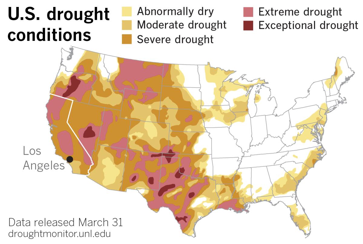
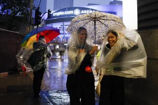
Despite a late-spring storm that brought heavy rain to parts of the Southland, California continues its slide back into drought after a promising wet fall and early winter.
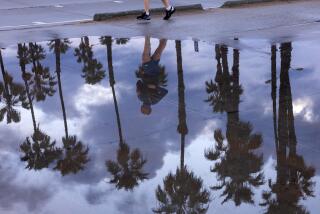
On Monday, 1.32 inches of rain fell in downtown Los Angeles to bring the total for March to 1.41 inches — meaning only 0.09 of an inch had fallen in the entire month before this week’s storm. That left downtown L.A. 0.82 of an inch short of normal for the month, which is 2.23 inches.
March’s shortfall comes on the heels of what are typically two of L.A.’s wettest months, January and February, which this year were 3.10 inches and 3.58 inches below normal, respectively. Just 0.19 of an inch of rain fell in January, and 0.06 of an inch in February.
The one bright spot was December, when 9.46 inches of rain fell downtown — 6.98 inches more than normal.
California officials are touting a $2.6-billion deal to boost the health of a vital watershed, but environmentalists are calling it a backroom scheme.
Given the season-long deficits, Monday’s storm didn’t move the drought needle by much. The January-to-March period went from being L.A.’s second-driest winter on record to its seventh-driest after the recent rains, according to climatologist Bill Patzert.
Many parts of California and the West received beneficial precipitation with the storm, but it was not enough to bring substantial relief from stubborn drought conditions, according to the most recent U.S. Drought Monitor, which showed that extreme drought expanded in parts of the state.
The California Department of Water Resources reported that higher-than-normal temperatures last week caused premature snowmelt, and about one-third of the snowpack’s water equivalency disappeared in a week. On Friday, the department announced that the statewide snow-water equivalent was 38% of normal for the date.
The state’s snowpack in the Northern Sierra was off to a great start in December and on track for a wet year, but then it flatlined after the start of the new year, said Ben Hatchett, a climatologist with the Western Regional Climate Center.
The “remarkable dry spell,” during which the state missed out on the majority of its wet season, was caused by blocking high pressure over western North America, he said. That high pressure diverted the storm track poleward, driving much-needed precipitation into British Columbia and Alaska, while the West Coast was “baking beneath a high-pressure ridge.”
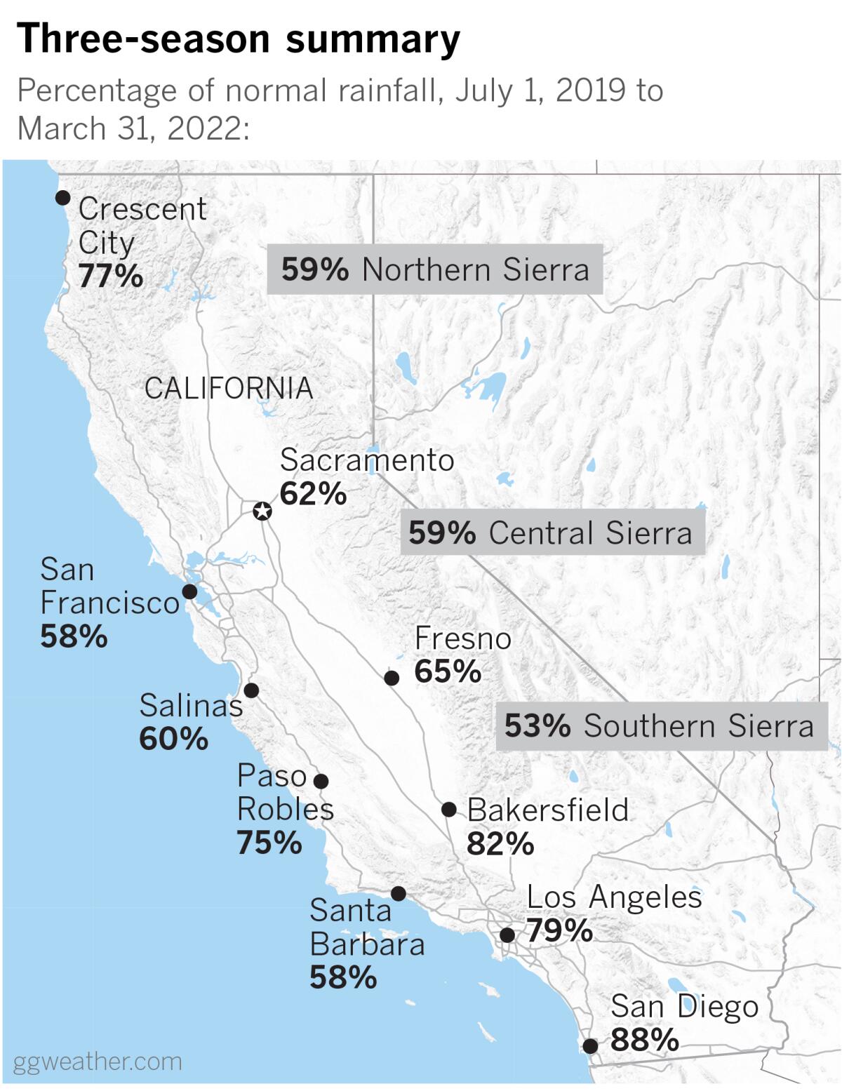
California and the Southwest are in their second consecutive La Niña winter, amplified by climate change, and a dry period that has plagued the West for more than two decades.
Looking at the the last three seasons, the northern half of California has received only one-half to two-thirds of its normal rainfall, according to meteorologist Jan Null of Golden Gate Weather Services. The southern half of the state has received close to three-quarters of normal rainfall.
No relief is in sight in the near term. Forecasters say high pressure will slide back into the state from the west next week, with dry offshore flow and four to five consecutive days of warming.
Thursday’s high temperatures in parts of Southern California are expected to be 15 to 20 degrees above normal, and records may be broken Thursday and Friday. Heat, low humidity and gusty winds are expected to cause elevated fire danger.
More to Read
Start your day right
Sign up for Essential California for news, features and recommendations from the L.A. Times and beyond in your inbox six days a week.
You may occasionally receive promotional content from the Los Angeles Times.
