Can a hurricane in Mexico bring relief to SoCal heat wave? It’s expected to bring plenty of moisture
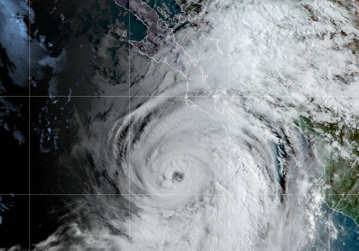
Hurricane Kay is expected to bring plenty of moisture to Southern California, with temperatures still forecast to be high heading into the weekend and humid conditions sticking around through Sunday.
Kay, a system off Mexico’s Baja California Peninsula, could bring humidity, flash floods, high winds and strong surf to Southern California.
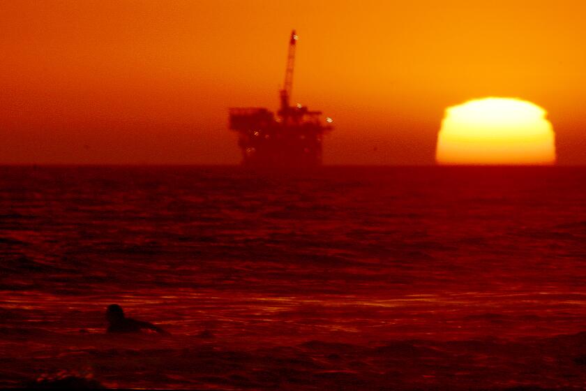
It follows the most brutal September heat wave in California history, which began last week and is expected to last nine days. Even at night, record-high low temperatures are offering little relief to residents or power suppliers. And coastal areas — often a refuge from heat — were also hit with scorching temperatures.
Mark Moede, a meteorologist at the National Weather Service in San Diego for nearly 30 years, called this week a particularly “extraordinary” weather event for the region.
“We could go from a day where we get hot, dry, maybe Santa Ana-type weather, and the following day ... there will be areas of rain,” Moede said of the shift in weather patterns from Friday to Saturday. “It is going to be a very dynamic end of the week regarding weather.”
The California Independent System Operator had issued a level 3 alert, a sign that the grid couldn’t meet the state’s electrical needs.
Kay, which is forecast to be a tropical storm when it is closest to San Diego, is predicted to deliver a moisture surge to Southern California starting Friday. To what extent it will affect Southern California is still being monitored, but forecasters are predicting potential flash floods, possible high winds and hazardous currents throughout the weekend.
The region is not across the finish line of this marathon-extreme weather event just yet, said Casey Oswant, meteorologist at the National Weather Service in San Diego. Saturday should be the start of some cooler temperatures, though sticky conditions will remain.
“Unfortunately, Hurricane Kay might not bring too much relief from the heat,” Oswant said. The overnight lows are expected to fall only to around the upper 70s in some areas, with others hovering at or above 80 degrees, until Sunday, when daily lows should begin traveling south.
“It is still going to feel pretty muggy.,” Oswant added.
The biggest decreases are expected in the valleys and deserts. In Coachella Valley, Palm Springs is expected to retreat from 108 degrees Thursday to 89 degrees Saturday, but lows will hardly budge, with about 85 degrees expected for Thursday morning and 78 degrees for Saturday morning. Ocotillo Wells, in the San Diego deserts, will see a similar trend: 107 degrees Thursday, and 89 degrees Saturday, with morning lows registering 86 degrees to 79 degrees, respectively.
The daytime decrease is in large part due to more clouds in the area, Oswant said.
While the highs will fall slightly in the city of San Diego, the lows will increase from 73 degrees Thursday morning to 77 degrees Saturday morning. The increased moisture from the storm makes it difficult for low temperatures to decline, especially at the coast, Oswant said. Sunday is expected to be particularly humid, with 90% to 100% humidity expected in the mountains and toward the coast, and the deserts forecast to be between 50% and 70%, their max humidity.
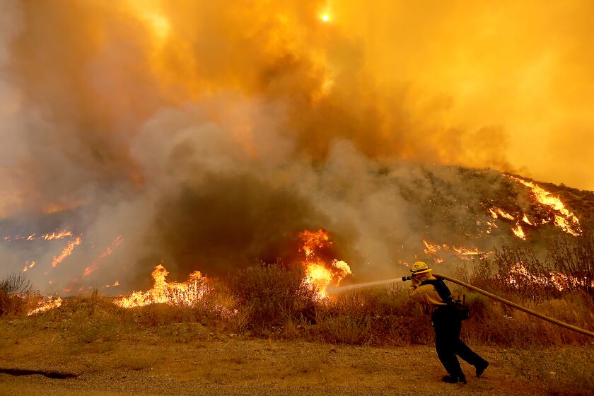
The Fairview fire, which has killed two people, has burned nearly 20,000 acres and remained 5% contained late Wednesday night.
Much of Southern California is expected to get at least a half-inch of rain Friday through Sunday. The National Oceanic and Atmospheric Administration Weather Prediction Center is forecasting possible flash floods.
The mountains and desert could see 2 to 3 inches of rain this weekend. Mt. Laguna is forecast to be hit with 3 and 4 inches of rain. Julian could see as much as 2½ inches of rain. Motorists should also be aware of possible heavy rains along Interstate 8, Oswant said, which could see anywhere from 1½ inches to 3 inches along portions of the freeway.
That could extend farther north into Coachella Valley and into the Riverside and San Bernardino Mountains, Oswant said.
The storm could also bring with it high winds, raising concerns for fire crews battling blazes near Hemet and another near Big Bear Lake.
David Sweet, a meteorologist at the National Weather Service in Oxnard, said weekend temperatures in parts of Los Angeles and Riverside counties should be cooler starting Saturday, with a chance of thunderstorms expected in some areas, but will remain stuffy and humid.
More to Read
Start your day right
Sign up for Essential California for news, features and recommendations from the L.A. Times and beyond in your inbox six days a week.
You may occasionally receive promotional content from the Los Angeles Times.
