Campaign to map earthquake faults has slowed to a crawl
After the 1971 Sylmar earthquake, California began an ambitious effort to map faults across the state.
Over the next two decades, officials published 534 maps of active earthquake faults. New construction was prohibited on top of these fissures because previous quakes showed that buildings could be torn apart during violent shaking.
But the mapping campaign has slowed to a crawl — with many dangerous faults still undocumented.
Since 1991, only 23 have been drawn. Because of budget cuts, none were completed between 2004 and 2011, according to records reviewed by The Times.
State officials said there are still about 300 maps to draw and even more to revise — including some in heavily populated areas of Southern California. That represents about 2,000 miles of faults statewide.
The slow pace affects public safety. The ban on building atop faults is enforced only for those formally mapped by the state; the regulations don’t cover faults not on California’s official map.
It has become an issue in recent months because of several new developments planned along the Hollywood fault, which runs through the heart of the famed entertainment district. A high-rise development has been approved by the Los Angeles City Council along the fault area, and another large mixed-use project nearby is already under construction.
State law requires new buildings located near faults mapped by the state to perform extensive testing to prove their structures are not on top of the fissures.
But the Hollywood fault has not been officially mapped, even though the state has known of its existence for decades.
The state geologist’s office said it hopes to complete mapping the Hollywood fault by 2014. After that, officials want to concentrate on the Santa Monica fault in the Westside. Officials are also concerned about several other zones they believe need further seismic research, including San Diego Harbor, Yorba Linda, the San Gabriel and Pomona valleys, Indio, Napa County and South Lake Tahoe.
The state geologist’s budget has dropped from $9.1 million in 2001 to $2.9 million for the current fiscal year. State geologist John Parrish said his office scraped up funding from its existing budget to restart the mapping program last year, though he said progress has been slow.
“We try to perform as best we can do,” Parrish said.
Many earthquake faults have already been extensively researched by scientists at places such as USC, Caltech and the University of California. When creating a map, the state reviews all this outside research and draws a roughly quarter-mile zone around the fault. Under the state’s Alquist-Priolo Earthquake Fault Zoning act, developers in that zone must prove their structure does not sit on top of the active faults.
The 557 maps the state has completed represent various parts of different fault lines, including such well-known ones as the San Andreas, Hayward and Newport-Inglewood.
Experts say it’s crucial to complete the mapping to keep new structures away from dangerous areas straddling faults.
“Then there’s no mistake [about] the red line,” said retired state geologist Robert Sydnor. “It helps at the political level: the city council and the mayor cannot somehow override” it.
James Dolan, a USC earth sciences professor who has experience mapping faults, recalled driving through the Westside when he was doing research on the Santa Monica fault 20 years ago. “I was stunned to see, either right next to or on top of where I was mapping the fault, a big building in excavation,” he said.
He called around and found out the fault had not been officially mapped by the state, so the property was not covered by the law.
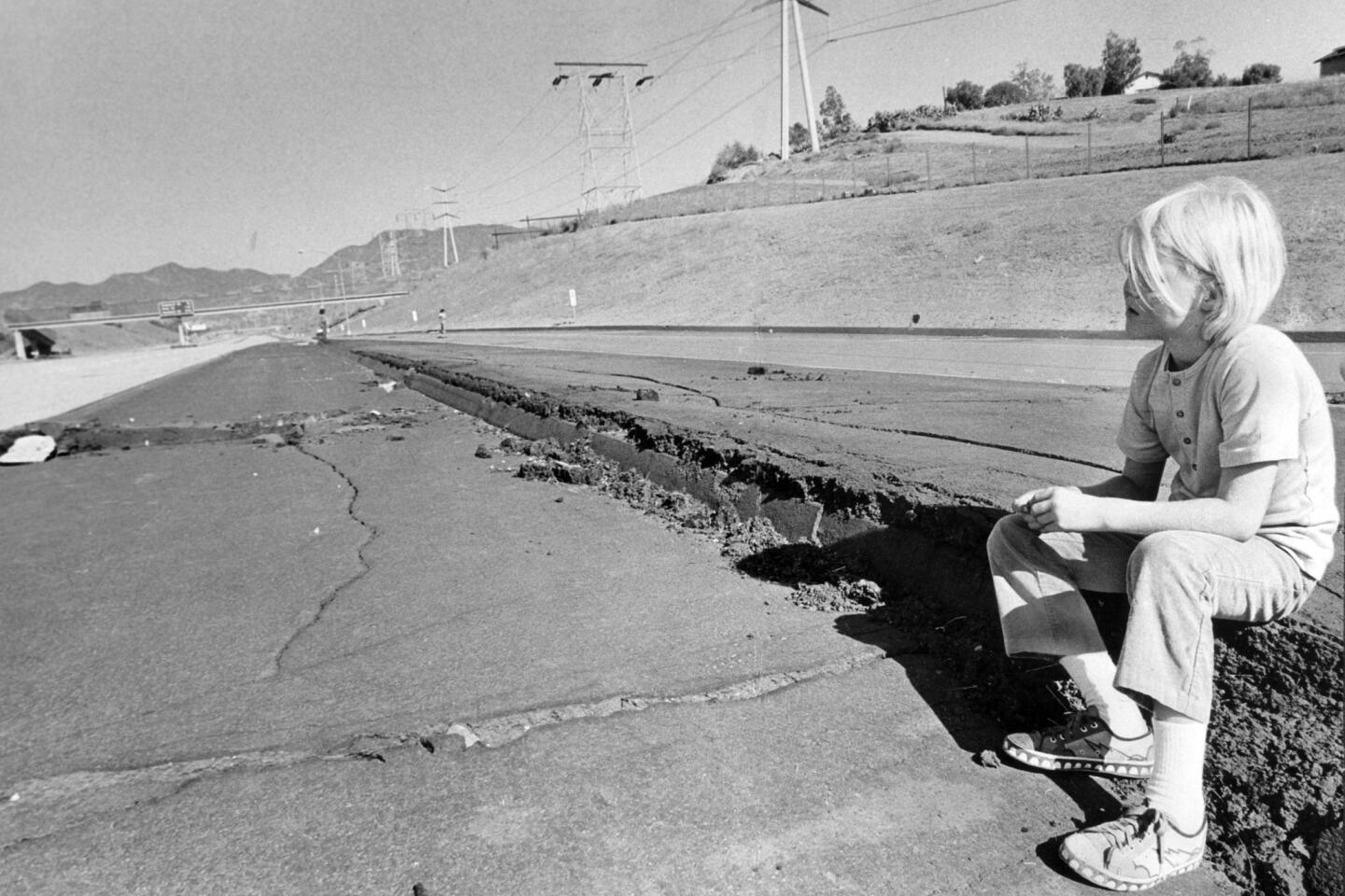
Seismic safety experts have long studied the destruction caused above faults when big quakes strike. But the Sylmar quake reinforced the risks to officials.
One side of the San Fernando fault moved as much as 8 feet from the other side. Many homes and commercial buildings were severely damaged by the ground fracturing. About 80% of the buildings along the fault suffered severe to moderate damage.
The law applies to new construction along faults. But the discovery of fissures has led some to take action. Los Angeles Southwest College demolished two buildings in 1991 that straddled the Newport-Inglewood fault. The Los Angeles Unified School District tore down a portion of the new Belmont Learning Center after finding that a fault ran underneath it.
In Hayward, the original City Hall sits on the Hayward fault and has slowly been damaged by earth movement. The city abandoned the building after the 1989 Loma Prieta earthquake.
Between the 1987 Whittier Narrows quake and the 1994 Northridge quake, some cities stepped up production of their own fault maps. But Parrish said that city mapping has now essentially stopped.
In the case of the Hollywood fault, The Times found the city’s map incomplete. It does not include some sections of the fault drawn in maps published in scientific journals and by federal and state agencies.
Back in the 1970s, the state began its mapping by focusing on faults with recent histories of major ruptures, such as the San Andreas, which caused both the 1906 San Francisco earthquake and the Loma Prieta quake. By contrast, the Hollywood fault is capable of producing a 7.0 earthquake but hasn’t ruptured in modern L.A. history.
Parrish said state officials also had to pay special attention to mapping areas where an earthquake could cause soil to liquefy into mud. The dangers of liquefaction became apparent in 1989, when parts of San Francisco’s Marina district were destroyed.
Still, Parrish said there are many faults in populated areas that need to be mapped.
“If you don’t know what’s there, then it’s easy to just ignore it,” he said. “That’s why the Legislature set it up that they be zoned — to make local planning departments aware of these high-hazard areas.”
The landmark earthquake law that started the mapping was co-written by the late state Sen. Alfred E. Alquist, who was considered a champion of seismic safety.
His wife, Elaine Alquist, recently retired after serving in the state Senate. Fault mapping took a back seat during the state’s long financial crisis of the last decade, but Alquist said she believes now is the time for the Legislature to begin investing again.
“We have a history in California and in America of not doing things to take care of issues until somebody dies,” Alquist said. “It would be a crying shame that we have not updated our process for mapping fault lines.... We need to put money into this. We need to know exactly where the fault lines are.”


Start your day right
Sign up for Essential California for news, features and recommendations from the L.A. Times and beyond in your inbox six days a week.
You may occasionally receive promotional content from the Los Angeles Times.