Tracking an atmospheric river from the sky
A team from the National Oceanic and Atmospheric Administration flew over a California-bound atmospheric river to gauge its strength. The visualization below illustrates how much water vapor is moving through the atmosphere and how fast it is traveling.
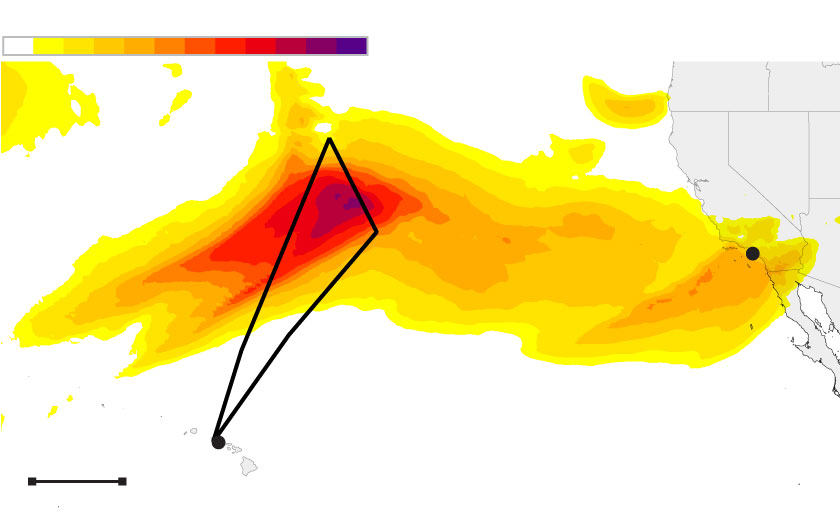
Atmospheric river strength
Pacific Ocean
Los
Angeles
Atmospheric
river
Flight path
Honolulu
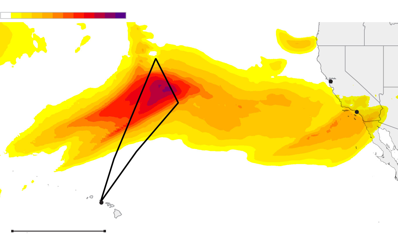
Atmospheric river strength
ORE.
NEV.
Pacific Ocean
San Francisco
CALIF.
Atmospheric river
Los
Angeles
Flight path
Honolulu
HAWAII
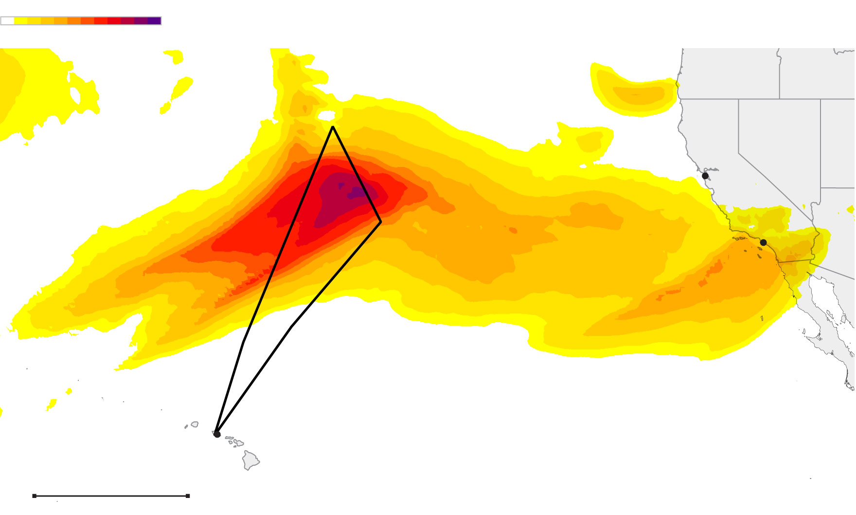
Atmospheric river strength
ORE.
NEV.
Pacific Ocean
San Francisco
CALIF.
Atmospheric river
Los
Angeles
Flight path
Honolulu
HAWAII
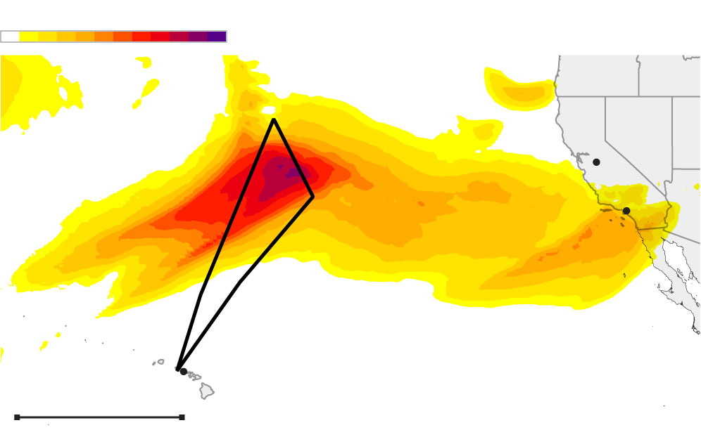
Atmospheric river strength
San
Francisco
Pacific Ocean
Atmospheric river
Los
Angeles
Flight path
Honolulu
500 MILES
Center for Western Weather and Water Extremes at Scripps Institution of Oceanography
Sean Greene LOS ANGELES TIMES