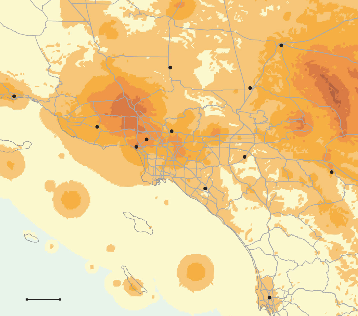
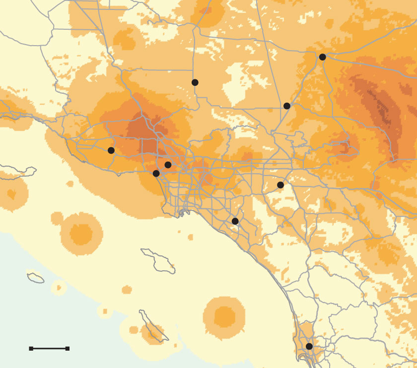
50 years of earthquakes
Every earthquake has one magnitude, but its effects and how people feel it differ from one site to another. The U.S. Geological Survey measures this with an intensity scale. An intensity of 4 at one site means many people reported feeling the earthquake. After 7, buildings at the location start to show damage. The map displays the strongest shaking — or highest intensity — recorded at each point in Southern California since 1974.
Earthquake intensity
Barstow
Lancaster
Victorville
Santa Barbara
Thousand Oaks
Pasadena
Los Angeles
Riverside
Santa Monica
Palm Springs
Irvine
San Diego
20 MILES
Barstow
Lancaster
Victorville
Thousand
Oaks
Los Angeles
Riverside
Santa Monica
Irvine
20 MILES
San Diego
U.S. Geological Survey data provided by Vince Quitoriano and David Wald
Ana E. Azpúrua LOS ANGELES TIMES