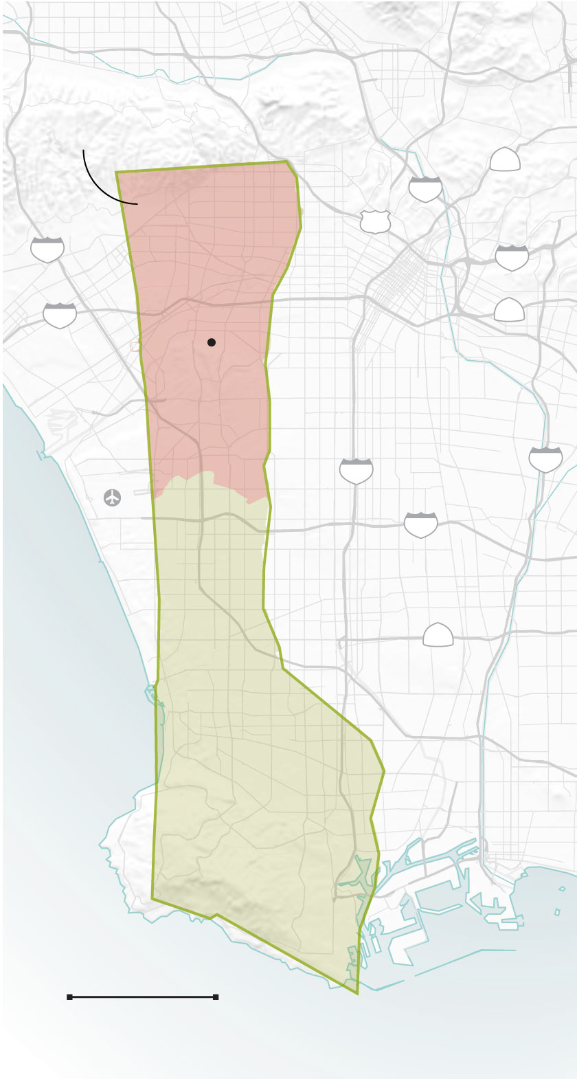
Burbank
Studio City
Griffith
Park
Evacuation zone
110
Los Feliz
Hollywood
5
Beverly Hills
101
Koreatown
405
10
Los Angeles
Gaza
City
60
10
Culver
City
Santa
Monica
710
Inglewood
110
LAX
South Gate
105
Lynwood
Hawthorne
Compton
91
Torrance
Carson
GAZA STRIP
Long Beach
Rancho Palos
Verdes
San
Pedro
5 MILES
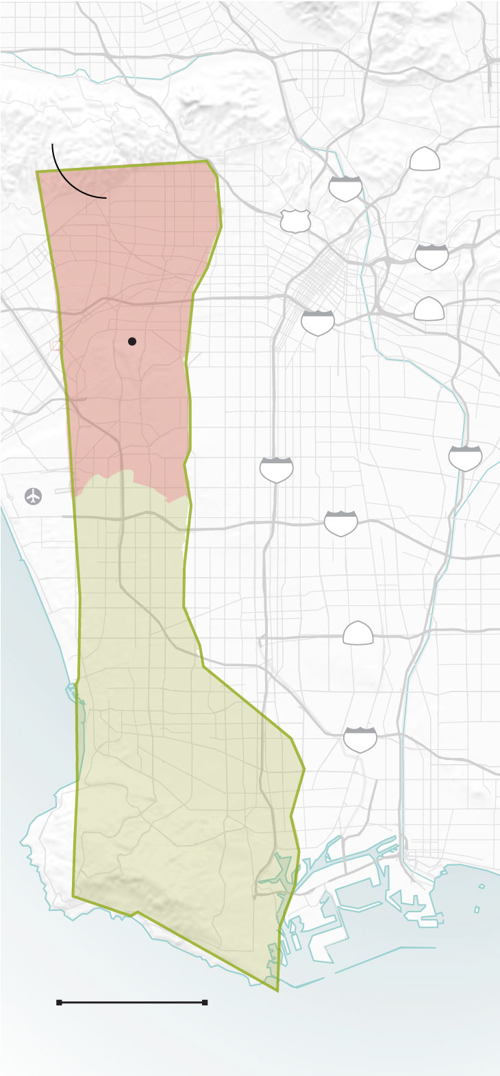
Burbank
Studio City
Griffith
Park
Evacuation zone
110
Los Feliz
Hollywood
5
Beverly Hills
101
Koreatown
10
Los Angeles
Gaza
City
60
10
Culver
City
710
Inglewood
110
LAX
South Gate
105
Lynwood
Hawthorne
Compton
91
Torrance
Carson
405
GAZA STRIP
Long Beach
Rancho Palos
Verdes
San
Pedro
5 MILES
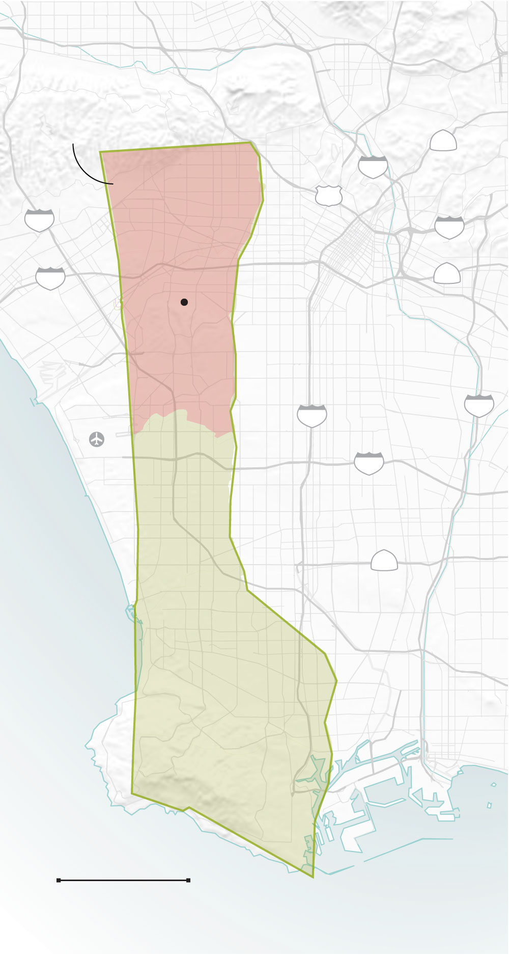
Burbank
Studio City
Griffith
Park
Evacuation zone
110
Los Feliz
Hollywood
5
101
Beverly Hills
Koreatown
405
10
Los Angeles
Gaza
City
60
10
Culver
City
Santa
Monica
Inglewood
710
110
LAX
South Gate
105
Lynwood
Hawthorne
Compton
91
Torrance
Carson
GAZA STRIP
Long Beach
Rancho Palos
Verdes
San Pedro
5 MILES
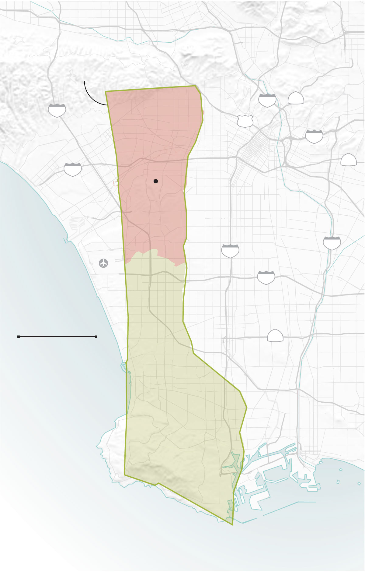
Burbank
Studio City
Griffith
Park
Evacuation zone
Los Feliz
Hollywood
110
5
405
Beverly Hills
101
Koreatown
10
Los Angeles
60
Gaza
City
10
Culver
City
Santa
Monica
710
Inglewood
110
LAX
South Gate
105
Lynwood
Hawthorne
Compton
5 MILES
91
Torrance
Carson
GAZA STRIP
Long Beach
Rancho Palos
Verdes
San Pedro
United Nations, OpenStreetMap, USGS, Times reporting
Lorena Iñiguez Elebee LOS ANGELES TIMES