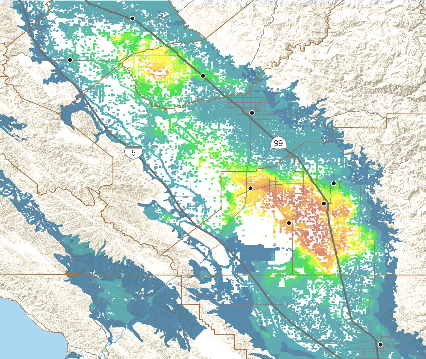
The Tulare Lake Basin is rapidly sinking
Satellite measurements show land subsidence in the San Joaquin Valley and nearby areas between June 2015 and Oct. 2023.
Vertical land displacement in feet
Merced
MADERA COUNTY
Los Banos
MERCED
COUNTY
Madera
Fresno
FRESNO COUNTY
TULARE COUNTY
SAN BENITO
COUNTY
CALIFORNIA
AQUEDUCT
Lemoore
Visalia
Tulare
Corcoran
KINGS
COUNTY
MONTEREY
COUNTY
SAN LUIS OBISPO
COUNTY
KERN COUNTY
Bakersfield
Pacific Ocean

Merced
MADERA
COUNTY
FRESNO
COUNTY
Madera
MERCED
COUNTY
Fresno
TULARE
COUNTY
CALIFORNIA
AQUEDUCT
SAN BENITO
COUNTY
Visalia
Tulare
Corcoran
MONTEREY
COUNTY
KINGS
COUNTY
KERN COUNTY
SAN LUIS OBISPO
COUNTY
Bakersfield
California Department of Water Resources, Esri
Paul Duginski LOS ANGELES TIMES