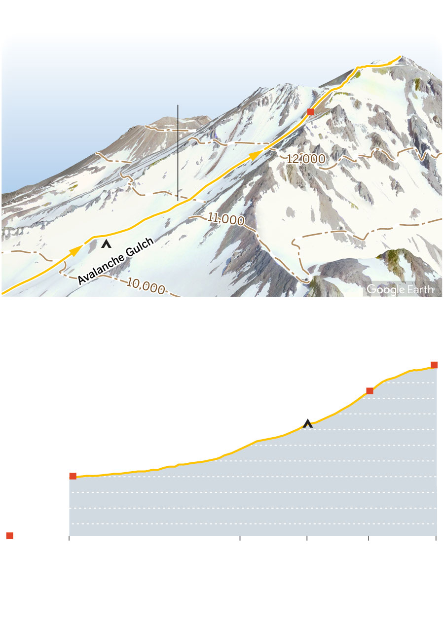
A steep ascent to the summit
Summit
Avalanche
Gulch route
Red Banks
Helen Lake Camp
14,179 ft.
Summit
12,600 ft.
Red Banks
10,400 ft.
Helen Lake Camp
7,000 ft.
Trailhead
3,600 ft.
City
0 Miles from trailhead
2.5
3.5
4.4
5.3
Satellite imagery from Google Earth
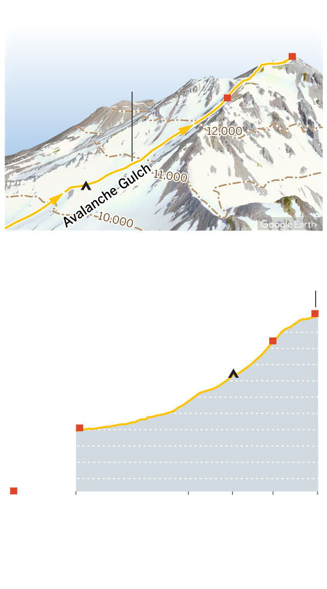
A steep ascent to the summit
Summit
Avalanche
Gulch route
Red Banks
Helen Lake
Camp
14,179 ft.
Summit
12,600 ft.
Red Banks
10,400 ft.
Helen Lake Camp
7,000 ft.
Trailhead
3,600 ft.
City
0 Miles from
trailhead
2.5
3.5
4.4
5.3
Satellite imagery from Google Earth