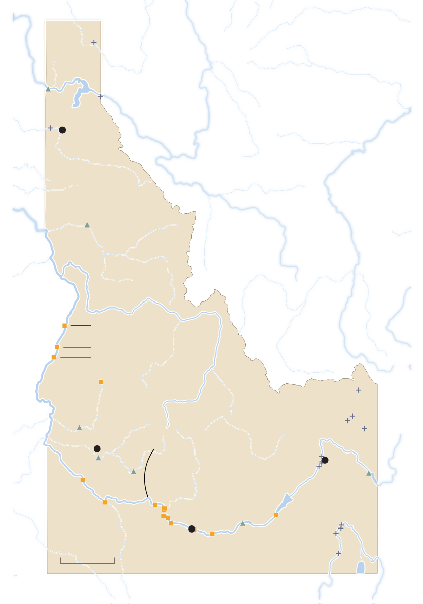
Coeur d’Alene
Hells Canyon
Oxbow
Brownlee
Boise
SNAKE RIVER
Idaho Falls
Twin Falls
U.S Energy Atlas, Open Street Maps
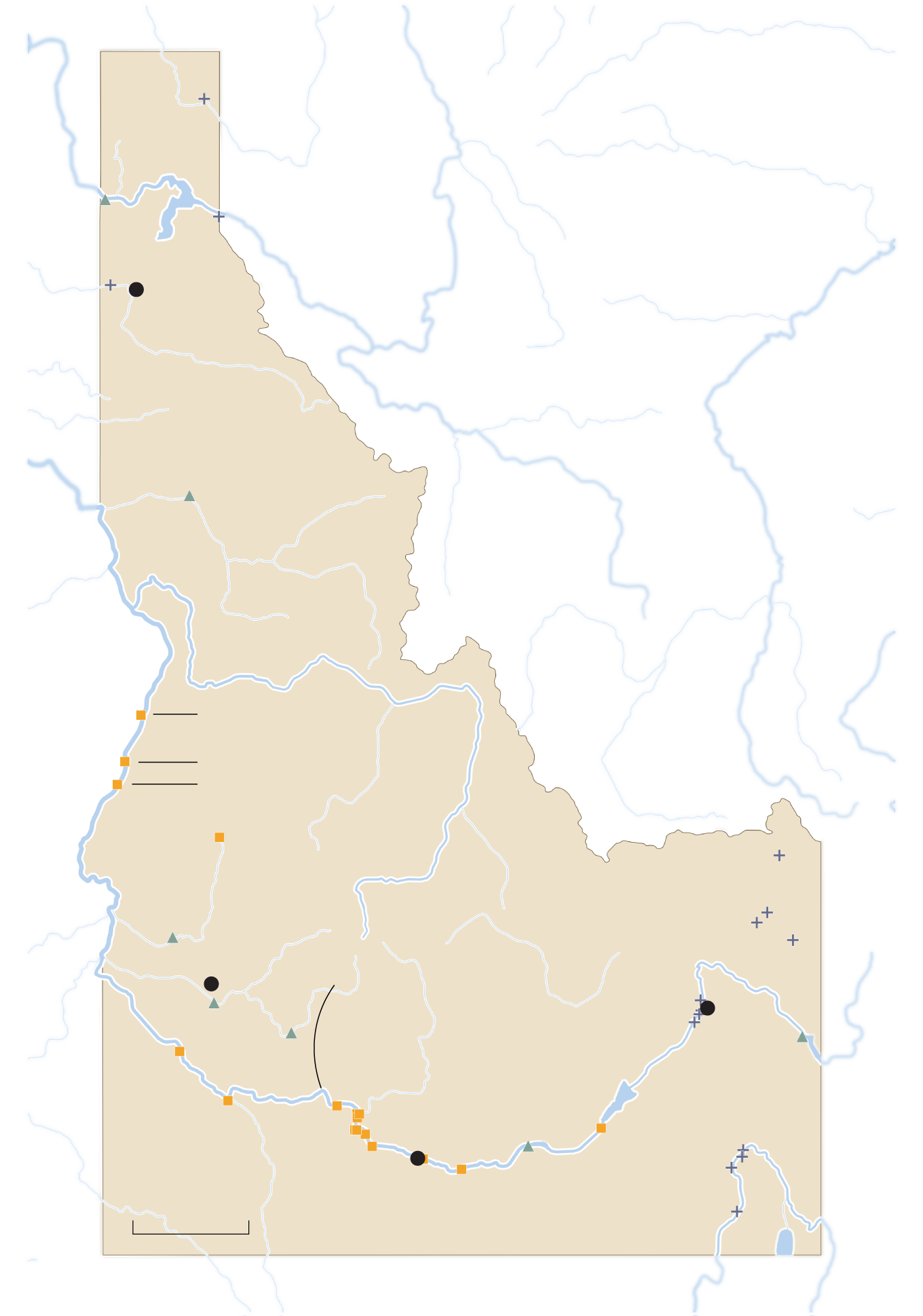
Coeur d’Alene
Hells Canyon
Oxbow
Brownlee
Boise
SNAKE RIVER
Idaho Falls
Twin Falls
U.S Energy Atlas, Open Street Maps
Idaho Power’s hydro dams lie primarily on the Snake River
Dam ownership
Idaho Power
U.S. government
Other