More than 18,000 buildings burned in Northern California. Here’s what that looks like from above
Updated
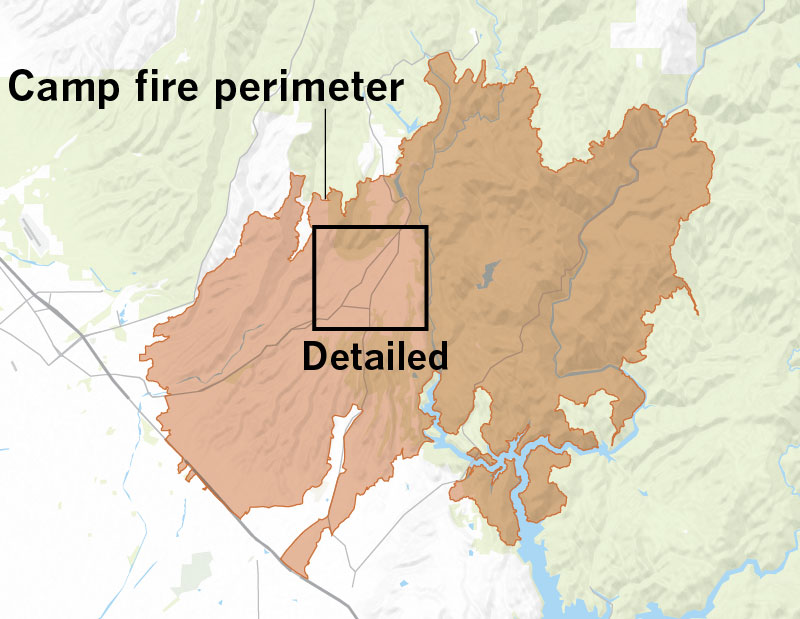
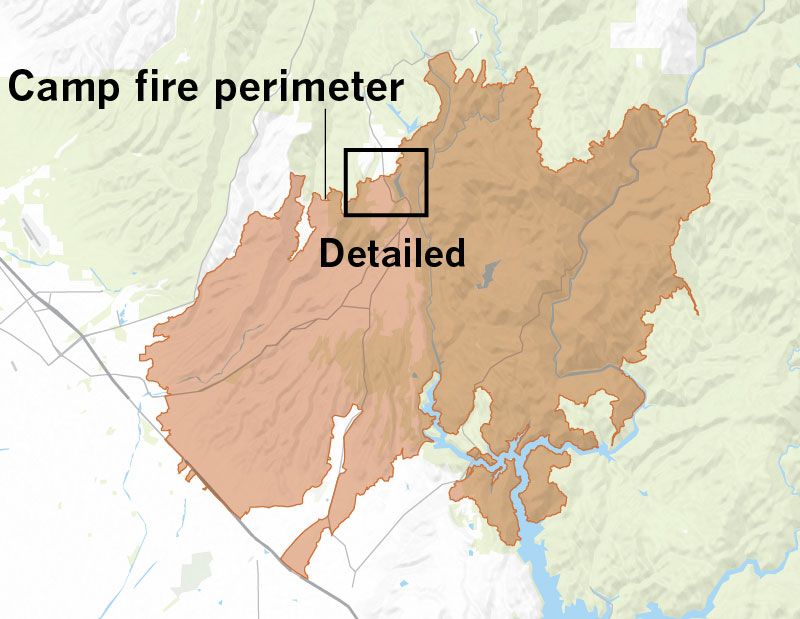
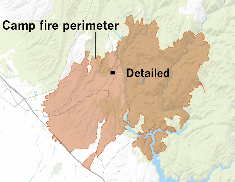
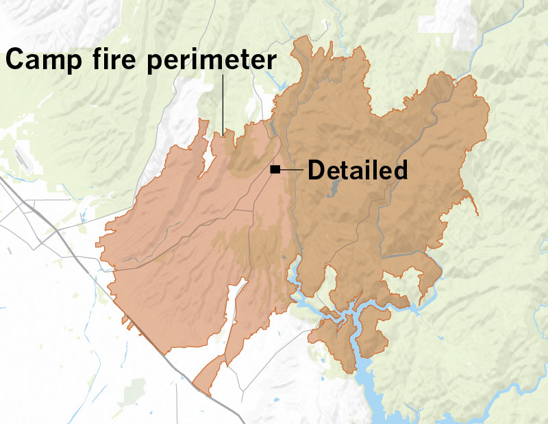
The Camp fire was the most destructive wildfire in the California’s history. Officials have identified the thousands of buildings it destroyed. Most are homes. Here’s where damaged or destroyed buildings have been identified. See Cal Fire’s map »
Buildings destroyed by the Camp fire
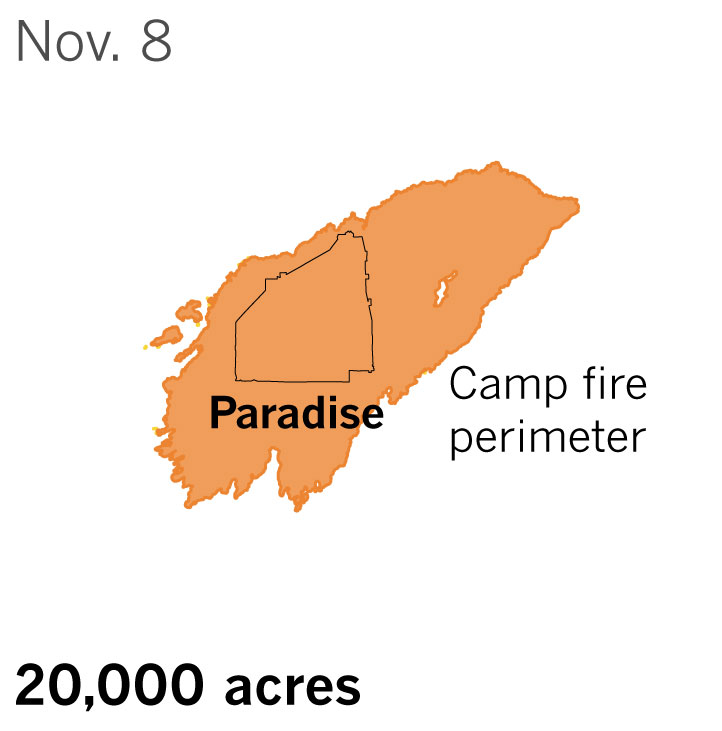
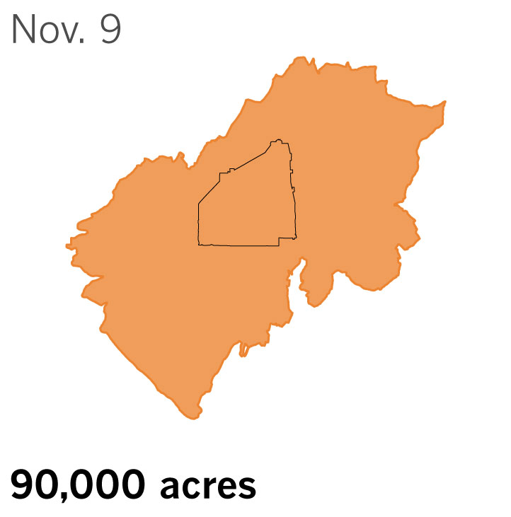
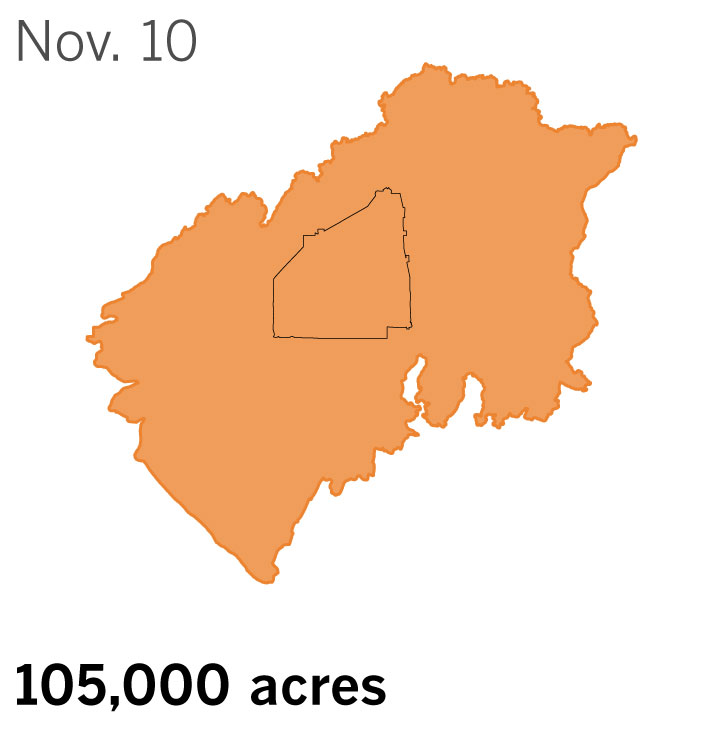
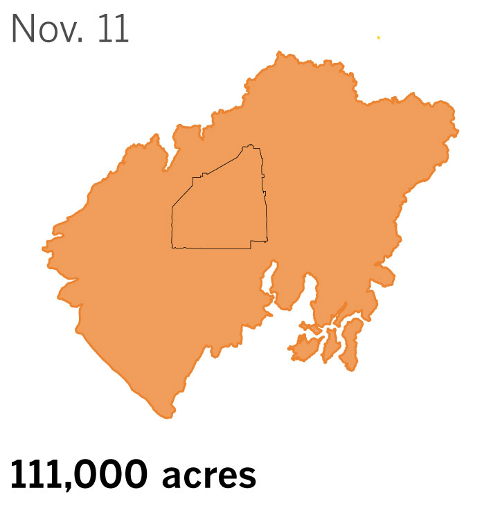
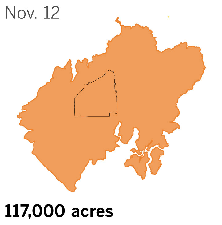
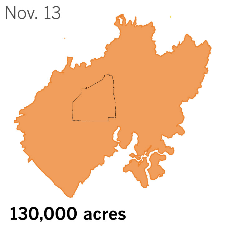
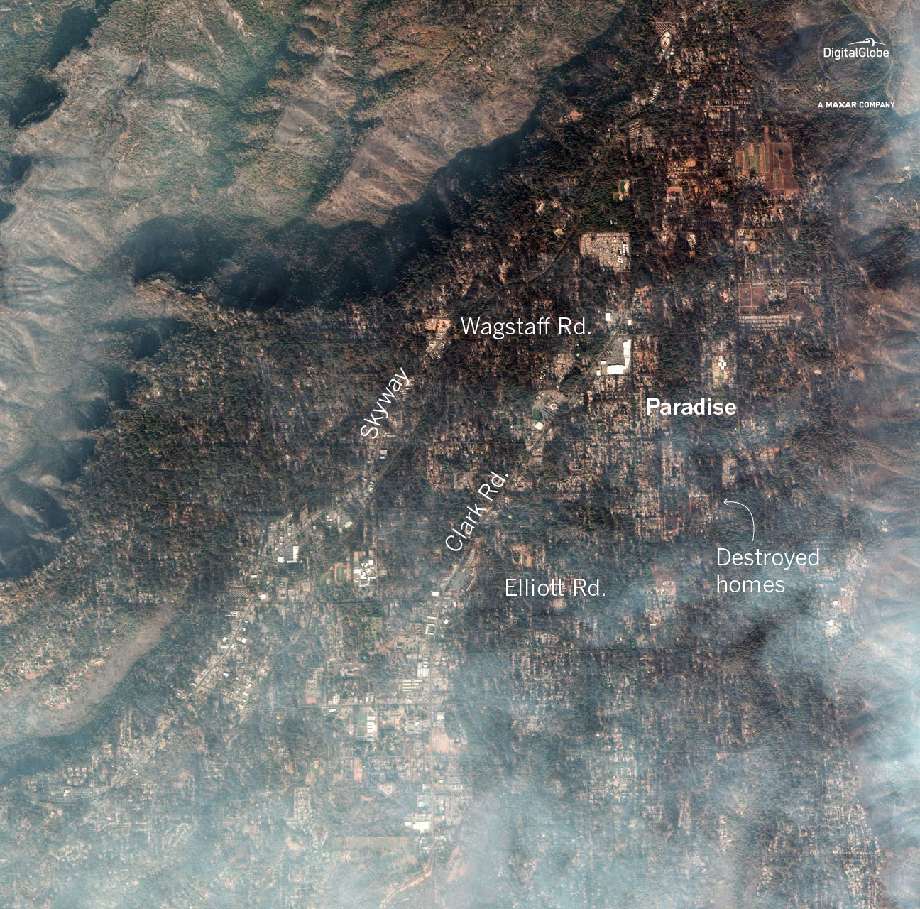
The Camp fire, which began Nov. 8, tore through the town of Paradise in Butte County, destroying and damaging thousands of buildings.
Destruction in Paradise
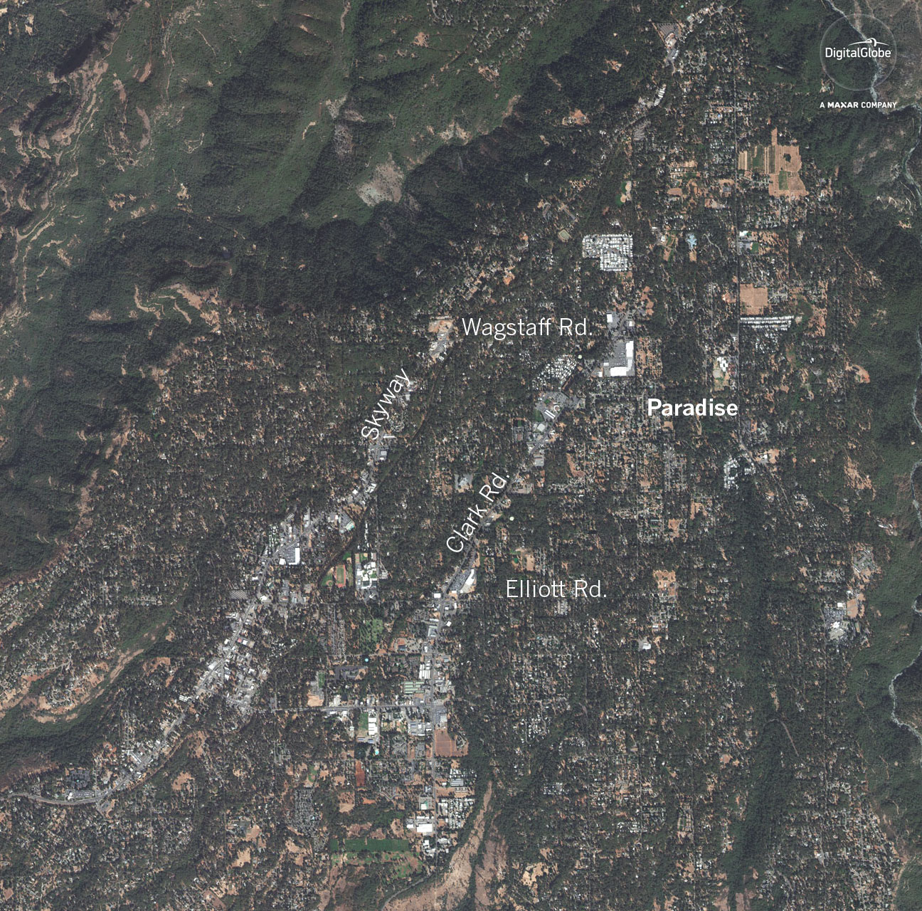
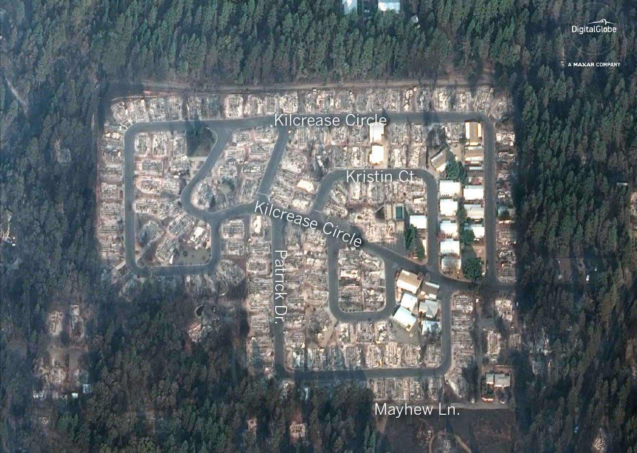
Aerial imagery taken on Nov. 18 by DigitalGlobe shows that nearly every home in Paradise was destroyed.
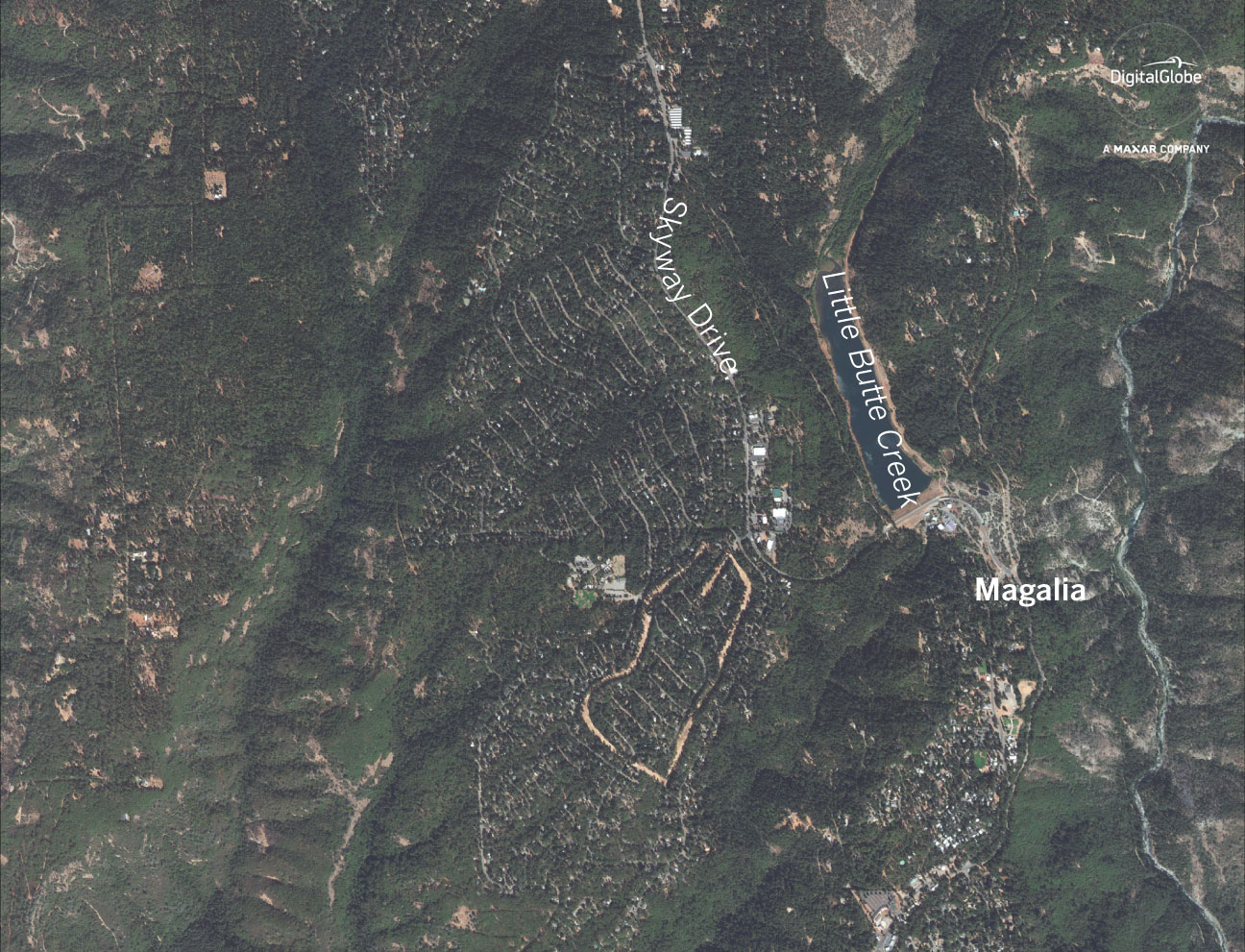
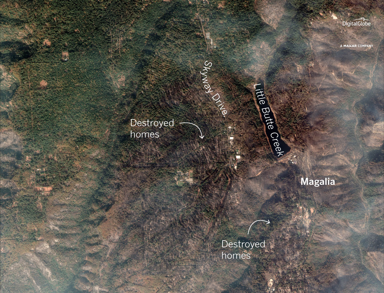
Magalia
Almost 3,000 structures were destroyed in Magalia, an unincorporated community in northern Butte County. The majority of destroyed buildings were homes.
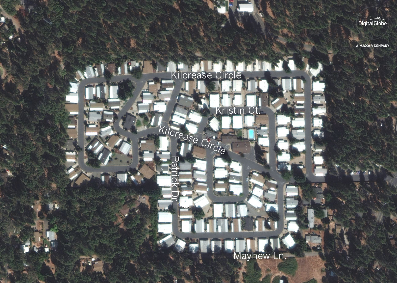
Kilcrease Circle
Some of the most visible damage in the northern part of Paradise is in Kilcrease Circle, where nearly every home was destroyed or damaged. According to data released by Cal fire, there are only fourteen homes in this neighborhood that did not sustain any damage.
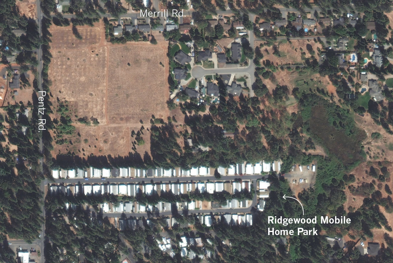
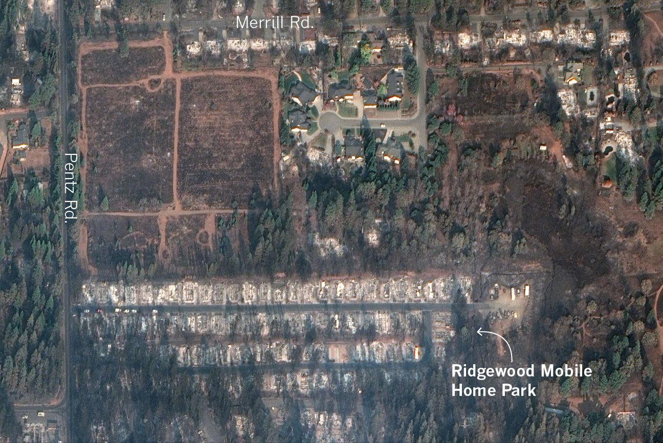
Ridgewood Mobile Home Park
The Camp fire began northeast of Paradise. Ridgewood Mobile Home Park, on the eastern side of the town, may have been one of the first neighborhoods impacted by the fire. The mobile home park was completely destroyed. According to Cal fire, not a single home was left standing.
Sources: Cal Fire, Nextzen, OpenStreetMap, DigitalGlobe