Photos before and after the Camp fire reveal a town destroyed
A McDonald’s. A gas station. Thousands of homes. Residents of the town of Paradise lost everything.
The California Department of Forestry and Fire Protection is conducting an inventory of the damage. So far the agency has found more than 15,000 buildings ruined by the Camp fire.
Throughout their investigation they’ve taken thousands of photos. Here are some of them.
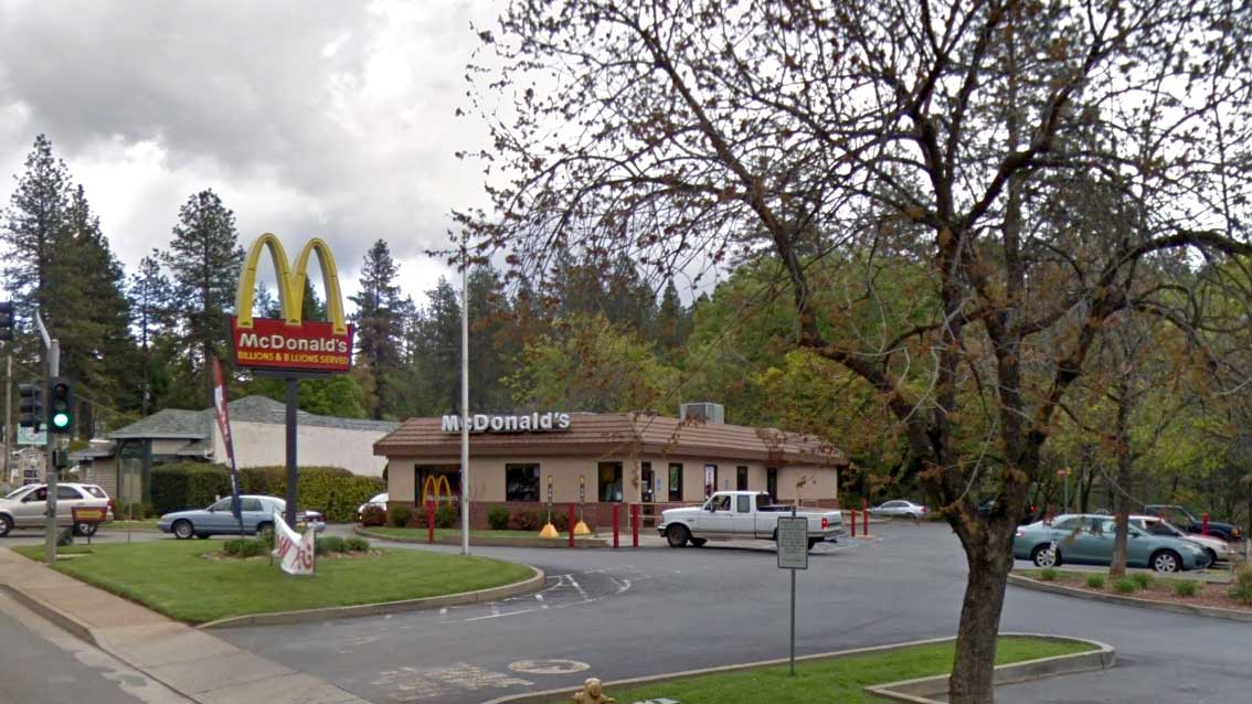
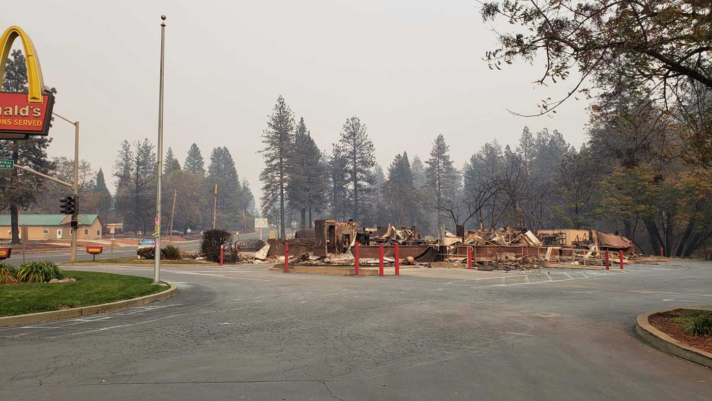
McDonald's
On Clark Road
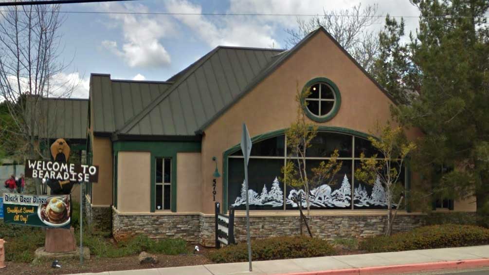
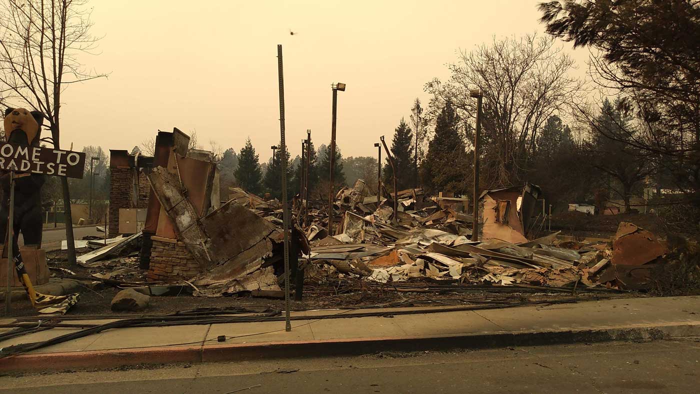
Black Bear Diner
On Clark Road south of the McDonald's
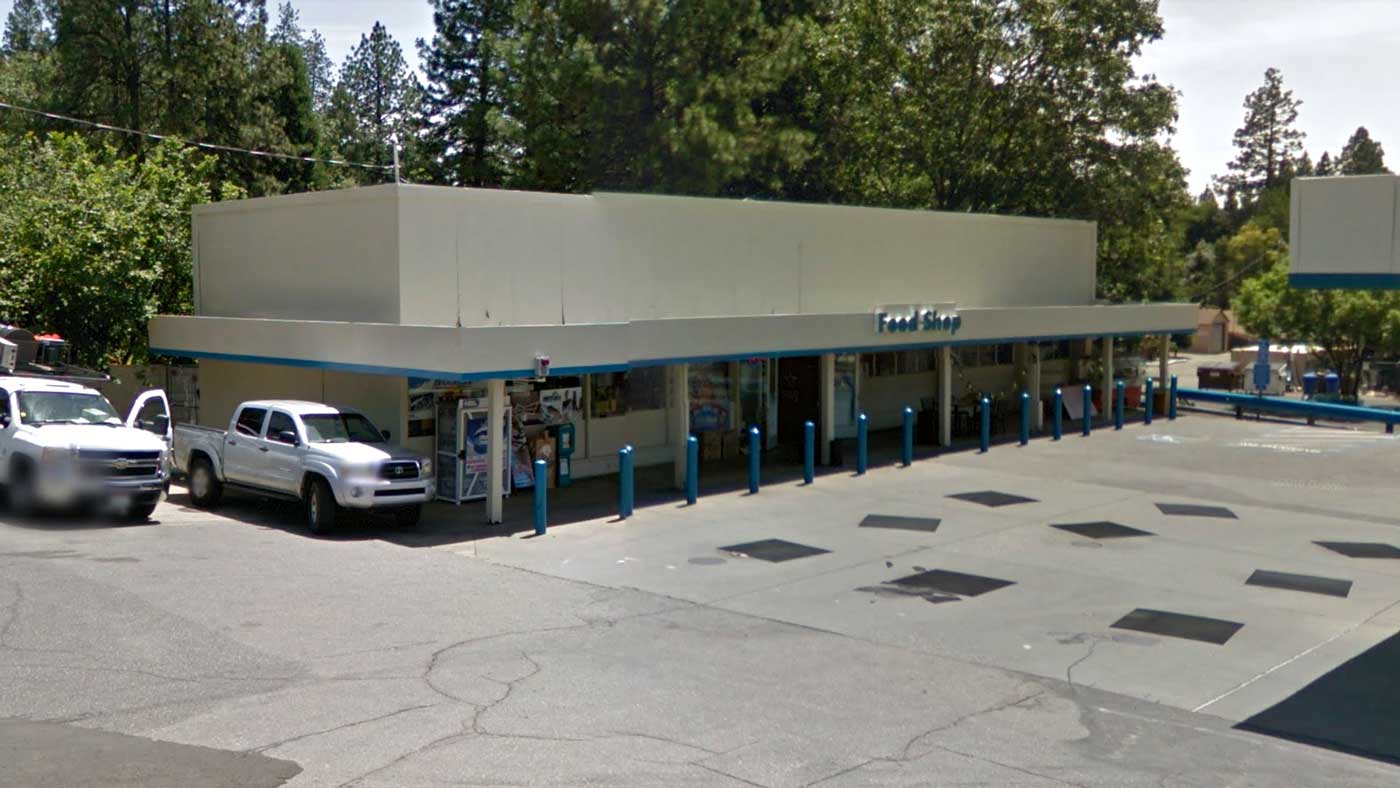
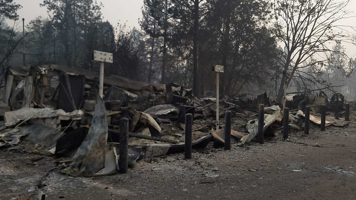
Valero gas station
At the corner of Elliott Road and Skyway
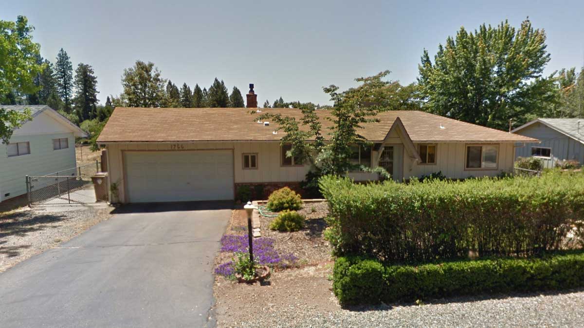
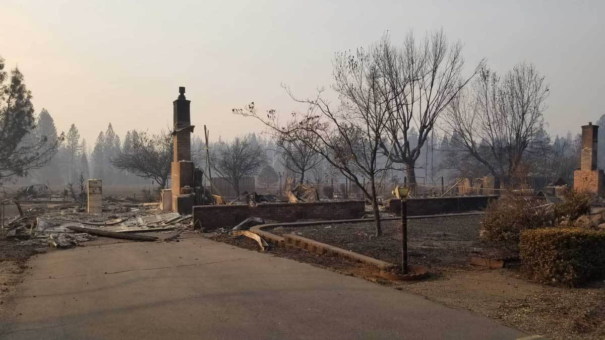
Fickett Lane
On the eastern side of Paradise
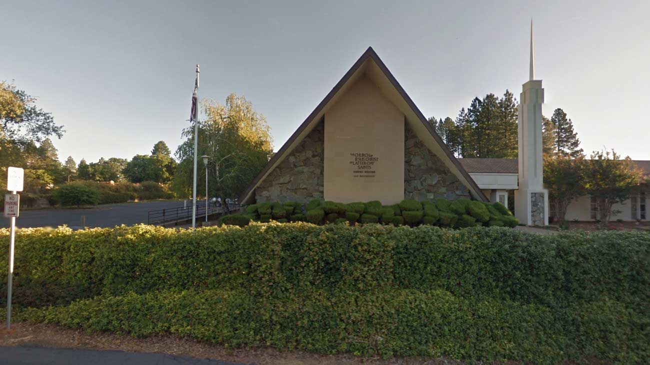
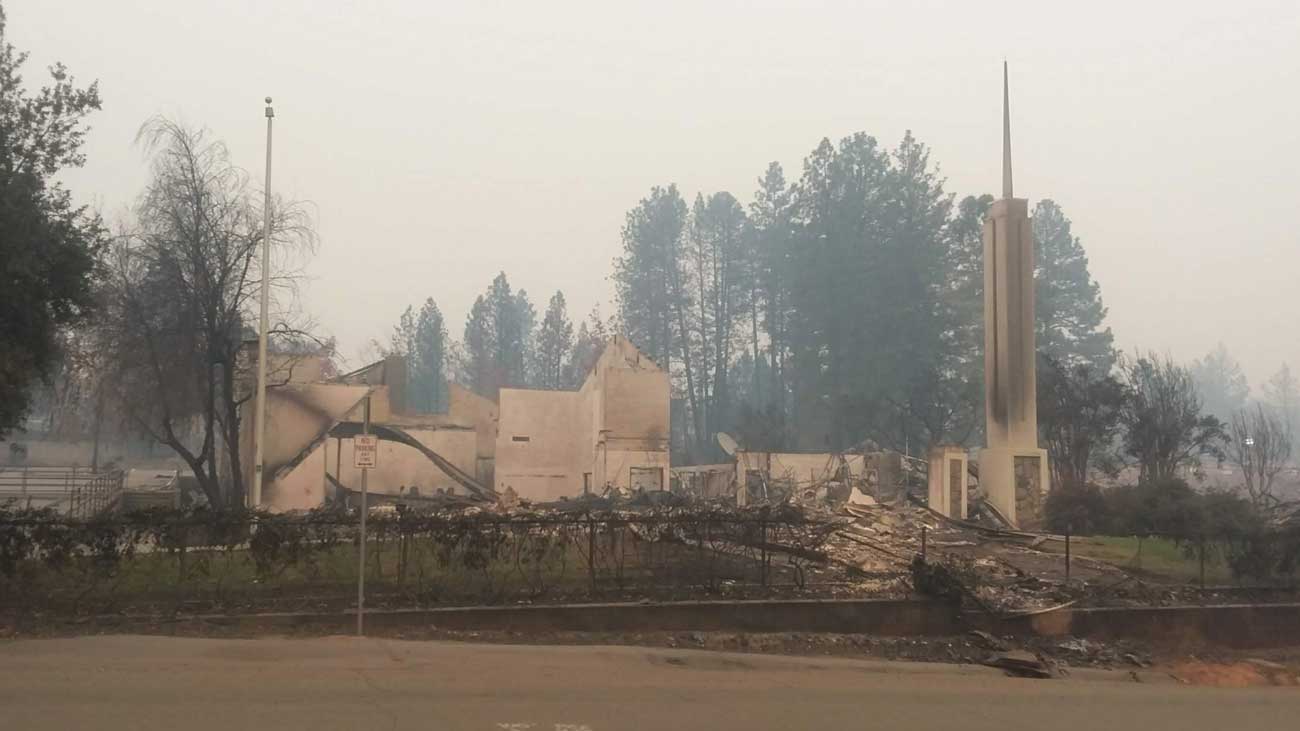
The Church of Jesus Christ of Latter-day Saints
On the corner of Buschmann and Clark roads
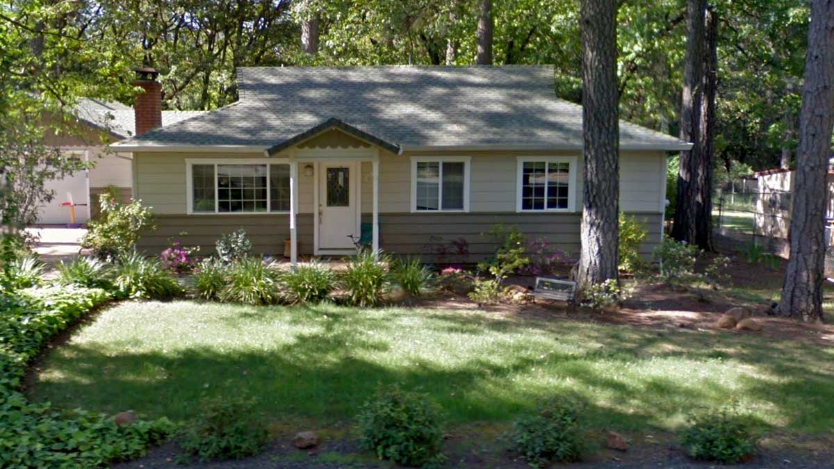
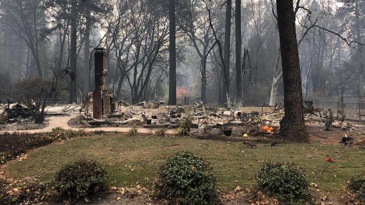
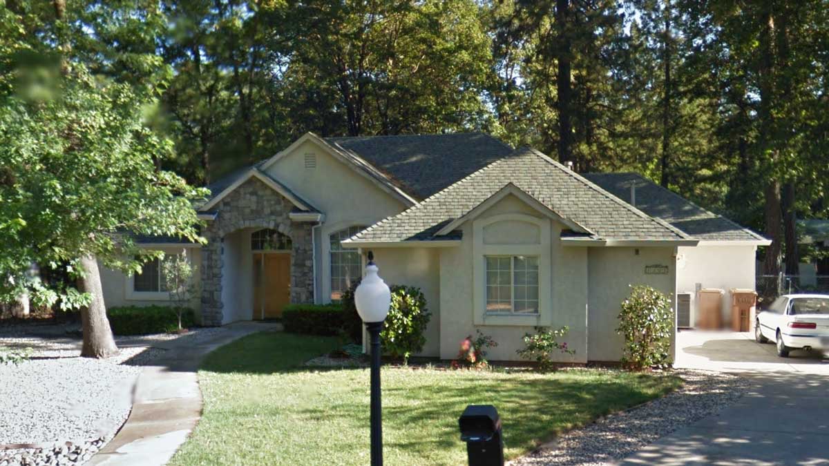
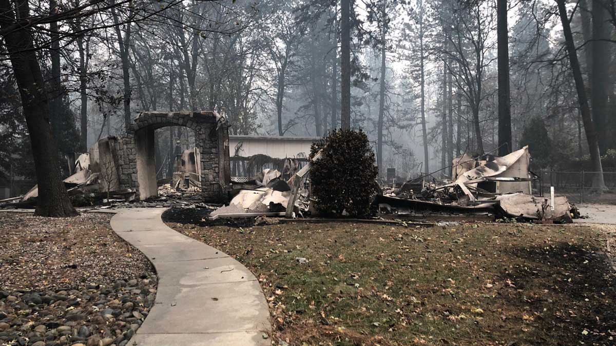
Sequoia Court
In northern Paradise
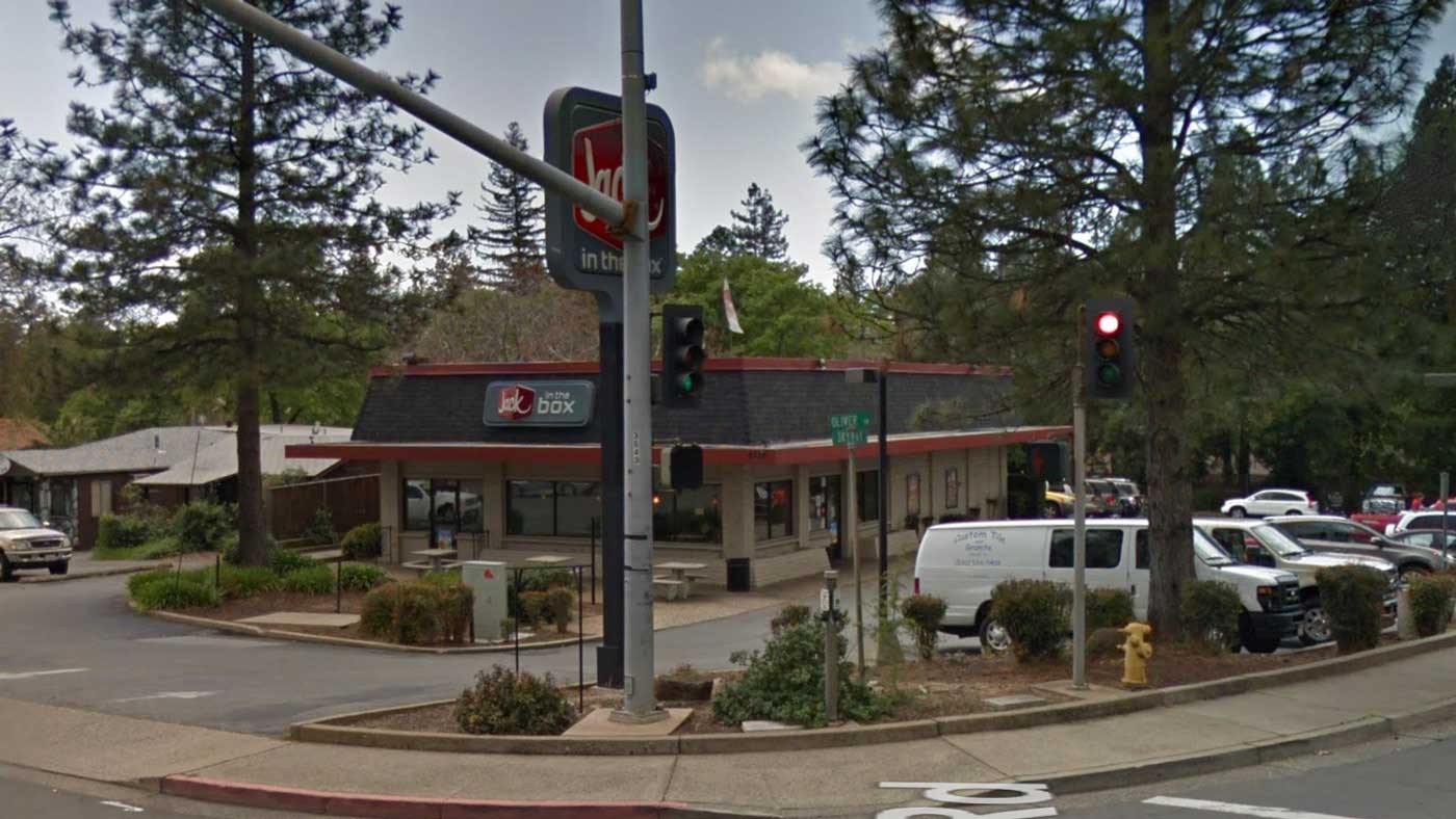
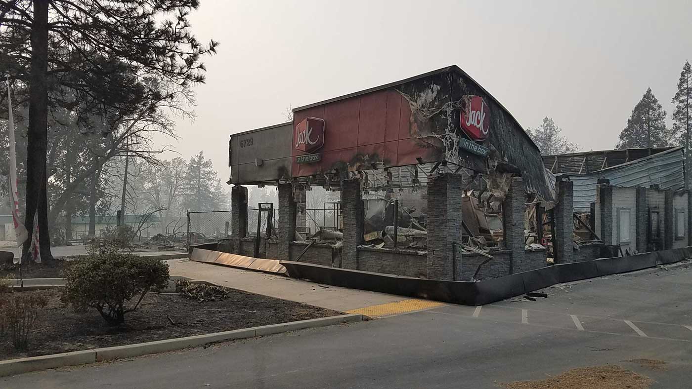
Jack in the Box
At the corner of Skyway and Oliver Road
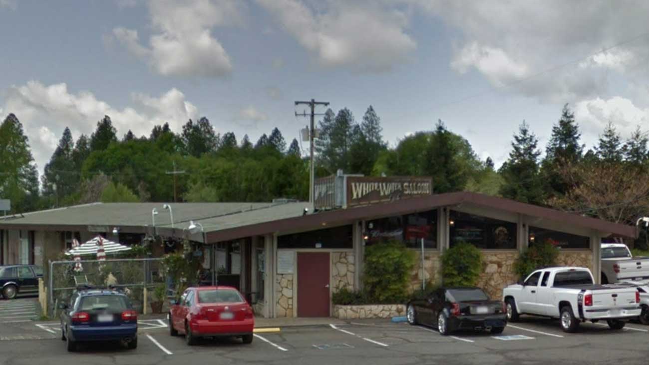
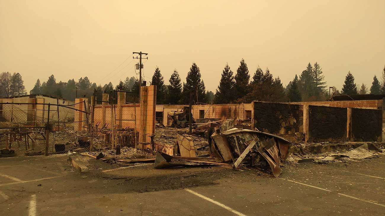
White Water Saloon
At the corner of Clark and Pearson roads
Merrill Road
In the northeastern corner of Paradise
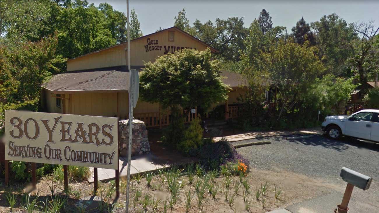
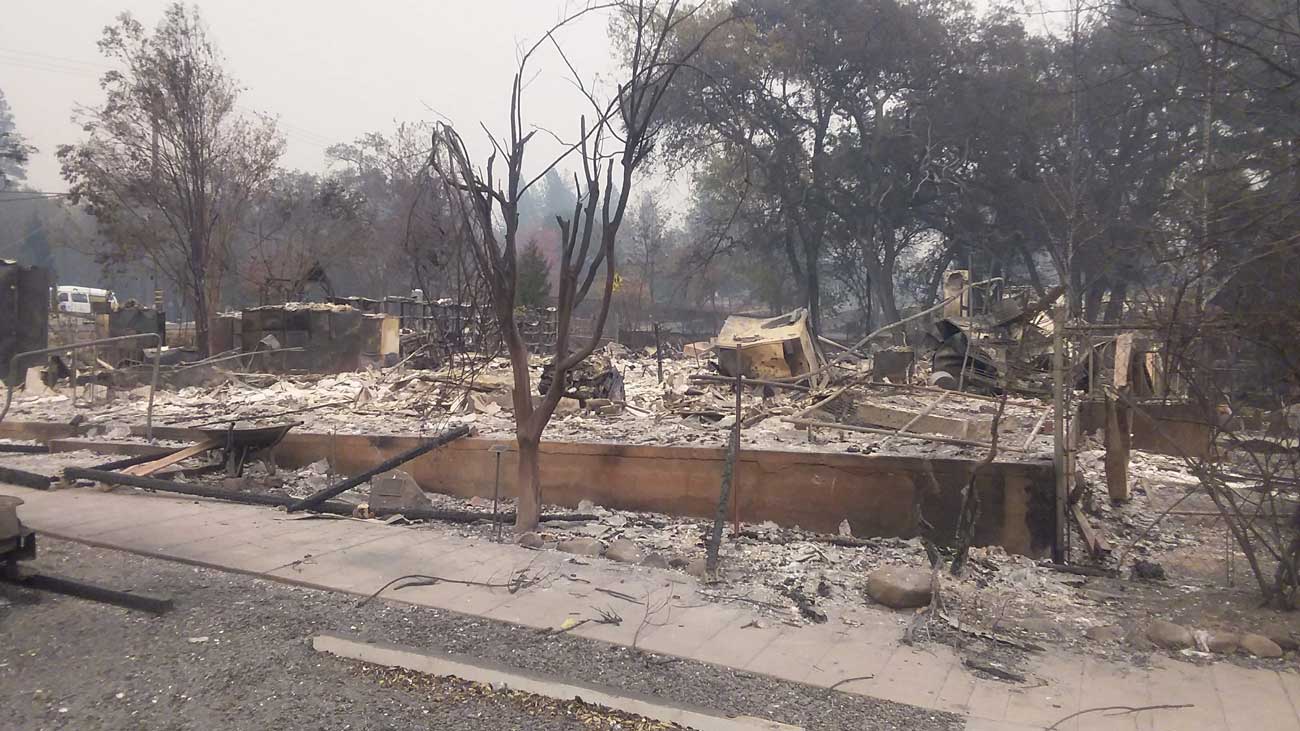
Gold Nugget Museum
On Pearson Road in the center of town
See all the photos here.