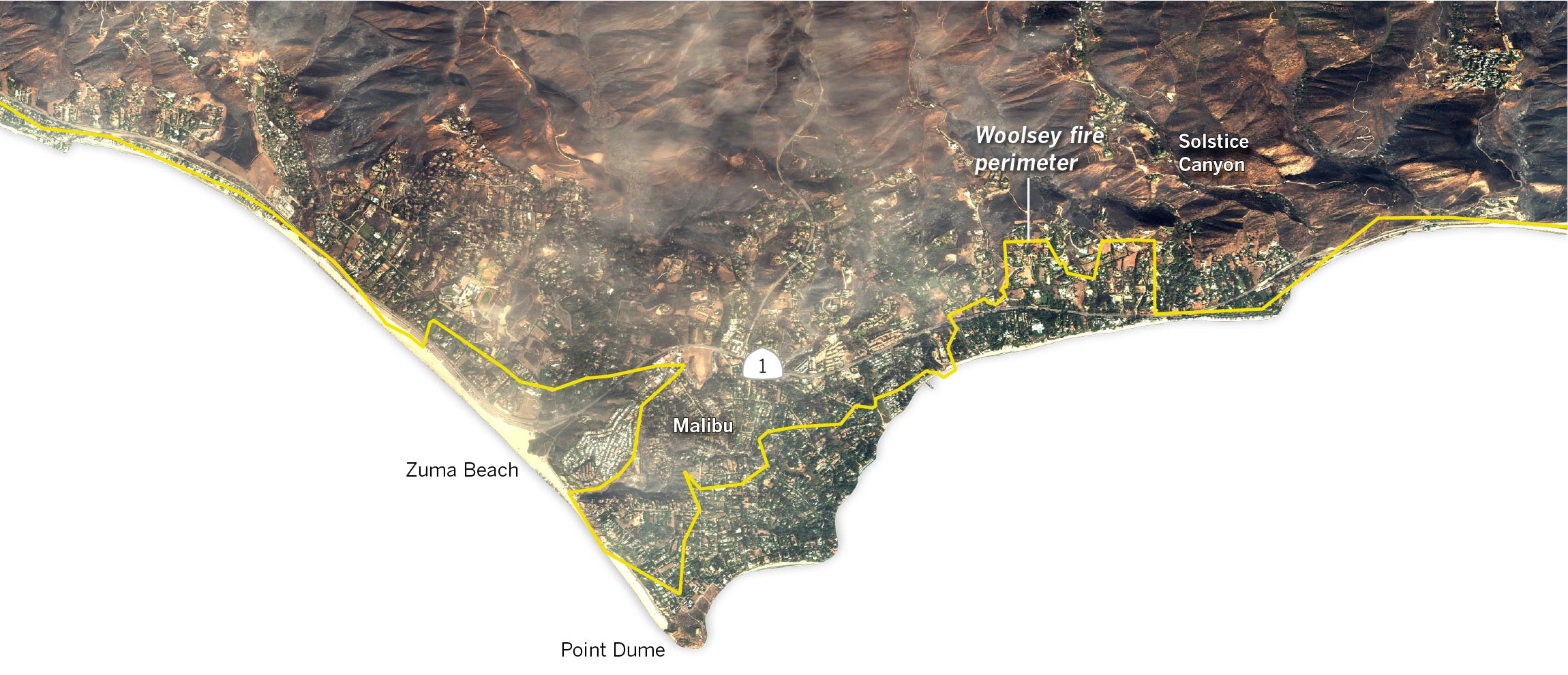
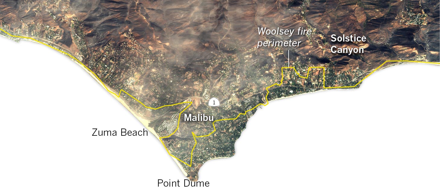
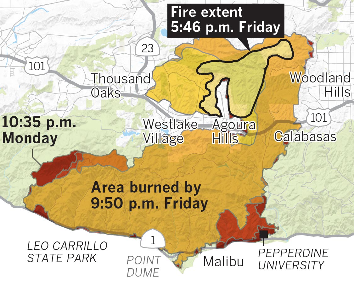
Where the fire spread
Fueled by extremely dry conditions and strong winds, the fire spread rapidly after it started north of the 101 Freeway, near Thousand Oaks and Agoura Hills. By Friday, the fire had jumped the freeway and roared through the hills of Malibu.

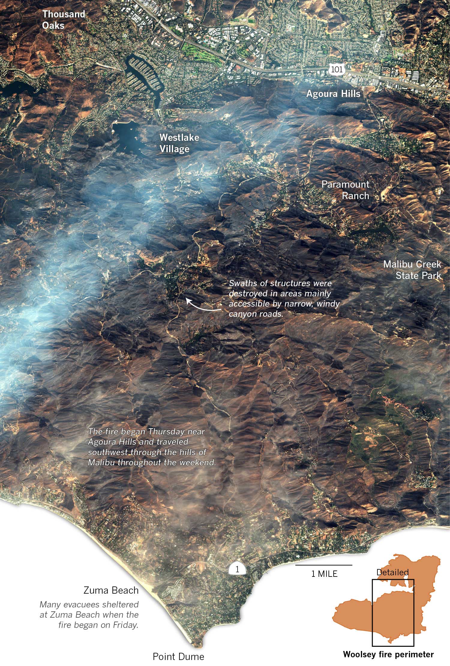
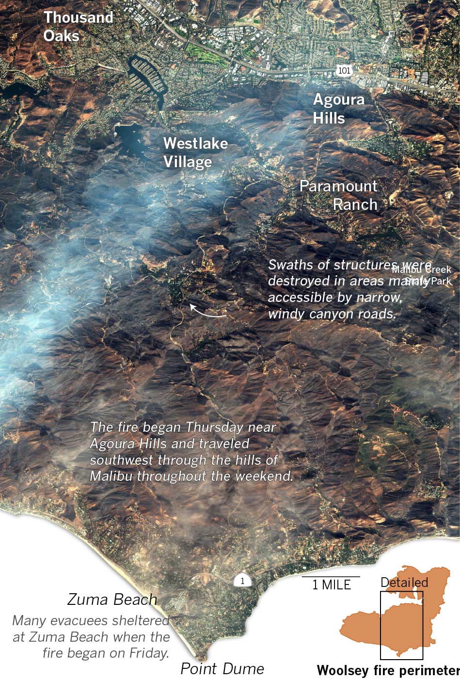
Destruction comes to Malibu
The hilly terrain in communities near Malibu and Agoura Hills suffered some of the heaviest devastation from the fire. DigitalGlobe satellite imagery shows the Woolsey fire hit areas south of the 101 Freeway particularly hard.
Among the areas left in ruin was Western Town, an Old West film set at Paramount Ranch that has been featured in several films since the 1940s.
And while the campground at Malibu Creek State Park remained largely untouched, the buildings in the back of the park are gone and the landscape was charred black beyond the parking lot.
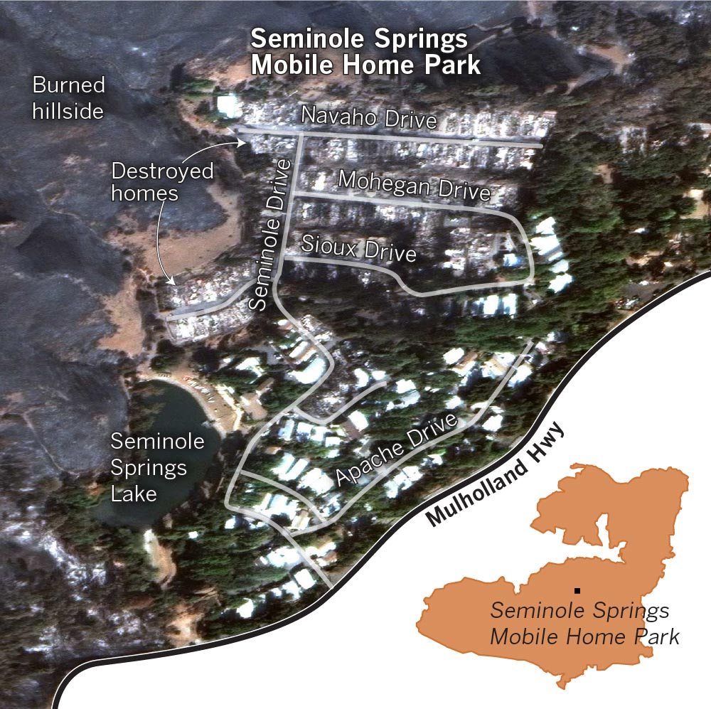
Seminole Springs
One of the clearest images of the destruction so far is from a mobile home park in the Malibu Hills, which was nearly completely leveled in the fire.

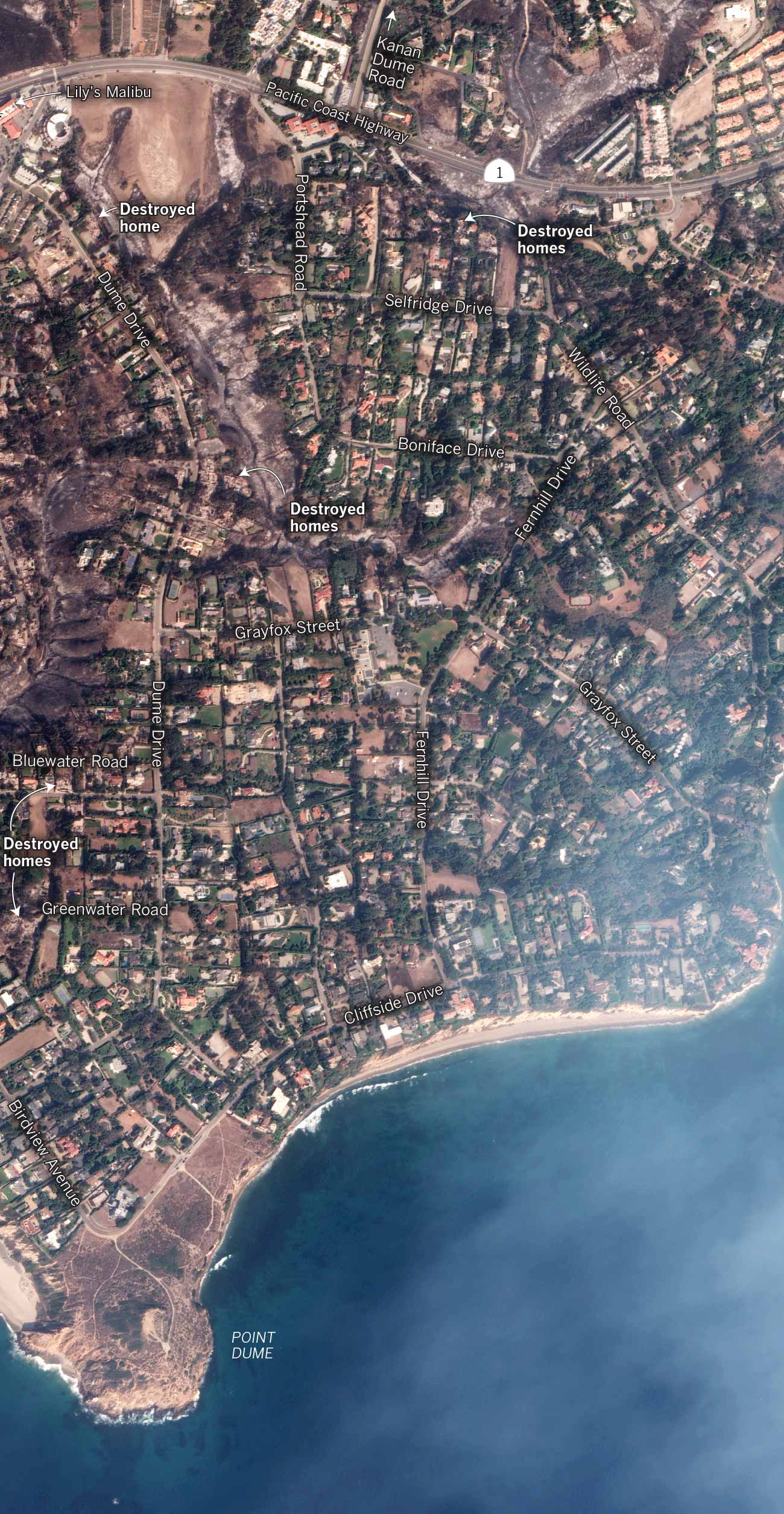
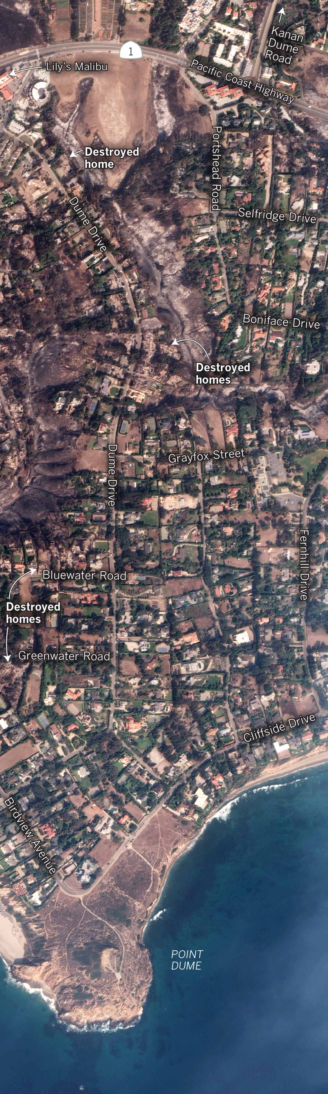
Point Dume
The fire burned south into Malibu, destroying at least 11 homes along Dume Drive as far south as Greenwater Road.