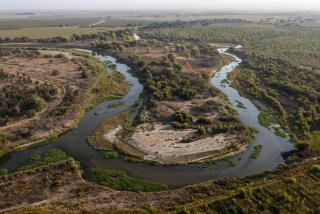
See: California’s state parks now open for virtual hikes
High-tech mapping unveiled this week allows armchair travelers to virtually hike California’s state parks.
And some of the images captured over the course of three months are spectacular, especially if you have a nice, big screen. It was a partnership between Google and California parks that brought about the interactive maps.
Google has mapped 14 of California’s state parks. See five of them above. The images are accessed just as you would access roads using Street View. Go to Google Maps or the California Department of Parks and Recreation site.
Google’s Trekker put the street view camera system onto a wearable backpack, snapping photos as the wearer hiked.
Elizabeth Goldstein of the California State Parks Foundation told the L.A. Times: “Information is key for people who are not active users of state parks. You want to know what a place is like.”
Lace up your hiking boots and follow me at @AmyTheHub
More to Read
Start your day right
Sign up for Essential California for news, features and recommendations from the L.A. Times and beyond in your inbox six days a week.
You may occasionally receive promotional content from the Los Angeles Times.


