State parks team with Google to attract a new generation of visitors
- Share via
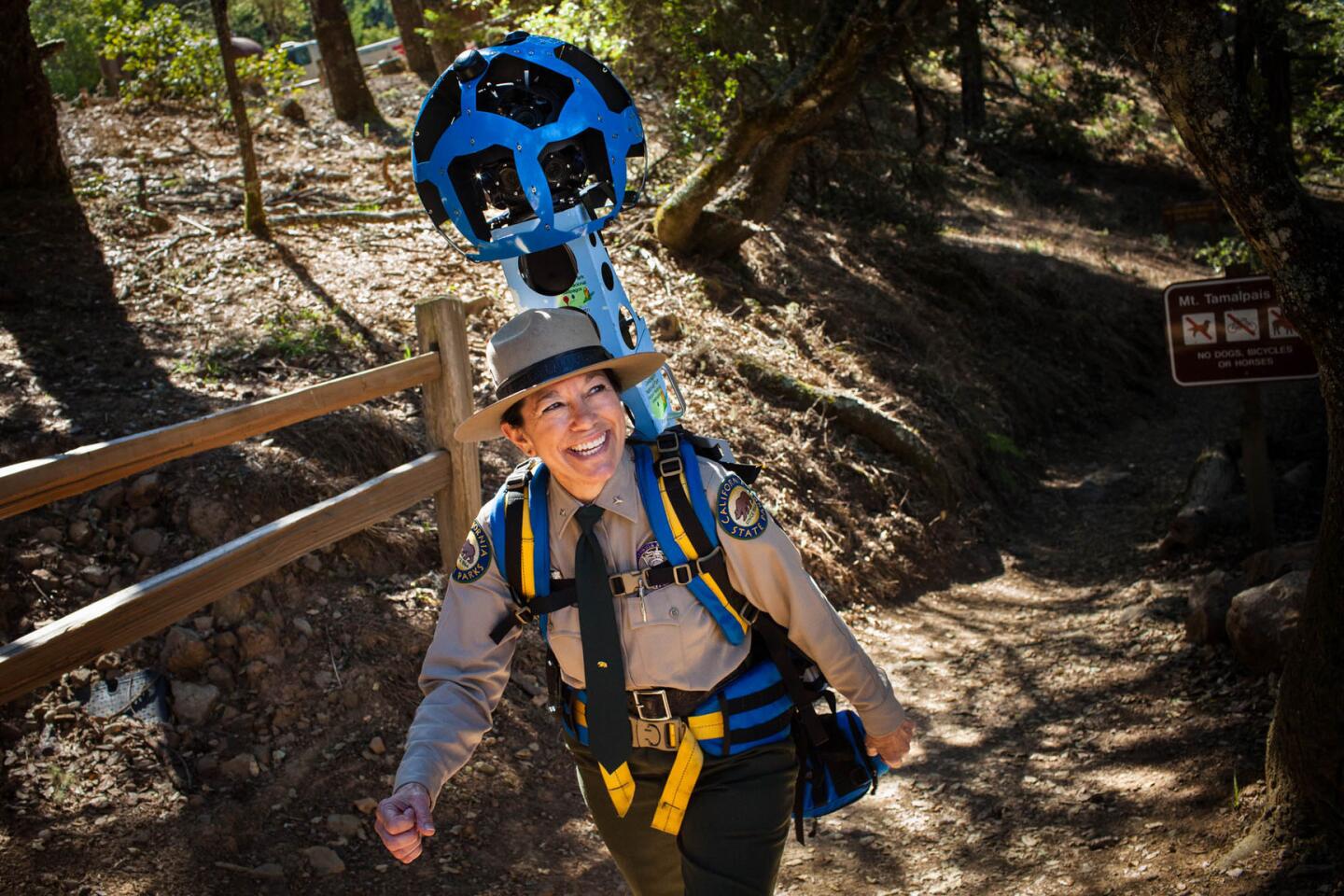
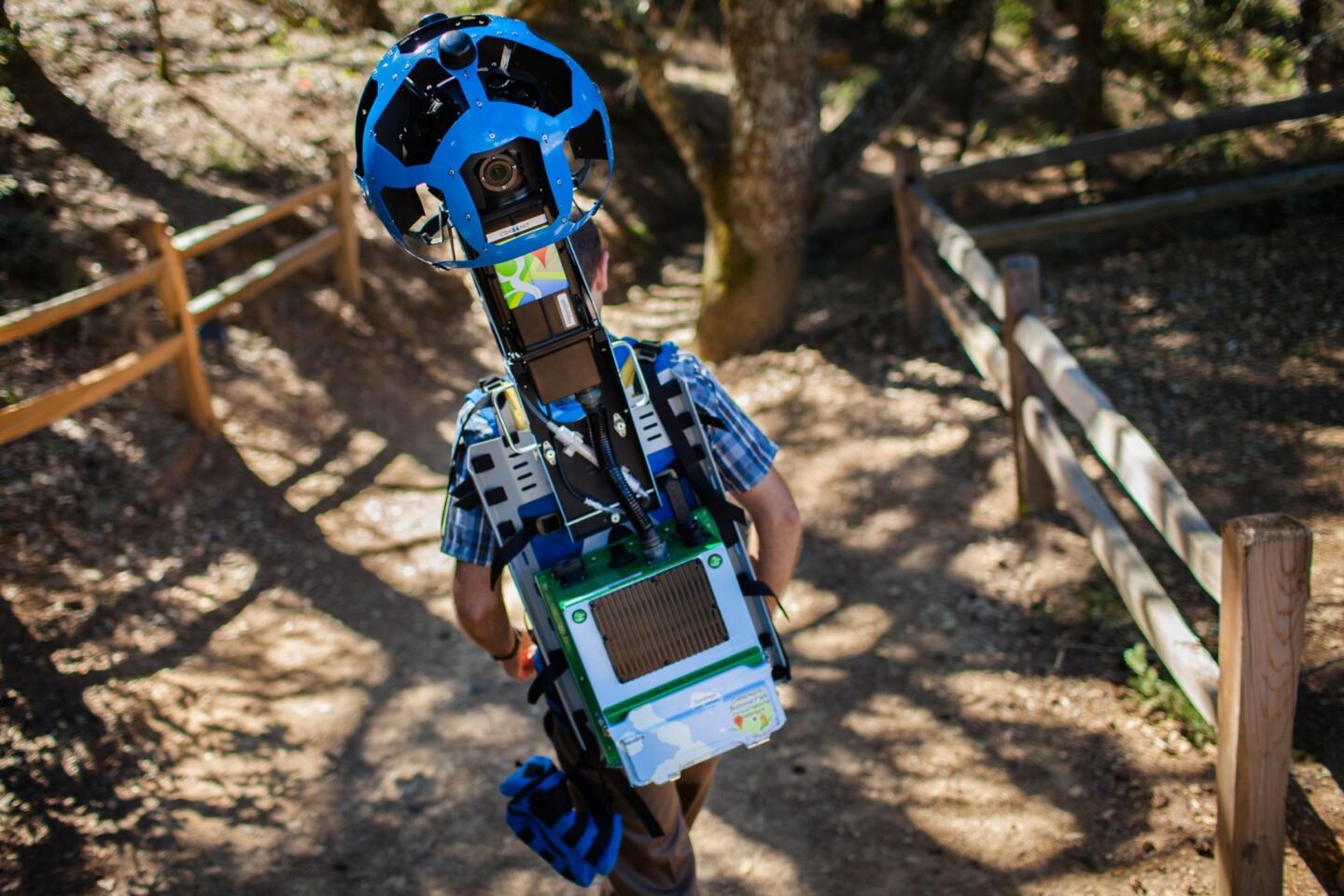
SACRAMENTO — — Three months ago, a group of Google contractors began walking the trails of California parks wearing electronic equipment that jutted above their heads and sprouted cameras from metal globes.
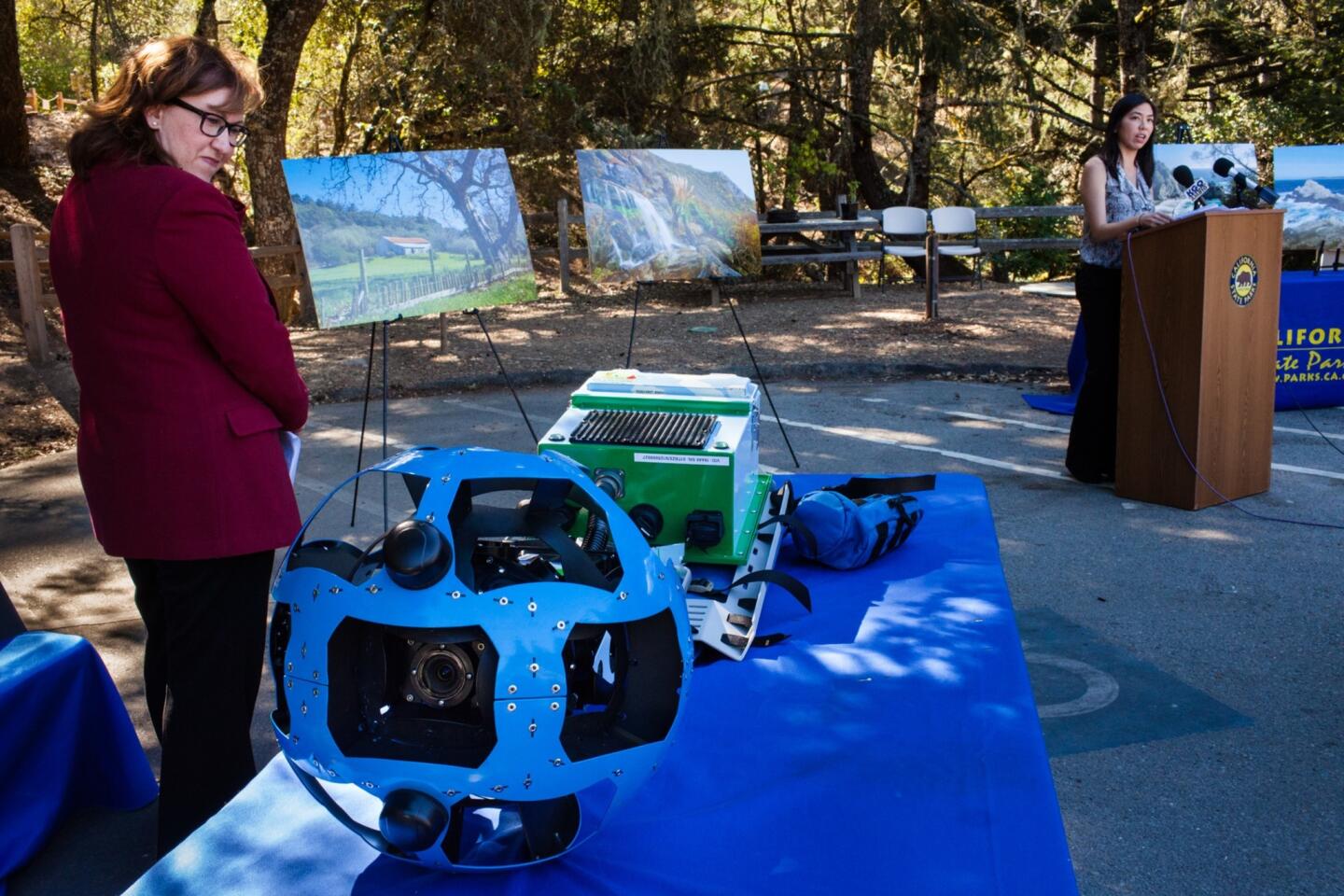
They traversed San Francisco Bay Area beaches, hiked through the redwoods of Big Sur and trudged to the top of Marin County’s scenic Mt. Tamalpais while the cameras captured a continuous stream of images. The result: online maps that enable Internet users to virtually explore more than a dozen state parks.
The high-tech mapping unveiled Tuesday is part of an extensive makeover — an attempt by the state Department of Parks and Recreation to draw new people and revenue after years of stagnation, internal turmoil and financial scandal.
Officials responsible for preserving some of California’s most beautiful and historic sites want to show they can adapt to a wired world and appeal to a new generation of potential visitors.
“Years from now, when we look at the parks system, this is the time when we had the opportunity to make great change,” acting parks director Lisa Mangat said.
Other innovations are being tried as well. An experiment at some state beaches in Orange County enables visitors to pay for parking with smartphones, eliminating the need to slog across the sand to feed quarters into expired meters. Architecture students have designed new park cabins for people who wouldn’t consider sleeping in a tent. And a firm specializing in data visualization is developing software to make it easier to find outdoor activities around the state.
“There are many good signs of real energy and revival,” said Jon Christensen, a UCLA senior researcher focused on environmental issues who is working on the software.
The catalyst for the introspection and subsequent changes was an accounting scandal in 2012, when officials discovered millions of dollars hidden in a department account at a time when parks were being threatened for closure by budget cuts.
The director, Ruth Coleman, was forced out and replaced by a former Marine major general, Anthony Jackson. He retired in May, after a year and a half on the job, and Mangat took his place.
Even after the accounting scandal was sorted out, other issues remained. An independent group created by the Legislature, the Parks Forward commission, issued a draft report in April saying the department “has not been able to keep pace with the times.”
Lance Conn, a co-chair of the commission, compared the parks system to a car that never got an oil change. A Bay Area businessman who enjoys taking his three sons on outdoor trips, it bothered him that California’s entrepreneurial spirit wasn’t rubbing off on state parks.
“This is the white-hot center of innovation,” Conn said. “We should be applying that to some of our natural treasures.”
Now the state is starting to catch up. By the end of the year, officials plan to nearly triple the number of parks where visitors can pay for parking or entrance fees with credit cards.
Brian Ketterer, a parks district superintendent in Orange County, has already taken the next step by allowing payments via smartphone. The system is online at Huntington, Bolsa Chica, San Clemente and San Onofre state beaches.
“Although the state parks can be seen as technology deficient, I think when there is a good idea, we’re finding that people want to know how it works and how it can be implemented statewide,” Ketterer said.
The partnership with Google Inc. is another attempt to bring technology into the parks system. The mapping was done for free with equipment known as the Google Trekker, which was first used at the Grand Canyon in October 2012.
So far, Google has mapped 14 state parks in California and is considering expanding the initiative to other locations. Users can access the images just like they would examine roads using the company’s Street View feature.
“Our goal is to create the most comprehensive and accurate and useful map as possible,” said Deanna Yick, a program manager for Google Maps. “When the road ends, it doesn’t mean there isn’t more to explore.”
Supporters hope the images will whet the appetite of Californians who wouldn’t otherwise lace up their boots for a day of hiking.
“Information is key for people who are not active users of state parks,” said Elizabeth Goldstein, president of the California State Parks Foundation. “You want to know what a place is like. You want to prepare in advance.”
That’s also the idea behind a mobile application being developed by Stamen Design in San Francisco with the support of the Resources Legacy Fund, a conservation group in Sacramento.
The goal, Christensen said, is a unified system in which people can search for activities at all kinds of parks, whether they’re run by local, state or federal government.
“It’s really important to connect a new generation to California parks,” he said. “We know that generation is very technologically adept and socially connected.”
Members of that generation helped design new cabins for the parks system as part of an architecture class at Cal Poly Pomona. When the class began, some of the students had never been camping — the target audience for the structures.
The most popular design became known as “the wedge.” The structure is rustic, without electricity or plumbing, but has a more modern look, with a slanted roof and large windows to let in light.
Officials are exploring how to start erecting the cabins in state parks.
“These creative ideas point in a new direction, and shows that the Department of Parks and Recreation is open to new ideas,” said Michael Woo, dean of the College of Environmental Design at Cal Poly Pomona.
Twitter: @chrismegerian
More to Read
Sign up for Essential California
The most important California stories and recommendations in your inbox every morning.
You may occasionally receive promotional content from the Los Angeles Times.


