U.S., Mexico to install quake sensors in two border city areas
In an unusual international partnership, the U.S. Geological Survey and U.S. Department of Defense on Wednesday announced a half-million-dollar investment to install 11 earthquake monitoring machines in the Mexicali and Tijuana areas after last year’s Mexicali earthquake revealed huge gaps in quake detection.
U.S. and Mexican officials said the monitoring equipment is critical so scientists can identify the worst-hit areas within minutes after a quake and tell authorities where to send emergency crews.
“Earthquakes have no borders. We share common faults along that area. And hopefully this network will contribute to saving lives and property,” said Robert Mackay, chief of a humanitarian assistance branch of the U.S. Northern Command, a division of the Defense Department.
Outdated quake detection equipment in Mexico last year meant that hours went by before officials knew exactly where the worst-hit areas were. Officials are also aiming to make U.S. and Mexican quake-monitoring systems compatible with each other. The upgraded Mexican system also could be used as a backup in the event the U.S. earthquake-monitoring system fails during a major quake.
“We basically have a big blind spot to the south — unless we can get data from the Mexican network. So that allows us to expand our ability to see what’s going on,” said Doug Given, coordinator for the Southern California Seismic Network.
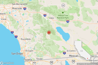
Immediately after last year’s Sierra El Mayor 7.2 earthquake on Easter, U.S. scientists could only guess exactly where the epicenter was. Then, as the aftershocks developed, officials could see only the hazy area where the aftershocks were happening, rather than precise locations that would have shown which fault was responsible for the quake and which direction the aftershocks were headed.
Because they did not have sensitive equipment, Mexican authorities missed an early opportunity to identify the areas that suffered the worst shaking, said Roberto Quaas Weppen, director general of the Mexican National Center for Prevention of Disasters.
Knowing exactly where quakes are happening is important for scientists, because a quake could begin in Mexico and travel northward into California through aftershocks. “In fact, a year ago, we were a little worried that that might be happening,” Given said. With the current equipment, “the situational awareness of what’s going on is not there.”
“Without instrumentation, how do you know what’s gone on? All you know is, gosh, something bad happened in Mexicali,” Given said. The sensors will give scientists the ability to quickly locate which neighborhoods — on both sides of the border — suffered the worst shaking.
Southern California faced problems before it was equipped with sensitive seismic sensors. For instance, during the 1971 Sylmar earthquake, authorities first focused on the mountains north of the San Fernando Valley, which was the epicenter of the quake, before they understood that the fault ruptured southward toward populated areas, Given said.
“It was hours before people really recognized the extent of the damage in places like the veterans hospital, because they were all up in the mountains looking for the fault,” Given said.
Given also said that because the public Internet will go dark after a big earthquake, it’s essential for the Mexican quake system to be linked with satellites to keep data flowing after the Big One.
The $500,000 investment in the program came from the U.S. Northern Command, which was created after the Sept. 11 attacks to coordinate natural disaster relief operations domestically and in neighboring countries.
The Mexican government is separately spending $50 million to upgrade its own earthquake-monitoring system.
More to Read
Start your day right
Sign up for Essential California for news, features and recommendations from the L.A. Times and beyond in your inbox six days a week.
You may occasionally receive promotional content from the Los Angeles Times.


