January will end on a dry note in Southern California as the jet stream locks into a zonal pattern

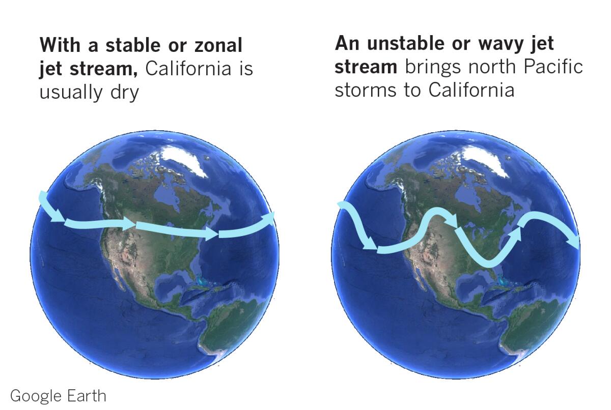
January will continue to be dry in Southern California as the jet stream settles into a stable or zonal pattern, which means it flows more directly from west to east with little fluctuation. A wavy or undulating jet stream is the pattern that brings storms from the north Pacific into California.
“When the winter jet stream calms down, Southern California stays dry,” says Bill Patzert, former climatologist at NASA’s Jet Propulsion Laboratory.
When the jet stream is unstable, it meanders from north to south and back again. Cold air sinks farther south and warm air is carried into higher latitudes. A wavy jet stream can snag wet storms from the Gulf of Alaska and send them on a collision course with the California coast.
January’s rainfall has been unimpressive to date, and Jan Null, veteran meteorologist with Golden Gate Weather Services, agrees that the last week of the month looks relatively dry. Seasonal precipitation totals for Northern and Central California continue to fall behind normal.

Of particular concern is the Northern Sierra 8-Station Index, which is at 67% of seasonal normal, as of Thursday. The index is the average of eight precipitation measuring sites that provide a representative sample of the Northern Sierra’s major watersheds. These watersheds include the Sacramento, Feather, Yuba and American rivers. These rivers flow into some of California’s biggest reservoirs, providing a large portion of the state’s water supply.
Going farther south, as of Thursday the 5-station index for the Central Sierra is at 54% of normal, and the 6-station index for the Tulare Basin and the Southern Sierra is at 58% of normal, according to Golden Gate Weather Services.

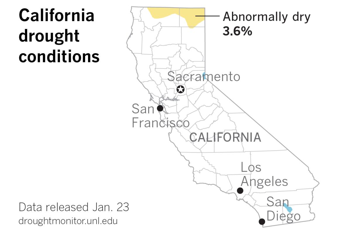
The most recent Drought Monitor, released Thursday, continues to show just 3.6% of the state as abnormally dry. This has remained unchanged for weeks. But does that mean the state is really out from under drought conditions?
“Drought is more than recent snowpack and rainfall,” Patzert warns. “Groundwater levels are dangerously low in many areas. Without more winter rain and snow, we could easily slip back into drought.”
Patzert says January has been a flop as far as rain is concerned. “Hopefully, we’ll have some excitement in February and March.”
More to Read
Sign up for Essential California
The most important California stories and recommendations in your inbox every morning.
You may occasionally receive promotional content from the Los Angeles Times.


