Hurricane Sandy churning in Atlantic; outer bands roil Florida
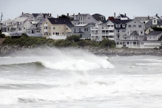
Rain in Florida and beach erosion are the first effects from deadly Hurricane Sandy, still more than 200 miles off the coast of the United States and expected to make landfall sometime on Tuesday, officials said Friday.
“We expect the storm to make landfall sometime Tuesday, but we don’t know exactly where,” meteorologist and public affairs officer for the National Oceanic and Atmospheric Administration said by telephone from Florida. It is also too soon to predict how strong it will be when it arrives, he said.
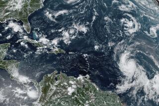
Sandy was pummeling the Bahamas Friday and has left 39 people dead across the Caribbean, according to the Associated Press. It is about 250 miles southeast of Cape Canaveral, Fla., and is a Category One hurricane, carrying maximum sustained winds of 80 mph, according to NOAA’s projections. It is moving north at about six miles an hour.
PHOTOS: En route to Frankenstorm
The latest forecast has Sandy remaining a Category One hurricane as it cross the Atlantic Ocean, expected to be 250 miles from Florida by Saturday morning and less than 200 miles from North Carolina by Sunday night.
It is projected to make landfall around New Jersey by Tuesday where it could meet up with two other storms, one from the west and cold air from Canada to make a large storm – dubbed a Frankenstorm by forecasters -- that bring winds and pelting rain through the Mid-Atlantic state up to New England.
Exactly where the storm lands is less important than the size of the area effected by winds, Feltgen explained. “As far as wind is considered, this is a large storm at this time and the wind is covering a large area,” he said.
PHOTOS: Good names for bad storms
In the last 24 hours, Florida has received one to three inches of rain with some areas receiving up to six inches, he said. There have been problems with beach sand moving onto highways near Fort Lauderdale, he said.
As Sandy moves north, the rain in Florida is expected to taper off markedly, he said.
A tropical storm warning remains in effect for parts of Florida’s east coast and a tropical storm watch is in effect for parts of North Carolina, according to NOAA. A warning means that tropical storm conditions are expected while a watch means the conditions are possible. Both are lesser stages than a hurricane warning or watch.
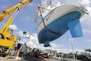
Of greater concern is what happens when Sandy meets up with the other storms, as forecast, and threatens the populous Northeast. Officials have already activated emergency centers throughout the region and have put utilities on standby to deal with possible outages.
Friday morning, President Obama was briefed by telephone on preparations, the White House announced. Attending the briefing were FEMA Administrator Craig Fugate, National Hurricane Center Director Dr. Rick Knabb and Homeland Security advisor John Brennan. Obama directed FEMA “to ensure that all available federal resources are being brought to bear to support state and local responders,” according to the White House.
The Red Cross also announced that it was “mobilizing volunteers, shelters, relief supplies and disaster vehicles,” Charley Shimanski, senior vice president of Disaster Services for the Red Cross, said in a prepared statement. People have been urged to update their disaster plans and store water and supplies in the event of power outages.
ALSO:
Colorado man: ‘Kill Obama’ message on home was vandalism
Nanny suspect in stabbings: Mom finds a kitchen knife, 2 kids dead
New York police officer arrested in plot to kidnap, cook, eat 100 women
More to Read
Start your day right
Sign up for Essential California for news, features and recommendations from the L.A. Times and beyond in your inbox six days a week.
You may occasionally receive promotional content from the Los Angeles Times.
