California bakes as winter temperatures set new records across the state

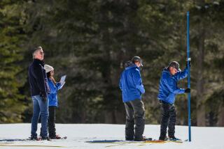
Early February weather was a dramatic change from this time last year, when Lake Tahoe had so much snow that figuring out where to put it all was a major challenge.
Under a baking sun, Russell Neches peeled off his long-sleeved base layer to hit the ski slopes at Royal Gorge Cross Country Resort near Lake Tahoe.
Early February should be the the dead of California’s winter, yet Neches was skiing in — and sweating through — his T-shirt.
“As soon as there was sun, it was unbearably hot,” said the 37-year-old Oakland resident.
Unseasonably warm and dry temperatures blanketed California over the weekend, shattering records across the state and bringing clear blue skies that were expected to linger through next weekend.
At the resorts near Lake Tahoe, the weather was so warm — 12 to 18 degrees above average — that the snow was melting, leaving behind puddles of water and slush. Some would-be skiers opted to go hiking instead.
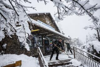
It was a dramatic change from this time last year, when Tahoe had so much snow that figuring out where to put it all was a major challenge.
In Northern California, residents in the famously foggy City by the Bay traded their winter coats and sweaters for T-shirts and shorts over the weekend.
The high temperature in San Francisco was 74 on Saturday and Sunday, setting new records for both days.
About 100 miles south, Salinas also had two consecutive days of record-breaking heat, reaching 81 on Saturday and 80 on Sunday.
Elsewhere around the Bay Area, new records were set Saturday at Oakland International Airport, with 76 degrees; in Santa Rosa, 76; and in San Jose, 78.
Up in Sonoma County’s wine country, temperatures in Healdsburg rose to 80 degrees on Saturday. That broke a record of 75 set 112 years ago, way back in 1906.
The city of Ukiah in Mendocino County hit a high of 78 Sunday. It was the fourth consecutive day of tying or breaking the daily temperature record.
Half Moon Bay also reached 78 degrees on Sunday, not only breaking a record for the day but tying the record-high temperature for the month of February.
In downtown Los Angeles, where February is typically the wettest month of the year, temperatures Sunday peaked at 81 degrees. (That was still 10 degrees cooler than the record set in 1995, when it was 91 degrees on Feb. 4.)
Sandberg reached 82 degrees, breaking a daily record of 74 set in 2015 and a monthly record of 78 set on Feb. 13, 2014.
Record-breaking heat also hit Woodland Hills, where temperatures reached 89 degrees, and Palmdale, which saw a high of 77.
Daniel Swain, a climate scientist at UCLA (where the high temperature was 79 on Sunday), said people have been noticing the rising temperatures because of the warmth has been so extreme.
One of the reasons is a persistent pattern of West Coast ridging, Swain said. That’s an area of high atmospheric pressure that brings mild weather.
“This year it’s been more pronounced in Southern California, but increasingly it’s extended further north,” he said.
The warm, dry weather can be traced in part to the phenomenon known as La Niña, in which there are colder-than-average sea surface temperatures in the tropical east Pacific Ocean, Swain said. The warming in the western tropical Pacific, along with the loss of Arctic sea ice, are also factors, he said.
Experts expect extreme weather to become the norm in the state as the climate changes and global temperatures rise.
“At least in terms of warmth, we know this is the direction things are heading ... hotter summers and more warm temperatures in the winter that prevent Sierra Nevada snowfall or snow accumulation,” Swain said.
“The key thing to keep in mind, though: The evidence does not suggest that California is heading in a permanently drier direction,” he added. “We saw just last winter, even in a dry decade, we can have a really wet year that causes the opposite issue.”
While the weather is expected to cool down this week, it will still be warm, with above-average temperatures forecast through the weekend.
“It’s going to be up a handful of degrees, down a handful of degrees, not ever really getting cold,” said Kathy Hoxsie, a meteorologist with the National Weather Service in Oxnard.
Hoxsie said in about 10 days, there’s a chance the winter weather pattern will start breaking down, which could mean a chance of rain.
Her colleagues farther south seemed less optimistic.
“Supposedly there’s going to be 6 more weeks of winter,” the National Weather Service in San Diego posted on its Facebook page. “I guess this means 6 more weeks of sunny, warm, and dry conditions?”
Lin reported from Lake Tahoe and Tchekmedyian from Los Angeles.
rong-gong.lin@latimes.com | @ronlin
alene.tchekmedyian@latimes.com | @AleneTchek
More to Read
Start your day right
Sign up for Essential California for news, features and recommendations from the L.A. Times and beyond in your inbox six days a week.
You may occasionally receive promotional content from the Los Angeles Times.
