Next worry: mudslides
When Clint Watson returned home to La Canada Flintridge, the wildfire evacuee was relieved to find that the flames had spared his neighborhood.
Today, however, the 21-year-old is working feverishly to protect his home from a new menace: mudslides.
For nearly two weeks, Watson has been laboring in his backyard, staking sheets of door-sized plywood into the earth. He hopes the barriers will save the house he shares with his mother and grandmother by diverting any debris flows to a nearby street.
“But if it ends up raining too much,” he said wearily, “there’s nothing we can do about it.”
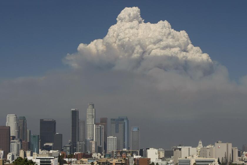
The Station fire, which is 91% contained, has blackened more than 160,500 acres in the San Gabriel Mountains and left barren hillsides towering over Los Angeles. When the winter rains start, there is little vegetation left in the burn areas to prevent water, rocks, grit and branches from coursing down steep canyons and ravines toward thousands of homes.
Although mudslides are a frequent occurrence after fires, authorities are concerned that this year’s flows could contain larger amounts of debris than usual. The San Gabriel Mountains are made up of rock types that easily shatter and crumble.
“A lot of these slopes are already shedding substantial debris down into the channels -- fine sediment and rock falls,” said Richard Hadley, spokesman for a team of scientists, engineers and other experts assembled by the U.S. Forest Service to assess the effects of the fire. Debris flows off these hills can be “almost like flowing concrete,” he said.
“And on these really steep slopes, there can be a lot of power behind it.”
The intense heat from the blaze can also cause the soil to effectively seal itself, resulting in even larger and faster flows, he said. Some past debris flows have even knocked homes from their foundations.
The so-called Burn Area Emergency Response Team is studying satellite imagery and conducting soil tests to determine where the fire’s effects have been most severe. With that information, it will model water flows, in order to identify the communities most at risk and recommend measures to protect lives and property. Its report is expected by Wednesday.
Possible safety measures include installing temporary barriers to divert flows, officials said. Seeding the slopes is not an option.
“We have 60- to 70-degree slopes pretty much everywhere,” Hadley said. “The seeding would typically get washed off the slope.”
The Los Angeles County Department of Public Works oversees an elaborate flood control system. It includes 14 major dams, about 500 miles of open channels and 3,000 miles of storm drains that dump water into the Pacific Ocean.
Nine basins have also been carved into the foothills in the affected area to trap debris before storm flows reach urban areas, said Mark Pestrella, public works deputy director. Maintenance crews are clearing out the basins and removing any obstructions from the channels and drains, so they will have full capacity available when it rains. The basins can also be expanded, if needed.
“The system works very well every year, year in and year out,” Pestrella said. But he cautioned that some residences, particularly those located at the foot of burned slopes, could still be at risk.
“This particular fire, it burned right up to this urban interface . . . and there is a huge risk for all these homes,” said Jayme Laber, a senior hydrologist with the National Weather Service in Oxnard.
The Public Works department has dispatched engineers to assess the risk to individual homes and recommend ways to protect them. Their main focus is the foothill communities of Los Angeles, La Crescenta, La Canada Flintridge and Altadena, Pestrella said.
Residents who have not received a visit can contact Public Works to schedule one. The department can also send them a brochure with tips about protecting their homes. But under some circumstances, Pestrella said, the only course of action might be to evacuate.
The U.S. Geological Survey and the National Weather Service have collaborated on an early warning system, based on studies to determine how much precipitation over what period of time can be expected to trigger a flash flood or mudslide.
Although Southern California is experiencing a drought, climate forecasters say increases in the surface temperature of parts of the Pacific signal a moderate El Nino, which could mean a wet winter. Still, the climate phenomenon can be unpredictable.
“Under a moderate El Nino, there is still a possibility that there will be below normal rainfall,” Laber said. Even so, he cautioned, “we can still get some pretty big storms with a high risk of flash floods and debris flows. So the best advice I can give to homeowners is get prepared now.”
In La Canada Flintridge, Lillian Guarino, 89, is resigned to whatever happens. She has already had a landscaper over to put in a few plants on the blackened hillside behind her yellow house. She also plans to collect sandbags from the Fire Department. But after more than 40 years at the top of Ocean View Boulevard, she is under no illusions.
“Gone through fire, gone through floods, gone through the earthquake,” she said, smiling. “If the mud comes, we’ll dig out, I guess.”
--
corina.knoll@latimes.com
More to Read
Sign up for Essential California
The most important California stories and recommendations in your inbox every morning.
You may occasionally receive promotional content from the Los Angeles Times.
