How long will it rain? What to expect from Southern California’s 1st storm of the season
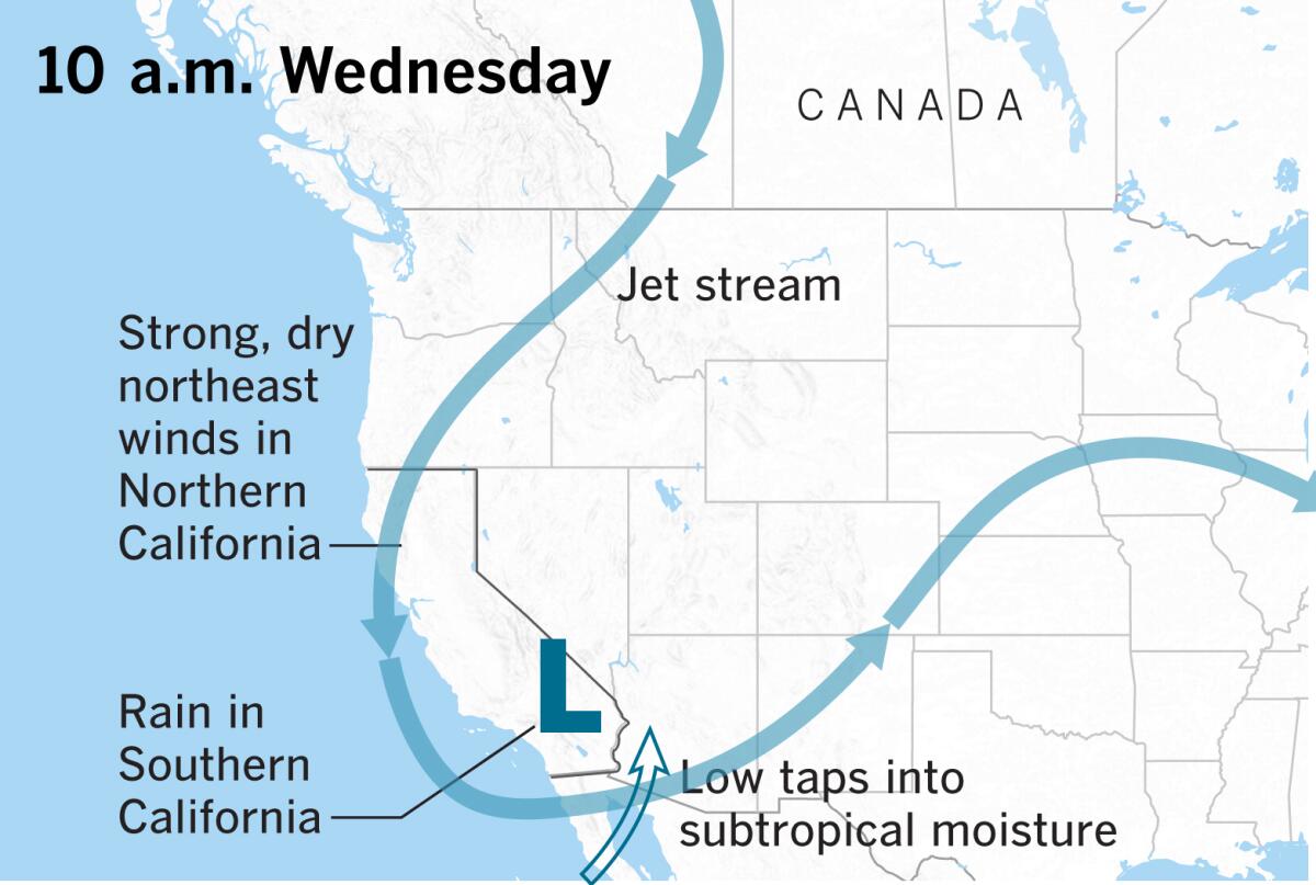
The first storm of the season is moving into Southern California this week.
Here’s what to expect:
THE FORECAST
Tuesday: The Los Angeles area is expected to see about half an inch of rain, with the San Gabriel Valley foothills and mountains getting a stronger downpour.
Wednesday: The mercury will drop into the 60s, and rain is expected to arrive across the entire region — from the coasts to the valleys. Thunderstorms can’t be ruled out in the southern part of the area, particularly in San Diego County.
Thursday: There is a chance of showers in the morning and into the afternoon, but rains should dissipate as the day continues.
Friday: Look for cloudy skies to start the weekend.
SNOW
Snow is predicted at 10,000 feet and above on Tuesday evening, but that range will lower to 6,000 feet by Wednesday evening. Elevations above 7,000 feet could get 6 to 10 inches, and elevations from 6,000 to 6,500 feet could see 1 to 2 inches.
DANGEROUS SURF
Officials are warning of high surf and rip currents associated with the storm.
“There is an increased risk for ocean drowning,” the National Weather Service said. “Rip currents can pull swimmers and surfers out to sea. Large breaking waves can cause injury, wash people off beaches and rocks and capsize small boats near shore.”
FLOOD RISK
In the burn zones of the recent Barham and Getty fires, residents should be aware of the potential for mudslides that the rainy season could bring, forecasters warned. Officials said this week’s rain probably wouldn’t be strong enough to cause mudslides in burned-out areas.
FIRE RISK
The few days of rain won’t be enough to erase the fire threat across Southern California. By the weekend, the weather will become dry and sunny again, bringing the potential for more fire danger, the weather service said.
More to Read
Sign up for Essential California
The most important California stories and recommendations in your inbox every morning.
You may occasionally receive promotional content from the Los Angeles Times.
