Heat, Santa Ana winds hit Southern California this week, but a chance of showers awaits
Heat and dry Santa Ana winds with elevated fire danger are on tap through Friday in Southern California, with record high temperatures possible Thursday and Friday, forecasters said, but conditions are expected to cool through the weekend and turn breezy and colder with a chance of showers early next week.
Moderate Santa Ana winds, gusting 30 to 50 mph, are forecast through Friday in L.A. and Ventura counties. A heat advisory took effect at 11 a.m. Wednesday and will remain through 6 p.m. Friday, and temperatures could soar into triple digits for coastal plains and valleys, as well as in the Santa Clarita Valley and the Santa Monica Mountains, the National Weather Service said. Red-flag fire warnings are not expected, however, because vegetation is still green from late March rains.
On Wednesday, a sea breeze kept coastal areas cool, with high temperatures in the 60s and 70s, the weather service said. Inland areas saw temperatures in the 80s and 90s.
Glendale hit 98 degrees, forecasters said. Nearby Pasadena hit 96. Thousand Oaks was 91 degrees, while temperatures in the San Gabriel Valley were in the low to mid-90s.
Temperatures hit 89 degrees around downtown Los Angeles, the weather service said.
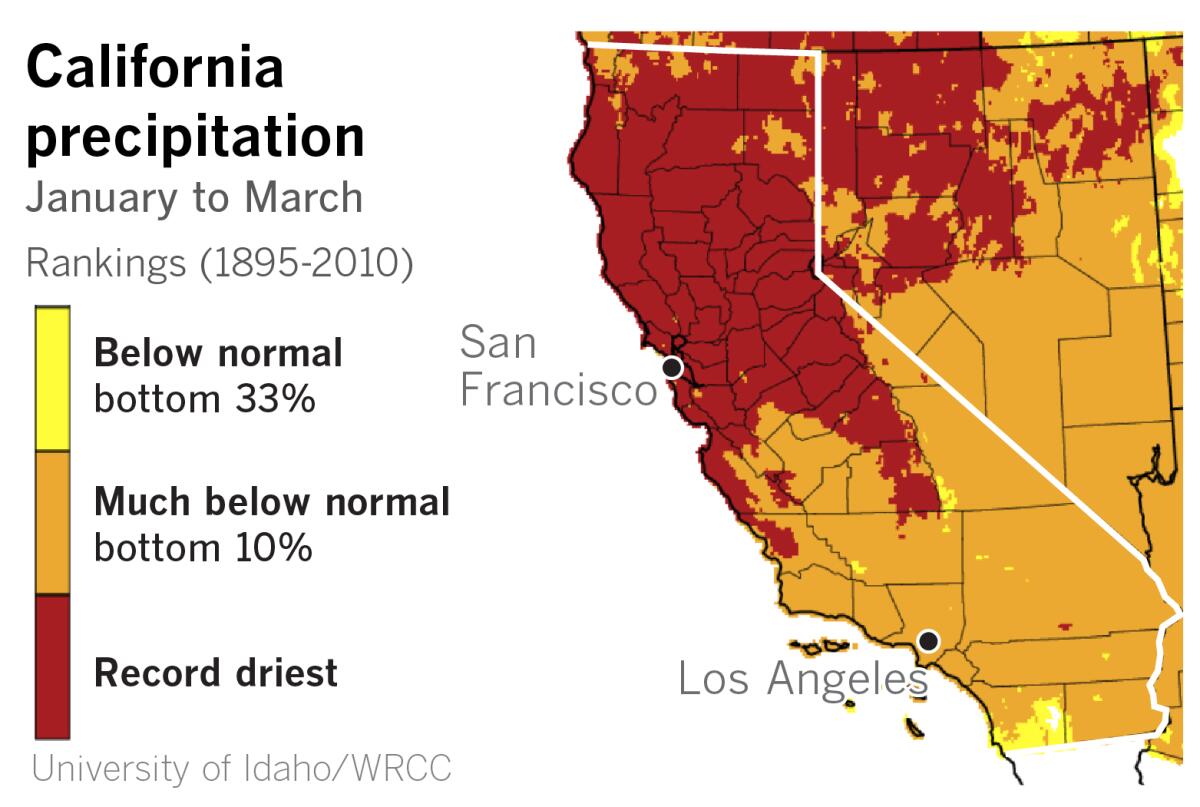
After record precipitation in December, California has been mostly parched through what are normally the state’s wettest months. The northern half of the state racked up its driest January-to-March period on record, and the southern half falls almost entirely in the much-below-normal category.
California officials are touting a $2.6-billion deal to boost the health of a vital watershed, but environmentalists are calling it a backroom scheme.
The heat and winds will be a sharp reversal from conditions last weekend, when a thick marine layer kept skies overcast west of the mountains and produced areas of drizzle.
“We won’t see too much of low clouds this coming week,” said Mark Moede, a meteorologist with the weather service in San Diego.
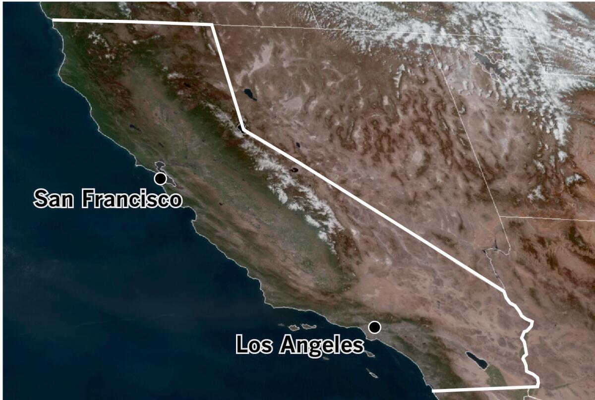
A satellite picture taken Tuesday afternoon showed clear skies over the length of the state.
A strong upper-level ridge of high pressure will build over the West Coast by Thursday, driving the hot weather this week, Moede said.
Meanwhile, in the Upper Midwest and Great Lakes regions, a deep upper-level low-pressure system with very cold air will be in place, and cold, dense air will sink down to ground level in the Great Basin.
What are heat-related illnesses and how are they treated? Are they preventable or inevitable? We talked to health experts for the answers.
This air will provide the high-pressure component at the surface for Southern California’s Santa Ana winds. The pressure gradient, or difference, between this surface high pressure to the east of California and lower pressure at the coast is what drives the winds, which are expected to be strongest Wednesday into Thursday morning.
As is typical of Santa Ana winds, which heat up and dry out as they flow downslope to sea level in Southern California, relative humidity levels could plummet as low as 3% to 10%. The unseasonable nature of the heat wave could heighten effects for heat-sensitive people and those working or recreating outdoors, and forecasters urge people to make sure they’re adequately hydrated.
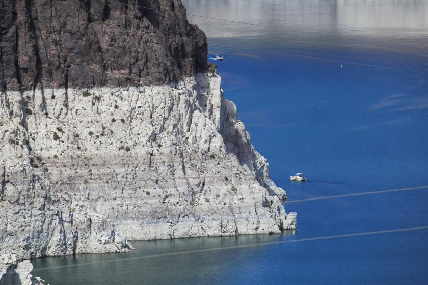
Newsom declared a statewide drought emergency and is asking all Californians to conserve water. Here are some ideas for how to do that.
Temperatures could rise as high as 90 to 102 Thursday and Friday, including in coastal areas.
The Santa Ana pattern will break down Sunday, and a trough of low pressure will ride down the West Coast. That will bring below-average temperatures and a chance of showers early in the week, which culminates in Passover and Easter, although models indicate the system is likely to be a mostly dry inside slider.
Times staff writer Gregory Yee contributed to this report.
More to Read
Start your day right
Sign up for Essential California for news, features and recommendations from the L.A. Times and beyond in your inbox six days a week.
You may occasionally receive promotional content from the Los Angeles Times.
