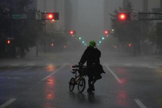
Tropical Storm Bill skirts Houston, but the danger is not over
- Share via
Reporting from Houston — Houston appears to have dodged the storm this time.
Tropical Storm Bill alarmed officials and residents alike, coming on the heels of a massive storm last month.
The city opened its emergency operations center, as did the state. Some schools and employers closed early.
Highway signs flashed flood warnings, “Turn around, don’t drown!” Residents stocked up on water and other staples.
But after Bill made landfall Tuesday about 150 miles south along the Gulf Coast at Matagorda Island, it skirted Houston.
Some areas saw up to 3 inches of rapid rain. Spotty showers and clouds lingered late Tuesday, nothing like the Memorial Day storm that drenched the nation’s fourth-largest city, flooding streets, cars and homes.
“It was never supposed to make a direct hit on Houston and Galveston.
They won’t see the full impacts of this storm,” Steve Fano, a meteorologist with the National Weather Service in Fort Worth, said late Tuesday, “The I-35 corridor and points east will be the hardest hit.”
“The main concern is flooding,” he said, “This is a very slow-moving system, now it’s not even 20 mph. And the heavy rains that are occurring right now are going to continue,” as the storm shifts northwest through Austin and San Antonio overnight.
Heavy rain can be expected, he said, up to half a foot in places.
Central Texas was already inundated last month, and the area – known as the Hill Country – is full or rivers and creeks prone to flash flooding, Fano said.
Dallas officials also activated their emergency operations center late Tuesday, wary of flood risks to local reservoirs.
“The month of May was especially wet for much of Texas, including central Texas. With rivers still in flood stage or full, you add another quick 6 inches of rain to those basins, and they are going to experience some flooding,” Fano said.
Follow: @mollyhf for more national news
More to Read
Sign up for Essential California
The most important California stories and recommendations in your inbox every morning.
You may occasionally receive promotional content from the Los Angeles Times.


