Oroville Dam holds up as officials christen new spillway two years after near disaster
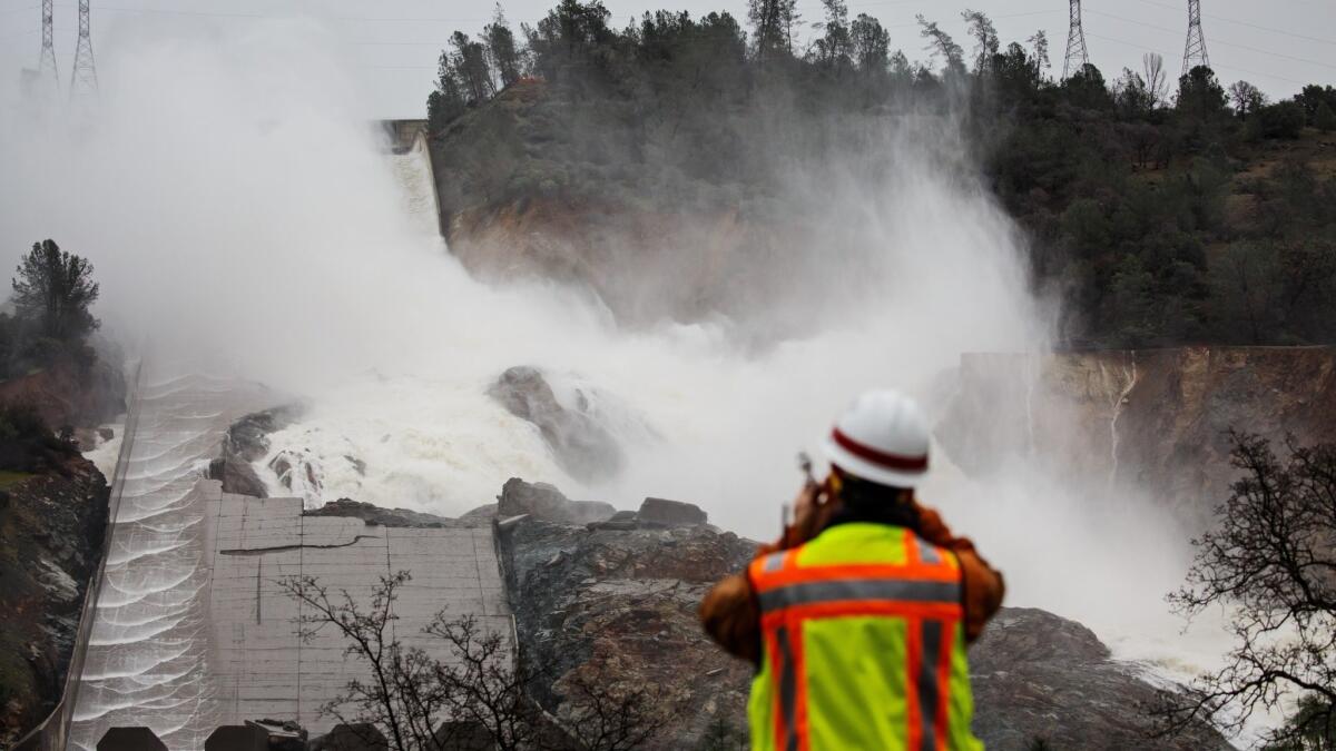
Bystanders were met with the rumble of rushing water as Oroville Dam’s gates released millions of gallons of water down a newly reconstructed concrete spillway on Tuesday for the first time since the structure failed two years ago.
In February 2017, people who live downstream in Oroville watched in disbelief as millions of gallons of water eroded the main spillway of the nation’s tallest dam, sending a deluge of water cascading down a hillside and forcing thousands of residents to evacuate. That scenario was exactly what bystanders watching the first water flow from the newly rebuilt spillway hoped to avoid.
“It is beautiful,” resident Teri Tata said as she livestreamed the frothy water flowing down the spillway. “It looks awesome, guys. It’s being contained very well.”
Water officials said the system was working as anticipated as water flowed down the spillway and into the Feather River before noon Tuesday. It was the spillway’s first major test after the near-disaster in 2017 that led to a $1.1-billion reconstruction project.
The water level in the reservoir, a key stockpile of California’s water supply, has risen significantly after several storms in the last month to 854 feet. Boosted by an extremely wet winter, the water level was 106% of average for the date Monday, but was still at only 80% capacity, according to the state Department of Water Resources.
Still, the reservoir’s level had reached a point where officials said some water needed to be released to make room for runoff from storms drenching the region this week and, eventually, melting snow from the Sierra Nevada.
In late February, the state’s snowpack — swelled by a series of moisture-packed winter storms — was already 113 inches deep, which equates to 43½ inches of water if it were to melt.
Warmer temperatures in March led to some melting, so when officials took stock of the snowpack again Tuesday, the depth had decreased to 106.5 inches. Temperatures quickly got cooler, though, causing the melted water to freeze. If the frozen water and snow piled on top of it were to melt, it would equal 51 inches of water — the fourth best snow-water content measurement ever for the Phillips station, said Chris Orrock, a spokesman for the Department of Water Resources.
That leaves the snowpack at 161% of average statewide and 200% of average for the Monday measurement. Surveyors will return to the Phillips station in May for another measurement.
All of the state’s reservoirs are at or above their historical average levels, boosted by more than 30 atmospheric river storms since October, said Kristopher Tjernell, deputy director of the Department of Water Resource’s Integrated Watershed Management Program. Although the stellar snowpack bodes well for the state’s water supply, it also means public agencies will have to juggle water levels across the state’s network of reservoirs when warm spring temperatures arrive and melt the snow.
“It’s been a great, great winter, but it’s not all fun and games,” said John Paasch, the department’s chief of flood operations. “Water managers throughout the state are analyzing this data and having conversations about how to best manage and operate their reservoirs…and what to expect in terms of releases and river elevations.”
At the height of the snowmelt — especially after a wet winter — water district managers conduct daily conference calls to coordinate how much water each expects to release into California’s web of rivers, bypasses, creeks and canals.
The coordination is crucial because the reservoir releases affect water levels far downstream days later. Also, one reservoir’s release may coincide with another, so managers must chart how much water rivers and levees can support before overflowing.
“We don’t want everyone releasing a lot of water at the same time when that will overwhelm the levies downstream,” Orrock said. In the past, abrupt warm weather has led to the snowpack melting quickly, Orrock said. Water officials said they hope this year the warming will be gradual for a steadier runoff. “It’s dumping snow right now and it’s really cold,” he said. “We should be OK.”
By early afternoon in Oroville, officials expected to release 8,300 cubic feet per second — about 3.7 million gallons per minute — from the reservoir. Water officials expect they may have to increase flows up to 60,000 cubic feet per second to the Feather River later in the week as rain continues to pound the region.
The reconstructed spillway can handle water flowing at a rate of 270,000 cubic feet per second, which is much greater than the amount officials would ever expect to release at a time, said Erin Mellon, a spokeswoman for the Department of Water Resources.
The massive spillway reconstruction, which cost more than $1 billion, required pouring more than 1.2 million cubic yards of concrete — enough to fill 372 Olympic-size swimming pools. The main spillway alone contains enough concrete to build a sidewalk from Oroville to Amarillo, Texas.
Water was flowing at a rate of 50,000 cubic feet per second when the spillway began disintegrating on Feb. 7, 2017, after a deluge in the Feather River watershed filled the 50-year-old reservoir and forced operators to open the spillway gates.
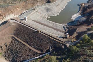
When the main spillway failed, an adjacent emergency spillway that at the time was nothing more than an earthen hill was used. The hillside quickly eroded, which forced 188,000 people downriver in Butte County to flee out of concern the concrete lip of the dam would fail and send a 30-foot wall of water down the Feather River into the community.
An analysis of the cause behind the main spillway’s failure pointed to a series of questionable decisions during construction, including relying on relatively thin layers of concrete around vital joints, poor drainage for water that seeped into the chute and weak reinforcements.
A report released in January 2018 by an independent forensic team organized by the Assn. of State Dam Safety Officials contended that the dam’s owner, the Department of Water Resources, was “significantly overconfident and complacent about the integrity of its State Water Project civil infrastructure, including dams.”
The report found that periodic inspections of the spillway failed to identify the original design flaws and the subsequent deterioration of the spillway’s integrity. Officials say those issues have been fixed with the reconstruction project.
“We are proceeding with normal operations,” Mellon said. “We are ready for this storm and future weather that Mother Nature has in store for us.”
Twitter: @Hannahnfry
More to Read
Start your day right
Sign up for Essential California for news, features and recommendations from the L.A. Times and beyond in your inbox six days a week.
You may occasionally receive promotional content from the Los Angeles Times.
