This motorcycle adventure up to 12,000 feet is open only twice a year. Could these riders complete it?

In the Eastern Sierra near Bishop is a mountain route unofficially known as the highest motorable road in California.
The dirt section at the top is maintained by the University of California scientific research facility at Barcroft Station and access is open just two days a year. (Dates for 2017 have passed, and those for 2018 haven’t been announced. For information, call [760] 873-4344 or check the facility website.)
Hikers can do the last piece of road on foot any time between June and October by driving within two miles of the facility. But riding up is a special treat.
To me, that was catnip. I contacted Bike-urious blogger Abhi Eswarappa, a friend who shares my taste for the offbeat, and we made a plan: Let’s make a motorcycle adventure out of riding up to 12,000 feet.
We selected Independence, Calif., for our base camp for several reasons. First, it would put us within striking distance of White Mountain Road and let us attack the mountain early, before the day got too hot.
Second, it would give us the opportunity to visit with Cris Chater, a.k.a. Strider, the charming innkeeper at the Mt. Williamson Motel and Base Camp, one of the most pleasant hostelries along the entire Eastern Sierra corridor.

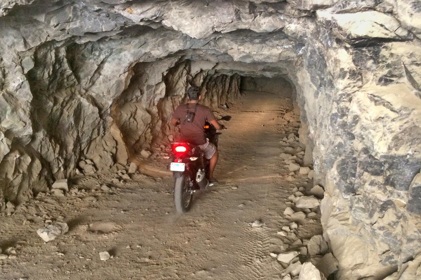
Third, we could knock two items off our shared bucket list: I would be able to visit the memorial to the Japanese internment camp at Manzanar, and Abhi would get to fulfill his dream of riding a motorcycle into an abandoned mine.
Manzanar came first. Despite what I knew of the history of the wartime internment of Japanese Americans, I left the national historic site impressed by the displays and depressed by this shameful act of racial prejudice.
A visit to the lonely nearby Manzanar cemetery, in 100-degree heat, did nothing to lift my mood.
We continued on to Abhi’s bucket list item. We drove up a rugged, boulder-strewn dirt road, glad we were in a sturdy four-wheel-drive truck, until we reached the Reward gold mine, active from about 1900 to 1950 but now abandoned.
Abhi unloaded his motorcycle, strapped on his camera and rode into the 15-foot-square mine opening. I stood 10 feet deep inside the dark mine, glad of the cool silence.

Ten minutes later, Abhi emerged, grinning and eager to show me photos of the mine’s huge interior galleries.
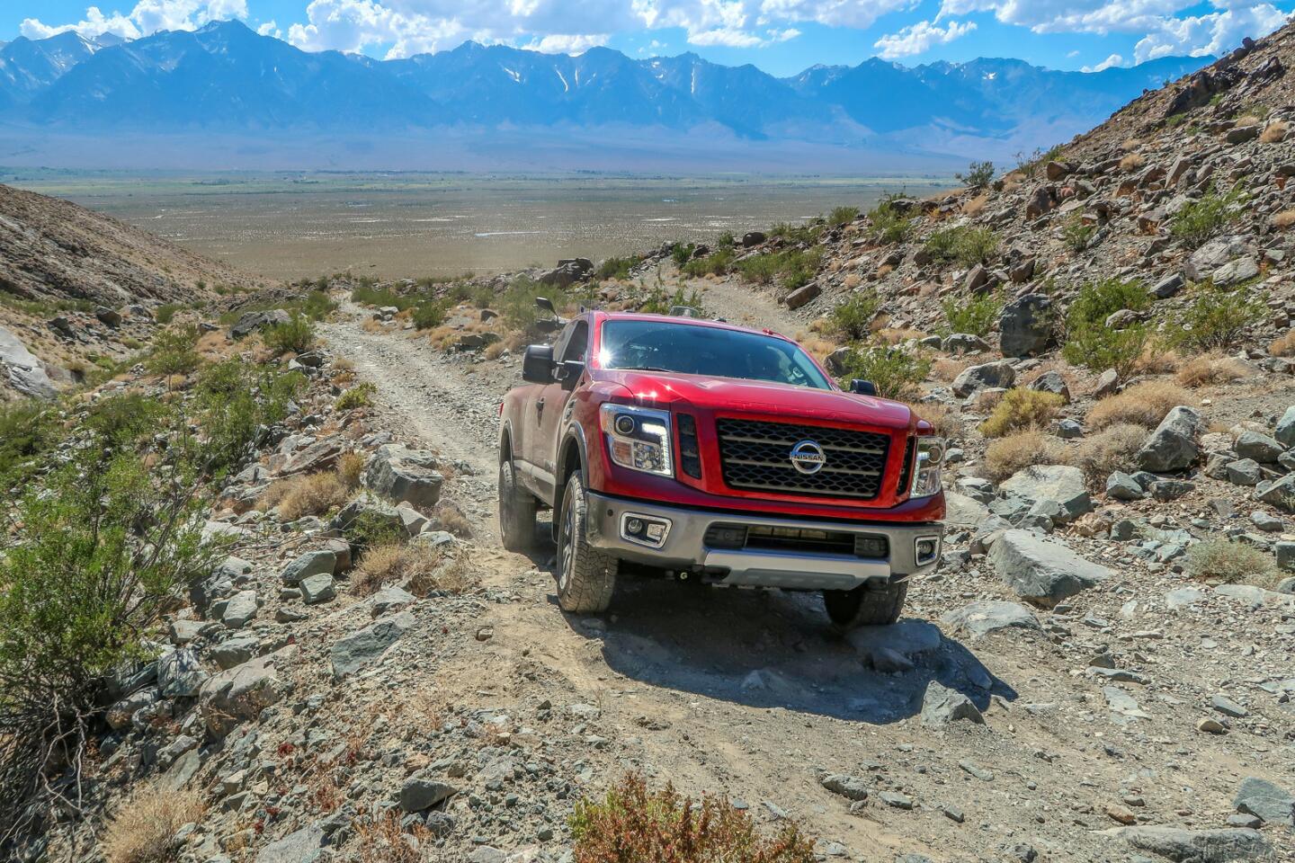
The next morning we rose early, ate the Mt. Williamson Motel’s complimentary bacon-and-eggs breakfast, and hit the road. We drove 27 miles to the turnoff for California Highway 168, unloaded the motorcycles from the truck, and started our ride.
White Mountain Road intersects the 168 and heads into the Ancient Bristlecone Pine Forest, part of the huge Inyo National Forest. Soon we had left the fields and farms, climbing from 4,000 to 6,000 feet along a road lined with scrubby, low-growing pines.
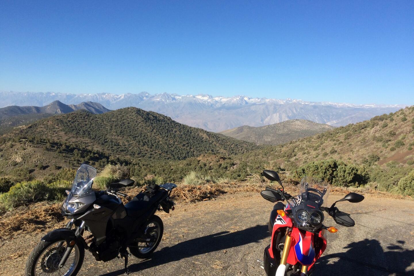
We stopped periodically to take pictures of the majestic Sierra, disagreeing over which peaks were Whitney and Williamson and enjoying the cool mountain air.
Though we were eager to complete our “highest motorable road” ride, we took a quick look at the Bristlecone Forest Visitor Center, then pressed on, leaving the paved section of White Mountain Road and hitting the dirt.
From there, the climb was sublime along a road designated a National Forest Scenic Byway. The well-maintained unpaved road was the ideal surface for the small dual-purpose motorcycles we were riding.

We skipped over the washboard and loose gravel, passing the slow-moving SUVs and pickup trucks, quickly covering the 14 miles of rugged road from the visitor center to a gate where, ordinarily, all traffic is halted.
But today was special, one of the two days a year when the operators of White Mountain Research Center at Barcroft Station open the last two miles of road to the research center to vehicular traffic.
Past signs warning “High Clearance Required, 4WD Recommended” we rode, stopping only when the road ended in the center’s parking lot at 12,470 feet.
Other vehicles had preceded us, most carrying ardent climbers ready to walk five more miles to summit White Mountain, one of the Sierra’s tallest peaks at 14,252 feet.
We declined a suggestion to join them, feeling the effects of the thin air and not dressed for the occasion.
The research center is not open to the public, but a pair of friendly workers showed us around and explained some of the science that takes place at the high-altitude facility. They also recommended some alternate routes back.
We took them up on their suggestions, first exploring the unpaved road through Wyman Canyon, then stopping for a proper visit at the Bristlecone Forest Visitor Center.
We were clumsy in our motorcycle gear — and huffing from the altitude — but managed a one-mile walk through the gnarled and twisted pines, said to be the oldest living creatures on Earth.
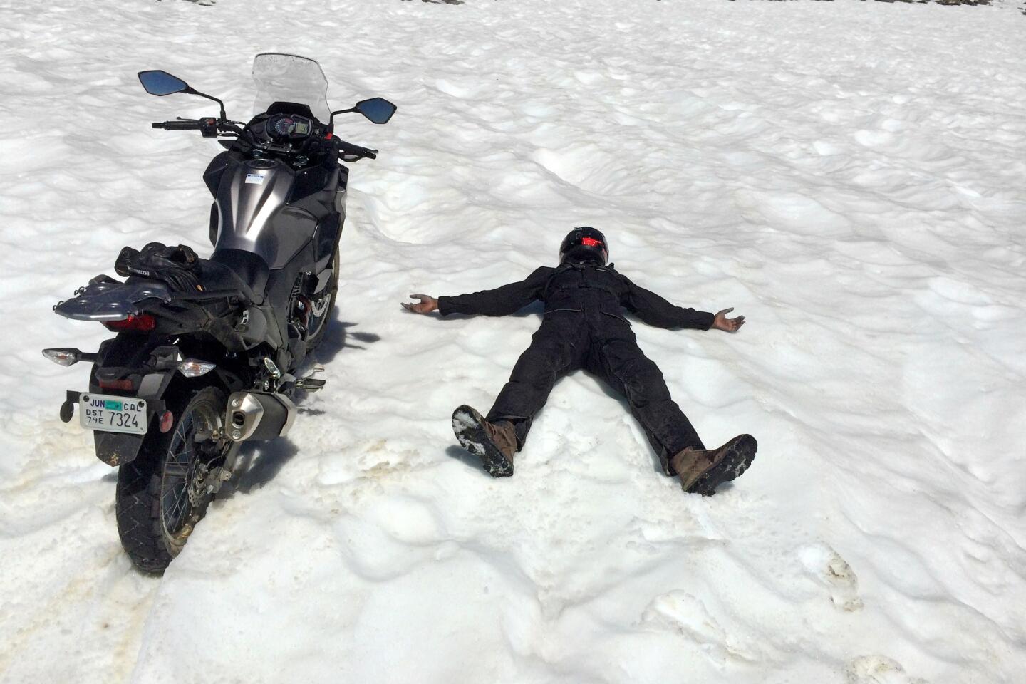
For the ride down, we decided to skip the pavement and test our mettle on rugged Silver Canyon Road. Out of the pines, descending steep rocky sections through sage, scattered oak trees and hairpin turns, we slowly made our way off the hill, stopping regularly to admire the staggering Sierra peaks, still snow-capped in late July.
The road eventually began to flatten, then culminated in a series of six water crossings before depositing us near Bishop — and into 105-degree heat.
After the challenging and increasingly overheated ride, it felt great to shed our protective motorcycle gear and slide into an air-conditioned truck. We were still talking about the ride when we got back to L.A. five hours later.
If you go
The White Mountain Research Center road is open just two days a year. For information, call (760) 873-4344 or check its website. White Mountain Road, reached on U.S. 395 and California 168, is said to be the highest motorable road in California. The highest paved road, though, is nearby Rock Creek Road, which climbs to 10,320 feet.
WHERE TO STAY
Mt. Williamson Motel and Base Camp, 515 S. Edwards St., Independence, Calif.; (760) 878-2121m. Mountaineering veteran Cris Chater’s camp is a waystation for backpackers on the Pacific Crest Trail or tackling Mt. Whitney through the Onion Valley portal. Its comfortable rooms, pristine bathrooms, powerful air conditioning and hearty free breakfast more than justified the $140 we each paid for our non-smoking, queen-bed rooms.
WHERE TO EAT
There are limited dining options in Independence, so we had a serviceable dinner at Amigo’s Mexican Restaurant (285 N. Main St., Bishop; [760] 872-2189, open 11:30 a.m. to 9 p.m. daily), and an acceptable lunch at Country Kitchen (181 S. Main St., Big Pine; [760] 938-2402. Open 7 a.m.-9 p.m. daily).
WHEN TO GO
The paved road to the ancient bristlecone pine forest is open year round, except when there’s too much snow to plow. It would make a worthy detour on the way to or from Mammoth or Yosemite. The unpaved section on the approach to White Mountain is also open but is not recommended for two-wheel-drive vehicles or those without high ground clearance.
Silver Canyon Road is for four-wheelers and experienced off-road motorcycle riders only.


Sign up for The Wild
We’ll help you find the best places to hike, bike and run, as well as the perfect silent spots for meditation and yoga.
You may occasionally receive promotional content from the Los Angeles Times.