Alameda County piers
Dumbarton PierOverview: Walk this asphalt span and look down at the surface and you may see faint traces of yellow in the middle of the pier. Then it hits you: This looks like an old road. And, indeed, Dumbarton Pier was once a road, the starting point for the first bridge built across the bay in 1927. (A sister pier, now closed, called the Ravenswood Pier, sits opposite.) It’s not the most scenic spot, though the wetlands that parallel the road to the pier provide some ambience. There’s abundant bird life as well as a wildlife center as you enter the area.
Parking: Free parking alongside the road as you approach the pier.
Directions: Exit Interstate 880 to Highway 84 to the Paseo Padre Parkway exit. Follow the road south under the highway. It turns into Thornton Avenue and winds past the wildlife center. The pier is about 3 miles beyond the center.
Port View/7th Street Pier
Overview: This pier, nearly 50 years old, is not much more than 100 feet long, but it has an interesting octagonal shape. If you stumble across it, it’s worth a brisk walk to check out the water, but it isn’t necessarily a destination pier.
Parking: Free parking in the park, about a quarter-mile walk to the pier.
Directions: In Richmond, exit Interstate 880 at 8th Street. Go west to Peralta and make a left. Turn right onto 7th Street and follow it to the park and pier.
Berkeley Pier
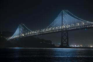
Overview: When the San Mateo Pier closed in the late ‘90s, the Berkeley Pier officially became the longest in the state, stretching more than 3,000 feet. It’s a long, often lonely walk out and back on a gray day, but it’s rewarding because you get a sense of the immensity of San Francisco Bay. The pier has a timeless feel (marred only by traces of contemporary graffiti) underscored by views as far away as the Golden Gate Bridge.
Background: There have been wharves and piers in this area since 1854.The pier often served as a principal ferry dock, but the opening of the Bay Bridge to San Francisco in 1936 put an end to its use for that purpose. The current pier was built in 1959 for recreational uses, and then lengthened by 1,000 feet in 1962. It has stayed about the same for the last half-century.
Parking: Free, at the sizable lot across from the foot of the pier.
Directions: Exit Interstate 80 at University Avenue. Take University toward the water where it dead-ends near the pier.
-- Christopher Smith
More to Read
Sign up for The Wild
We’ll help you find the best places to hike, bike and run, as well as the perfect silent spots for meditation and yoga.
You may occasionally receive promotional content from the Los Angeles Times.
