As wildfires roar in Southern California, cooler weather to aid battle
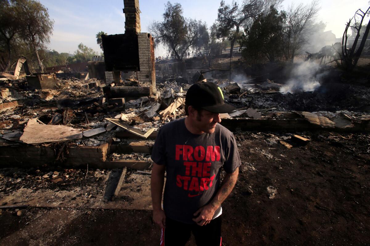
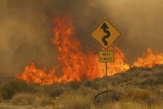
After days of hot, bone-dry conditions that fueled wildfires in San Diego County, firefighters can finally look forward to some relief from Mother Nature, forecasters said Friday.
“It’ll still be warm to hot, but each day from here on out it will be cooling,” said National Weather Service meteorologist James Thomas.
The winds around the fires in Camp Pendleton, San Marcos and Carlsbad that have burned more than 10,000 acres since Tuesday will die down to slight breezes, he said.
And while the wind shift will push smoke and ash that’s been blowing out to sea all week back inland, it will also mean cooler, moist air -- aiding firefighters trying to get a handle on the massive brush fires, Thomas said.
“We’re getting further away from these Santa Ana conditions we’ve been experiencing,” Thomas said.
By Sunday, temperatures around the fires could be in the 70s with humidity upward of 30%. Winds on the county’s desert slopes and mountaintops, however, could reach 30 mph, sustaining the potential for a fire to break out and quickly spread, Thomas said.
Meanwhile, “May Gray” should be making its first appearance in Los Angeles County by Monday, said Andrew Rorke, a senior forecaster for the National Weather Service.
“It took long enough,” Rorke said. “May Gray finally arrives on Sunday. The big news -- residents in Long Beach will actually wake up and see clouds overhead.”
The onshore breeze that will benefit firefighters in San Diego will also cool communities across the rest of Southern California, Rorke said. Temperatures are expected to be in the 70s and 80s from the beach to the valleys with a slight chance of drizzle across the region.
“It’s the diametric opposite to last week,” Rorke said.
May Gray and June Gloom are caused by the temperature difference between the land, which is warming up after winter, and the ocean, which is still cooler. The difference produces the flow of cool, moist air from ocean to land. But so far this May, the Santa Ana winds are wiping out the cooler flow of air from the shore.
The conditions are causing problems across the region. Los Angeles County fire officials responded to about two dozen brush fires Wednesday and Thursday.
So far this year, California has seen double the number of brush fires than average. Because there was so little rain this year, the moisture level in the brush is incredibly low.
“Everything is fueled by the heat. So a car fire next to a piece of brush — everything is escalated,” said Keith Mora, an inspector with the Los Angeles County Fire Department. “Anything right now is complicated by the weather.”
Typically, Santa Ana winds begin to hit in October and generally last for a day or two. The latest Santa Ana pattern is lasting a whole week, Bill Patzert, a climatologist for NASA’s Jet Propulsion Laboratory, told The Times.
Late-year Santa Anas are tempered by the arrival of winter rains. But Patzert said he doesn’t expect any sizable precipitation for six more months, until the forecasted wet El Nino conditions arrive.
More to Read
Start your day right
Sign up for Essential California for news, features and recommendations from the L.A. Times and beyond in your inbox six days a week.
You may occasionally receive promotional content from the Los Angeles Times.
