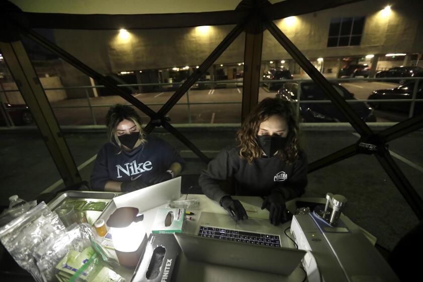
Earthquake swarm: Small quakes hit the California-Mexico border
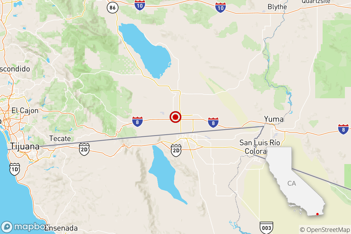
A swarm of small earthquakes has struck near the California-Mexico border, centered beneath the town of El Centro in Imperial County.
Scientists are closely watching the cluster, which began at 6:07 p.m. Monday with a magnitude 2.8 quake, followed six minutes later by the largest quake so far, a magnitude 4. There were 18 aftershocks within the first two hours, Caltech seismologist Egill Hauksson said.
By Tuesday morning, there had been dozens of aftershocks, including a magnitude 3.3 quake that hit just before 2 a.m.
No damage was reported in El Centro, which has a population of about 44,000. El Centro is the seat of Imperial County, one of the nation’s most important agricultural regions. The region has been hit hard in past quakes, most recently during the magnitude 7.2 earthquake that struck south of the California-Mexico border on Easter Sunday in 2010, killing two people in Mexicali and damaging buildings on both sides of the border.
This part of California, about 180 miles southeast of downtown Los Angeles, is routinely a source of interest among seismologists when earthquakes happen there. The region was particularly active with earthquakes in the late 1970s and 1980s.
“Swarms in this region are often prolific and can last for weeks,” Hauksson said. “There’s no lack of faults there.”
Swarms of small quakes are not unusual for this area, Hauksson said. “These have happened numerous times before without being followed by a major earthquake,” he said.
Swarms of small quakes are not a reliable predictor of earthquakes that cause major damage, seismologist Lucy Jones says.
Jones said two of the bigger quakes in historic time closest to Monday’s swarm, a magnitude 6.9 earthquake in 1940 and a magnitude 6.4 quake in Imperial Valley in 1979, came without any preceding swarm of small earthquakes.
Hauksson said earthquake scientists would monitor the earthquake sequence closely. Although there is no way to predict the exact time and location of California’s next damaging earthquake, small earthquakes are still important to closely monitor, especially when they occur close to major faults.
The cluster of small earthquakes Monday is in an area that may be along a hypothetical unmapped southeastern section of the Superstition Hills fault, Hauksson said. The Superstition Hills fault ruptured in a significant earthquake in 1987, a magnitude 6.6 event called the Superstition Hills earthquake.
Currently, the Superstition Hills fault is mapped as ending roughly nine miles from the city of El Centro. But it’s possible the fault continues under the heart of the city — but evidence of the fault may be hidden by sediments that have filled up a valley, according to Hauksson.
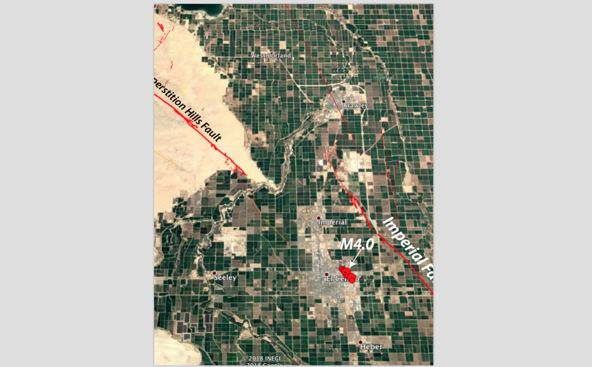
The epicenter of Monday’s magnitude 4 earthquake is about 25 miles southeast of the epicenter of the Superstition Hills earthquake of 1987. The Superstition Hills quake, which followed a magnitude 6.2 temblor on a nearby fault that hit 11 hours earlier, caused $4 million in damage and injured 94 people in Imperial County and left 3,000 people temporarily homeless in the Mexicali area of Mexico.
Monday’s quakes were also just four miles from a parallel fault — the Imperial fault. The Imperial fault last ruptured in a quake causing major damage in the 1979 Imperial Valley quake. That magnitude 6.4 earthquake caused $30 million in damage, injured 91 people, and damaged more than 1,500 homes and over 400 commercial buildings.
An average of 234 earthquakes with magnitudes of 3.0 to 4.0 occur each year in California and Nevada, according to a recent three-year data sample.
Did you feel these earthquakes? Consider reporting what you felt to the USGS.
Even if you didn’t feel this small earthquake, you never know when the Big One is going to strike. Ready yourself by following our five-step earthquake preparedness guide and building your own emergency kit.
An initial version of this story was automatically generated by Quakebot, a computer application that monitors the latest earthquakes detected by the USGS. A Times editor reviewed the post before it was published; it was later updated with reporting from Times reporters. If you’re interested in learning more about the system, visit our list of frequently asked questions.
More to Read
Sign up for Essential California
The most important California stories and recommendations in your inbox every morning.
You may occasionally receive promotional content from the Los Angeles Times.

