Hurricane Rosa poses risk of flash floods to eastern California, Las Vegas, Arizona
The moisture from Hurricane Rosa could pose a risk of flash flooding to Baja California, eastern California, Las Vegas and Arizona as it approaches the coast late Sunday.
The remnants of Rosa could bring as much as a year’s worth of rain to desert areas such as California’s Imperial Valley and Arizona’s Yuma County — both significant producers of vegetables for the nation.
“The big concern is the moisture and how much rainfall we’re going to get,” said Andrew Deemer, meteorologist for the National Weather Service in Phoenix. The National Hurricane Center said the main hazard is heavy rainfall, both in Mexico and the American Desert Southwest.
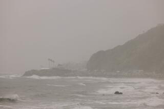
Swells generated by the hurricane were also expected to produce life-threatening surf and rip currents off Southern California. In Los Angeles and Orange counties, surf could build up to 8 feet high by late Saturday, and up to 10 feet on Sunday and Monday on beaches facing the south. Sneaker waves could inundate beaches, and during high tide, some coastal areas may suffer minor flooding.
In southeastern California and Arizona, isolated thunderstorms are possible on Sunday, leading to heavier rainfall Monday into Tuesday. It’s possible that 2 to 4 inches of rain could fall in one to two days.
That kind of rain would be significant for Yuma, which sees only 3½ inches of rain in an entire year on average, Deemer said. And 1 to 2 inches of rain in the Imperial Valley would also be equal to its average total annual rainfall.
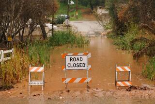
The National Weather Service issued a flash flood watch for southeastern California and Nevada as well as northwest Arizona starting Monday afternoon through Tuesday night. The National Hurricane Center said Baja California could see even greater amounts of rain — perhaps 3 to 6 inches.
The center of Rosa was expected to approach Baja California on Monday, but is forecasted to weaken to a tropical storm by that point.
Los Angeles, Orange and San Diego counties were expected to see little rain — perhaps a quarter of an inch in the cities of L.A. County, half an inch in the San Gabriel Mountains, and anywhere from a few tenths of an inch to three-quarters of an inch in the valleys of the Inland Empire and San Diego County. The rain for those areas could begin Monday night and continue into Tuesday.
“There’s some concern over the burn scars, so we’ll be monitoring that,” said meteorologist Bruno Rodriguez of the National Weather Service’s San Diego office.
But overall, “it’s not going to be a big soaker for us, at least the way things are looking right now. We’re going to be on the periphery of this,” said meteorologist Carol Smith of the weather service’s Oxnard office.
The northern reaches of the Bay Area could see its first rain of the season. On Saturday, there might be some light showers in the northern Bay Area. A separate system coming from Alaska is forecast to arrive late Monday into Tuesday that could bring in widespread showers across the entire Bay Area and down into the Central Coast, said meteorologist Rick Canepa of the National Weather Service’s Monterey office.
Snow is possible beginning Tuesday in the Sierra Nevada above 9,000 feet, the National Weather Service office in Hanford said, with accumulations of 2 to 5 inches.
“This is likely to catch many off guard, given the recent dry and warm weather,” the weather service office in Reno said. “While the highest passes could see light accumulation, snow is likely to quickly melt, given the time of the year.”
More to Read
Sign up for Essential California
The most important California stories and recommendations in your inbox every morning.
You may occasionally receive promotional content from the Los Angeles Times.
