Bond fire: Evacuations, road closures, shelters

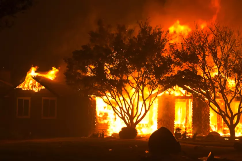
The Bond fire, which was sparked Wednesday night in Orange County, has exploded to more than 7,000 acres and is threatening several canyon communities.
The fire was moving southwest, out of the foothills, on Thursday.
Several areas are under both mandatory and voluntary evacuations. The latest map of evacuation areas from the Orange County Sheriff’s Department is available here.
Here are the areas under evacuation as of Thursday afternoon:Mandatory evacuations
Modjeska Canyon
Silverado Canyon
Williams Canyon
Foothill Ranch east and Foothill Ranch north
Portola Canyon
Black Star Canyon
Baker Canyon
Voluntary evacuations
Borrego Canyon
Baker Ranch
Live Oak Canyon
Trabuco Canyon
Rose Canyon
Cowan Heights
Lemon Heights
Holy Jim Canyon
Red Cross evacuation point
A temporary Red Cross evacuation point has been set up in Lot 2 of Santiago Canyon College, 8045 E. Chapman Ave., in Orange.
Because of the COVID-19 pandemic, authorities said no congregate shelter was available and urged evacuees “to seek safety with family/friends or in a hotel.”
Small pets shelter
1630 Victory Road, Tustin
Road closures
Santiago Canyon Road from Jackson Ranch to the 241 Freeway
133 toll road:
- Northbound between the 5 Freeway and the 241 toll road
- Northbound connector to the northbound 241 toll road is closed
- Northbound/southbound 5 Freeway connector to the northbound 133 is closed
241 toll road:
- Northbound between the 133 interchange and the 91 Freeway
- Southbound between the 91 and Portola Parkway (north)
261 toll road:
- Northbound between Edinger/Walnut and the 241
Avoid canyon roads.


Sign up for Essential California
The most important California stories and recommendations in your inbox every morning.
You may occasionally receive promotional content from the Los Angeles Times.