Coast Guard Wants System to Track Ships : Harbors: Radar and computerized displays are seen as a way to maintain safety around Long Beach and Los Angeles ports. The Coast Guard would gain authority to issue navigational commands from shore.
- Share via
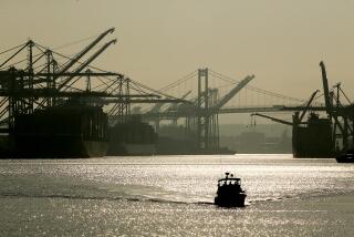
LONG BEACH — Moving to improve port safety in the wake of the 1989 Exxon Valdez oil spill, the Coast Guard has asked Congress for $4.5 million to set up an electronic ship-tracking system for Los Angeles and Long Beach harbors.
Coast Guard personnel at a hilltop observation station in San Pedro would use radar and computerized displays to guide ships sailing within 20 miles of the ports. They would also have the authority to issue navigational commands--a prospect that has some in the shipping industry nervous.
“Some people in the industry are concerned that they’ll have people on shore telling them, ’10 degrees right rudder,’ ” said Capt. Oliver Williams, an Arco shipping adviser who chairs a port safety panel that includes shippers, port officials and the Coast Guard. “But this is an issue of space management. You have to control things before problems develop.”
The Coast Guard funding request, among the Bush Administration’s budget proposals for fiscal 1993, is part of a federal effort to improve so-called vessel traffic services, or VTS, in the wake of the massive Exxon Valdez oil spill in Alaska’s Prince William Sound.
More than half a dozen U.S. ports use electronic vessel tracking, among them New York, Houston/Galveston and San Francisco. But many do not, including Los Angeles/Long Beach, New Orleans and Port Arthur, Tex.--the three places where the Coast Guard wants to install VTS in fiscal 1992-93.
With Los Angeles and Long Beach now the nation’s busiest shipping centers--handling cargo that includes crude oil, fuels and chemicals--environmentalists are pleased that the two ports loom large in the Coast Guard’s plans.
“We know a disaster like the Exxon Valdez could happen here, and if it does, it would affect Southern California for a long time,” said Lisa Weil of American Oceans Campaign, a group based in Santa Monica. “We need to have the best protection available and I believe the Coast Guard can offer it.”
Coast Guard officials say their request was prompted in part by a U.S. Department of Transportation study that ranks 23 ports according to how much they would benefit from new or improved electronic vessel tracking.
Los Angeles/Long Beach placed fifth behind New Orleans, Port Arthur, Houston/Galveston and Mobile, Ala., in the ranking, which was released March 5.
In the past, the two Southland ports have not figured prominently in such studies because the reports concentrated almost exclusively on accident rates, Coast Guard officials say. Thanks largely to good weather and easy approaches, the officials say, Los Angeles and Long Beach harbors have relatively few collisions, groundings and rammings.
But the study took other factors into account--among them, how major maritime spills would affect each region economically. With its thriving sea commerce and beaches attractive to tourists and waterfront property buyers, the Los Angeles and Long Beach area scored heavily.
“When you crank in the economic concerns, Los Angeles and Long Beach got bumped way up,” said Capt. Jim Morris, the Coast Guard official in charge of Los Angeles and Long Beach harbors. “If there were a major accident here there would be a tremendous economic impact.”
The only ship tracking being provided now for Los Angeles and Long Beach harbors is limited in scope. The Marine Exchange, a nonprofit group controlled by the shipping industry, monitors a small area outside the federal breakwater for ships that request the service.
The exchange has been developing a plan to expand its radar coverage and require all large ships to participate, but exchange members say they will not move forward if the Coast Guard ultimately conducts vessel tracking.
“When we were drafting our plan, there was no indication that the Coast Guard would provide VTS here,” said Arco’s Williams, one of the architects of the Marine Exchange plan. “If the government is willing to run VTS it probably makes more sense that they do it.”
Environmental groups agree, pointing out that the Marine Exchange would not have the authority to issue navigational commands in an emergency. Said Weil, of American Oceans Campaign: “If there’s a problem, the Coast Guard has more authority to get a ship to comply.”
Coast Guard officials say they plan to establish a vessel tracking station by expanding and re-equipping the exchange’s San Pedro observation tower, which is on Coast Guard land.
The station would track ships within 20 miles of Los Angeles and Long Beach harbors but would not cover Santa Monica Bay, which is not visible from the tower by radar because of hilly terrain on the nearby Palos Verdes Peninsula.
Ships entering the zone would be required to maintain radio communications with the tower. The Coast Guard would track them with radar and a computer system that creates sophisticated electronic chart displays.
“What we would have is more sophisticated than what the Marine Exchange has,” said Capt. Thomas Robinson, the Coast Guard’s chief of operations for the southwest United States. “This system gives the layout of the harbor and shows who everybody is, where they are and how they are moving.”
Coast Guard officials say the station’s personnel would handle traffic by “advising” ships how to proceed. But in an emergency, they say, the vessel tracking station would not hesitate to issue orders.
“We can tell a captain, ‘Stop, turn your vessel around,’ ” said Capt. Michael Mierzwa, chief of the Coast Guard’s vessel traffic services division in Washington. “We do that very few times, but it’s a key point.”
More to Read
Sign up for Essential California
The most important California stories and recommendations in your inbox every morning.
You may occasionally receive promotional content from the Los Angeles Times.


