Victory Claimed in Predicting El Nino : Climate: Scientists use supercomputers to anticipate the fickle warm current and its often destructive impact on crops. Refinements can lead to valuable forecasts a year in advance.
- Share via
SAN FRANCISCO — The wintertime pulse of warm ocean water off Ecuador called El Nino has long been known as a significant if mysterious influence on climate. Only recently, however, have supercomputer modeling and coordinated data-gathering allowed scientists to fully appreciate the role El Nino plays in driving the world’s weather, bringing drought to Brazil one year and floods to the Midwest the next.
Last week, scientists from the Scripps Institute of Oceanography and Columbia University told their colleagues at an American Geophysical Union meeting here that they have developed models that can predict El Ninos--and the crop failures and other regional weather impacts they spawn.
Using vast amounts of data collected this year in one of the most comprehensive oceanographic and atmospheric research projects ever, researchers said they soon should be able to refine those models to the point where they can routinely give accurate one- or two-year warnings of seasons that will be unusually wet, dry, hot or cold.
“As recently as 1982, the largest El Nino of the century was already well under way before experts even realized that it was happening,” said Mark Cane of Columbia University’s Lamont-Doherty Earth Observatory. “In 1985, the idea that El Ninos could be predicted at all was heavily disputed. Now the question is not, ‘Can it be predicted?’ but rather, ‘How well can it be predicted?’ ”
“Most people will now agree that we can predict the darn thing . . . with not one or two but three different models,” said Timothy P. Barnett of Scripps’ Climate Research Division in La Jolla.
After listening to the various presentations, many scientists at the meeting were convinced that reliable El Nino forecasts are at hand.
“There is real predictability of tropical sea-surface temperatures up to a year in advance,” said Ed Sarachik of the University of Washington.
The data-gathering effort--a combination of two international collaborations called the Tropical Ocean Global Atmosphere Program (TOGA) and the Coupled Atmosphere-Ocean Research Experiment (COARE)--used automated buoys, surface ships, aircraft and the space shuttle to document precisely how the ocean and atmosphere interact northeast of New Guinea.
This area, known as the western Pacific warm pool, is the birthplace of El Ninos and of a related atmospheric phenomenon called the Southern Oscillation, several scientists said in a series of lectures Wednesday. When the Southern Oscillation builds a high-pressure mass of air over New Guinea and Australia, strong westerly winds blow across the Pacific Ocean.
This causes a mass of warm water--El Nino--to surge across the Pacific toward the northwest coast of South America, where it depresses a natural cold-water current. The process can raise sea-surface temperatures in the Eastern Pacific 18 degrees Fahrenheit, significantly increasing evaporation and cloud formation and radically altering rainfall patterns in North and South America, Africa, Southeast Asia and Australia.
El Nino, named by South American fishermen for the Christ child after it increased their catch, also has measurable effects on sea-surface temperatures in the equatorial Atlantic and Indian oceans, Mojib Latif of Germany’s Max Planck Institute reported in one talk. For reasons that are not clear, he said, sea-surface temperature measurements indicate that the pulse of warm water somehow appears to jump continents and circumnavigate the globe, bringing odd weather with it.
By studying such factors as winds and sea-surface temperatures, Cane and other scientists, including Barnett, said they have independently developed different models that can predict El Ninos a year or more in advance. They then use that information in global climate computer models to forecast whether coming seasons will be rainy or dry, warmer than normal or cooler.
Using his team’s El Nino model, which is based on Pacific Ocean wind patterns as measured by a team from Florida State University, Cane said that he and his colleagues have been able to forecast not only the weather but crop yields in Zimbabwe with about 70% accuracy.
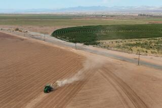
Cane and Nick Graham of Scripps said that such predictions can help farmers prepare for drought by storing water, changing irrigation patterns or planting crops that do not require a lot of water.
In northeastern Brazil, Cane and Graham forecast a drought last year. They said the region’s farmers were warned in time, planned accordingly and produced 530,000 tons of cereal grain, 82% of a wet-year harvest. A similar, surprise drought five years earlier produced a harvest only 15% of normal.
“We were either good or lucky” with the forecast, Graham said, “but we were correct.”
Cane acknowledged that his model failed to foresee the unusual renewal of El Nino this year--an event that was recorded by a Franco-American satellite, Topex-Poseidon, which uses a radar altimeter to measure warm-water bulges in the oceans.
“It’s inevitable,” he said. “If you (make forecasts) long enough, nature will get you.”
But, Cane added, El Nino models should become more accurate and reliable when they are modified to take advantage of the exhaustive data gathered last winter by the TOGA-COARE project.
“We need more data because the models are not as good as they should be,” he said. “But more data would help us to improve the models.”


